-
Christian Collectibles
-
Christian Sheet Music
-
Vatican Stamps
-
Vatican Coins & Paper Money
-
Antiques
-
Antiquities
-
Architectural & Garden
-
Decorative Arts
-
Ethnographic
-
Furniture
-
Maps, Atlases & Globes
-
United States (Pre-1900)
-
United States (1900-Now)
-
AK, HI
-
AL, FL, GA, MS, NC, SC
-
AR, IA, KS, LA, MO, NE
-
AZ, CA, CO, NM, NV, UT
-
CT, MA, ME, NH, RI, VT
-
DC, DE, MD, NJ, NY, PA
-
ID, OR, WA
-
IL, IN, MI, OH, WI
-
MN, MT, ND, SD, WY
-
OK, TX
-
VA, WV, KY, TN
-
Entire US
-
United States (Date Unknown)
-
Africa
-
Asia
-
Australasia/ Oceania
-
Canada
-
Central America/ Caribbean
-
Europe
-
India
-
Ireland
-
Mexico
-
Middle East
-
North America
-
South America
-
United Kingdom
-
Maps on CD
-
World Maps
-
Globes
-
Mixed Lots
-
Reproductions
-
Price Guides & Publications
-
Other
|
In
Order by: Available to: This site contains affiliate links for which I may be compensated
|
Buy It Now
$7.00 Shipping Location: Rockville, United States Overall, the map is in Acceptable Condition. There are many nicks, tears and creases along the edges. The corners are torn and creased. There are pin ... moreholes in the corners. The map also has wear and browning.
Buy It Now
$4.95 Shipping Location: Bar Harbor, United States The Panama Canal was completed on August 15, 1914. showing completed Panama Canal. U.S. Canal Zone. 1914 Original Antique Map. Arctic Regions. Very historcally ... moreimporant and scarce map. map taken from.
Buy It Now
$6.95 Shipping Location: Dover, United States Mineral Map of the Dominion of Canada. Issued c. 1915.
Buy It Now
$6.95 Shipping Location: Dover, United States Alberta, British Columbia, and Yukon Railway Territories. Issued 1915, Canada. Original center fold as issued.
Buy It Now
$9.00 Shipping Location: Denver, United States The folding book like design makes it easy to carry around, perfect for those who want to discover the hidden gems of New Jersey. Don't miss out on the ... moreopportunity to own this valuable piece of history.
Buy It Now
$5.25 Shipping Location: Dayton, United States 24-64th Congress, 1st Session, December 6, 1915-September 8, 1916: Examinations Of Rivers and Harbors IV.". Map is in Very Good Condition! Any Browning ... moreIs Enhanced By My Phone! Great Map!
Buy It Now
$3.00 Shipping Location: Greenville, United States Some discoloration. Six small holes at folds. Two larger holes also at folds. Two small rips at edges on folds. Several tack holes around edges.Map is ... moredouble-sided.
Buy It Now
$4.00 Shipping Location: United States There were also 2 editions, one with linenbacking and one without linenbacking, this map has the linenbacking. This is an antique 1915 map and not a reprint ... moreor reproduction. This is an antique map and not a reprint or reproduction, the map is printed on thick fine paper, with no printing on verso.
Buy It Now
$15.45 Shipping Location: Corunna, United States Map is linen backed.
Buy It Now
$4.00 Shipping Location: United States This is an antique 1915 map and not a reprint or reproduction. This is an antique map and not a reprint or reproduction, the map is printed on thick fine ... morepaper, with no printing on verso. The superb handcoloring is period to the map, so few of these were done it was cheaper for them to have them handcolored, than printed color.
Buy It Now
$15.45 Shipping Location: Corunna, United States Map is linen backed.
Buy It Now
$4.50 Shipping Location: United States This is an antique 1915 map and not a reprint or reproduction. This is an antique map and not a reprint or reproduction, the map is printed on thick fine ... morepaper, with no printing on verso. The superb handcoloring is period to the map, so few of these were done it was cheaper for them to have them handcolored, than printed color.
Buy It Now
$4.00 Shipping Location: Winter Springs, United States The fine handcoloring on the map is period. The map is in nice condition. Printed on thick paper, with no printing on reverse. This is an antique map ... moreand not a reprint or reproduction. The size of the map is 16.5" by 23.5".
Buy It Now
$6.95 Shipping Location: Dover, United States Physical Map of the Dominion of Canada. Issued c. 1915. Color coded key below title indicates heights of land and depths of water.
Buy It Now
$6.95 Shipping Location: Dover, United States Early 20th century color lithographed map. Interesting and unusual large format map with an unusual focus. Issued 1915, Canada.
Buy It Now
$6.95 Shipping Location: Dover, United States The Port of Amsterdam. Issued c.1915-20 era, Amsterdam by city. Original fold lines as issued in a folding pocket map format.
Buy It Now
$4.69 Shipping Location: Greenacres, United States It is identified as the 1915 edition of the Hindman quadrangle, based on surveys in 1912 and printed in 1925. Genuine original color lithographed fold-out ... moredissected topographical map of parts of Knott and Floyd counties in eastern Kentucky's coal country, printed more than 95 years ago.
Buy It Now
$4.50 Shipping Location: United States There were also 2 editions, one with linenbacking and one without linenbacking, this map has the linenbacking. This is an antique 1915 map and not a reprint ... moreor reproduction. This is an antique map and not a reprint or reproduction, the map is printed on thick fine paper, with no printing on verso.
Buy It Now
$4.00 Shipping Location: United States This is an antique 1915 map and not a reprint or reproduction. This is an antique map and not a reprint or reproduction, the map is printed on thick fine ... morepaper, with no printing on verso. The map is from the very rare 1915 E. Belcher Hyde Atlas of Suffolk County New York.
Buy It Now
$4.00 Shipping Location: Winter Springs, United States The fine handcoloring on the map is period. The map is in nice condition. Printed on thick paper, with no printing on reverse. This is an antique map ... moreand not a reprint or reproduction. The size of the map is 16.5" by 23.5".
Buy It Now
$6.05 Shipping Location: Belvedere Tiburon, United States Agriculture up and down the Central Valley drastically altered the landscape of San Joaquin County. Although the area shown here generally was flush with ... morewater in the rainy season and damming allowed water to be tapped year round, areas further to the south were much drier.
Buy It Now
$4.50 Shipping Location: United States This is an antique 1915 map and not a reprint or reproduction. This is an antique map and not a reprint or reproduction, the map is printed on thick fine ... morepaper, with no printing on verso. The superb handcoloring is period to the map, so few of these were done it was cheaper for them to have them handcolored, than printed color.
Buy It Now
$4.50 Shipping Location: United States This is an antique 1915 map and not a reprint or reproduction. This is an antique map and not a reprint or reproduction, the map is printed on thick fine ... morepaper, with no printing on verso. The map is from the very rare 1915 E. Belcher Hyde Atlas of Suffolk County New York.
Buy It Now
$3.00 Shipping Location: Greenville, United States This item is in very good condition. There is discoloration at the front folds. There are a few holes that look like holes from tacks.Some discoloration ... moreat folds. Three small holes at folds.Route hand marked on map.Light handwritten marks in pencil.
Buy It Now
$6.05 Shipping Location: Belvedere Tiburon, United States The backside features a bonus map of the famous town of Sausalito. Beautiful 1920 map of Mill Valley, with Sausalito on the verso. Rancho del Sausalito ... morethe town’s founder, William Richardson.
Buy It Now
$4.50 Shipping Location: United States There were also 2 editions, one with linenbacking and one without linenbacking, this map has the linenbacking. This is an antique 1915 map and not a reprint ... moreor reproduction. This is an antique map and not a reprint or reproduction, the map is printed on thick fine paper, with no printing on verso.
Buy It Now
Free Shipping Location: Wilton, United States It's in great condition!
Buy It Now
$4.50 Shipping Location: United States This is an antique 1915 map and not a reprint or reproduction. This is an antique map and not a reprint or reproduction, the map is printed on thick fine ... morepaper, with no printing on verso. The superb handcoloring is period to the map, so few of these were done it was cheaper for them to have them handcolored, than printed color.
Buy It Now
$6.95 Shipping Location: Dover, United States Petrograd - 1915. Issued 1915, Paris by P. Monsanglant. Map by L. Desbuissons. Uncommon early 20th century color lithographed city plan.
Buy It Now
Free Shipping Location: RICHMOND, United Kingdom Format: Sheet map - full size. Condition: Used - Good. Condition: Possibly light to moderate discolouration, wear on sides and tears. Age: See Map Title. ... moreFor example, a fault can be as minor as discolouration or as serious as a complete failure, as long as the item has been subject to normal usage.
Buy It Now
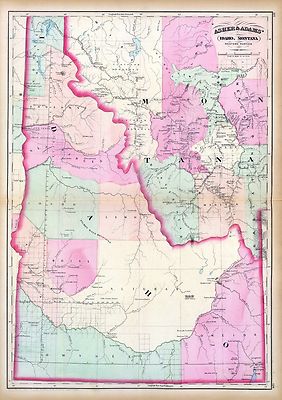
$3.95 Shipping Location: Clarkston, United States Rare Map Collection This DVD is part of our Historic Map and Atlas Collection. We have dozens of Atlas maps on DVD and CD ranging from the 1500s to the ... more1900s covering many areas and topics. Please Check our Ebay Store for what's available. FOR MANY MORE EDUCATIONAL CD TITLES ON THIS AND MANY OTHER SUBJECTS PLEASE VISIT OUR EBAY STORE VERY LARGE HIGH RESOLUTION MAP COLLECTION ON DVD! please see full table of contents and sample illustrations below) This DVD Contains 101 Maps of Idaho Including 44 PANORAMIC MAPS of various Idaho Cities These are scans of the ORIGINAL maps by various Cartographers. on DVD System requirements PC or Mac compatible. Files are simple PDF files with a basic HTML interface(just like viewing a webpage) Works with ALL versions of Windows. Maps of Idaho 0041037 Idaho. Montana west Asher& Adams 1874, 0586049 Idaho. Hand colored. Relief shown by hachures. Shows counties. Indian reservations, townships, settlements, rivers, etc. Mitchell. Samuel Augustus 1880, 0806001 Road map Idaho. Mont. Wyo. Rand McNally and Company; Texas Company 1937, 2212244 Partie des Etats-Unis. Amer. Sep. 39. Hand col. lithographed map. Relief shown by hachures. Shows Indians tribes with populations. Lewis and Clarke's route, etc. Covers parts of Idaho, Montana and Wyoming. Vandermaelen. Philippe 1827, 2738014 32D. Part Of South-Eastern Idaho Part Of South-Eastern Idaho. Atlas Sheet No. 32(D) Issued June 30, 1879. Weyss, Lang& Herman Del. Expedition of 1877, Under the Command of 1st Lieut. Geo. M. Wheeler, Corps of Engineers, U.S. Army. U.S. Geographical Surveys West Of The 100th Meridian. 1879, 2738015 32D. Land Classification Map Of Part Of South-Eastern Idaho. showing land classification. In full color with area and percentage of classifications noted. Wheeler. G.M. 1879, 2738020 41A. Parts Of Southern Idaho& Northern Utah Wheeler. G.M 1880, 2773005 Map Of The Road From Missouri To Oregon. Section V. Fremont. J.C. Preuss, Charles 1846, 2773006 Map Of The Road From Missouri To Oregon. Section VI.
Buy It Now
$14.99 Shipping Location: Ivanhoe, Australia The fund was the first such charitable effort for a war. By 1902, at the end of the Boer Wars, the circulation was over a million, making it the largest ... morein the world. Date: - 1899. The map shows the theatre of war, around the South African Republic (the Transvaal) and the Orange Free State.
Buy It Now
$4.00 Shipping Location: Winter Springs, United States This is an antique 1915 map and not a reprint or reproduction. This is an antique map and not a reprint or reproduction, the map is printed on thick fine ... morepaper, with no printing on verso. The superb handcoloring is period to the map, so few of these were done it was cheaper for them to have them handcolored, than printed color.
Buy It Now
$4.00 Shipping Location: Winter Springs, United States The map is from the very rare 1915 E. Belcher Hyde Atlas of Suffolk County New York. The photo wont show the full beauty of the map. The size of the map ... moreis 17" by 27". FREE scheduling, supersized images.
Buy It Now
$8.70 Shipping Location: Canton, United States Map Of The 1883 Richmond & Danville R.R. & Connections Train/Railroad Route Map (Blown up copy. 17"x11" comes with plastic sleeve, cardboard back, and ... morewill be shipped with cardboard front and back for protection during shipping. )
Buy It Now
$4.69 Shipping Location: Greenacres, United States It is identified as the 1918 edition of the Prestonburg quadrangle, based on surveys in 1915 and printed in 1932. What gives this map an extra touch of ... morecharm is that it has been dissected and mounted on linen — to facilitate use of the map during research, so the folds would not wear when the map was opened and closed.
Buy It Now
$4.50 Shipping Location: United States This is an antique 1915 map and not a reprint or reproduction. This is an antique map and not a reprint or reproduction, the map is printed on thick fine ... morepaper, with no printing on verso. The superb handcoloring is period to the map, so few of these were done it was cheaper for them to have them handcolored, than printed color.
Buy It Now
$15.00 Shipping Location: Brooklyn, United States The Grand Canyon, which would not be designated as a National Park until 1919, is depicted in Arizona, with the Grand Canyon Railway serving as a connection ... moreto the natural wonder. This railway would soon be bought by the ATSF and operated as a spur line.
Buy It Now
$24.92 Shipping Location: GULLANE, United Kingdom Covers from CHULLERA POINT in the north to ACEBUCHE POINT & GIBRALTAR in the south. Features both nautical and inland detail noting both topographical ... morefeatures and thousands of depth soundings (in fathoms).
Buy It Now
$9.99 Shipping Location: Ivanhoe, Australia Date: - 1872. In 1853, the Tip-Top House was erected to compete. Rebuilt of wood with 91 rooms in 1872–1873, the Summit House burned in 1908, then was ... morereplaced in granite in 1915. The wealth of material for this purpose is almost boundless.
Buy It Now
$4.00 Shipping Location: Winter Springs, United States This is an antique 1915 map and not a reprint or reproduction. This is an antique map and not a reprint or reproduction, the map is printed on thick fine ... morepaper, with no printing on verso. The superb handcoloring is period to the map, so few of these were done it was cheaper for them to have them handcolored, than printed color.
Buy It Now
$12.85 Shipping Location: Rochester, United States See also: List of artists and writers from Alaska. A dog team in the Iditarod Trail Sled Dog Race, arguably the most popular winter event in Alaska. Alaska ... moreMining District. Alaska Interstate Highways.
Buy It Now
$15.00 Shipping Location: Brooklyn, United States The earliest publication of this map we have been able to trace in 1908. Editions followed in 1910 (present example), 1915, and 1917. Along the bottom ... moreof the map roughly 1000 tows are identified and referenced.

Buy It Now
$3.95 Shipping Location: Rochester, United States RARE Old Pocket Map Colton's Township Map of Pennsylvania and the Southern Counties of New York 1876 For offer. A very interesting American imprint! ... moreFresh from a local estate- never offered on the market until now! I could not locate a copy of this book for sale anywhere. Vintage. Old, Original, Antique- NOT a Reproduction- Guaranteed! New York: Colton. 1876. Nicely Hand colored. 44 x 30 inches when fully unfolded. COMPLETE. In very good condition. Acid free archival repair to rips on back and a few fold joints. Front cover nearly detached, hanging on by small piece of paper. Light age toning/ minimal foxing. Please see photos. If you collect 19th century American imprints. Americana illustration, atlas, State of PA- Southern Tier NY, etc. this is a nice one for your bibliophile library or paper/ ephemera collection. Combine shipping on multiple bid wins! Pennsylvania Listeni/ˌpɛnsɨlˈveɪnjə/ Pennsylvania German: Pennsilfaani) Officially the Commonwealth of Pennsylvania, is a U.S. state that is located in the Northeastern and Mid-Atlantic regions of the United States, and the Great Lakes region. The state borders Delaware to the southeast, Maryland to the south, West Virginia to the southwest, Ohio to the west, Lake Erie and Ontario, Canada to the northwest, New York to the north and New Jersey to the east. The Appalachian Mountains run through the middle of the state. Pennsylvania is the 33rd largest. The 6th most populous, and the 9th most densely populated of the 50 United States. The state's five most populous cities are Philadelphia, Pittsburgh, Allentown, Erie, and Reading. The state capital is Harrisburg. Pennsylvania has 51 miles(82 km) of coastline along Lake Erie and 57 miles(92 km)6] of shoreline along the Delaware Estuary. The state is one of the 13 original founding states of the United States. Geography Further information: Geography of Pennsylvania and List of counties in Pennsylvania Counties of Pennsylvania Pennsylvania is 170 miles(274 km) north to south and 283 miles(455 km) ea
Buy It Now
$29.91 Shipping Location: NORTHWICH, United Kingdom It is folding and linen-backed. It covers from Norway, Sweden and the Gulf of Finland at the top to Serbia and Romania at the bottom edge. A few smudges ... moreto the border. Marbled paper covers when folded up with cream illustrated label to the front cover with details of publisher.
Buy It Now
$21.18 Shipping Condition: Used Location: LONDON, United Kingdom [Ordnance Survey] Edition of 1915 - Essex [New Series] Sheet NLXXVII. London Sheet II. Upper Clapton - Lea Bridge - Walthamstow Marshes. Caption below ... morepicture:'[Ordnance Survey] Edition of 1915 - Essex [New Series] Sheet NLXXVII.
Buy It Now
$3.12 Shipping Location: MANCHESTER, United Kingdom We have published 3 versions of this map, showing how it developed across the years. Here we have this lovely modern reproduction map of PENDLETON (NORTH) ... moreshowing the area as it was back in 1915. Lancs Sheet 104.01bPendleton (North) 1915 - published 2015; intro by Chris Makepeace.
Buy It Now
$15.00 Shipping Location: TORQUAY, United Kingdom The Times Contour Road Map of Hampshire, Dorset & Adjacent CountiesProduced & Published by GeographiaMeasures 77cm x 98.5cmSuspected to be 1915 to 1940This ... moreis in very poor condition. Although linen backed pages/sections are loose. The cover page is already loose
Buy It Now
$22.58 Shipping Location: WIGAN, United Kingdom Condition: - Cover a little rubbed, map showing signs of use and wear, see photos for details. Up to 2kg will be £3.95, up to 5Kg £7.85, up to 10Kg £9.50, ... moreupto 20Kg £11.00.
Buy It Now
$33.65 Shipping Condition: Used Location: LONDON, United Kingdom [Ordnance Survey] Edition of 1915 - London Sheet IV. Middlesex Sheet XVI. Caption below picture:'[Ordnance Survey] Edition of 1915 - London Sheet IV. ... moreA copy of the colour key that was originally published with the final "New Survey" itself will be provided with the map., 1928.
Buy It Now
$33.65 Shipping Condition: Used Location: LONDON, United Kingdom [Ordnance Survey] Edition of 1915 - London Sheet VIII. Middlesex Sheet XXI. Surrey Sheet II. 14 (Parts of). Caption below picture:'[Ordnance Survey] Edition ... moreof 1915 - London Sheet VIII. A copy of the colour key that was originally published with the final "New Survey" itself will be provided with the map., 1928.
Buy It Now
$9.99 Shipping Location: Ivanhoe, Australia Mount Washington from Sheffield. Date: - 1872. In 1853, the Tip-Top House was erected to compete. Rebuilt of wood with 91 rooms in 1872–1873, the Summit ... moreHouse burned in 1908, then was replaced in granite in 1915.
Buy It Now
$24.69 Shipping Location: STOURPORT-ON-SEVERN, United Kingdom First edition 1905 - this is a 1915 Revised Edition.
Buy It Now
$33.65 Shipping Condition: Used Location: LONDON, United Kingdom [Ordnance Survey] Edition of 1915 - Essex [New Series] Sheet NLXXVII. London Sheet II. Middlesex Sheet XII. South Tottenham - Stoke Newington - Stamford ... moreHill - Upper Clapton - Harringay Warehouse District.
Buy It Now
Free Shipping Location: RICHMOND, United Kingdom Format: Sheet map - full size. Condition: Used - Good. Age: See Map Title. For example, a fault can be as minor as discolouration or as serious as a complete ... morefailure, as long as the item has been subject to normal usage.
Buy It Now
$22.43 Shipping Location: LONDON, United Kingdom Large folding pocket map issued by the survey office of Ceylon, published in 1910 under the orders of Mr. R. S. Templeton who was the Surveyor General ... moreof island from 1910 to 1915. Excellent condition: laid on linen.
Buy It Now
$24.86 Shipping Location: NORWICH, United Kingdom Published by George Philip & Son Lrd, nd c1915 going by the small car illustration to the front cover. Covers with wear to the edges and corners, as shown. ... moreMap itself is paper on cloth, with a little wear to the folds, but generally in good order.

Buy It Now
$3.12 Shipping Location: MANCHESTER, United Kingdom LLANDAFF 1915 SHEET 43.10 This map is taken from the 1/2500 plans and Reproduced by Alan Godfrey at about 15 inches to the mile. It is highly detailed ... moreand covers an area of about one and a half square miles This very detailed map covers much of Llandaff and the northern part of Canton. Today this is all part of Cardiff. Coverage stretches from Windway Road eastward to Cathedral Road. And from the River Taff southward to Romilly Road. The centre of Llandaff is in top left quarter of the map and features here include the Cathedral, Llandaff House, Llandaff Mill, castle remains, The Palace, Minor Canonries, etc. Elsewhere features include the north part of Victoria Park, Howell's School, Llandaff Fields, Sir David's Fields, St Catherine's church, Pontcanna, Anchor Patent Fuel Works, Crown Wagon& Engineering Works, Star Patent Fuel Works etc plus a short stretch of the Glamorganshire Canal. On the reverse we include a directory of Llandaff in 1906. A Fantastic detailed Map which is invaluable for family genealogy and historic studies The map links up with sheet 43.11 Cardiff North to the north and 43.14 Canton to the south which I am also selling on Ebay right now. NO MORE P+P FOR ANY OTHER ITEMS BOUGHT! I AM NOW SELLING MORE MAPS FROM AROUND THIS AREA. NO EXTRA P+P FOR MORE ITEMS BOUGHT.SAME P+P FOR 1 ITEM AS IT WOULD BE FOR 100! Contact me on karenswift@blueyonder.co.uk if you have any questions SEE MY SHOP FOR MORE MAPS FROM THIS AND OTHER AREAS. CLICK HERE I AM NOW SELLING MORE MAPS FROM AROUND THIS AREA. NO EXTRA P+P FOR MORE ITEMS BOUGHT. SAME P+P FOR 1 ITEM AS IT WOULD BE FOR 100! U.K. BUYERS CAN PAY EASILY BY BANK TRANSFER. IT'S FREE FOR YOU AND ME! Pay me with PayPal. I don't charge my buyers extra! Powered by
Buy It Now
Free Shipping Location: RICHMOND, United Kingdom Format: Sheet map - full size. For example, a fault can be as minor as discolouration or as serious as a complete failure, as long as the item has been ... moresubject to normal usage. Condition: Used - Good.
Buy It Now
$3.95 Shipping Location: Clarkston, United States Old plat of the grounds in the NE part of the pasture of Mount Vernon from the summit of the hills on which the log’d cabbins are. 0632016 Virginia, Maryland ... moreand Delaware. 4577017 Map of Virginia. Walteri Raleigh, Equestris ordinis Viri, Anno Dn¯i. MDLXXXV regni Vero Sereniss.
|
|
|
In
|
1915 ANTIQUE ROAD MAP CATTARAUGUS COUNTY NEW YORK– Olean Ellicottville Salamanca
Estate Auction find. Up for sale is a printed road map of Cattaraugus County. New York from 1915. This map is an original print and is approximately 15 inches tall x 16.5 inches wide(including binding edge with 3 holes) On the map is printed– MAP of CATTARAUGUS COUNTY. COMPILED FOR THE ROCHESTER MOTORING ASSO. AND SERVICE CO. INC, BY Beil Van Tuyle(I think. The signature is difficult for me to read) 1915. The scale is one inch = 3 miles. The map shows roads. Rail road lines, villages, hamlets, and some road names in Cattaraugus County, New York. One can see Olean. Allegany, Salamanca, Little Valley, Ellicottville, Randolph, Gowanda, Franklinville, etc. The condition is used as these were Pre-owned. Age appropriate wear and paper has yellowed over time. 3 holes along one edge for binding. It was in a book that was folded down the middle. Some ... morestaining and edge wear. No tears into printed areas. Please review the photos as they provide the best indication of condition. This would make a great historical decoration once framed. I have attempted to describe this item as accurately as possible. If you have further questions. Please ask. Communication: If you have any questions. Please eMail me. I will check for eMails at least once a day(usually in the mornings) and reply as soon as I can. Payment: PayPal preferred. If paying by check. Please advise. I will ship item once check has cleared. NY State Buyers will be charged NY State Sales Tax. Return policy: My desire is that you are fully satisfied. So. If you have a problem, please let me know as soon as possible. You will have up to 7 days to notify me of any issues and if item is not received in satisfactory condition, I will provide full refund(minus all shipping fees) once item is returned in original packaging. Feedback will be given once it is received. Shipping: I will ship item once payment is cleared. Shipping charges will be added to purchase price. Will ship rolled in a mailing tube/box and use primarily USPS Priority or First Class Mail(estimate
|
|
 |