-
Christian Collectibles
-
Christian Sheet Music
-
Vatican Stamps
-
Vatican Coins & Paper Money
-
Antiques
-
Antiquities
-
Architectural & Garden
-
Decorative Arts
-
Ethnographic
-
Furniture
-
Maps, Atlases & Globes
-
United States (Pre-1900)
-
United States (1900-Now)
-
AK, HI
-
AL, FL, GA, MS, NC, SC
-
AR, IA, KS, LA, MO, NE
-
AZ, CA, CO, NM, NV, UT
-
CT, MA, ME, NH, RI, VT
-
DC, DE, MD, NJ, NY, PA
-
ID, OR, WA
-
IL, IN, MI, OH, WI
-
MN, MT, ND, SD, WY
-
OK, TX
-
VA, WV, KY, TN
-
Entire US
-
United States (Date Unknown)
-
Africa
-
Asia
-
Australasia/ Oceania
-
Canada
-
Central America/ Caribbean
-
Europe
-
India
-
Ireland
-
Mexico
-
Middle East
-
North America
-
South America
-
United Kingdom
-
Maps on CD
-
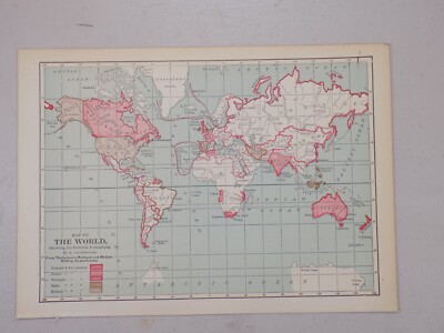
World Maps
-
Globes
-
Mixed Lots
-
Reproductions
-
Price Guides & Publications
-
Other
|
In
Order by: Available to: This site contains affiliate links for which I may be compensated
|
Buy It Now
Free Shipping Location: Augusta, United States This 11" x 14 1/2" map is in VERY GOOD condition with light tone and soil, from a disbound Cram's atlas ©1901. "AN AUTHENTIC ORIGINAL MAP NOT A REPRODUCTION".
Buy It Now
Free Shipping Location: Augusta, United States This 14 1/2" x 22" map is in VERY GOOD+ condition with light tone, soil, and a fold in the middle as issued, from a disbound George Cram atlas ©1901. ... more"An Authentic Original Map Not A Reproduction".
Buy It Now
$6.00 Shipping Location: Columbia, United States
$16.92 Shipping Location: Petersburg, United States
Buy It Now
Free Shipping Location: Augusta, United States "An Authentic Original Map Not A Reproduction".
Buy It Now
Free Shipping Location: Schertz, United States This antique original atlas map was printed in 1901 by the famous cartographer/publisher Geo. A. Ogle & Co. It features Freeburg in St. Clair County in ... moreIllinois, USA, and is a great resource for those interested in ancestry, genealogy, and family history research. The map is over 120 years old and is in excellent condition. Free shipping is available within the USA, and calculated shipping rates are available for worldwide delivery. Please note that the cover and title page are not included, they are only for reference. Don't miss out on the opportunity to own this rare and historic piece!
Buy It Now
Free Shipping Location: Augusta, United States "An Authentic Original Map Not A Reproduction".
Buy It Now
$5.00 Shipping Location: Fernandina Beach, United States They are previously owned and may show very fine handling marks and shelf wear and will not be perfect. In antique condition with yellowing, staining, ... morespotting and discoloration of paper. It has rounded corners, creases, small tears along edges, ragged edges and is wrinkled.
Free Shipping Location: San Antonio, United States This Map was removed from a 1901 Cram's Atlas of the World. The map is not " new " or in " new " condition, it was printed in 1901. ~ CRAM1901/071122. ... moreIncluding Hundreds of RareCivil War. The full page is approx.
Buy It Now
Free Shipping Location: Schertz, United States This antique original atlas map was printed in 1901 by the famous cartographer/publisher Geo. A. Ogle & Co. It features Freeburg Township in St. Clair ... moreCounty in Illinois, USA, and is a great resource for those interested in ancestry, genealogy, and family history research. The map is over 120 years old and is in excellent condition. Free shipping is available within the USA, and calculated shipping rates are available for worldwide delivery. Please note that the cover and title page are not included, they are only for reference. Don't miss out on the opportunity to own this rare and historic piece!
Buy It Now
Free Shipping Location: Augusta, United States "An Authentic Original Map Not A Reproduction".
Buy It Now
Free Shipping Location: Schertz, United States This antique original atlas map was printed in 1901 by the famous cartographer/publisher Geo. A. Ogle & Co. It features O'Fallon Township in St. Clair ... moreCounty in Illinois, USA, and is a great resource for those interested in ancestry, genealogy, and family history research. The map is over 120 years old and is in excellent condition. Free shipping is available within the USA, and calculated shipping rates are available for worldwide delivery. Please note that the cover and title page are not included, they are only for reference. Don't miss out on the opportunity to own this rare and historic piece!
Buy It Now
Free Shipping Location: Augusta, United States "An Authentic Original Map Not A Reproduction".
Buy It Now
Free Shipping Location: Augusta, United States This 22" x 14 1/2" map is in VERY GOOD condition with light tone, soil, edge wear, and a fold in the middle as issued, from a disbound Cram's atlas ©1901. ... more"An Authentic Original Map Not A Reproduction".
Buy It Now
$4.55 Shipping Location: Oakland, United States This antique map of Maryland and Delaware was published by Rand McNally & Co. in 1901. It measures 7 inches by 6 inches and is a great addition to any ... moremap collection. The map features detailed depictions of the two states, including cities, towns, and geographical features. It is a perfect item for history enthusiasts or those interested in cartography.The map is in great shape, with no tears or stains. It has been well preserved over the years and is ready for display. This item is perfect for collectors or as a gift for someone who appreciates antique maps. Don't miss out on the chance to own a piece of history.
Buy It Now
$6.18 Shipping Location: TORRINGTON, United Kingdom MAP IS AN ANTIQUE ORIGINAL AND NOT A MODERN REPRODUCTION.
Buy It Now
$4.55 Shipping Location: Oakland, United States This antique map of South America by Rand McNally & Co. is a true gem for any collector or lover of vintage maps. The intricate details and artistry on ... morethis piece is a testament to the skill of the cartographer and publisher. The map dates back to 1901, making it a rare find and a valuable addition to any collection.The map measures 7x6 inches and features the geography, towns, and cities of South America as they were depicted over a century ago. Whether you're a history buff, a cartography enthusiast, or just appreciate the beauty of antique maps, this piece is sure to impress. Don't miss your chance to own a piece of history!
Buy It Now
Free Shipping Location: Schertz, United States This antique original atlas map was printed in 1901 by the famous cartographer/publisher Geo. A. Ogle & Co. It features Mascoutah Township in St. Clair ... moreCounty in Illinois, USA, and is a great resource for those interested in ancestry, genealogy, and family history research. The map is over 120 years old and is in excellent condition. Free shipping is available within the USA, and calculated shipping rates are available for worldwide delivery. Please note that the cover and title page are not included, they are only for reference. Don't miss out on the opportunity to own this rare and historic piece!
Buy It Now
$4.55 Shipping Location: Oakland, United States This antique map of Wyoming from 1901 by Rand, McNally & Co. is a rare find for collectors and enthusiasts alike. Featuring detailed cartography and published ... moreover a century ago, this piece provides a glimpse into the state's history and geography. The map measures 7x6 inches and is in good condition considering its age. Perfect for display or research purposes, this item would make a great addition to any collection of North America maps or antique memorabilia.
Buy It Now
$6.95 Shipping Location: Dover, United States Issued 1901, Chicago by George Cram. Southern Half - California. Uncommon detailed large early 20th century color lithographed map.
Buy It Now
$4.13 Shipping Location: Columbia, United States
$6.00 Shipping Location: Blue Bell, United States THIS MAP IS IN GOOD CONDITION AND PUBLISHED BY THE CHICAGO DAILY NEWS. CONDITION: MAP IS IN GOOD. MULTIPLE WINS.
Buy It Now
Free Shipping Location: Augusta, United States "An Authentic Original Map Not A Reproduction".
Buy It Now
Free Shipping Location: Augusta, United States This 14 1/2" x 11" map is in VERY GOOD+ condition with very light tone, soil and two black spots from publishing as seen in the last photo, from a disbound ... moreGeorge Cram atlas ©1901. "An Authentic Original Map Not A Reproduction".
Buy It Now
Free Shipping Location: Schertz, United States This antique original atlas map was printed in 1901 by the famous cartographer/publisher Geo. A. Ogle & Co. It features Marissa Township in St. Clair ... moreCounty in Illinois, USA, and is a great resource for those interested in ancestry, genealogy, and family history research. The map is over 120 years old and is in excellent condition. Free shipping is available within the USA, and calculated shipping rates are available for worldwide delivery. Please note that the cover and title page are not included, they are only for reference. Don't miss out on the opportunity to own this rare and historic piece!
Buy It Now
$13.05 Shipping Location: BOURNE END, United Kingdom Produced by Benjamin Eli Smith for The Century Atlas of the World c1901. Overall Excellent Condition with Original Litho Colour. Antique Map Iowa State ... moreMap. Blank to verso.
Buy It Now
Free Shipping Location: Schertz, United States This antique original atlas map was printed in 1901 by the famous cartographer/publisher Geo. A. Ogle & Co. It features New Athens Township in St. Clair ... moreCounty in Illinois, USA, and is a great resource for those interested in ancestry, genealogy, and family history research. The map is over 120 years old and is in excellent condition. Free shipping is available within the USA, and calculated shipping rates are available for worldwide delivery. Please note that the cover and title page are not included, they are only for reference. Don't miss out on the opportunity to own this rare and historic piece!
Buy It Now
Free Shipping Location: San Antonio, United States This Map was removed from a 1901 Cram's Atlas of the World. The map is not " new " or in " new " condition, it was printed in 1901. ~ CRAM1901/071122. ... moreIncluding Hundreds of RareCivil War. The full page is approx.
Buy It Now
Free Shipping Location: Augusta, United States This 11 1/2" x 14 1/2" map is in VERY GOOD condition with light tone and soil, from a disbound Cram's atlas ©1901. "An Authentic Original Map Not A Reproduction".
Buy It Now
Free Shipping Location: Augusta, United States "An Authentic Original Map Not A Reproduction".
Buy It Now
Free Shipping Location: Augusta, United States "An Authentic Original Map Not A Reproduction".
Buy It Now
Free Shipping Location: Augusta, United States "An authentic original map, not a reproduction".
Buy It Now
$4.00 Shipping Location: Pinetop, United States On offer, an original USGS topographic map depicting coast of California OCEANSIDE to ENCINITAS 1925 Edition. It is clean and uncreased and in very good ... morecondition. It measures 19.75 inches long and 15.75 inches wide. Scale is 1 over 62,500. It will frame up beautifully and immediately become a personalized antique heirloom. This map could be your favorite gift to your Southern California friends and family. Make any reasonable offer. Four dollar USPS shipping.
Buy It Now
Free Shipping Location: Schertz, United States This antique original atlas map was printed in 1901 by the famous cartographer/publisher Geo. A. Ogle & Co. It features Millstadt in St. Clair County ... morein Illinois, USA, and is a great resource for those interested in ancestry, genealogy, and family history research. The map is over 120 years old and is in excellent condition. Free shipping is available within the USA, and calculated shipping rates are available for worldwide delivery. Please note that the cover and title page are not included, they are only for reference. Don't miss out on the opportunity to own this rare and historic piece!
Buy It Now
Free Shipping Location: Augusta, United States "An Authentic Original Map Not A Reproduction".
Buy It Now
Free Shipping Location: Monroeville, United States Genuine original antique and historical maps. Prints, engravings and illustrated books Antique& old vintage pictures prints& maps from POSTAPRINT: ... moreTopography. Good town views& city plans. Fine art engravings, WORLD 1901: Collectable Antique Map by Longmans Green. Projected on centre of Atlantic + Pacific Ocean, Authentic vintage& antique pictures prints and maps by mail order. There is printing on the back. Item I/D VM-2862 OVERALL SIZE incl. margins: 13.5x10.5 Inches. 34x27 Cms. FOLDING. IMAGE Size Varies: 12x9 Inches. 30x23 Cms All measurements are approximate. VERIFY THE DATE FOR MORE MAPS FROM THIS SERIES THE SCAN BELOW IS AN ENLARGED SECTION AS AN EXAMPLE OF THE DETAIL PROVENANCE THE PUBLIC SCHOOL ATLAS OF MODERN GEOGRAPHY IN 33 MAPS EXHIBITING CLEARLY THE MORE IMPORTANT PHYSICAL FEATURES OF THE COUNTRIES DELINEATED AND NOTING ALL THE CHIEF PLACES OF HISTORICAL. COMMERCIAL OR SIMILAR INTEREST. Edited…by the Rev. George Butler PUBLISHED 1901 BY Longmans Green& Co. 39 Paternoster Row London. New York and Bombay. This was issued as an illustration in the above book. AUTHENTICITY WARRANTED TO BE A GENUINE OLD ITEM. PRINTED AT THE DATE STATED. We NEVER offer modern day copies. The buyer may wish to print this page. CONDITION Good. Suitable for framing. Please see the scan. All old maps and prints are subject to normal ageing which is not obtrusive unless otherwise stated. PAYMENT PAYPAL PREFERRED PLEASE. RETURNS POLICY SATISFACTION GUARANTEED or your money back. Buyer pays return postage. Orders are normally mailed within 1 business day of payment. Except for vacations etc. UK DELIVERY BY 1st CLASS MAIL: Normally 1-2 working days. INTERNATIONAL BY AIR MAIL: Normally 5-10 working days. Please understand we cannot guarantee the efficiency of the Postal Services. Although they are generally reliable. More information WE HAVE BEEN IN BUSINESS FOR OVER 30 YEARS MANY 1000'S OF AUTHENTIC ANTIQUE COLLECTABLE and VINTAGE ITEMS ON OFFER France: Gravures et Cartes anciennes. Deutschland: Alte Lankart
Buy It Now
$12.42 Shipping Location: BOURNE END, United Kingdom Overall Excellent Condition with Original Litho Colour. for The Century Atlas of the World c1901. Published: The New Century Atlas published by the Matthews-Northrup ... moreCo. He graduated from Amherst College.
Buy It Now
$13.05 Shipping Location: BOURNE END, United Kingdom Produced by Benjamin Eli Smith for The Century Atlas of the World c1901. Overall Excellent Condition with Original Litho Colour. Antique Map State of ... moreMontana. Blank to verso.
Buy It Now
$8.51 Shipping Location: Medford, United States In Bromley's Atlas of 1901, this map is identified as Plate 9. Assessors and various other city officials (planners, fire and police forces, utility and ... moreservice providers, etc.) thereby had critical information readily available.
Buy It Now
Free Shipping Location: Nevada City, United States It has been expertly LINEN-BACKED. Exceedingly rare. The Midway Oil Field (Now, Midway-Sunset Oil Field) was discovered in Kern County in 1894. It is ... morethe largest oil field in California. It has produced over 3 billion barrels of oil to date, with substantial reserves still in the ground.
Buy It Now
$8.51 Shipping Location: Medford, United States In Bromley's Atlas of 1901, this map is identified as Plate 16. Assessors and various other city officials (planners, fire and police forces, utility ... moreand service providers, etc.) thereby had critical information readily available.
Buy It Now
Free Shipping Location: Schertz, United States This antique original atlas map was printed in 1901 by the famous cartographer/publisher Geo. A. Ogle & Co. It features Lebanon Township in St. Clair ... moreCounty in Illinois, USA, and is a great resource for those interested in ancestry, genealogy, and family history research. The map is over 120 years old and is in excellent condition. Free shipping is available within the USA, and calculated shipping rates are available for worldwide delivery. Please note that the cover and title page are not included, they are only for reference. Don't miss out on the opportunity to own this rare and historic piece!
Buy It Now
$12.42 Shipping Location: BOURNE END, United Kingdom For The Century Atlas of the World c1901. Published: The New Century Atlas published by the Matthews-Northrup Co. He graduated from Amherst College. An ... moreoriginal double page map with centrefold as issued within Atlas.
Buy It Now
Free Shipping Location: Schertz, United States This antique plat atlas map was printed in 1901 by Geo. A. Ogle & Co. and features La Prairie, Kingston, New Liberty, Meyer, Paloma & Fowler Townships ... morein Adams County, Illinois. Measuring at 17x29 inches, this map is great for ancestry, genealogy, and family history research. The map is over 120 years old and is in its original condition. Please note that the title page is not included, it is only for reference. Free shipping is available for the USA, while calculated shipping is available worldwide.
Buy It Now
Free Shipping Location: Augusta, United States "An Authentic Original Map Not A Reproduction".
Buy It Now
Free Shipping Location: Augusta, United States This 22" x 14 1/2" map is in VERY GOOD+ condition with light tone, a creased bottom left corner not affecting the printed area, and a fold in the middle ... moreas issued, from a disbound George Cram atlas ©1901.
Buy It Now
Free Shipping Location: Schertz, United States This original atlas map was printed in 1901 by the famous cartographer/publisher Geo. A. Ogle & Co. It features Marissa Township in St. Clair County in ... moreIllinois, USA, and is a great resource for those interested in ancestry, genealogy, and family history research. The map is over 120 years old and is in excellent condition. Free shipping is available within the USA, and calculated shipping rates are available for worldwide delivery. Please note that the cover and title page are not included, they are only for reference. Don't miss out on the opportunity to own this rare and historic piece!
Buy It Now
$11.60 Shipping Location: Belton, United States Map is about 20 1/2 " wide x 28 1/8". 11 2023 Map Box 2, Folder AC, #19.
Buy It Now
Free Shipping Location: Augusta, United States "An Authentic Original Map Not A Reproduction".
Buy It Now
Free Shipping Location: Augusta, United States "An Authentic Original Map Not A Reproduction".
Buy It Now
Free Shipping Location: Augusta, United States This 11" x 14 1/2" map is in GOOD condition with light tone, soil and edge wear, from a disbound Cram's atlas ©1901. "An Authentic Original Map Not A ... moreReproduction".
Buy It Now
Free Shipping Location: Augusta, United States This 14 1/2" x 22" map is in VERY GOOD condition with light tone, soil and a fold in the middle as issued, from a disbound George Cram atlas ©1901. "An ... moreAuthentic Original Map Not A Reproduction".
Buy It Now
Free Shipping Location: Schertz, United States This antique original atlas map was printed in 1901 by the famous cartographer/publisher Geo. A. Ogle & Co. It features Engelmann Township in St. Clair ... moreCounty in Illinois, USA, and is a great resource for those interested in ancestry, genealogy, and family history research. The map is over 120 years old and is in excellent condition. Free shipping is available within the USA, and calculated shipping rates are available for worldwide delivery. Please note that the cover and title page are not included, they are only for reference. Don't miss out on the opportunity to own this rare and historic piece!
Buy It Now
Free Shipping Location: Marana, United States This Map was removed from a 1901 Atlas and is in good acceptable condition. ~ NATIONAL1901/020821. Including Hundreds of RareCivil War. the page edges, ... morefoxing, spots, paper browning & brittle paper from over.
Buy It Now
Free Shipping Location: Marana, United States This Map was removed from a 1901 Atlas and is in good acceptable condition. ~ NATIONAL1901/020821. Including Hundreds of RareCivil War. 110+ years of ... moreaging. Study the photos carefully, this is the actual map you.
Buy It Now
Free Shipping Location: Schertz, United States This original atlas map was printed in 1901 by the famous cartographer/publisher Geo. A. Ogle & Co. It features The City of Belleville & Environs in St. ... moreClair County in Illinois, USA, and is a great resource for those interested in ancestry, genealogy, and family history research. The map is over 120 years old and is in excellent condition. Free shipping is available within the USA, and calculated shipping rates are available for worldwide delivery. Please note that the cover and title page are not included, they are only for reference. Don't miss out on the opportunity to own this rare and historic piece!
Buy It Now
Free Shipping Location: Augusta, United States "An Authentic Original Map Not A Reproduction".
Buy It Now
$85.00 Shipping Location: Hope Valley, United States Brass plate on the top.
Buy It Now
$11.85 Shipping Location: Dover, United States Issued 1772, Paris by Vaugondy. Map by Thomas Jefferys. Original fold lines as issued. Remarkable mid-18th century engraved map with attractive hand color.
Buy It Now
$11.85 Shipping Location: Dover, United States Decorative large antique wood engraved map with original hand color. Portraits of Abraham Lincoln at top left, W. Scott bottom left, Seward top right ... moreand McClellan bottom right. Issued 1863-6, New York by Harper Brothers.
|
|
|
In
|
Original 1901 Map ALABAMA Mobile Talladega Huntsville Birmingham Montgomery Clay
Original 1901 Map ALABAMA Mobile Talladega Huntsville Birmingham Montgomery Clay Handsome original antique map of Alabama. Lithographed in color and printed more than 110 years ago. The image area measures 30.4 x 22.3 cm[12" x 8-3/4" And the map was published by George Franklin Cram in 1899. Longitude is measured from Greenwich and Washington. Details includes cities. Towns, railroads, and natural features, and the map labels 66 counties. Among the named places and features are Anniston, Bessemer, Mobile, Talladega, Birmingham, Montgomery, Clay County, and Huntsville. The scans below give a closer look: This is an original. Authentic antique map, not a reproduction or modern reprint. And it is fully guaranteed to be genuine. It includes a mileage scale and place-name index. This attractive map would make a very impressive display ... morein your den or office. It would also make a perfect gift. And we'll include our helpful framing tips for your reference, along with a photocopy of the dated title page from the book in which it was published. Condition: This map is in very good condition. Bright and clean, with no marks. Rips, or tears. We are pleased to offer it with our unconditional. Money-back guarantee. SHIPPING: We gladly ship anywhere in the World. And we use sturdy, professional packing materials to assure safe delivery. The shipping charges are as follows: Within the United States. Including Alaska, Hawaii, and APO addresses: $4.59 To Canada or Mexico: $9.99 To all other international destinations: $14.29(These charges reflect recent increases made by the United States Postal Service for international delivery. We will appreciate your prompt payment for this item. If you need more time or have any other questions about making your payment. Or if you may desire any special services, such as overnight delivery or tracking number, please contact us. Florida residents add 6.5% sales tax. Be sure to check our auction listings on eBay for other antique and collectible maps and ephemera. Simply click on t
|
|
|
1901 Antique FLORIDA Map Vintage State Map 1900s Collectible Atlas Map
ANTIQUE FLORIDA STATE MAP This is an original. Not reproduction, vintage map which was carefully removed from an atlas. Item measures approximately 20" by 13" and is in very good condition. Map is a centerfold as issued. I happily combine purchases to save on shipping fees. Your item will be packaged in a plastic sleeve. And shipped in a cardboard mailing tube. Please email with questions. I will answer your email promptly! Be sure to add me to your! Check out my! Powered by The free listing tool. List your items fast and easy and manage your active items.
|
|
|
1901 Antique GEORGIA Map Vintage State Map 1900s Collectible Atlas Map
ANTIQUE GEORGIA STATE MAP This is an original. Not reproduction, vintage map which was carefully removed from an atlas. Item measures approximately 20" by 13" and is in very good condition. Map is a centerfold as issued. I happily combine purchases to save on shipping fees. Your item will be packaged in a plastic sleeve. And shipped in a cardboard mailing tube. Please email with questions. I will answer your email promptly! Be sure to add me to your! Check out my! Powered by The free listing tool. List your items fast and easy and manage your active items.
|
|
|
Antique ATLANTA Georgia Map BEAUTIFUL 1901 Vintage Atlas Map
ANTIQUE ATLANTA GEORGIA COLLECTIBLE MAP This is an original. Not reproduction, vintage map which was carefully removed from an atlas. Map measures approximately 9.5" by 12" and is in very good condition- it is not perfectly flat, there is some light rippling. I happily combine purchases to save on shipping fees. Your item will be packaged in a plastic sleeve. And shipped in a cardboard mailing tube. Please email with questions. I will answer your email promptly! Be sure to add me to your! Check out my! Powered by The free listing tool. List your items fast and easy and manage your active items.
|
|
|
1901 Florida Original Dated Color Atlas Map* Alabama map on back .112 years-old!
1901 Florida Antique Dated Atlas Color Map Gorgeous. Original 1 9 01 Florida Antique Dated Color Atlas map. Alabama color map is on the back This is an ORIGINAL.NOT A REPRINT. 1 1 2 + year-old Dated on the front atlas map.The total size of the entire map measures 1 4" x 11 1/4" with the borders. The map is indexed on the borders where it lists counties and the major towns and cities with their respective populations; The map shows towns. Railroads, rivers, and other Geographic features, etc. Great, Historic Item. NOTE: This map doesn't show roads. NOTE CONDITION: The map has a little border and corner wear. including a lightly creased upper corner, Otherwise. It is in Nice Condition and will look wonderful matted and framed(These old maps make great gifts) Please see the attached photo to view the Map. And a couple of closeup ... moresections of the map. Please note that the map is too large for my scanner.There is a border all the way around the map.Also. The map is much clearer than the scan illustrates. The printing is small but very clear and readable* Minimum bid for this 1 1 2 year-old map starts at only $ 9.9 5 or purchase it for only $ 12.9 5. U.S. Buyer pays $3.00 for shipping. 1-4 maps can be combined to save on shipping. Maps are shipped in sturdy mailing tubes. NO INTERNATIONAL SHIPPING Please Note: This is an original 1 9 01 d ated atlas map. If you have any questions about this map or any of my items. Please email me before bidding. Thanks! 0 51 6 13 F la01.1( r) Please visit my Ebay store to view my Florida. Georgia. Alabama, Carol ina and other vintage maps. Thanks for looking! NO INTERNATIONAL SHIPPING Thanks for your understanding!
|
|
|
1901 Mississippi Original Dated Color Atlas Map* Kent/Tenn on back 112 yrs-old!
1901 Mississippi Antique Dated Atlas Color Map Description. Gorgeous. Original 1 9 01 Mississippi Antique Dated Color Atlas map. Kentucky& Tennessee color map is on the back This is an ORIGINAL.NOT A REPRINT. 1 1 2 + year-old Dated on the front atlas map.The total size of the entire map measures 1 4" x 11 1/4" with the borders. The map is indexed on the borders where it lists counties and the major towns and cities with their respective populations; The map shows towns. Railroads, rivers, and other Geographic features, etc. Great, Historic Item. NOTE: This map doesn't show roads. NOTE CONDITION: The map has a little border and corner wear. including a lightly creased upper corner and a couple of very small border spots, Otherwise. It is in Nice Condition and will look wonderful matted and framed(These old maps make great ... moregifts) Please see the attached photo to view the Map. And a couple of closeup sections of the map. Please note that the map is too large for my scanner.There is a border all the way around the map.Also. The map is much clearer than the scan illustrates. The printing is small but very clear and readable* Minimum bid for this 1 1 2 year-old map starts at only $ 9.9 5 or purchase it for only $ 12.9 5. U.S. Buyer pays $3.00 for shipping. 1-4 maps can be combined to save on shipping. Maps are shipped in sturdy mailing tubes. NO INTERNATIONAL SHIPPING Please Note: This is an original 1 9 01 d ated atlas map. If you have any questions about this map or any of my items. Please email me before bidding. Thanks! 0 51 8 13 Miss01.1( r) Please visit my Ebay store to view my Mississippi. Louisiana, Florida. Georgia. Alabama, Car olina and other vintage maps. Thanks for looking! NO INTERNATIONAL SHIPPING Thanks for your understanding!
|
|
|
1901 MAP OF GEORGIA / S CAROLINA Original Colored Lithograph Rand McNally & Co
Auction Wizard 2000 Listing Template- AW2KLOT#6305 Please note that Customs delays for international shipping have been SIGNIFICANT lately- days or even weeks longer than they should be! Please take this into consideration Our goal is 5 star service! If you feel we have not lived up to a 5 star rating. Please contact us as we only want 100% satisfied customers and NO misunderstandings! Description below pictures* 1901 MAP OF GEORGIA/ S CAROLINA Original Colored Lithograph Rand McNally& Co* $31.45 An Original Vintage Antique Map: Not a Reproduction! See Our Ebay Store for other Antique Maps! Free US Shipping on Purchases of $100 value or more of Maps and Prints Description: This is an authentic antique map approximatley 112 years old! Published by Rand McNally& Co. in 1901. Colored lithographic engraving. Map of the Georgia on one ... moreside with Map of the South Carolina on the reverse. The map is not mounted. Matted or framed and is being sold as a single sheet as shown in the first picture. Size: Map measures approximately 14 by 11 1/4 inches(35.5 x 28.5 cm) as seen in the pictures. Condition: This map is in good to very good condition. Some soiling evident along edges. Light foxing as seen in the pics. Small tears along edges. It is basically as seen in the pics. Will frame up nicely. See pictures for more on condition. The pictures shown are of the actual print being sold. Shipping: Please use the calculator under the"Shipping and payments" tab above to determine shipping for your location. All packages are sent with Delivery confirmation where possible. We always combine shipping. So on multiple items please wait until we send you an invoice with the correct shipping applied. Maps and Prints will be shipped either flat or rolled depending on the items being shipped. We use only sturdy shipping materials to make sure the package arrives at its destination in undamaged condition. Insurance is on US! Please ask if you have any questions about shipping. Payment Details: We accept most major credit ca
|
|
|
1901 Mississippi Original Color Atlas Map** Indexed w/ Population ..112 yrs-old!
1901 Mississippi Antique Atlas Color Map Description. Gorgeous. Original 1 901 Mississippi Antique Color Atlas map. This is an ORIGINAL.NOT A REPRINT. 1 1 2 + year-old undated atlas map.The total size of the entire map measures 11" x 1 4 1/2" with the borders. The map is indexed on the side border where it lists counties and the major towns and cities with their respective populations; The map shows towns. Railroads, rivers, and other Geographic features, etc. Great, Historic Item. NOTE: This map doesn't show roads. NOTE CONDITION: The map has very lite border and corner wear. Otherwise. It is in Nice Condition and will look wonderful matted and framed(These old maps make great gifts) Please see the attached photo to view the Map. And a couple of closeup sections of the map. Please note that the map is too large for my scanner.There ... moreis a border all the way around the map.Also. The map is much clearer than the scan illustrates. The printing is small but very clear and readable* Minimum bid for this 1 1 2 year-old map starts at only $ 9.95 or purchase it for only $ 1 2.9 5. U.S. Buyer pays $3.00 for shipping. 1-4 maps can be combined to save on shipping. Maps are shipped in sturdy mailing tubes. NO INTERNATIONAL SHIPPING Please Note: This is an original 1 901 undated atlas map. For the winning bidder. I will enclose a copy of the 1 901 dated copyright page. If you have any questions about this map or any of my items. Please email me before bidding. Thanks! 0 51 3 13 Miss 01. 2( c) Please visit my Ebay store to view my Mississippi. Louisiana, Alabama, Texas. Dallas, Georgia, Atlanta and other vintage maps. Thanks for looking! NO INTERNATIONAL SHIPPING Thanks for your understanding! RcmdId ViewItemDescV4,RlogId p4%60bo7%60jtb9%3Fuk.rp*60%3F3%3Aa%3E-13eb693f26a-0xfe-
|
|
|
1901 map of North Carolina. 22 X 14 1/2 inches. Genuine. Beautiful.
This is a beautiful map of North Carolina from a salvaged 1901 Cram's Atlas. Map was tipped in the atlas. So back is clean with only print on it. This map would look fantastic framed under glass. Shows many towns and locations that no longer exist. A true historical item. Investment quality. Map will come carefully rolled in kraft paper and inside a strong pvc mailing tube. Tracking number will be sent and we get our maps out in one business day.
|
|
|
1901 map Georgia. 22 X 14 1/2 inches. Genuine. Beautiful.
This is a beautiful map of atlanta from a salvaged 1901 Cram's Atlas. Map was tipped in the atlas. So back is clean with only print on it. This map would look fantastic framed under glass. Shows many towns and locations that no longer exist. A true historical item. Investment quality. Map will come carefully rolled in kraft paper and inside a strong pvc mailing tube. Tracking number will be sent and we get our maps out in one business day.
|
|
|
1901 map of South Carolina. 22 X 14 1/2 inches. Genuine. Beautiful.
This is a beautiful map of South Carolina from a salvaged 1901 Cram's Atlas. Map was tipped in the atlas. So back is clean with only print on it. This map would look fantastic framed under glass. Shows many towns and locations that no longer exist. A true historical item. Investment quality. Map will come carefully rolled in kraft paper and inside a strong pvc mailing tube. Tracking number will be sent and we get our maps out in one business day.
|
|
|
1901 map of Mississippi. .22 X 14 1/2 Genuine beautiful
This is a beautiful map of Mississippi from a salvaged 1901 Cram's Atlas. Map was tipped in the atlas.So back is clean with only print on it. This map would look fantastic framed under glass. Shows many towns and locations that no longer exist. A true historical item. Investment quality. Map will come carefully rolled in kraft paper and inside a strong pvc mailing tube. Tracking number will be sent and we get our maps out in one business day.
|
|
|
1901 map of Alabama .22 X 14 1/2 Genuine beautiful
This is a beautiful map of Alabama from a salvaged 1901 Cram's Atlas. Map was tipped in the atlas.So back is clean with only print on it. This map would look fantastic framed under glass. Shows many towns and locations that no longer exist. A true historical item. Investment quality. Map will come carefully rolled in kraft paper and inside a strong pvc mailing tube. Tracking number will be sent and we get our maps out in one business day.
|
|
|
1901 map of Birmingham, Al. 11 X 14 1/2 Genuine beautiful
This is a beautiful map of Birmingham from a salvaged 1901 Cram's Atlas. Map was tipped in the atlas.So back is clean with only print on it. There is also a map of Montreal. This map would look fantastic framed under glass. Shows many towns and locations that no longer exist. A true historical item. Investment quality. Map will come carefully rolled in kraft paper and inside a strong pvc mailing tube. Tracking number will be sent and we get our maps out in one business day.
|
|
|
Savannah Georgia 1901 Parkway Hand Color Map Municipal Hospital Soldiers Home
Savannah Georgia 1901 Parkway Hand Color Map Municipal Hospital Soldiers Home SAVANNAH Original 1901"Plan showing proposed Savannah Parkway" Hand colored. Map is in good condition, overall size 17' x 9' Purchase with confidence. We have been in the antique print, map, and document business since 1976 and guarantee our items as advertised. See additional photos below! The black circles that show in some of the listings are magnets that we use to hold image. To See More Photos/Scenes Powered by Click Here. Double your traffic. Get Vendio Gallery- Now FREE! RcmdId ViewItemDescV4,RlogId p4%60bo7%60jtb9%3Feog4d72f%2Bf7%60%3E-1416d3e8b01-0xfb-
|
|
|
1901 Antique Map of NORTH CAROLINA Beautiful VINTAGE Collectible Map
ANTIQUE MAP OF NORTH CAROLINA This is an original. Not reproduction, antique map which was carefully removed from an atlas. This map measures approximately 13.5" by 20" and is in very good condition. Please notice that the map is not perfectly flat. Map is a centerfold as issued. We happily combine purchases to save on shipping fees. Your map will be shipped First Class in a plastic sleeve. Within a cardboard mailing tube. Please email with questions. We will answer your email promptly! Please visit our ebay store. Plaindealing Vintage Paper. Check out my! Be sure to add me to your Powered by The free listing tool. List your items fast and easy and manage your active items.
|
|
|
1901 Antique MAP of SOUTH CAROLINA 1900s Vintage COLLECTIBLE Map
ANTIQUE MAP OF SOUTH CAROLINA This is an original. Not reproduction, vintage map which was carefully removed from an atlas. Map measures approximately 13 inches by 20 inches and is in very good condition. The map is not perfectly flat. Map is a centerfold, as issued. I happily combine purchases to save on shipping fees. Your item will be packaged in a plastic sleeve. And shipped First Class in a cardboard mailing tube. Please email with questions. I will answer your email promptly! Be sure to add me to your! Check out my! Powered by The free listing tool. List your items fast and easy and manage your active items.
|
|
|
1901 map Atlanta. 11 X 14 1/2 inches. Genuine. Beautiful.
This is a beautiful map of Atlanta from a salvaged 1901 Cram's Atlas. Map was tipped in the atlas. So back is clean with only print on it. This map would look fantastic framed under glass. Shows many towns and locations that no longer exist. A true historical item. Investment quality. Map will come carefully rolled in kraft paper and inside a strong pvc mailing tube. Tracking number will be sent and we get our maps out in one business day. We gladly combine shipping when buying multiple maps from our store. Just let us know and we will send a corrected invoice that will show only a single shipping price. Buy as many maps as you want. And pay only one postage charge.
|
|
|
1901 Alabama Original Color Atlas Map** ..Indexed with Population 112 Years-Old!
1901 Alabama Original Color Atlas Map* Indexed with Population 112 Years-Old! Gorgeous. Original 1 901 Alabama Color Atlas Map. This is an ORIGINAL.NOT A REPRINT. 112 +++ year-old Undated atlas map.that measures 11" x 14 1/2" with the borders and would look fantastic matted and framed. The map is indexed on the side border where it lists the counties and the major towns and cities with their respective populations; The map shows towns and cities, railroads. Creeks and Rivers and other geographical features. NOTE: The map doesn't show roads. Great. Historic Item. NOTE CONDITION: The map has a little border and corner wear. Otherwise. It is in Nice Condition. Please see the attached photo to view the Map and a couple of closeup of a sections of the map. Please note that the map is too large for my scanner.also. All of the printing ... moreis much clearer than the scan illustrates, streets, etc. are small but very clear and readable even for an old blind guy like me* Purchase this 112 year-old map for only $9.95. U.S. Buyer pays $3.00 for shipping. 1-4 maps can be combined to save on shipping. NO INTERNATIONAL SHIPPING PLEASE READ: This is an original 1 901 undated atlas map. For the the winning bidder. I will enclose a copy of the dated 1 901 copyright page to keep with their map. I prefer satisfied customers and try to accurately describe all of my maps and Ebay items so there is not any misunderstandings.If you have any questions about this map or any of my Ebay items. Please email me before bidding. Thanks! 120213 Ala01.2(C) Please Visit My Ebay Store To View My Vintage Alabama. Birmingham, Mississippi, Georgia, Florida, Arkansas, Texas, Oklahoma and Other Antique Maps. Thanks For Looking! NO INTERNATIONAL SHIPPING Thanks for your understanding! RcmdId ViewItemDescV4,RlogId p4%60bo7%60jtb9%3Fvo%7B%3Dd70f%2Bf52%3E-142afc4547f-0x100-
|
|
|
1901 Antique SOUTH CAROLINA Map Beautiful Vintage Collectible Map
VINTAGE MAP OF SOUTH CAROLINA This is a beautiful. Vintage map. The map was carefully removed from an atlas. This map measures approximately 13" by 20" and is in very good condition. Map is a centerfold as issued. Your item will be shipped in a cardboard mailing tube and sent First Class mail. We happily combine purchases to save on shipping fees. Please email with questions. We will answer your email promptly! Please visit our ebay store. Plaindealing Vintage Paper. Be sure to add me to your! Check out my! Powered by The free listing tool. List your items fast and easy and manage your active items.
|
|
|
1901 Antique FLORIDA Map Beautiful Vintage Collectible Map
VINTAGE MAP OF FLORIDA This is a beautiful. Vintage map. The map was carefully removed from an atlas. This map measures approximately 13" by 20" and is in very good condition. Map is a centerfold as issued. Your item will be shipped in a cardboard mailing tube and sent First Class mail. We happily combine purchases to save on shipping fees. Please email with questions. We will answer your email promptly! Please visit our ebay store. Plaindealing Vintage Paper. Be sure to add me to your! Check out my! Powered by The free listing tool. List your items fast and easy and manage your active items.
|
|
|
1901 Antique BIRMINGHAM MAP Vintage Map 1900s Collectible Map
ANTIQUE BIRMINGHAM ALABAMA COLLECTIBLE MAP This is an original. Not reproduction, vintage map. This map was carefully removed from an atlas. The map measures approximately 10" by 13" and is in good condition. Notice that the map is not perfectly flat, it has rippling. I happily combine purchases to save on shipping fees. Your item will be packaged in a plastic sleeve. And shipped in a cardboard mailing tube. Please email with questions. I will answer your email promptly! Be sure to add me to your! Check out my! Powered by The free listing tool. List your items fast and easy and manage your active items.
|
|
|
1901 Atlanta, Ga. Original Antique Color Atlas Map** ... 112 years-old!!
1901 Atlanta. Georgia Original Color Atlas Map Gorgeous. Original 1901 Main portion of Atlanta, Georgia Atlas Map. This is an ORIGINAL.NOT A REPRINT. 112 +++ year-old Undated atlas map.that measures 11" x 14 1/2" with the borders and would look fantastic matted and framed. The Map includes Numerous Points of interest. Jail. Court House, Cotton Spinning Cos. Cotton Factory, State Capitols, Union Depot, Several Depots, Custom House, cemeteries, Streets, rails, etc. Great. Historic Item. NOTE CONDITION: The map has a little border and corner wear, otherwise. It is in Nice Condition. Please see the attached photo to view the Map and a couple of closeup of a sections of the map. Please note that the map is too large for my scanner.also. All of the printing is much clearer than the scan illustrates, streets, etc. are small but very clear ... moreand readable even for an old blind guy like me* Purchase this 112 year-old Atlanta map for only $14.95. U.S. Buyer pays $3.00 for shipping. $9.00 shipping to Canada. 1-4 maps can be combined to save on shipping. PLEASE READ: This is an original 1901 undated atlas map. For the winning bidder. I will enclose a copy of the dated 1901 copyright page to keep with their map. I prefer satisfied customers and try to accurately describe all of my maps and eBay items so there is not any misunderstandings.If you have any questions about this map or any of my Ebay items. Please email me before bidding. Thanks! 121313 Atl01.1(C) Please Visit My Ebay Store To View My Vintage Atlanta. Charleston, South& North Carolina, Georgia, Florida and Other Antique Maps. Thanks For Looking! dhep.RcmdId ViewItemDescV4,RlogId p4%60bo7%60jtb9%3Fuk%601d72f%2Bishm%3Ed%7Fhep-143722eb486-0xd6-
|
|
|
1901 Florida Dated Color Atlas Map* Alabama map on back . 113 years-old!
1901 Florida Dated Color Atlas Map*113 years-old! Description: Gorgeous. Original 1901 Florida Dated Color Atlas Map. Alabama Color map is on the back. This is an ORIGINAL.NOT A REPRINT. 113 year-old undated atlas map dated on the front.that measures 14" x 11 1/2" with the borders. The map is indexed on the borders where it lists area. Population broken down by race and gender and it lists the major towns and cities with their respective populations; The map shows the major towns and cities, major railroads, rivers, and other geographic features, etc. Great. Historic Map. PLEASE NOTE CONDITION: The map has some lite corner and border wear, Otherwise. It is in nice condition. Please see the attached photo to view the map. A closeups of the map. NOTE: the map is too large for my scanner.There is a border all the way around the map.Also. ... moreThe map is much clearer than the scan illustrates.The printing is small but very clear and readable* Purchase this great old map for only $11.95. U.S. Buyer pays $3.00 for shipping. Buyers. 1-4 maps can be combined to save on shipping. Maps are sent in sturdy shipping tubes. PLEASE READ: This is an original 1901 dated atlas map. If you have any questions about this map or any of my items. Please email me before bidding. I prefer satisfied customers. Thanks! 020614 Fla01.2(r) Please Visit My Ebay Store To View My West Virginia, New Orleans. Florida, Alabama, Birmingham, Georgia, Carolinas, Atlanta and Other Antique Maps. Thanks For Looking! NO INTERNATIONAL SHIPPING Unless buyers contact me first and agree to the new International shipping charges.Probably $10.00-12.00. Thanks for your understanding! dhep.RcmdId ViewItemDescV4,RlogId p4%60bo7%60jtb9%3Fuk%601d72f%2Bishm%3Ed%7Fhep-1440a3b6754-0xe3-
|
|
|
1901 Vintage NORTH CAROLINA Map 1900s Vintage Atlas Map BEAUTIFUL
ANTIQUE COLLECTIBLE MAP of NORTH CAROLINA This is an original. Not reproduction, vintage map which was carefully removed from an atlas. Map measures approximately 13.5" by 20" and is in very good condition. This map is a centerfold as issued. I happily combine purchases to save on shipping fees. Your item will be packaged in a plastic sleeve. And shipped in a cardboard mailing tube. Please email with questions. I will answer your email promptly! Be sure to add me to your! Check out my! Powered by The free listing tool. List your items fast and easy and manage your active items. a;06d2.RcmdId ViewItemDescV4,RlogId p4%60bo7%60jtb9%3Fuk.rp73%28%3Ea%3B06d2-1440a3b66c5-0xd5-
|
|
|
Atlanta in 1901 City Map by George F. Cram, Atlas Page w/Charlston SC on Back
My mother is from Georgia. So we gave Atlanta top billing in the title. Although Charleston, South Carolina isn't very far up the coast from her home town of Savannah. Map page taken from a hard bound atlas. Published by George F. Cram. Of Chicago Ill, dated 1901. Page measures 11-1/2" x 14-3/8" somewhat less margin on the binding side of the page(left for Charleston, right for Atlanta. Details include streets and names. Railway lines and prominent buildings. Shipped between cardboard. Please email with any questions or comments. PayPal with in 2 days or Cash or credit/ debit accepted for'pay on pickup' option. 5 Star Service: Next Day Shipping. After your payment clears to our PayPal account. WASHINGTON STATE RESIDENTS PLEASE ADD SALES TAX APPROPRIATE TO YOUR LOCAL JURISDICTION.
|
|
|
Birmingham Alabama Map 1901 page from George F Cram Atlas
Birmingham. Alabama as it was at the turn of the last century. Shows streets and names. Railway lines and parks. Original atlas page, not reproduction print. From a George F. Cram atlas dated 1901. Map measures 14-3/8" across. 11" top to bottom. Printed on heavy weight paper in black and white with pink, green, and blue high lights. Shipped between cardboard. Please email with any questions or comments. PayPal with in 2 days or Cash or credit/ debit accepted for'pay on pickup' option. 5 Star Service: Next Day Shipping. After your payment clears to our PayPal account. WASHINGTON STATE RESIDENTS PLEASE ADD SALES TAX APPROPRIATE TO YOUR LOCAL JURISDICTION.
|
|
|
Florida state The Everglades Liberty County 1901 antique detailed color map
Florida Issued 1901. Chicago by Cram A much under-rated detailed large-format map of this state at the start of the 20th century. Rail lines are precisely shown. With specific stops identified. Fine original antique offset color map. Printed on quality paper which retains its inherent structural flexibility and soundness. In near VG or better condition. Minor light surface age wear and faint unifrom age toning, overall the map is clean and very attractive[note: we grade very conservatively and always seek to disclose any noteworthy flaws] The printed area remains visually pleasing. A nice impression of an interesting antique map. Any minor defects along the sheet edges and in the margins may be seen in the photos. Sheet measures c. 14 3/8" W x 22" H. Printed area measures c. 12 3/4" W x 19 7/8" H. Original fold line as ... moreissed. 63132] Guaranteed Authentic! We do not sell modern reprints. Condition: We only handle. Sell& ship original vintage and antique items. Old printed sheets of paper. Items which are really old, like we say. Not modern copies or modern reproductions. We strive to describe our items accurately. We are trying to present it accurately. We understand you cannot see it in person. We wish to convey condition correctly with careful digital photography. Accurate flat-bed scans of the item which are zoomable, precise printed sheet& image sizes and knowledgeable descriptive words. It is important to understand that many old items survive merely by chance. And all are somewhat unique if you inspect them closely. Few of the same type match exactly if compared side-by-side. Each has it's own characteristics and patina. Sometimes minor, other times quite noticable. Individual pieces have typically seen numerous owners and been handled many times over the course of their existence. On old sheets of paper. Short edge splits( which are often carefully repaired with discrete small pieces of archival tape) Light foxing, minor age discoloration, etc. are all things to expect. It'
|
|
|
Antique Map of ALABAMA 1901 State Map Vintage 1900s BEAUTIFUL Atlas Map
ANTIQUE MAP OF ALABAMA This is an original. Not reproduction, vintage map of Alabama. This map was carefully removed from an antique atlas. It is in very good condition and measures approximately 12.5" by 9. Your item will be packaged in a plastic sleeve. Within a cardboard mailing tube. We happily combine purchases to save on shipping fees. Please email with questions. We will answer your email promptly! Please visit our ebay store. Plaindealing Vintage Paper. Be sure to add me to your Check out my! Powered by The free listing tool. List your items fast and easy and manage your active items.
|
|
|
1901 Vintage SOUTH CAROLINA MAP Beautiful Antique State MAP Atlas Map
VINTAGE MAP OF SOUTH CAROLINA This is an original. Not reproduction, vintage map of South Carolina which was carefully removed from an atlas. This map measures approximately 9" by 12.5" and is in very good condition. Your item will be packaged in a plastic sleeve. Within a cardboard mailing tube. We happily combine purchases to save on shipping fees. Please email with questions. We will answer your email promptly! Please visit our ebay store. Plaindealing Vintage Paper. Be sure to add me to your! Check out my! Powered by The free listing tool. List your items fast and easy and manage your active items. g.RcmdId ViewItemDescV4,RlogId p4%60bo7%60jtb9%3Fuk%601d72f%2Bjw%60hquvg%3Eg-146b3c98dd1-0x103-
|
|
|
Original Old 1901 Antique Soil MAP - NORTH CAROLINA - ALAMANCE CO. Sheet
Original Old 1901 Antique Soil MAP- NORTH CAROLINA- ALAMANCE CO. Sheet Published by the U.S. Dept. of Agriculture- Bureau of Soils.10. SIZE: Measures about 19 1/2" x 28" Blank on reverse. CONDITION: Overall Very Good. With original folds 100% Guaranteed old and original.
|
|
|
1901 Georgia Original Color Atlas Map** Indexed with population ..113 Years-old!
1901 Georgia Original Color Atlas Map Gorgeous. Original 1901 Georgia Color Atlas map. This is an ORIGINAL.NOT A REPRINT. 113 + year-old undated atlas map.The total size of the entire map measures 11" x 14 1/2" with the borders. The map is indexed on the side border where it lists counties and some towns with their respective populations. The map shows towns and cities. Railroads, rivers and other Geographic features, etc. Great, Historic Item. NOTE: This map doesn't show roads. NOTE CONDITION: The map has some lite border and corner wear. Otherwise, it is in Nice Condition and will look wonderful matted and framed(These old maps make great gifts) Please see the attached photo to view the Map. And a couple of closeup sections of the map. Please note that the map is too large for my scanner.There is a border all the way around ... morethe map.Also. The map is much clearer than the scan illustrates. The printing is small but very clear and readable* Purchase this 113 year-old map for only $11.95. U.S. Buyer pays $3.00 for shipping. Maps are shipped in sturdy mailing tubes. Please Note: This is an original 1901 undated atlas map. For the buyer. I will enclose a copy of the dated 1901 copyright page to keep with their map. If you have any questions about this map or any of my items. Please email me before bidding. Thanks! 081914 Ga01.2(C) Please visit my Ebay store to view my Alabama. Birmingham, Florida, Georgia, Atlanta, North and South Carolina and other vintage maps. Thanks for looking! ALL INTERNATIONAL BUYERS PLEASE DON'T BID UNTIL YOU READ THE FOLLOWING: Please be aware that some packages going into Canada. The UK and France are taking a very long time for delivery.2-or More weeks in some cases depending on customs. Although I mail them as quickly as I can.I have no control over how long it takes for them to be delivered after I mail them.Also, These old maps are shipped in sturdy mailing tubes and are very, very rarely lost. However, I send these via first class airmail
|
|
|
1901 Alabama Original Color Atlas Map** Indexed with population ..113 Years-old!
1901 Alabama Original Color Atlas Map Gorgeous. Original 1901 Alabama Color Atlas map. This is an ORIGINAL.NOT A REPRINT. 113 + year-old undated atlas map.The total size of the entire map measures 11" x 14 1/2" with the borders. The map is indexed on the side border where it lists counties and some towns with their respective populations. The map shows towns and cities. Railroads, rivers and other Geographic features, etc. Great, Historic Item. NOTE: This map doesn't show roads. NOTE CONDITION: The map has some lite border and corner wear. Otherwise, it is in Nice Condition and will look wonderful matted and framed(These old maps make great gifts) Please see the attached photo to view the Map. And a couple of closeup sections of the map. Please note that the map is too large for my scanner.There is a border all the way around ... morethe map.Also. The map is much clearer than the scan illustrates. The printing is small but very clear and readable* Purchase this 113 year-old map for only $10.95. U.S. Buyer pays $3.00 for shipping. Maps are shipped in sturdy mailing tubes. Please Note: This is an original 1901 undated atlas map. For the buyer. I will enclose a copy of the dated 1901 copyright page to keep with their map. If you have any questions about this map or any of my items. Please email me before bidding. Thanks! 081914 Ala01.1(C) Please visit my Ebay store to view my Alabama. Birmingham, Florida, Georgia, Atlanta, North and South Carolina and other vintage maps. Thanks for looking! ALL INTERNATIONAL BUYERS PLEASE DON'T BID UNTIL YOU READ THE FOLLOWING: Please be aware that some packages going into Canada. The UK and France are taking a very long time for delivery.2-or More weeks in some cases depending on customs. Although I mail them as quickly as I can.I have no control over how long it takes for them to be delivered after I mail them.Also, These old maps are shipped in sturdy mailing tubes and are very, very rarely lost. However, I send these via first class airmai
|
|
|
1901 Charleston, SC Color Atlas Map** Atlanta map on Back.. 113 years-Old!
1901 Charleston. SC Color Atlas Map* Atlanta map on Back. 113 years-Old! Gorgeous. Original Main Section of 1901 Charleston. SC. Color Atlas Map. Atlanta map is on the back. This is an ORIGINAL.NOT A REPRINT. 113 +++ year-old Undated atlas map.that measures 11" x 14 1/2" with the borders and would look fantastic matted and framed. The Map includes a Numerous Points of interest. Base Ball Park. South Ca rolina Military Academy. Race Course, Orphan House, Stock Yards, Court House, Post Office. Depots, Cemeteries. Streets, rails, etc. Great. Historic Item. NOTE CONDITION: The map has a little border and corner wear. otherwise. It is in Very Nice Condition. Please see the attached photo to view the Map and a couple of closeup of a sections of the map. Please note that the map is too large for my scanner.also. All of the printing is ... moreSMALL but much clearer than the scan illustrates, streets, etc. are small but clear and readable even for an old blind guy like me* U.S. Buyer pays $3.00 for shipping. 1-4 maps can be combined to save on shipping. PLEASE READ: This is an original 1901 undated atlas map. For the buyer. I will enclose a copy of the dated 1901 copyright page to keep with their map. I prefer satisfied customers and try to accurately describe all of my maps and Ebay items so there is not any misunderstandings.If you have any questions about this map or any of my Ebay items. Please email me before bidding. Thanks! 082914 Charl01.1( C) Please Visit My Ebay Store To View My Vintage South C arolina. North Carolina, Florida, Georgia, Atlanta and Other Antique Maps. Thanks For Looking! ALL INTERNATIONAL BUYERS PLEASE READ: Please be aware that the post office has increased their international shipping costs to the poi nt that I no longer want to offer any of my items for international buyers unless I NO LONGER SHIP INTERNATIONAL UNLESS THE BUYER IS WILLING TO PAY THE $ 10.00 shipping fee. Thanks for your understanding!
|
|
|
1901 Florida Antique Dated Color Atlas Map* Alabama map on back ..113 years-old!
1901 Florida Dated Color Atlas Map Description: Gorgeous. Original 1 901 Florida Antique Dated Color Atlas Map. Alabama color map is on the back. This is a LARGE ORIGINAL.NOT A REPRINT. 113 +++ year-old dated atlas map that measures 14" x 11" with the borders and would look fantastic matted and framed. The map is indexed on the borders where it lists area and population and population for numerous towns and cities; The map shows towns and cities. Railroads, rivers, streams and other Geographic features, etc. NOTE: The map doesn't show roads. Great. Historic Item. NOTE CONDITION: The map has a some lite border and corner wear. Otherwise. It is in Nice Condition. Please see the attached photo to view the Map and a couple of closeup sections of the map. Please note that the map is too large for my scanner.also. All of the printing ... moreis small but very readable* P urchase this great old map for only $9.95. U.S. Buyer pays $3.00 for shipping. 1-4 maps can be combined to save on shipping. PLEASE READ: This is an original undated 1 901 dated on the front atlas map. I prefer satisfied customers and try to accurately describe all of my maps and Ebay items so there is not any misunderstandings.If you have any questions about this map or any of my Ebay items. Please email me before bidding.Thanks! 110714 Fla 01.2(R) Please Visit My eBay Store To View My Florida. Alabama, Birmingham, Georgia and My Other Vintage Maps. Thanks For Looking!
|
|
|
1901 Florida Original Color Atlas Map** Indexed with population ..114 Years-old!
1901 Florida Original Color Atlas Map Gorgeous. Original 1901 Florida Color Atlas map. This is an ORIGINAL.NOT A REPRINT. 114 + year-old undated atlas map.The total size of the entire map measures 11" x 14 1/2" with the borders. The map is indexed on the side border where it lists counties and some towns with their respective populations. ie. Miami had 2,000 people) The map shows towns and cities. Railroads, rivers and other Geographic features, etc. Great, Historic Item. NOTE: This map doesn't show roads. NOTE CONDITION: The map has some lite border and corner wear. Otherwise, it is in Nice Condition and will look wonderful matted and framed(These old maps make great gifts) Please see the attached photo to view the Map. And a couple of closeup sections of the map. Please note that the map is too large for my scanner.There is ... morea border all the way around the map.Also. The map is much clearer than the scan illustrates. The printing is small but very clear and readable* Purchase this 114 year-old map for only $11.95. U.S. Buyer pays $3.00 for shipping. Maps are shipped in sturdy mailing tubes. Please Note: This is an original 1901 undated atlas map. For the buyer. I will enclose a copy of the dated 1901 copyright page to keep with their map. If you have any questions about this map or any of my items. Please email me before bidding. Thanks! 011315 Fla01.2(C) Please visit my Ebay store to view my Alabama. Birmingham, Florida, Georgia, Atlanta, North and South Carolina and other vintage maps. Thanks for looking! ALL INTERNATIONAL BUYERS PLEASE DON'T BID UNTIL YOU READ THE FOLLOWING: Please be aware that some packages going into Canada. The UK and France are taking a very long time for delivery.2-or More weeks in some cases depending on customs. Although I mail them as quickly as I can.I have no control over how long it takes for them to be delivered after I mail them.Also, These old maps are shipped in sturdy mailing tubes and are very, very rarely lost. However, I s
|
|
|
1901 Antique ALABAMA Map - SUPERB Vintage 1900s Atlas Map Gallery Wall Art
ANTIQUE COLLECTIBLE MAP OF ALABAMA This is an original. Not reproduction, vintage map which was carefully removed from an atlas. Item measures approximately 13" by 20" and is in very good condition. Map is a centerfold as issued. I happily combine purchases to save on shipping fees. Please email with questions. I will answer your email promptly! Be sure to add me to your! Check out my! Powered by The free listing tool. List your items fast and easy and manage your active items.
|
|
|
Original Old 1901 Antique Soil MAP - MISSISSIPPI - YAZOO Sheet
Original Old 1901 Antique Soil MAP- MISSISSIPPI- YAZOO Sheet Published by the U.S. Dept. of Agriculture- Bureau of Soils.14. SIZE: Measures about 21 x 33 1/2" Blank on reverse. CONDITION: Overall Very Good. With original folds 100% Guaranteed old and original.
|
|
 |