|
|
Order by: Available to: This site contains affiliate links for which I may be compensated
|

Buy It Now
$3.95 Shipping Location: Clarkston, United States Rare Map Collection This DVD is part of our Historic Map and Atlas Collection. We have dozens of Atlas maps on DVD and CD ranging from the 1500s to the ... more1900s covering many areas and topics. Please Check our Ebay Store for what's available. FOR MANY MORE EDUCATIONAL CD TITLES ON THIS AND MANY OTHER SUBJECTS PLEASE VISIT OUR EBAY STORE VERY LARGE HIGH RESOLUTION MAP COLLECTION ON DVD! please see full table of contents and sample illustrations below) This DVD Contains 154 Maps of Oregon Including 9 PANORAMIC MAPS of various Oregon Cities These are scans of the ORIGINAL maps by various Cartographers. on DVD System requirements PC or Mac compatible. Files are simple PDF files with a basic HTML interface(just like viewing a webpage) Works with ALL versions of Windows. Maps of Oregon 0041031 Asher& Adams 1874 Oregon. 0233007 Vancouver. George, 1757-1798 1828 Cote NO. L'Amerique 3. 0565026 Mitchell. Samuel Augustus 1860 Map Of Oregon. Washington, And Part Of British Columbia. 0586048 Mitchell. Samuel Augustus 1880 Ore. Wash. Ida. Mont. 0594048(Mitchell. Samuel Augustus) 1890 Oregon. Washington. 1070021 U.S. General Land Office 1866 Oregon. 2239024 Lloyd. H. H. 1873 Oregon. And the Territory of Washington. 2483039 Mitchell. Samuel Augustus 1870 Ore. Wash. Idaho, Mont. 2544008 Holdredge. Sterling M. 1866 Oregon. 2710029 Walling. H. F. Gray, Ormando Willis; Lloyd, H. H. 1872 Oregon. And the Territory of Washington. 3354005 Vancouver. George, 1757-1798 1798 The Coast of N.W. America. 3354006 Vancouver. George, 1757-1798 1798 Views of Parts of the Coast of North West America. 3355031 La Perouse. Jean-Francois de Galaup, comte de, 1741-1788 1797 Cote. N.O. de l'Amerique. 3. 3405011 Webber. John, 1751-1793; Bligh, William, 1754-1817; Cook, James, 1728-1779 1785 Views. W. coast America. 3565150 Rand McNally and Company 1897 Oregon. 4119012 Duflot de Mofras. Eugene 1844 Rio Colombia. 4442004 United States Exploring Expedition(1838-1842) Wilkes. Charles, 1798-1877 1841 Map of the Oregon Territory. 4520046 Rand McNa

Buy It Now
$3.95 Shipping Location: Clarkston, United States Rare Map Collection This DVD is part of our Historic Map and Atlas Collection. We have dozens of Atlas maps on DVD and CD ranging from the 1500s to the ... more1900s covering many areas and topics. Please Check our Ebay Store for what's available. FOR MANY MORE EDUCATIONAL CD TITLES ON THIS AND MANY OTHER SUBJECTS PLEASE VISIT OUR EBAY STORE VERY LARGE HIGH RESOLUTION MAP COLLECTION ON DVD! please see full table of contents and sample illustrations below) This DVD Contains 220 Maps of Georgia Including 15 PANORAMIC MAPS of various Georgia Cities These are scans of the ORIGINAL maps by various Cartographers. on DVD System requirements PC or Mac compatible. Files are simple PDF files with a basic HTML interface(just like viewing a webpage) Works with ALL versions of Windows. Early Maps of Georgia[Part of South Carolina and Georgia] Engineer Bureau. Dec. 24th 1864. Map of the seat of war. In South Carolina, and Georgia. 1861 Camp McDonald; a school of Instruction for the 4th Brigade Georgia Volunteers His excellency Governor Joseph E. Brown. Commander in Chief. Souvenir edition, 1917. The State of Georgia. Showing the major campaign areas and engagement sites of the War between the States, 1861-1865. Sketch of portions of seacoast of South Carolina& Georgia Drawn by A. Lindenkohl. Autogr. copy by H. Lindenkohl. 1862 The Virginia. Tennessee, and Georgia Air Line; the Shenandoah Valley R.R. Norfolk& Western R.R. East Tennessee, Virginia, Georgia R.R. its leased lines, and their connections. 1882 Part of northern Georgia: no. 2/ compiled under the direction of Capt. Wm. E. Merrill. Chief, Top'l Eng'r, D.C. Map of the cost[sic] of Georgia& Florida. 1863 Map showing the proposed Tennessee. Alabama, and Georgia Railroad connecting and extending the Chattanooga Southern Railway, Marietta and North Georgia Railway, Knoxville, Cumberland Gap and Louisville Railroad, and Morristown and Cumberland Gap Railroad. Sketch of the Atlantic coast of the United States from Savannah River to St. Mary's River. Embrac

Buy It Now
$3.95 Shipping Location: Clarkston, United States Rare Map Collection This DVD is part of our Historic Map and Atlas Collection. We have dozens of Atlas maps on DVD and CD ranging from the 1500s to the ... more1900s covering many areas and topics. Please Check our Ebay Store for what's available. FOR MANY MORE EDUCATIONAL CD TITLES ON THIS AND MANY OTHER SUBJECTS PLEASE VISIT OUR EBAY STORE VERY LARGE HIGH RESOLUTION MAP COLLECTION ON DVD! please see full table of contents and sample illustrations below) This DVD Contains 224 Maps of Ohio Including 49 PANORAMIC MAPS of various Ohio Cities These are scans of the ORIGINAL maps by various Cartographers. on DVD System requirements PC or Mac compatible. Files are simple PDF files with a basic HTML interface(just like viewing a webpage) Works with ALL versions of Windows. Maps of Ohio 0028048 0041019 0073008 0086000 0089018 0102026 0104010 0107000 0122021 0149044 0151050 0152049 0157002 0175002 0186002 0241000 0278011 0280011 0285023 0352035 0358040 0512002 0514002 0545032 0551002 0565021 0565022 0572031 0572032 0586030 0586031 0592032 0594031 0594033 0789003 0827002 0890135 0953002 0954002 0977025 1070001 1550045 1690102 2054039 2094029 2118002 2134063 2212255 2301018 2341006 2377002 2436053 2483028 2501018 2557001 2589031 2593028 2680026 2709035 2710001 2710002 2710003 2710004 2710006 2721029 2721033 2743009 2755012 2782009 2809022 2844040 2844041 2861012 2866043 2870006 2871017 2905023 2960002 2983002 3007057 3113002 3161002 3189002 3370001 3471006 3471007 3565103 3565104 3565105 3565106 3816000 3825029 3884011 3888034 4324014 4453020 4510002 4520024 4534027 4541002 4553002 4557029 4574030 4577024 4577028 4584061 4587049 4628043 4727019 4807158 4825048 4835037 4850043 4862018 4869010 4907001 4908002 4909002 4910001 4966008 Bird's Eye View Maps 8a.jpg 4b.jpg 4a.jpg 1.jpg 2.jpg 3.jpg 4.jpg 5.jpg 6.jpg 7.jpg 9.jpg 10.jpg 11.jpg 12.jpg 13.jpg 14.jpg 15.jpg 16.jpg 17.jpg 18.jpg 19.jpg 20.jpg 21.jpg 22.jpg 23.jpg 24.jpg 25.jpg 26.jpg 27.jpg 28.jpg 29.jpg 30.jpg 31.jpg 32.jpg 33.jpg 34.jpg 35.jpg 36.jpg 37.jpg 38.jpg 39.j

Buy It Now
$3.95 Shipping Location: Clarkston, United States Rare Map Collection This DVD is part of our Historic Map and Atlas Collection. We have dozens of Atlas maps on DVD and CD ranging from the 1500s to the ... more1900s covering many areas and topics. Please Check our Ebay Store for what's available. FOR MANY MORE EDUCATIONAL CD TITLES ON THIS AND MANY OTHER SUBJECTS PLEASE VISIT OUR EBAY STORE VERY LARGE HIGH RESOLUTION MAP COLLECTION ON DVD! please see full table of contents and sample illustrations below) This DVD Contains 139 Maps of Rhode Island Including 4 PANORAMIC MAPS of various Rhode Island Cities These are scans of the ORIGINAL maps by various Cartographers. on DVD System requirements PC or Mac compatible. Files are simple PDF files with a basic HTML interface(just like viewing a webpage) Works with ALL versions of Windows. Maps of Rhode Island 0028035 Arrowsmith. Aaron; Lewis, Samuel) 1812 Rhode Island. 0089012 Bradford. Thomas G. 1838 Rhode Island. 0122008 Carey. H. C. Lea, I. 1822 Map Of Rhode Island. 0285011 Finley. Anthony 1831 Rhode Island. 0327013 Hopkins. Griffith Morgan 1875 v.1 pl.L Ward 2. 0632009 Morse. Jedidiah 1794 Rhode Island. 0845008 Reid. John; Winterbotham, W. 1796 State of Rhode Island. 2436040 Arrowsmith. Aaron) Lewis, Samuel 1804 Rhode Island. 2501006 Henshaw. Frances H. 1828 Rhode Island. 2542007 Carey. Mathew; Harris, Caleb; Harris, Harding 1795 State of Rhode Island. 2746004 Sotzmann. Daniel Friedrich 1797 Rhode Island. 2862029 Carey. Mathew 1796 State of Rhode Island. 3951001 Blaskowitz. Charles; Faden, William 1777 Topographical Chart of the Bay of Narraganset. 4015000 Winsor. Asa 1842 Winsor Farm. 4453013 Goodrich. S.G. Bradford, Thomas G. 1841 Rhode Island. 4520015 Rand McNally and Company 1879 Rhode Island. 4577010 Carey. Mathew 1814 State of Rhode Island. 4584050 Lucas. Fielding Jr. 1823 Rhode Island. 4834001 Geological Survey(U.S. 1891 Contents: Rhode Island atlas. 4834002 Geological Survey(U.S. 1891 R.I. index map. 4834004 Geological Survey(U.S. 1891 R.I. sheet 1. 4834005 Geological Survey(U.S. 1891 R.I. sheet

Buy It Now
$3.50 Shipping Location: Clarkston, United States Rare Map Collection This DVD is part of our Historic Map and Atlas Collection. We have dozens of Atlas maps on DVD and CD ranging from the 1500s to the ... more1900s covering many areas and topics. Please Check our Ebay Store for what's available. FOR MANY MORE EDUCATIONAL CD TITLES ON THIS AND MANY OTHER SUBJECTS PLEASE VISIT OUR EBAY STORE VERY LARGE HIGH RESOLUTION MAP COLLECTION ON DVD! please see full table of contents and sample illustrations below) This DVD Contains 179 Maps of Wisconsin Including 63 PANORAMIC MAPS of various Wisconsin Cities These are scans of the ORIGINAL maps by various Cartographers. on DVD System requirements PC or Mac compatible. Files are simple PDF files with a basic HTML interface(just like viewing a webpage) Works with ALL versions of Windows. Maps of Wisconsin 4067b 0073009 0104013 0131002 0137002 0138002 0149053 0151060 0160002 0207002 0352038 0425129 0535036 0537034 0545037 0565024 0572035 0579038 0586036 0586037 0594038 0890132 0936004 0936009 0936011 0936015 0936017 1012072 1070005 1071009 1071010 1550050 1661002 1690114 1710001 1954091 2054044 2094034 2094035 2129002 2134066 2212246 2239023 2301015 2301016 2307019 2483034 2710028 2721030 2743011 2866065 2871019 2905024 3007058 3078002 3471001 3471002 3565120 3565122 3737006 3803038 3825006 3888042 3939002 4046001 4323010 4324016 4328036 4453039 4520021 4557034 4574033 4578034 4587057 4727030 4740050 4807164 4825058 4835042 4866058 4944002 4977044 4982002 5028090 5028091 5041035 5198018 5207002 5208002 5363034 5370016 5371118 5398002 5454000 5479094 5539000 5745061 5755020 5784038 6727036 cw0033000 rr001140 rr001160 rr001170 rr001190 rr001220 rr001290 rr003130 rr003690 rr003800 rr004110 rr004140 rr004400 rr004630 rr004660 rr006200 Bird's Eye View Maps 36a 1 2 3 4 5 6 7 8 9 10 11 12 13 14 15 16 17 18 19 20 21 22 23 24 25 26 27 28 29 30 31 32 33 34 35 36 37 38 39 40 41 42 43 44 45 46 47 48 49 50 51 53 54 55 56 57 58 59 60 61 62 Includes the following city Bird's Eye View maps wi1 MILWAUKEE 1906, wi2 ANTIGO 1886, wi3 APPLET

Buy It Now
$3.50 Shipping Location: Clarkston, United States Rare Map Collection This DVD is part of our Historic Map and Atlas Collection. We have dozens of Atlas maps on DVD and CD ranging from the 1500s to the ... more1900s covering many areas and topics. Please Check our Ebay Store for what's available. FOR MANY MORE EDUCATIONAL CD TITLES ON THIS AND MANY OTHER SUBJECTS PLEASE VISIT OUR EBAY STORE VERY LARGE HIGH RESOLUTION MAP COLLECTION ON DVD! please see full table of contents and sample illustrations below) This DVD Contains 152 Maps of Washington state Including 18 PANORAMIC MAPS of various Washington Cities These are scans of the ORIGINAL maps by various Cartographers. on DVD System requirements PC or Mac compatible. Files are simple PDF files with a basic HTML interface(just like viewing a webpage) Works with ALL versions of Windows. Maps of Washington 0041039 Asher& Adams 1874 Washington. 0149058 Colton. G.W. 1856 Washington And Oregon. 1070022 U.S. General Land Office 1866 Washington Territory. 2212243 Vandermaelen. Philippe, 1795-1869 1827 Partie des Etats Unis. Amer. Sep. 38. 2449088 Stieler. Adolf 1875 Vereinigte Staaten Von Nord-Amerika In 6 Blattern. Bl. 1. 2544009 Holdredge. Sterling M. 1866 Washington. 2905030 Johnson. A.J. 1860 Washington And Oregon. 3461000 U.S. General Land Office 1879 Washington Territory. 3565151 Rand McNally and Company 1897 Washington. 3825009 Rogers. Henry Darwin; Johnston, Alexander Keith, 1804-1871 1857 Territories Of Washington And Oregon. 4476002 Espinosa y Tello. J. 1802 Carta Esferica de los Reconocimientos Hechos en la Costa N.O. 4520044 Rand McNally and Company 1879 Washington. 4653000 Anderson. O.P. and Co. 1890 City Of Seattle And Environs. 5215001 Rand McNally and Company 1925 Rand McNally Official 1925 Auto Trails Map Washington Oregon. 5370034 Cram Atlas Company 1875 Washington. 5392001 Northern Pacific Railroad Company 1888 Land grant W. Wash. N. Oregon. ct000263 Gill(J.K. Co. J.K. Gill& Cos. map of Washingtonter. Published/Created: S.l. 1878. ct000267 Under a black cloud! Published/Created: S.l. 1883] ct

Buy It Now
$3.95 Shipping Location: Clarkston, United States Rare Map Collection This DVD is part of our Historic Map and Atlas Collection. We have dozens of Atlas maps on DVD and CD ranging from the 1500s to the ... more1900s covering many areas and topics. Please Check our Ebay Store for what's available. FOR MANY MORE EDUCATIONAL CD TITLES ON THIS AND MANY OTHER SUBJECTS PLEASE VISIT OUR EBAY STORE VERY LARGE HIGH RESOLUTION MAP COLLECTION ON DVD! please see full table of contents and sample illustrations below) This DVD Contains 265 Maps of Texas Including 21 PANORAMIC MAPS of various Texas Cities These are scans of the ORIGINAL maps by various Cartographers. on DVD System requirements PC or Mac compatible. Files are simple PDF files with a basic HTML interface(just like viewing a webpage) Works with ALL versions of Windows. Maps of Texas 00062 Amerique Septentrionale Map of the New World showing borders of France. Spain, England, Shows California as an island. Sanson. Nicholas 1650, 00110 Map of Texas and the Countries Adjacent: Emory. W. H This map accompanied the annexation treaty negotiated between the U.S. and Texas in 1844. And was part of the accompanying documentation sent to the Senate when the treaty was considered. For Texas to be annexed to the U.S. by treaty, the Senate had to ratify the treaty by 2/3 votes. It did not, and the treaty was defeated. As a result, the Texas annexation question became a political issue in the 1844 presidential election Compiled in the Bureau of the Corps of Topographical Engineers From the Best Authorities. For the State Departmen 1844, 00113 Gray's New Map of Texas and Indian Territory Gray. Frank A 1876, 00337 Mexico& Guatimala Lizars. Daniel 1833, 00384 Nueva Hispania Tabula Nova Map of New Spain Ruscelli. G, 1564, 0041016 Texas East portion. Asher& Adams 1874, 0041017 Texas West portion. Asher& Adams 1874, 00574 Map of The Republic of Texas John Arrowsmith's map of Texas published in 1841 quickly became known for its accuracy and soon became on of the most popular and influential maps of the new republic. P

Buy It Now
$3.95 Shipping Location: Clarkston, United States Rare Map Collection This DVD is part of our Historic Map and Atlas Collection. We have dozens of Atlas maps on DVD and CD ranging from the 1500s to the ... more1900s covering many areas and topics. Please Check our Ebay Store for what's available. FOR MANY MORE EDUCATIONAL CD TITLES ON THIS AND MANY OTHER SUBJECTS PLEASE VISIT OUR EBAY STORE VERY LARGE HIGH RESOLUTION MAP COLLECTION ON DVD! please see full table of contents and sample illustrations below) This DVD Contains 244 Maps of Connecticut Including 53PANORAMIC MAPS of various Connecticut Cities These are scans of the ORIGINAL maps by various Cartographers. on DVD System requirements PC or Mac compatible. Files are simple PDF files with a basic HTML interface(just like viewing a webpage) Works with ALL versions of Windows. Early Maps of Connecticut A correct map of Connecticut from actual survey. 1797 Map of the railroads of Connecticut to accompany the report. 1893. Prepared by S. D. Tilden. Hartford. Connecticut. From the best authorities. 1795 A map of Connecticut and Rhode Island with Long Island Sound. c. 1776 Willimantic. Conn. 1882 From Blake Mountain Connecticut. 1794 Connecticut. From actual survey. 1813 A new and accurate map of Connecticut and Rhode Island. From best authorities. 1780 Clark's map of Litchfield County. Connecticut. 1859 Connecticut. 1786 Map of Tolland County. Connecticut. 1857 Clark's map of Fairfield County. Connecticut. 1856 Connecticut from the best authorites. 1796 Smith's map of Hartford County. Connecticut. 1855 Map of Middlesex County. Connecticut. 1859 Map of the county of New Haven. Connecticut. 1852 Map of Windham County. Connecticut. 1856 Map of New London County. Connecticut. 1854 To the right honourable. The Earl of Shelbourne, His Majesty's principal Secretary of State for the Southern Department. This plan of the colony of Connecticut in North-America. Is humbly dedicated by his lordships most obedient humble servt. Moses Park. Novr. 24, 1766. A map of the colonies in Connecticut and Rhode Island. Divi

Buy It Now
$3.95 Shipping Location: Clarkston, United States Rare Map Collection This DVD is part of our Historic Map and Atlas Collection. We have dozens of Atlas maps on DVD and CD ranging from the 1500s to the ... more1900s covering many areas and topics. Please Check our Ebay Store for what's available. FOR MANY MORE EDUCATIONAL CD TITLES ON THIS AND MANY OTHER SUBJECTS PLEASE VISIT OUR EBAY STORE VERY LARGE HIGH RESOLUTION MAP COLLECTION ON DVD! please see full table of contents and sample illustrations below) This DVD Contains 161 Maps of Vermont Including 23 PANORAMIC MAPS of various Vermont Cities These are scans of the ORIGINAL maps by various Cartographers. on DVD System requirements PC or Mac compatible. Files are simple PDF files with a basic HTML interface(just like viewing a webpage) Works with ALL versions of Windows. Maps of Vermont 0089009 Bradford. Thomas G. 1838 Vermont. 0122010 Carey. H. C. Lea, I. 1822 Map Of Vermont. 0149019 Colton. G.W. 1856 Vermont. 0285009 Finley. Anthony 1831 Vermont. 0594012 Mitchell. Samuel Augustus 1890 Vermont. N.H. 0632006 Morse. Jedidiah 1794 Vermont. 0845007 Reid. John; Winterbotham, W. 1796 Vermont. 2501003 Henshaw. Frances H. 1828 Vermont. 2542004 Carey. Mathew 1795 Vermont. 2746005 Sotzmann. Daniel Friedrich 1797 Vermont. 2862025 Carey. Mathew 1796 Vermont. 3565068 Rand McNally and Company 1897 Vermont. 4402000 Faden. William; Gerlach, P.Deputy Quarter Master General 1780 Action Huberton. A plan of a battle at Hubbardton. Vermont, the only important battle fought in Vermont during the Revolution. 4453010 Goodrich. S.G. Bradford, Thomas G. 1841 Vermont. 4520012 Rand McNally and Company 1879 Vermont And New Hampshire. 4577006 Carey. Mathew 1814 Vermont. 4584049 Lucas. Fielding Jr. 1823 Vermont. 4628035 Burr. David H. 1803-1875 1835 Vermont And New Hampshire. 4633003 H.W. Burgett and Company; Beers. J.B. Co. 1876 Map Of Vermont. 4850035 Greenleaf. Jeremiah 1840 Vermont And New Hampshire. 4863025 Carey. Mathew 1811 Vermont. 4865002 Carey. Mathew 1796 Vermont. From actual Survey. ar087900 plan of the town of Cabot. State
Buy It Now
$3.95 Shipping Location: Clarkston, United States Geological Survey (U.S.). [New York, John Bachmann, c1861]. [Washington, D.C.], 1935-. cw0304500 Bachmann, John. [S.l.], U.S. Coast Survey, A. D. Bache, ... moreSupt., [1865]. cw0079a60 Nicholson, W. L. Silers Bald.
Buy It Now
$3.95 Shipping Location: Clarkston, United States Old plat of the grounds in the NE part of the pasture of Mount Vernon from the summit of the hills on which the log’d cabbins are. 0632016 Virginia, Maryland ... moreand Delaware. 4577017 Map of Virginia. Walteri Raleigh, Equestris ordinis Viri, Anno Dn¯i. MDLXXXV regni Vero Sereniss.
Buy It Now
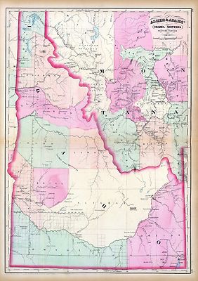
$3.95 Shipping Location: Clarkston, United States Rare Map Collection This DVD is part of our Historic Map and Atlas Collection. We have dozens of Atlas maps on DVD and CD ranging from the 1500s to the ... more1900s covering many areas and topics. Please Check our Ebay Store for what's available. FOR MANY MORE EDUCATIONAL CD TITLES ON THIS AND MANY OTHER SUBJECTS PLEASE VISIT OUR EBAY STORE VERY LARGE HIGH RESOLUTION MAP COLLECTION ON DVD! please see full table of contents and sample illustrations below) This DVD Contains 101 Maps of Idaho Including 44 PANORAMIC MAPS of various Idaho Cities These are scans of the ORIGINAL maps by various Cartographers. on DVD System requirements PC or Mac compatible. Files are simple PDF files with a basic HTML interface(just like viewing a webpage) Works with ALL versions of Windows. Maps of Idaho 0041037 Idaho. Montana west Asher& Adams 1874, 0586049 Idaho. Hand colored. Relief shown by hachures. Shows counties. Indian reservations, townships, settlements, rivers, etc. Mitchell. Samuel Augustus 1880, 0806001 Road map Idaho. Mont. Wyo. Rand McNally and Company; Texas Company 1937, 2212244 Partie des Etats-Unis. Amer. Sep. 39. Hand col. lithographed map. Relief shown by hachures. Shows Indians tribes with populations. Lewis and Clarke's route, etc. Covers parts of Idaho, Montana and Wyoming. Vandermaelen. Philippe 1827, 2738014 32D. Part Of South-Eastern Idaho Part Of South-Eastern Idaho. Atlas Sheet No. 32(D) Issued June 30, 1879. Weyss, Lang& Herman Del. Expedition of 1877, Under the Command of 1st Lieut. Geo. M. Wheeler, Corps of Engineers, U.S. Army. U.S. Geographical Surveys West Of The 100th Meridian. 1879, 2738015 32D. Land Classification Map Of Part Of South-Eastern Idaho. showing land classification. In full color with area and percentage of classifications noted. Wheeler. G.M. 1879, 2738020 41A. Parts Of Southern Idaho& Northern Utah Wheeler. G.M 1880, 2773005 Map Of The Road From Missouri To Oregon. Section V. Fremont. J.C. Preuss, Charles 1846, 2773006 Map Of The Road From Missouri To Oregon. Section VI.

Buy It Now
$3.95 Shipping Location: Clarkston, United States Rare Map Collection This DVD is part of our Historic Map and Atlas Collection. We have dozens of Atlas maps on DVD and CD ranging from the 1500s to the ... more1900s covering many areas and topics. Please Check our Ebay Store for what's available. FOR MANY MORE EDUCATIONAL CD TITLES ON THIS AND MANY OTHER SUBJECTS PLEASE VISIT OUR EBAY STORE VERY LARGE HIGH RESOLUTION MAP COLLECTION ON DVD! please see full table of contents and sample illustrations below) This DVD Contains 170 Maps of Mississippi These are scans of the ORIGINAL maps by various Cartographers. on DVD System requirements PC or Mac compatible. Files are simple PDF files with a basic HTML interface(just like viewing a webpage) Works with ALL versions of Windows. Maps of Mississippi 0089033 Mississippi. Bradford. Thomas G. 1838, 0122024 Map Of Mississippi. Carey. H. C. Lea, I. 1822, 0149038 Mississippi. Colton. G.W. 1856, 0285028 Mississippi. Finley. Anthony 1831, 0537024 New Map Of Mississippi. Mitchell. Samuel Augustus 1846, 0977020 New Map Of Mississippi. Tanner. Henry S. 1836, 1070012 Mississippi. U.S. General Land Office 1866, 2301028 Mississippi. Morse. Sidney E. Sidney Edwards) Breese, Samuel 1845, 2788011 Map of the Seat of War among the Creek Indians. Melish. John 1815, 3565097 Mississippi. Rand McNally and Company 1897, 4453035 Mississippi. Goodrich. S.G. Bradford, Thomas G. 1841, 4520031 Mississippi. Rand McNally and Company 1879, 4584064 Mississippi. Lucas. Fielding Jr. 1823, 4628054 Mississippi. Burr. David H 1835, 4664022 Plan Of Nogales. The earliest map of the area of Vicksburg. With a key decoding the letters on the map. Uncolored with scale in fathoms. Collot. George Henri Victor; Tardieu, P.F. 1796, 4664024 Town and Fort of Natchez. Probably the earliest map of Natchez. Uncolored with the scale in fathoms. Collot. George Henri Victor; Tardieu, P.F. 1796, 4807154 Mississippi. Grassl. J. Joseph) Meyer, Joseph 1852, 4850054 Mississippi. Greenleaf. Jeremiah 1840, 5455000 State of Mississippi. U.S. General Land Office 1878, ct0006

Buy It Now
$3.95 Shipping Location: Clarkston, United States Rare Map Collection This DVD is part of our Historic Map and Atlas Collection. We have dozens of Atlas maps on DVD and CD ranging from the 1500s to the ... more1900s covering many areas and topics. Please Check our Ebay Store for what's available. FOR MANY MORE EDUCATIONAL CD TITLES ON THIS AND MANY OTHER SUBJECTS PLEASE VISIT OUR EBAY STORE VERY LARGE HIGH RESOLUTION MAP COLLECTION ON DVD! please see full table of contents and sample illustrations below) This DVD Contains 104 Maps of Kansas Including 10 PANORAMIC MAPS of various Kansas Cities These are scans of the ORIGINAL maps by various Cartographers. on DVD System requirements PC or Mac compatible. Files are simple PDF files with a basic HTML interface(just like viewing a webpage) Works with ALL versions of Windows. Early Maps of Kansas 0041026 Kansas Asher& Adams 1874, 0041027 Nebraska.and Kansas Asher& Adams 1874, 3565134 Kansas. Rand McNally and Company 1897, 3933001 Kansas And The Gold Mines.The map is of eastern Kansas west to the 98th meridian. With an inset of the"Routes from the Missouri River to the Kansas Gold Mines. This inset does not show Colorado, even though it was formed in 1860. There is a list of the Population of Kansas Counties, and a vignette of an Indian. Gunn. O.B. Mitchell, D.T. 1862, 4520041 Kansas. Rand McNally and Company 1879, 5370017 Kansas. Cram Atlas Company 1875, ct000891 J.H. Colton& Co. Coltons Kansas and Nebraska. New York. 1855 ct001342 Hartley French Dickson& Co. Map of the recently discovered gold regions in Western Kansas& Nebraska/ from actual surveys notes& observations by Hartley French Dickson& Co. 1859? ct001346 Mitchell. D. T. David T. Mitchells sectional map of Kansas/ compiled from the field notes in the Surveyor Generals office by David T. Mitchell. U.S. surveyor and land agent, Lecompton, Kansas; showing the U.S. survey up to 1859. Lecompton. Kansas: David T. Mitchell, 1859 cwh00204[Base map of Kansas] 1893] pm002260 Ruger. A. Birds eye view of the city of Atchison. Atchison Co

Buy It Now
$3.95 Shipping Location: Clarkston, United States Rare Map Collection This DVD is part of our Historic Map and Atlas Collection. We have dozens of Atlas maps on DVD and CD ranging from the 1500s to the ... more1900s covering many areas and topics. Please Check our Ebay Store for what's available. FOR MANY MORE EDUCATIONAL CD TITLES ON THIS AND MANY OTHER SUBJECTS PLEASE VISIT OUR EBAY STORE VERY LARGE HIGH RESOLUTION MAP COLLECTION ON DVD! please see full table of contents and sample illustrations below) This DVD Contains 146 Maps of Utah Including 7 PANORAMIC MAPS of various Utah Cities These are scans of the ORIGINAL maps by various Cartographers. on DVD System requirements PC or Mac compatible. Files are simple PDF files with a basic HTML interface(just like viewing a webpage) Works with ALL versions of Windows. Maps of Utah 0041032 Utah. Shows townships. Distances along railroads, etc. Asher& Adams 1874, 0408004 Utah Basin. Geological) King. Clarence 1876, 0950001 Map of the Great Salt Lake. Stansbury. Howard; Gunnison, J.W. Preuss, C. 1852, 0950002 Map of a Reconnoissance between Fort Leavenworth. and the Great Salt Lake Stansbury. Howard; Gunnison, J.W. Preuss, C. 1852, 1070018 Utah. Indian reservations are outlined in gray. U.S. General Land Office 1866, 2078001 Green River from the Union Pacific Rail Road to White River(land cover) Geological and Geographical Survey of the Territories(U.S. Powell. John Wesley, 1834-1902; Thompson, A. H. Almon Harris) 1839-1906; De Motte, B. C. Bishop, F. M. 1876, 2078002 Green River from the Union Pacific Rail Road to White River(geology) Geological and Geographical Survey of the Territories(U.S. Powell. John Wesley, 1834-1902; Thompson, A. H. Almon Harris) 1839-1906; De Motte, B. C. Bishop, F. M. 1876, 2078003 Structure sections through the Uinta Mountains. Geological and Geographical Survey of the Territories(U.S. Powell. John Wesley 1876, 2078004 Displacement diagrams. through the Uinta Mountains. Geological and Geographical Survey of the Territories(U.S. Powell. John Wesley 1876, 2078005 Ste

Buy It Now
$3.95 Shipping Location: Clarkston, United States Rare Map Collection This DVD is part of our Historic Map and Atlas Collection. We have dozens of Atlas maps on DVD and CD ranging from the 1500s to the ... more1900s covering many areas and topics. Please Check our Ebay Store for what's available. FOR MANY MORE EDUCATIONAL CD TITLES ON THIS AND MANY OTHER SUBJECTS PLEASE VISIT OUR EBAY STORE VERY LARGE HIGH RESOLUTION MAP COLLECTION ON DVD! please see full table of contents and sample illustrations below) This DVD Contains 219 Maps of Illinois Including 63 PANORAMIC MAPS of various Illinois Cities These are scans of the ORIGINAL maps by various Cartographers. on DVD System requirements PC or Mac compatible. Files are simple PDF files with a basic HTML interface(just like viewing a webpage) Works with ALL versions of Windows. Maps of Illinois 0041021 0079001 0089020 0122028 0149049 0151055 0152054 0176002 0285027 0352037 0535035 0537032 0586032 0594034 0749003 0977028 1159142 2368002 2483030 2680030 2755017 2794003 2809025 2843003 2844046 2861005 2866046 2871005 2880002 2905025 2915006 3007058 3190002 3206004 3274000 3471006 3565110 3565111 3565113 3580002 3714000 3715000 3716000 3741005 3803036 3825012 3884011 3888037 3939002 3944001 4071001 4079002 4079004 4220001 4220002 4324015 4328034 4453022 4464001 4513002 4520027 4541002 4557032 4574032 4578032 4584068 4587054 4628046 4727022 4727023 4727024 4740043 4797000 4821002 4825053 4825055 4850046 4862023 4866055 4869011 4877001 4918002 4923002 4924002 4925002 4957002 4962002 4963003 4966015 4977042 5022027 5022031 5028085 5028089 5030001 5041019 5045002 5048001 5048002 5059000 5131003 5138001 5145002 5198015 5363032 5370015 5371118 5371122 5388023 5398002 5418002 5439000 5450000 5479087 5522000 5537000 5538000 5745059 5755019 5784034 5784035 5802004 5840029 5956043 6921124 cw0001500 cw0012700 cw0023500 cw0033000 cw0075600 cw0077600 cw0213000 cw0215000 la000120 rr000720 rr001140 rr001150 rr001160 rr001190 rr001210 rr001220 rr002020 rr002030 rr002040 rr002070 rr003690 rr004110 rr004140 rr004240 rr004250 rr004260 rr00431

Buy It Now
$3.95 Shipping Location: Clarkston, United States Rare Map Collection This DVD is part of our Historic Map and Atlas Collection. We have dozens of Atlas maps on DVD and CD ranging from the 1500s to the ... more1900s covering many areas and topics. Please Check our Ebay Store for what's available. FOR MANY MORE EDUCATIONAL CD TITLES ON THIS AND MANY OTHER SUBJECTS PLEASE VISIT OUR EBAY STORE VERY LARGE HIGH RESOLUTION MAP COLLECTION ON DVD! please see full table of contents and sample illustrations below) This DVD Contains 218 Maps of New Jersey Including 43 PANORAMIC MAPS of various New Jersey Cities These are scans of the ORIGINAL maps by various Cartographers. on DVD System requirements PC or Mac compatible. Files are simple PDF files with a basic HTML interface(just like viewing a webpage) Works with ALL versions of Windows. Maps of New Jersey 0028038 0041007 0073007 0089015 0102017 0104004 0122012 0149025 0151032 0278006 0280006 0285014 0346020 0352023 0358029 0425081 0537013 0545016 0565012 0572021 0586019 0592018 0594017 0632012 0845011 0977011 0998002 1234003 1573001 1573003 1690064 2054023 2094022 2134059 2287000 2301013 2307017 2436043 2468011 2483017 2501008 2542009 2585069 2589029 2593026 2680017 2721018 2743003 2755010 2782007 2788006 2809016 2844021 2862032 2866040 2902001 2902002 2905014 2931033 3055002 3061002 3346000 3565079 3803016 3884006 3888019 4061002 4075002 4089002 4111002 4324012 4328015 4453017 4520016 4534017 4551002 4557013 4574020 4577013 4584053 4587031 4628040 4727013 4807144 4825030 4835019 4850040 4863032 4864018 4865009 4866040 4869005 4966013 5028032 5028033 5041016 5146002 5323000 5363013 5388016 5438000 5479042 5580049 5745042 5755007 5784017 5956021 6727015 ar070600 ar070900 ar071200 ar071300 ar071301 ar071400 ar071402 ar071403 ar071601 ar071602 ar071603 ar071800 ar072600 ar072700 ar072701 ar073701 ar103601 ar104101 ar104400 ar105500 ar105700 ar106800 ar106900 ar109100 ar114300 ar114400 ar121100 ar124600 ar124700 ar124900 ar125200 ar125500 ar125600 ar125700 ar125800 ar125900 ar126200 ar126500 ar126700 ar127200 ar127300 ar127400 a

Buy It Now
$3.95 Shipping Location: United States Rare Map Collection This DVD is part of our Historic Map and Atlas Collection. We have dozens of Atlas maps on DVD and CD ranging from the 1500s to the ... more1900s covering many areas and topics. Please Check our Ebay Store for what's available. FOR MANY MORE EDUCATIONAL CD TITLES ON THIS AND MANY OTHER SUBJECTS PLEASE VISIT OUR EBAY STORE VERY LARGE HIGH RESOLUTION MAP COLLECTION ON DVD! please see full table of contents and sample illustrations below) This DVD Contains 201 Maps of Tennessee Including 12 PANORAMIC MAPS of various Tennessee Cities These are scans of the ORIGINAL maps by various Cartographers. on DVD System requirements PC or Mac compatible. Files are simple PDF files with a basic HTML interface(just like viewing a webpage) Works with ALL versions of Windows. Maps of Tennessee' A preliminary agricultural map of Tennessee based on the distribution of geological formations. 1896 Tennessee Centennial Exposition. Nashville, Tennessee, 1897. Sketch of the environs of Shelbyville. Wartrace& Normandy, Tennessee Compiled from the best information under the direction of Capt. N. Michler, Corps of Topographical Engrs. U.S.A. by John E. Weyss, Maj. Ky. Vols. Chief Asst. Drawn by C. S. Mergell. Photographed by M. Carpenter. 1863 Tennessee-North Carolina. A map of the Tennessee government. Formerly part of North Carolina. 1795 Reconnaissance erosion survey of the State of Tennessee. 1934 Middle Tennessee/ G.H. Blakeslee-1863. Alternate title at bottom: Fourteen trips across Tennessee 1862-1864 Tennessee. 1826 National Park Service recreational map of Tennessee.195? State of Tennessee. Roadless and undeveloped area evaluation II, RARE II final environmental statement: January 1979/ U.S. Department of Agriculture, Forest Service, Southern Region. A new map of Tennessee. 1850 Mountain region of North Carolina and Tennessee. 1864 The state of Tennessee. 181? The Virginia. Tennessee, and Georgia Air Line; the Shenandoah Valley R.R. Norfolk& Western R.R. East Tennessee, Virginia, Georgia R.R. its lease

Buy It Now
$3.95 Shipping Location: Clarkston, United States Rare Map Collection This DVD is part of our Historic Map and Atlas Collection. We have dozens of Atlas maps on DVD and CD ranging from the 1500s to the ... more1900s covering many areas and topics. Please Check our Ebay Store for what's available. FOR MANY MORE EDUCATIONAL CD TITLES ON THIS AND MANY OTHER SUBJECTS PLEASE VISIT OUR EBAY STORE VERY LARGE HIGH RESOLUTION MAP COLLECTION ON DVD! please see full table of contents and sample illustrations below) This DVD Contains 210 Maps of Florida Including 13 PANORAMIC MAPS of various Florida Cities These are scans of the ORIGINAL maps by various Cartographers. on DVD System requirements PC or Mac compatible. Files are simple PDF files with a basic HTML interface(just like viewing a webpage) Works with ALL versions of Windows. Maps of Florida 0041011 Florida Asher& Adams 1874, 0089031 Florida Bradford. Thomas G. 1838, 0104008 Florida Burr. David H 1839, 0122032 Florida Carey. H. C 1822, 0149036 Florida Colton. G.W. 1856, 0278013 Florida Finley. Anthony 1826, 0285031 Florida Finley. Anthony 1831, 0346029 Coast Of West Florida and Louisiana.with the Bahama Islands. Jefferys. Thomas 1776, 0537022 Florida Mitchell. Samuel Augustus 1845, 0565018 County Map Of Florida. Mitchell. Samuel Augustus 1860, 0586026 Florida. Mobile Mitchell. Samuel Augustus 1880, 0594027 Florida Mitchell. Samuel Augustus 1890, 0632022 East and West Florida Morse. Jedidiah 1794, 0890141 Florida Society for the Diffusion of Useful Knowledge(Great Britain) 1834, 0977018 Florida Tanner. Henry S. 1836, 1070014 Florida U.S. General Land Office 1866, 1780149 Florida. Gen. map XI Julius Bien& Co. United States. War Department 1895, 1780150 Florida. Gen. map XII Julius Bien& Co. United States. War Department 1895, 2209000 Map Of The Seat Of War In Florida Hood. Washington 1838, 2212268 Florides et Iles Lucayes Vandermaelen. Philippe 1827, 2239030 Florida. Georgia, and South Carolina Lloyd. H. H. 1873, 2301031 Florida Morse. Sidney Edwards) Breese, Samuel 1845, 2329007 Floride. Delta du Mississippi

Buy It Now
$3.95 Shipping Location: United States This DVD is part of our Historic Map and Atlas Collection. We have dozens of Atlas maps on CD and DVD ranging from the 1500s to the 1900s covering many ... moreareas and topics. Please Check our Ebay Store for what's available. FOR MANY MORE EDUCATIONAL DVD TITLES ON THIS AND MANY OTHER SUBJECTS PLEASE VISIT OUR EBAY STORE VERY LARGE HIGH RESOLUTION MAP COLLECTION ON DVD! please see full table of contents and sample illustrations below) This DVD Contains 127 Maps of ALASKA These are scans of the ORIGINAL maps. on DVD System requirements PC or Mac compatible. Files are simple PDF files with a basic HTML interface(just like viewing a webpage) Works with ALL versions of Windows. 0233009 Cote nord-ouest de l'Amerique. Reconnue par le Cape. Vancouver. Ve. partie. Depuis 5707'30" de latitude septle. et 22700' de longitude, jusqu'a 59059' de late. et 21900' de longe. with) Plan du Port Conclusion. with) Plan de Port Protection. with) Plan de l'entree de Cross-Sound. Vancouver. George 1828. 0233010 Cote nord-ouest de l'Amerique. Reconnue par le Cape. Vancouver. VIe. partie. Depuis 50045' i.e. 59045' de latitude septle. et 219030' de longde. jusqu'a 59056' de late. et 21208' de longde. with) Plan du Port Chalmers. Vancouver. George 1828. 0233011 Cote nord-ouest de l'Amerique. Reconnue par le Cape. Vancouver. VIIe. partie. Depuis 50030' de latitude seple. et 207020' de longitude or(ienta)le. jusqu'au Cap Douglas par 58052' de lat. et 207020' de long. with) Port Chatham. Vancouver. George 1828. 0233025 Plan du Port des Francais sur la cote du nord-ouest de l'Amerique. Par 58037' de latitude nord et 139050' de longitude occidentale decouvert le 2 Juillet 1786 par les Fregates Francaise la Boussole et l'Astrolabe. La Perouse. Jean-Francois de Galaup, comte de 1797. 0233026 Plan de l'entree du Port de Bucarelli sur la cote du nord-ouest de l'Amerique. Par 55015' de latitude nord et 136015' de longitude a l'ouest

Buy It Now
$3.50 Shipping Location: Clarkston, United States Rare Map Collection This DVD is part of our Historic Map and Atlas Collection. We have dozens of Atlas maps on DVD and CD ranging from the 1500s to the ... more1900s covering many areas and topics. Please Check our Ebay Store for what's available. FOR MANY MORE EDUCATIONAL CD TITLES ON THIS AND MANY OTHER SUBJECTS PLEASE VISIT OUR EBAY STORE VERY LARGE HIGH RESOLUTION MAP COLLECTION ON DVD! please see full table of contents and sample illustrations below) This DVD Contains 133 Maps of Nebraska Including 6 PANORAMIC MAPS of various Nebraska Cities These are scans of the ORIGINAL maps by various Cartographers. on DVD System requirements PC or Mac compatible. Files are simple PDF files with a basic HTML interface(just like viewing a webpage) Works with ALL versions of Windows. Maps of Nebraska 0149055 Colton. G.W. Date: 1856 Nebraska And Kanzas. 2719001 Everts& Kirk Date: 1885 Nebraska. 2773001 Fremont. J.C. Preuss, Charles Date: 1846 Map Of The Road From Missouri To Oregon. Section I. 2773002. J.C. Preuss, Charles Date: 1846 Map Of The Road From Missouri To Oregon. Section II. 2773003 Fremont. J.C. Preuss, Charles Date: 1846 Map Of The Road From Missouri To Oregon. Section III. 2905028 Johnson. A.J. Date: 1860 Nebraska And Kansas. 3565136 Rand McNally and Company Date: 1897 Nebraska. 3825008 Rogers. Henry Darwin; Johnston, Alexander Keith, 1804-1871 Date: 1857 Territory of Nebraska. 3919A Mid West Map Company Date: 1920 Cover: Nebraska highway map. 3919B Mid West Map Company Date: 1920 Text Page: Nebraska highway map 4520038 Rand McNally and Company Date: 1879 Nebraska. 4648000 U.S. General Land Office Date: 1879 State Of Nebraska. 5370018 Cram Atlas Company Date: 1875 Nebraska. ct000891 J.H. Colton& Co. Coltons Kansas and Nebraska. New York. 1855 ct001342 Hartley French Dickson& Co. Map of the recently discovered gold regions in Western Kansas& Nebraska/ from actual surveys notes& observations by Hartley French Dickson& Co. S.l. s.n. 1859? ct001346 Mitchell. D. T. David T. Mitchells sec

Buy It Now
$3.50 Shipping Location: Clarkston, United States Rare Map Collection This DVD is part of our Historic Map and Atlas Collection. We have dozens of Atlas maps on DVD and CD ranging from the 1500s to the ... more1900s covering many areas and topics. Please Check our Ebay Store for what's available. FOR MANY MORE EDUCATIONAL CD TITLES ON THIS AND MANY OTHER SUBJECTS PLEASE VISIT OUR EBAY STORE VERY LARGE HIGH RESOLUTION MAP COLLECTION ON DVD! please see full table of contents and sample illustrations below) This DVD Contains 212 Maps of California Including 59 PANORAMIC MAPS of various California Cities These are scans of the ORIGINAL maps by various Cartographers. on DVD System requirements PC or Mac compatible. Files are simple PDF files with a basic HTML interface(just like viewing a webpage) Works with ALL versions of Windows. Maps of California 0045001 Bancroft. A.L. 1873 Bancroft's Official Guide Map Of City And County Of San Francisco. 0149057 Colton. G.W. 1856 California. with) City of San Francisco. 0233005 Vancouver. George, 1757-1798 1828 Cote NO. L'Amerique 1. 0233012 Malaspina. Alessandro, 1754-1809; Spain. Marina; France. Depot-general de la Marine 1826 Californie. Cotes, Golfe du. 0233027 La Perouse. Jean-Francois de Galaup, comte de, 1741-1788 1797 Port de St. Francois. 0233028 La Perouse. Jean-Francois de Galaup, comte de, 1741-1788 1797 Monterey. Baie de. 0233029 Pantoja y Arriaga. Juan; La Perouse, Jean-Francois de Galaup, comte de, 1741-1788 1797 St. Diego. St. Blas. 0565027 Mitchell. Samuel Augustus 1860 County Map Of California. 0586050 Mitchell. Samuel Augustus 1880 California. San Francisco. 0594049 Mitchell. Samuel Augustus) 1890 California. San Francisco. 1070020 U.S. General Land Office 1866 California. 1592002 Blum. George W. 1896 Sonoma. Marin, Lake, and Napa Counties. 1592003 Blum. George W. 1896 San Mateo. Santa Cruz, Santa Clara, Alameda, and Contra Costa Counties. 1592004 Blum. George W. 1896 Colusa. Yolo, Napa, Butte, Yuba, Sutter, Solano, and Sacramento Counties. 1592005 Blum. George W. 1896 San Benito. Fresno, Monterey, San L
Buy It Now
$3.95 Shipping Location: United States This DVD is part of our Historic Map and Atlas Collection. Arkansas Map Collection. 0041014 Arkansas, Indian Territory. 0089035 Arkansas. 0149042 Arkansas. ... more0537026 New Map Of Arkansas. 0977022 New Map Of Arkansas.

Buy It Now
$3.50 Shipping Location: United States Rare Map Collection This DVD is part of our Historic Map and Atlas Collection. We have dozens of Atlas maps on DVD and CD ranging from the 1500s to the ... more1900s covering many areas and topics. Please Check our Ebay Store for what's available. FOR MANY MORE EDUCATIONAL CD TITLES ON THIS AND MANY OTHER SUBJECTS PLEASE VISIT OUR EBAY STORE VERY LARGE HIGH RESOLUTION MAP COLLECTION ON DVD! please see full table of contents and sample illustrations below) This DVD Contains 141 Maps of Colorado Including 26 PANORAMIC MAPS of various Colorado Cities These are scans of the ORIGINAL maps by various Cartographers. on DVD System requirements PC or Mac compatible. Files are simple PDF files with a basic HTML interface(just like viewing a webpage) Works with ALL versions of Windows. Maps of Colorado 0041033 Asher& Adams 1874 Colorado. 0586044 Mitchell. Samuel Augustus 1880 Colorado. 0594044(Mitchell. Samuel Augustus) 1890 Colorado. 0662001 Nell. Louis 1884 Map of the State of Colorado. 1070016 U.S. General Land Office 1866 Colorado Territory. 2212253 Vandermaelen. Philippe, 1795-1869; Delavault, A. 1827 Parties. Etats-Unis et Nouv. Mexique. Amer. Sep. 48. 2719169 Everts& Kirk 1885 Denver Junction. 2738037 Wheeler. G.M. 1879 52D. Part Of Central Colorado. 2738038 Wheeler. G.M. 1879 52D. Land Classification Map Of Part Of Central Colorado. 2738039 Wheeler. G.M. 1877 53C. Part Of Central Colorado. 2738049 Wheeler. G.M. 1877 61A. Parts Of Southwestern Colorado. 2738050 Wheeler. G.M. 1879 61B. Central Colorado. 2738051 Wheeler. G.M. 1876 61B. Economical Features Of Central Colorado. 2738052 Wheeler. G.M. 1875 61C. SW Colorado. 2738053 Wheeler. G.M. 1878 61C. Part Of Southwestern Colorado. 2738054 Wheeler. G.M. 1878 61C. Land Classification Map Of Part Of South Western Colorado. 2738055 Wheeler. G.M. 1876 61C. S.W. Colorado. San Juan Mining Region. 2738056 Wheeler. G.M. 1877 61C. Economical Features Of S.W. Colorado. San Juan Mining Region. 2738057 Wheeler. G.M. 1878 61D. Part Of South Western Colorado. 2738058 Wheeler. G.

Buy It Now
$3.95 Shipping Location: Clarkston, United States Rare Map Collection This DVD is part of our Historic Map and Atlas Collection. We have dozens of Atlas maps on DVD and CD ranging from the 1500s to the ... more1900s covering many areas and topics. Please Check our Ebay Store for what's available. FOR MANY MORE EDUCATIONAL CD TITLES ON THIS AND MANY OTHER SUBJECTS PLEASE VISIT OUR EBAY STORE VERY LARGE HIGH RESOLUTION MAP COLLECTION ON DVD! please see full table of contents and sample illustrations below) This DVD Contains 102 Maps of Montana Including 11 PANORAMIC MAPS of various Montana Cities These are scans of the ORIGINAL maps by various Cartographers. on DVD System requirements PC or Mac compatible. Files are simple PDF files with a basic HTML interface(just like viewing a webpage) Works with ALL versions of Windows. Maps of Montana 0041036 Montana east. Asher& Adams 1874, 0586040 Montana. Mitchell. Samuel Augustus 1880, 0594042 Montana. Idaho. Wyoming. Mitchell. Samuel Augustus 1890, 2212245 Partie des Etats Unis. Amer. Sep. 40. Shows Indians tribes with populations. Route of Lewis and Clarke, etc. Covers parts of Montana, Wyoming, North and South Dakota and Nebraska. Vandermaelen. Philippe 1827, 2313000 Montana Territory. U.S. General Land Office 1883, 3334001 Ide's Map Of Montana Ide. Arthur W. 1890, 3565139 Montana. Rand McNally and Company 1897, 4520048 Montana. Rand McNally and Company 1879, 5370033 Montana. Cram Atlas Company 1875, ct001176 Drewyer. George. Sketch given by George Drewyer. 5th August 1808: Bighorn River, Wyoming and Montana] 1808? ct001237r Rand McNally and Company. Map showing the land grant of the Northern Pacific Railroad Company in Montana. Idaho, and in part of North Dakota, and in part of eastern Washington, reaching from Dickinson, North Dakota, to Ritzville, eastern Washington. Chicago: Rand McNally& Co. C1890. pm002230 Ruger. A. Birds eye view of the city of Montana. Boone Co. Iowa 1868. Drawn by A. Ruger. Chicago. Chicago Lithographing Co. 1868] pm004520 Wellge. H. Henry) Billings. Montana, county seat of Yellowst

Buy It Now
$3.95 Shipping Location: United States Rare Map Collection This DVD is part of our Historic Map and Atlas Collection. We have dozens of Atlas maps on DVD and CD ranging from the 1500s to the ... more1900s covering many areas and topics. Please Check our Ebay Store for what's available. FOR MANY MORE EDUCATIONAL CD TITLES ON THIS AND MANY OTHER SUBJECTS PLEASE VISIT OUR EBAY STORE VERY LARGE HIGH RESOLUTION MAP COLLECTION ON DVD! please see full table of contents and sample illustrations below) This DVD Contains 185 Maps of Nevada Including 3 PANORAMIC MAPS of various Nevada Cities These are scans of the ORIGINAL maps by various Cartographers. on DVD System requirements PC or Mac compatible. Files are simple PDF files with a basic HTML interface(just like viewing a webpage) Works with ALL versions of Windows. Maps of Nevada 0408005 King. Clarence 1876 Nevada Plateau. Geological) 0408006 King. Clarence 1876 Nevada Basin. Geological) 0408013 King. Clarence 1876 Nevada Basin. Topographical) 0594046(Mitchell. Samuel Augustus) 1890 Utah. Nevada. 1070019 U.S. General Land Office 1866 Nevada. 1566001 Becker. George F. 1882 Map of the Washoe District Showing Mining Claims. 1566002 Becker. George F. 1882 Geological Map of the Washoe District. 1566003 Becker. George F. 1882 Vertical Cross Sections of the Lode. 1566004 Becker. George F. 1882 Vertical Cross Sections of the Lode. 1566005 Becker. George F. 1882 Vertical Cross Sections of the Lode. 1566006 Becker. George F. 1882 Horizontal Section of the Comstock Lode at the Sutro Tunnel Level 1566007 Becker. George F. 1882 Horizontal Section of the Comstock Lode at the Sutro Tunnel Level(South End) 1566008 Becker. George F. 1882 Longitudinal Vertical Projection of the Comstock Lode. Number I. 1566009 Becker. George F. 1882 Longitudinal Vertical Projection of the Comstock Lode. Number II. 1566010 Becker. George F. 1882 Longitudinal Vertical Projection of the Comstock Lode. Number III. 1566011 Becker. George F. 1882 Comstock Mine Maps. Number I. 1566012 Becker. George F. 1882 Comstock Mine Maps. Number II. 1566013 B

Buy It Now
$3.95 Shipping Location: Clarkston, United States Rare Map Collection This DVD is part of our Historic Map and Atlas Collection. We have dozens of Atlas maps on DVD and CD ranging from the 1500s to the ... more1900s covering many areas and topics. Please Check our Ebay Store for what's available. FOR MANY MORE EDUCATIONAL CD TITLES ON THIS AND MANY OTHER SUBJECTS PLEASE VISIT OUR EBAY STORE VERY LARGE HIGH RESOLUTION MAP COLLECTION ON DVD! please see full table of contents and sample illustrations below) This DVD Contains 114 Maps of Wyoming Including 3 PANORAMIC MAPS of various Wyoming Cities These are scans of the ORIGINAL maps by various Cartographers. on DVD System requirements PC or Mac compatible. Files are simple PDF files with a basic HTML interface(just like viewing a webpage) Works with ALL versions of Windows. Maps of Wyoming 0041035 Asher& Adams 1874 Wyoming. 0408002 King. Clarence 1876 Rocky Mountains. Geological) 0408009 King. Clarence 1876 Rocky Mountains. Topographical) 0586042(Mitchell. Samuel Augustus) 1880 Wyoming. 3565141 Rand McNally and Company 1897 Wyoming. 4069001 Holt. George L. 1885 Holt's New Map Of Wyoming. 4118001 Northern Pacific Railway Company 1898 Yellowstone National Park. 4118B Northern Pacific Railway Company 1898 Cover: Yellowstone National Park. 4520040 Rand McNally and Company 1879 Wyoming. 4618000 U.S. General Land Office 1879 Territory Of Wyoming. 5370031 Cram Atlas Company 1875 Wyoming. ct001176 Drewyer. George. Sketch given by George Drewyer. 5th August 1808: Bighorn River, Wyoming and Montana] 1808? ct001852 Bond. Frank, 1856-1940. Holts new map of Wyoming: compiled by permission from official records in U.S. Land Office/ Frank& Fred. Bond. Draftsmen. Cheyenne. Wyo. G.L. Holt, c1883(New York: G.W. C.B. Colton& Co. pm007752 Fowler. T. M. Thaddeus Mortimer) 1842-1922. Factoryville. Wyoming County, Penna/ drawn by T.M. Fowler, Morrisville, Pa. Morrisville] T.M. Fowler& James B. Moyer. 1891. pm010680 Stoner. J. J. Birds eye view of Cheyenne. Wyo. county seat of Laramie Co. 1882. Beck& Pauli, lith

Buy It Now
$3.95 Shipping Location: Clarkston, United States Click Here. Double your traffic. Get Vendio Gallery- Now FREE! Rare Map Collection This DVD is part of our Historic Map and Atlas Collection. We have ... moredozens of Atlas maps on DVD and CD ranging from the 1500s to the 1900s covering many areas and topics. Please Check our Ebay Store for what's available. FOR MANY MORE EDUCATIONAL CD TITLES ON THIS AND MANY OTHER SUBJECTS PLEASE VISIT OUR EBAY STORE VERY LARGE HIGH RESOLUTION MAP COLLECTION ON DVD! please see full table of contents and sample illustrations below) This DVD Contains 191 Maps of Missouri Including 39 PANORAMIC MAPS of various Missouri Cities These are scans of the ORIGINAL maps by various Cartographers. on DVD System requirements PC or Mac compatible. Files are simple PDF files with a basic HTML interface(just like viewing a webpage) Works with ALL versions of Windows. Maps of Missouri 0041023 Missouri. Asher& Adams 1874, 0089036 Missouri. Bradford. Thomas G. 1838, 0122029 Map Of Missouri. Carey. H. C. Lea, I. 1822, 0149051 Missouri. Colton. G.W. 1856, 0285030 Missouri. Finley. Anthony 1831, 0537033 New Map Of Missouri. Mitchell. Samuel Augustus 1846, 0586034 St. Louis. Mitchell. Samuel Augustus 1880, 0594036 St. Louis. Mitchell. Samuel Augustus 1890, 0977029 New Map Of Missouri. Tanner. Henry S. 1836, 1070009 Missouri. U.S. General Land Office 1866, 1159143 Map of St. Louis City. Campbell. Robert Allen; Warner& Beers; Union Atlas Co. 1876, 2301023 Missouri. Morse. Sidney E. Sidney Edwards) Breese, Samuel 1845, 2483033 St. Louis. Mitchell. Samuel Augustus 1870, 3565126 Missouri. Rand McNally and Company 1897, 3565127 St. Joseph. Rand McNally and Company 1897, 3565128 St. Louis. Rand McNally and Company 1897, 4197001 Map Of The City Of St. Louis. Paul. Rene 1844, 4453038 Missouri Goodrich. S.G. Bradford, Thomas G. 1841, 4577027 Missouri Territory formerly Louisiana. Carey. Mathew 1814, 4584069 Missouri. Lucas. Fielding Jr 1823, 4628047 Missouri. Burr. David H 1835, 4664016 Plan of Cape Girardo Plan of an early Missouri town on the Mississ

Buy It Now
$3.95 Shipping Location: Clarkston, United States Rare Map Collection This DVD is part of our Historic Map and Atlas Collection. We have dozens of Atlas maps on DVD and CD ranging from the 1500s to the ... more1900s covering many areas and topics. Please Check our Ebay Store for what's available. FOR MANY MORE EDUCATIONAL CD TITLES ON THIS AND MANY OTHER SUBJECTS PLEASE VISIT OUR EBAY STORE VERY LARGE HIGH RESOLUTION MAP COLLECTION ON DVD! please see full table of contents and sample illustrations below) This DVD Contains 181 Maps of Minnesota Including 44 PANORAMIC MAPS of various Minnesota Cities These are scans of the ORIGINAL maps by various Cartographers. on DVD System requirements PC or Mac compatible. Files are simple PDF files with a basic HTML interface(just like viewing a webpage) Works with ALL versions of Windows. Maps of Minnesota An illustrated historical atlas of the state of Minnesota. An illustrated historical atlas of the state of Minnesota. An illustrated historical atlas of the state of Minnesota. Outline map of Minneapolis and St. Paul. 1897 Chippewa National Forest. Minnesota/ U.S. Department of Agriculture, Forest Service. 1994 Railroad and post office map of Minnesota and Wisconsin. 1871 Township and railroad map of Minnesota published for the Legislative Manual. 1874. Minneapolis and Saint Anthony. Minnesota 1867. Drawn by A. Ruger. 1867 Davisons map 25 miles around Minneapolis 1881. Map showing the Burlington Cedar Rapids and Minnesota Railway and its connections. 1868 Map of Winona County. Minnesota. 1867. Minneapolis. Minnesota. W. V. Herancourt, del. 1885 View of St. Paul. Minnesota. By Geo. Ellsbury and Vernon Green. 1874 Panoramic view of the city of Red Wing. Goddhue[sic] Co. Minnesota, 1880/ Shober& Carqueville, Lith. Co. Carte de la riviere Longue: et de quelques autres. Qui se dechargent dans le grand fleuve de Missisipi[sic] Carte que les Gnacsitares: ont dessine sur des paux de cerfs 1703 Bird's eye view of the city of Mankato. Blue Earth County, Minnesota 1870. Merchants Lithographing Co. 1883 bird's eye view of L

Buy It Now
$3.95 Shipping Location: Clarkston, United States Rare Map Collection This DVD is part of our Historic Map and Atlas Collection. We have dozens of Atlas maps on DVD and CD ranging from the 1500s to the ... more1900s covering many areas and topics. Please Check our Ebay Store for what's available. FOR MANY MORE EDUCATIONAL CD TITLES ON THIS AND MANY OTHER SUBJECTS PLEASE VISIT OUR EBAY STORE VERY LARGE HIGH RESOLUTION MAP COLLECTION ON DVD! please see full table of contents and sample illustrations below) This DVD Contains 234 Maps of Michigan Including 45 PANORAMIC MAPS of various Iowa Cities These are scans of the ORIGINAL maps by various Cartographers. on DVD System requirements PC or Mac compatible. Files are simple PDF files with a basic HTML interface(just like viewing a webpage) Works with ALL versions of Windows. Maps of Michigan Map of Michigan showing the Toledo. Ann Arbor, North Michigan Railway and connecting lines. 1886, Map of the northwestern states. Shewing[sic] what proportion lies north of the parallel of South Bend of Lake Michigan. It will be seen at a glance. That the unbroken line of communication with the Atlantic seaboard, and the only winter route for northern Indiana, northern Illinois, Michigan, Iowa, Wisconsin, and Minnesota, will be by the Michigan Southern Railway, and south shore of Lake Erie. 1850, Railroad map of Michigan prepared for the commissioner of railroads. c1874, Skeleton map. Showing the position and connections of the Michigan Southern Rail Road(from Toledo to Chicago) with the several great rail road routes to the Atlantic seaboard and New York City via the south shore of Lake Erie. 1850, Official map of Michigan. Railroad, township and sectional, prepared under the direction of the commissioner of railroads. 1855, A map of part of the continent of North America: between the 35th and 51st degrees of north latitude. And extending from 890 degrees of west longitude to the Pacific Ocean/ compiled from the authorities of the best informed travellers by M. Lewis; copied by Nicholas King, 1805. Carte de la riviere Longue

Buy It Now
$3.95 Shipping Location: Clarkston, United States Rare Map Collection This DVD is part of our Historic Map and Atlas Collection. We have dozens of Atlas maps on DVD and CD ranging from the 1500s to the ... more1900s covering many areas and topics. Please Check our Ebay Store for what's available. FOR MANY MORE EDUCATIONAL CD TITLES ON THIS AND MANY OTHER SUBJECTS PLEASE VISIT OUR EBAY STORE VERY LARGE HIGH RESOLUTION MAP COLLECTION ON DVD! please see full table of contents and sample illustrations below) This DVD Contains 180 Maps of New Hampshire Including 44 PANORAMIC MAPS of various New Hampshire Cities These are scans of the ORIGINAL maps by various Cartographers. on DVD System requirements PC or Mac compatible. Files are simple PDF files with a basic HTML interface(just like viewing a webpage) Works with ALL versions of Windows. Maps of New Hampshire 0028031 0089008 0102011 0122006 0149018 0151025 0246002 0278003 0280003 0285008 0346017 0352019 0513002 0535018 0536005 0537008 0545011 0572014 0586012 0592013 0632007 0845004 0887010 0977007 1149024 1149025 1149026 1149029 1550022 1690052 2022006 2023002 2023281 2054018 2094017 2134053 2301006 2303000 2336002 2436036 2468008 2483010 2501002 2542003 2680011 2721012 2746002 2809005 2844010 2862026 2866035 2905011 2931027 2947002 2990000 3095011 3095018 3115002 3168002 3198003 3540004 3544000 3544003 3565067 3803011 3884003 3888013 4083005 4164002 4323004 4324010 4328011 4339002 4395002 4453009 4520012 4534010 4557009 4574013 4577007 4578008 4584047 4727005 4740025 4796004 4807138 4825024 4835013 4850035 4862014 4863026 4864012 4865003 4866034 4869002 4949002 4966016 5028018 5041012 5198010 5363008 5373000 5479028 5745036 5755004 5784012 5840055 5956009 6727011 6921120 ar079700 ar079900 ar080400 ar080800 ar081000 ar081001 ar081100 ar081200 ar086900 ar087000 ar087100 ar087200 ar087300 ar087400 ar087500 ar087600 ct000129 rr000980 rr000990 rr001030 rr001110 rr002540 rr003500 rr003870 rr005390 rr006170 Bird's Eye View Maps 1 2 3 4 5 6 7 8 9 10 11 12 13 14 15 16 17 18 19 20 21 22 23 24 25 26 27 28 29 30 31 32 33 34 35

Buy It Now
$3.95 Shipping Location: Clarkston, United States Rare Map Collection This DVD is part of our Historic Map and Atlas Collection. We have dozens of Atlas maps on DVD and CD ranging from the 1500s to the ... more1900s covering many areas and topics. Please Check our Ebay Store for what's available. FOR MANY MORE EDUCATIONAL CD TITLES ON THIS AND MANY OTHER SUBJECTS PLEASE VISIT OUR EBAY STORE VERY LARGE HIGH RESOLUTION MAP COLLECTION ON DVD! please see full table of contents and sample illustrations below) This DVD Contains 76 Maps of Oklahoma Including 7 PANORAMIC MAPS of various Oklahoma Cities These are scans of the ORIGINAL maps by various Cartographers. on DVD System requirements PC or Mac compatible. Files are simple PDF files with a basic HTML interface(just like viewing a webpage) Works with ALL versions of Windows. Maps of Oklahoma 0041015 Asher& Adams 1874 Indian Terr. Texas NW portion. 0586045 Mitchell. Samuel Augustus 1880 Indian Terr. 0594045(Mitchell. Samuel Augustus) 1890 Indian Territory. 1780163 Julius Bien& Co. United States. War Department 1895 Gen. map XXV. 3565132 Rand McNally and Company 1897 Indian Territory. Oklahoma. ct000224 Map of the Indian and Oklahoma territories. S.l. 1892. ct000225 Indian territory: compiled under the direction of the Hon. John H. Oberly. Commissioner of Indian Affairs, by C.A. Maxwell. S.l. 1889. ct000226 Indian territory: compiled from the official records of the records of the General Land Office and other sources under supervision of Geo. U. Mayo. S.l. 1887. ct000282 Geographical Publishing Co. Premier series map of Oklahoma and Indian Territory. S.l. 1905. ct001346 Mitchell. D. T. David T. Mitchells sectional map of Kansas/ compiled from the field notes in the Surveyor Generals office by David T. Mitchell. U.S. surveyor and land agent, Lecompton, Kansas; showing the U.S. survey up to 1859. Lecompton. Kansas: David T. Mitchell, 1859. ct001893 H.H. Lloyd& Co. County map of Texas. And Indian Territory. Chicago. Ill. Warner& Beers, 1875] pm007132 Fowler. T. M. Thaddeus Mortimer) 1842-192

Buy It Now
$3.95 Shipping Location: Clarkston, United States Rare Map Collection This DVD is part of our Historic Map and Atlas Collection. We have dozens of Atlas maps on DVD and CD ranging from the 1500s to the ... more1900s covering many areas and topics. Please Check our Ebay Store for what's available. FOR MANY MORE EDUCATIONAL CD TITLES ON THIS AND MANY OTHER SUBJECTS PLEASE VISIT OUR EBAY STORE VERY LARGE HIGH RESOLUTION MAP COLLECTION ON DVD! please see full table of contents and sample illustrations below) This DVD Contains 110 Maps of North and South Dakota Including 11 PANORAMIC MAPS of various North and South Dakota Cities These are scans of the ORIGINAL maps by various Cartographers. on DVD System requirements PC or Mac compatible. Files are simple PDF files with a basic HTML interface(just like viewing a webpage) Works with ALL versions of Windows. Maps of North and South Dakota 0041034 Dakota. Shows townships. Etc. Prime meridians: Greenwich and Washington. Asher& Adams 1874, 0565025 Minnesota. And Dacotah Mitchell. Samuel Augustus 1860, 0586043 Dakota.Shows counties. Indian reservations, settlements, railroads, rivers, etc. Mitchell. Samuel Augustus 1880, 0594043 Dakota. Relief shown by hachures. Shows counties. Indian reservations, settlements, railroads, rivers, etc. Mitchell. Samuel Augustus 1890 0806002 Road map N. S. Dakota. Relief shown by hachures and spot heights. Indexed. Includes table of gasoline taxes. Rand McNally and Company; Texas Company 1937, 1070008 Dakota Territory The territory is largely unsurveyed. Surveying has only been completed in a few townships right along the Missouri River. The map shows the treaty line of July 23. 1851. U.S. General Land Office 1866, 1172001 Reconnoissances in the Dacota Country. Detailed. Large scale maps of eastern Nebraska of the period. Map is without color. Warren. Gouverneur Kemble 1856, 2083002 Map of the Black Hills of Dakota. Relief shown by hachures. Includes 3-line note on Sioux Reservation. Geographical and Geological Survey of the Rocky Mountain Region(U.S. Jenney. Walter Proctor; Newton, Henry;

Buy It Now
$3.50 Shipping Location: Clarkston, United States Rare Map Collection This DVD is part of our Historic Map and Atlas Collection. We have dozens of Atlas maps on DVD and CD ranging from the 1500s to the ... more1900s covering many areas and topics. Please Check our Ebay Store for what's available. FOR MANY MORE EDUCATIONAL CD TITLES ON THIS AND MANY OTHER SUBJECTS PLEASE VISIT OUR EBAY STORE VERY LARGE HIGH RESOLUTION MAP COLLECTION ON DVD! please see full table of contents and sample illustrations below) This DVD Contains 167 Maps of Indiana Including 17 PANORAMIC MAPS of various Indiana Cities These are scans of the ORIGINAL maps by various Cartographers. on DVD System requirements PC or Mac compatible. Files are simple PDF files with a basic HTML interface(just like viewing a webpage) Works with ALL versions of Windows. Maps of Indiana Railroad map of Indiana. 1896 Cram's township and rail road map of Indiana. 1888 Johnson's map of Indiana showing the rail roads and townships compiled from the latest& best authorities. 1858 Colton's map of the state of Indiana. Compiled from the United States surveys& other authentic sources, exhibiting sections, fractional sections, railroads, canals&c. 1860 Rail road map accompanying the report an[d] exhibit of the Logansport& Northern Indiana Railroad showing its connections and the through route from St. Louis to New York of which this road forms a part; Logansport. Indiana May 1st 1854; L. S. Nash, Chief Engineer. View of Tell City. Perry County, Indiana: Praemie zum Tell City Anzeiger/ A. Hinnen. 187? Map showing the lines of the Columbus. Chicago, and Indiana Central Railway, and their connections. 1868 Map of the Fremont and Indiana Rail Road and its connections. December 1858. Map of the Bellefontaine and Indiana Railroad and connecting lines.1852 Railroad map of Indiana. By Col. Thomas A. Morris, Civil Engineer, 1850 The Indiana. Bloomington and Western Railway System. 1881 Map showing the Indiana& Illinois Central Railway and its connections. 1872 A section of Colton's large map of In

Buy It Now
$3.95 Shipping Location: Clarkston, United States Rare Map Collection This DVD is part of our Historic Map and Atlas Collection. We have dozens of Atlas maps on DVD and CD ranging from the 1500s to the ... more1900s covering many areas and topics. Please Check our Ebay Store for what's available. FOR MANY MORE EDUCATIONAL CD TITLES ON THIS AND MANY OTHER SUBJECTS PLEASE VISIT OUR EBAY STORE VERY LARGE HIGH RESOLUTION MAP COLLECTION ON DVD! please see full table of contents and sample illustrations below) This DVD Contains 211 Maps of Lousianna These are scans of the ORIGINAL maps by various Cartographers. on DVD System requirements PC or Mac compatible. Files are simple PDF files with a basic HTML interface(just like viewing a webpage) Works with ALL versions of Windows. Maps of Lousianna Louisiana. Carey's General atlas of the world and quarters. 1814 Military map of part of Louisiana Compiled at the U.S. Coast Survey Office. A. D. Bache, Supt. 1863. Drawn by H. Lindenkohl. E. Molitor, lith. Map of Las Ormigas Grant. Sabine and DeSoto Parishes, Louisiana 180? Map of a part of Louisiana and Mississippi. Illustrating the operations of the U.S. forces, in the Department of the Gulf Drawn by H. Lindenkohl. E. Moliter lith. 1863 Louisiana. Rand McNally and Company. 1895 Map of Louisiana& Arkansas. Prepared under direction of 1st Lieut. Wm. Hoelcke. 39 U.S. Infty, acting Chief Engineer at hd. qts. Dept. of La. by Helmuth Holtz. 1864? A map of Louisiana. With the course of the Missisipi, and the adjacent rivers, the nations of the natives, the French establishments and the mines; by the author of ye History of that colony. 1757. A map of Canada and the north part of Louisiana with the adjacent countrys. By Thos. Jefferys. Geographer to His Majesty, 1762. J. H. Colton's map of the state of Louisiana and eastern part of Texas compiled from United States Surveys. And other authentic sources, showing the counties, townships, sections. Fractional sections, settlement rights, railroads, c. 1863 Map of a part of the State of Louisiana exhibiting the route of the New-

Buy It Now
$3.95 Shipping Location: Clarkston, United States Rare Map Collection This DVD is part of our Historic Map and Atlas Collection. We have dozens of Atlas maps on DVD and CD ranging from the 1500s to the ... more1900s covering many areas and topics. Please Check our Ebay Store for what's available. FOR MANY MORE EDUCATIONAL CD TITLES ON THIS AND MANY OTHER SUBJECTS PLEASE VISIT OUR EBAY STORE VERY LARGE HIGH RESOLUTION MAP COLLECTION ON DVD! please see full table of contents and sample illustrations below) This DVD Contains 381 Maps of New York Including 204 PANORAMIC MAPS of various New York Cities These are scans of the ORIGINAL maps by various Cartographers. on DVD System requirements PC or Mac compatible. Files are simple PDF files with a basic HTML interface(just like viewing a webpage) Works with ALL versions of Windows. 5810025a 0065001 0089001 0089014 0102016 0103001 0103002 0109002 0122011 0149023 0162002 0173001 0179002 0278005 0280005 0289004 0300045 0358026 0469003 0536001 0536002 0537011 0537012 0545014 0565010 0579018 0586015 0594016 0845010 0887011 0977010 1510004 1550027 1568006 2036003 2134057 2135002 2255000 2483013 2489001 2499002 2501007 2512002 2531002 2542008 2556003 2585069 2587002 2680016 2710026 2755009 2782005 2808003 2848002 2862031 2866036 2905013 3186003 3186004 3211002 3211003 3223002 3228002 3386002 3472000 3540001 3540007 3545000 3547000 3565073 3574000 3803014 3884005 4055002 4083003 4242001 4247000 4328014 4331002 4337002 4524004 4534016 4550001 4557012 4566002 4570002 4577012 4584052 4587029 4835017 4850036 4862015 4863031 4864017 4865008 4922003 4966006 4970000 4971000 4977004 4999001 5022023 5041017 5073002 5128003 5135003 5157002 5182001 5198012 5285002 5298000 5301000 5327000 5363011 5370002 5371128 5371129 5387000 5388015 5399005 ar100600 ar108400 ar108600 ar109100 ar109200 ar109601 ar109900 ar110000 ar110100 ar110400 ar110700 ar110900 ar111300 ar114800 ar115300 ar115500 ar115700 ar115800 ar116001 ar116300 ar116500 ar116600 ar117000 ar117100 ar119900 ar120200 ar120900 ar121000 ar121400 ar121500 ar121600 ar122700 ar122900 ar12300

Buy It Now
$3.95 Shipping Location: Clarkston, United States Rare Map Collection This DVD is part of our Historic Map and Atlas Collection. We have dozens of Atlas maps on DVD and CD ranging from the 1500s to the ... more1900s covering many areas and topics. Please Check our Ebay Store for what's available. FOR MANY MORE EDUCATIONAL CD TITLES ON THIS AND MANY OTHER SUBJECTS PLEASE VISIT OUR EBAY STORE VERY LARGE HIGH RESOLUTION MAP COLLECTION ON DVD! please see full table of contents and sample illustrations below) This DVD Contains 205 Maps of Kentucky Including 7 PANORAMIC MAPS of various Kentucky Cities These are scans of the ORIGINAL maps by various Cartographers. on DVD System requirements PC or Mac compatible. Files are simple PDF files with a basic HTML interface(just like viewing a webpage) Works with ALL versions of Windows. Maps of Kentucky 0028046(Arrowsmith. Aaron) Lewis, Samuel Date: 1812 Short Title: Kentucky. 0041012 Asher& Adams Date: 1874 Short Title: Kentucky. Tennessee. 0089006 Bradford. Thomas G. Date: 1838 Short Title: Washington. Louisville and Jeffersonville. New Orleans. Cincinnati. 0089026 Bradford. Thomas G. Date: 1838 Short Title: Kentucky. 0104011 Burr. David H. 1803-1875 Date: 1839 Short Title: Map of Kentucky& Tennessee. 0122022 Carey. H. C. Lea, I. Date: 1822 Short Title: Map Of Kentucky. 0149040 Colton. G.W. Date: 1856 Short Title: The City Of Louisville Kentucky. with) The City Of New Orleans Louisiana. 0149043 Colton. G.W. Date: 1856 Short Title: Kentucky And Tennessee 0278010 Finley. Anthony Date: 1826 Short Title: Map of Kentucky and Tennessee. 0537028 Mitchell. Samuel Augustus Date: 1846 Short Title: New Map Of Kentucky. 0565016 Mitchell. Samuel Augustus Date: 1860 Short Title: County Map Of Kentucky. And Tennessee. 0586023 Mitchell. Samuel Augustus Date: 1880 Short Title: Kentucky. Tennessee. 0594024(Mitchell. Samuel Augustus) Date: 1890 Short Title: Kentucky. Tennessee. 0632018 Morse. Jedidiah Date: 1794 Short Title: Kentucky. 0845015 Reid. John; Winterbotham, W. Date: 1796 Short Title: State of Kentucky. 0977024 Tanner. Henry S
Buy It Now
$3.95 Shipping Location: Clarkston, United States Cambridgeboro, Crawford County, Pennsylvania, 1895 / drawn by T.M. Fowler, Morrisville, Pa. Du Bois, Clearfield County, Pennsylvania, 1895. Drawn by T. ... moreM. Fowler. Lindsey, Jefferson County, Pennsylvania.
Buy It Now
$3.95 Shipping Location: United States Martenet’s Map of Harford County, Maryland : shore lines and tide water from U.S. Coast Survey, the county from actual surveys / under direction of Simon ... moreJ. Martenet, Baltimore. Schmidt & Trowe, lithographers.
Buy It Now
$3.95 Shipping Location: Clarkston, United States This DVD is part of our Historic Map and Atlas Collection. at Falmouth, 4th September 1765. Joseph Noyes, surveyr. Joseph Noyes, survayor. Falmouth, May ... more22nd, 1766. This DVD Contains. Bird's eye view of the City of Bangor, Penobscot County, Maine, 1875.

Buy It Now
$3.50 Shipping Location: Clarkston, United States Rare Map Collection This DVD is part of our Historic Map and Atlas Collection. We have dozens of Atlas maps on DVD and CD ranging from the 1500s to the ... more1900s covering many areas and topics. Please Check our Ebay Store for what's available. FOR MANY MORE EDUCATIONAL CD TITLES ON THIS AND MANY OTHER SUBJECTS PLEASE VISIT OUR EBAY STORE VERY LARGE HIGH RESOLUTION MAP COLLECTION ON DVD! please see full table of contents and sample illustrations below) This DVD Contains 140 Maps of West Virginia Including 29 PANORAMIC MAPS of various West Virginia Cities These are scans of the ORIGINAL maps by various Cartographers. on DVD System requirements PC or Mac compatible. Files are simple PDF files with a basic HTML interface(just like viewing a webpage) Works with ALL versions of Windows. Maps of West Virginia 3565087 Rand McNally and Company Date: 1897 Short Title: West Virginia. 4190000 Richardson. C.S. Date: 1864 Short Title: Richardson's Map Of West Virginia. 4975106 Hayes. Eli L. Date: 1877 Short Title: Point Pleasant. Mason Co. West Va. with) West Columbia, Clifton, W. Va. 4975111 Hayes. Eli L. Date: 1877 Short Title: Huntington. Cabell Co. W. Va. 4975113 Hayes. Eli L. Date: 1877 Short Title: Ceredo. Wayne Co. 1st Dist. W. Va. with) Catlettsburg, Boyd Co. Ky. ar300700 Washington. George, 1732-1799. Main Title: Plat of a survey for William Hughes. Jr. of 460 acres in Frederick County, Va. on the Cacapon River] 1750. ct000363 Washington. George, 1732-1799. Main Title: Eight survey tracts along the Kanawha River. W.Va. showing land granted to George Washington and others. 1774? ct000592 West Virginia Geological Survey. Main Title: Soil map: West Virginia. Boone county sheet. Baltimore: A. Hoen& Co. 1913. ct000593 Swann. John S. Main Title: Title map of the coal field of the great Kanawha Valley. New York: G.W. C.B. Colton. 1867. ct000594 Hotchkiss. Jedediah, 1828-1899. Main Title: Map of Great Kanawha coal field showing location of mines. Staunton. Va. 1886. ct000595 Chesapeake and Ohio Railroad C

Buy It Now
$3.95 Shipping Location: Clarkston, United States Rare Map Collection This DVD is part of our Historic Map and Atlas Collection. We have dozens of Atlas maps on DVD and CD ranging from the 1500s to the ... more1900s covering many areas and topics. Please Check our Ebay Store for what's available. FOR MANY MORE EDUCATIONAL CD TITLES ON THIS AND MANY OTHER SUBJECTS PLEASE VISIT OUR EBAY STORE VERY LARGE HIGH RESOLUTION MAP COLLECTION ON DVD! please see full table of contents and sample illustrations below) This DVD Contains 276 Maps of Massachusetts Including 144 PANORAMIC MAPS of various Massachusetts Cities These are scans of the ORIGINAL maps by various Cartographers. on DVD System requirements PC or Mac compatible. Files are simple PDF files with a basic HTML interface(just like viewing a webpage) Works with ALL versions of Windows. Early Maps of Massachusetts Adams. 1882] Amesbury. c1890. Amesbury. c1914. Amherst. 1886] Ashland. 1878] Athol. 1887] Ayer. c1886. Baldwinville. c1886. Barre. 189- Barre. 1891. Beverly Farms. 1886] Beverly. 1886] Blackinton(North Adams) 1889 Boston. 1870. Boston. 1873. Boston. c1877. Boston. c1899. Boston. c1902. Boston. c1905. Boston. c1905. Brockton. d1844 Brockton. c1882. Canton. 1918] Chicopee. 1878] Clinton. 1876] Dalton. c1884. East Boston(Boston) 1879] East Douglas. 1886. East Pepperell. 1886. East Walpole. c1898. Edgartown. 1886? Fall River. c1877. Fitchburg. c1882. Fitchburg. c1915. Foxborough. 1879] Glendale. 1890. Graniteville. 1886] Great Barrington. c1884. Greenfield. 1877. Groton(Town) 1886] Haverhill. c1893. Haverhill. 1914] Haydenville. c1886. Hebronville. 1891. Hingham.South Hingham. c1885. Hinsdale. 1887? Holyoke. 1877] Holyoke. South Hadley Falls. 1881] Hopedale. c1899. Hopkinton. 1880. Housatonic. 1890. Huntington. 1886. Leominster. 1886] Lynn. d1820 Manchaug. 1891. Maynard. 1879. Medford. 1880] Merrimac. 1889. Middleboro. 1889. Millers Falls. 18- Mittineague. 1889 Monson. 1879] Nantasket Beach. 1879? Nantucket.Siansconset. 1881. Needham Heights. 1887] Newton Center(Newton)
Buy It Now
$3.95 Shipping Location: Clarkston, United States This DVD is part of our Historic Map and Atlas Collection. The results are very high quality and convincing. 0149013 Colton, G.W. New Brunswick, Nova ... moreScotia, … 1856 0149014 Colton, G.W. Canada East Or Lower Canada … 1856.
Buy It Now
$3.95 Shipping Location: Clarkston, United States This DVD is part of our Historic Map and Atlas Collection. South Carolina. 0089029 South Carolina. 0122019 Map Of South Carolina. 0346027 Map Of North ... moreAnd South Carolina With Their Indian Frontiers.
|
|
|
|
127 HI REZ antique maps ALASKA lot GENEALOGY history atlas panoramic county old
This DVD is part of our Historic Map and Atlas Collection. We have dozens of Atlas maps on CD and DVD ranging from the 1500s to the 1900s covering many areas and topics. Please Check our Ebay Store for what's available. FOR MANY MORE EDUCATIONAL DVD TITLES ON THIS AND MANY OTHER SUBJECTS PLEASE VISIT OUR EBAY STORE VERY LARGE HIGH RESOLUTION MAP COLLECTION ON DVD! please see full table of contents and sample illustrations below) This DVD Contains 127 Maps of ALASKA These are scans of the ORIGINAL maps. on DVD System requirements PC or Mac compatible. Files are simple PDF files with a basic HTML interface(just like viewing a webpage) Works with ALL versions of Windows. 0233009 Cote nord-ouest de l'Amerique. Reconnue par le Cape. Vancouver. Ve. partie. Depuis 5707'30" de latitude septle. et 22700' de longitude, jusqu'a ... more59059' de late. et 21900' de longe. with) Plan du Port Conclusion. with) Plan de Port Protection. with) Plan de l'entree de Cross-Sound. Vancouver. George 1828. 0233010 Cote nord-ouest de l'Amerique. Reconnue par le Cape. Vancouver. VIe. partie. Depuis 50045' i.e. 59045' de latitude septle. et 219030' de longde. jusqu'a 59056' de late. et 21208' de longde. with) Plan du Port Chalmers. Vancouver. George 1828. 0233011 Cote nord-ouest de l'Amerique. Reconnue par le Cape. Vancouver. VIIe. partie. Depuis 50030' de latitude seple. et 207020' de longitude or(ienta)le. jusqu'au Cap Douglas par 58052' de lat. et 207020' de long. with) Port Chatham. Vancouver. George 1828. 0233025 Plan du Port des Francais sur la cote du nord-ouest de l'Amerique. Par 58037' de latitude nord et 139050' de longitude occidentale decouvert le 2 Juillet 1786 par les Fregates Francaise la Boussole et l'Astrolabe. La Perouse. Jean-Francois de Galaup, comte de 1797. 0233026 Plan de l'entree du Port de Bucarelli sur la cote du nord-ouest de l'Amerique. Par 55015' de latitude nord et 136015' de longitude a l'ouest
|
|
|
220 old maps GEORGIA state PANORAMIC genealogy lots HISTORY teaching aid atlas
Rare Map Collection This DVD is part of our Historic Map and Atlas Collection. We have dozens of Atlas maps on DVD and CD ranging from the 1500s to the 1900s covering many areas and topics. Please Check our Ebay Store for what's available. FOR MANY MORE EDUCATIONAL CD TITLES ON THIS AND MANY OTHER SUBJECTS PLEASE VISIT OUR EBAY STORE VERY LARGE HIGH RESOLUTION MAP COLLECTION ON DVD! please see full table of contents and sample illustrations below) This DVD Contains 220 Maps of Georgia Including 15 PANORAMIC MAPS of various Georgia Cities These are scans of the ORIGINAL maps by various Cartographers. on DVD System requirements PC or Mac compatible. Files are simple PDF files with a basic HTML interface(just like viewing a webpage) Works with ALL versions of Windows. Early Maps of Georgia[Part of South Carolina and Georgia] Engineer Bureau. ... moreDec. 24th 1864. Map of the seat of war. In South Carolina, and Georgia. 1861 Camp McDonald; a school of Instruction for the 4th Brigade Georgia Volunteers His excellency Governor Joseph E. Brown. Commander in Chief. Souvenir edition, 1917. The State of Georgia. Showing the major campaign areas and engagement sites of the War between the States, 1861-1865. Sketch of portions of seacoast of South Carolina& Georgia Drawn by A. Lindenkohl. Autogr. copy by H. Lindenkohl. 1862 The Virginia. Tennessee, and Georgia Air Line; the Shenandoah Valley R.R. Norfolk& Western R.R. East Tennessee, Virginia, Georgia R.R. its leased lines, and their connections. 1882 Part of northern Georgia: no. 2/ compiled under the direction of Capt. Wm. E. Merrill. Chief, Top'l Eng'r, D.C. Map of the cost[sic] of Georgia& Florida. 1863 Map showing the proposed Tennessee. Alabama, and Georgia Railroad connecting and extending the Chattanooga Southern Railway, Marietta and North Georgia Railway, Knoxville, Cumberland Gap and Louisville Railroad, and Morristown and Cumberland Gap Railroad. Sketch of the Atlantic coast of the United States from Savannah River to St. Mary's River. Embrac
|
|
|
335 antique maps PENNSYLVANIA state lot GENEALOGY history atlas panoramic county
Click Here. Double your traffic. Get Vendio Gallery- Now FREE! Rare Map Collection This DVD is part of our Historic Map and Atlas Collection. We have dozens of Atlas maps on DVD and CD ranging from the 1500s to the 1900s covering many areas and topics. Please Check our Ebay Store for what's available. FOR MANY MORE EDUCATIONAL CD TITLES ON THIS AND MANY OTHER SUBJECTS PLEASE VISIT OUR EBAY STORE VERY LARGE HIGH RESOLUTION MAP COLLECTION ON DVD! please see full table of contents and sample illustrations below) This DVD Contains 335 Maps of Pennsylvania Including 160 PANORAMIC MAPS of various Pennsylvania Cities These are scans of the ORIGINAL maps by various Cartographers. on DVD System requirements PC or Mac compatible. Files are simple PDF files with a basic HTML interface(just like viewing a webpage) Works with ALL versions of Windows. ... moreEarly Maps of Pennsylvania Irvona. Clearfield County, Pennsylvania. 1895 Mount Pleasant. Pennsylvania. 1900 Somerset. Pennsylvania 1900. Drawn by T. M. Fowler. Oil City. Pennsylvania 1896. Drawn by T. M. Fowler. Rochester. Pennsylvania 1900. Drawn by T. M. Fowler. Pen Argyl. Pennsylvania 1894. Drawn by T. M. Fowler. New Kensington. Pennsylvania, 1902. Drawn by T. M. Fowler. New Brighton. Pennsylvania 1901. Drawn by T. M. Fowler. Indiana. Pennsylvania, 1900. Drawn by T. M. Fowler. Evans City. Pennsylvania 1900. Drawn by T. M. Fowler. Du Bois. Clearfield County, Pennsylvania, 1895. Drawn by T. M. Fowler. Lindsey. Jefferson County, Pennsylvania. 1895 Uniontown. Pennsylvania, 1897. Drawn by T. M. Fowler. Brownsville. Pennsylvania 1902. Drawn by T. M. Fowler. Belle Vernon. Pennsylvania, 1902. Drawn by T. M. Fowler. Hammond's bird's-eye view map of Philadelphia and vicinity/ Spofford. N.Y. 1926? Union City. Erie County, Pennsylvania 1895. Drawn by T. M. Fowler. Telford. Montgomery County, Pennsylvania 1894. Drawn by T. M. Fowler. South Fork. Cambria County, Pennsylvania 1900. Drawn by T. M. Fowler. North East. Erie County, Pennsylvania, 1896. Drawn by T. M. Fowler. New Kens
|
|
 |