|
|
Order by: Available to: This site contains affiliate links for which I may be compensated
|
Buy It Now
Free Shipping Location: Savannah, United States Original 1894 Antique 130-year-old Map of South Carolina Expressly Drawn and Engraved on Copper-Plate by Alvin Jewett Johnson for the 1894 Edition of ... moreJohnson's Cyclopedia: A Scientific, Historical, and Popular Treasury of Useful Knowledge, Illustrated with Plans, Engraved Prints, and Color Maps Complete in Eight Royal Octavo Volumes including an Atlas of the World, featuring Each American State, Major City, and Territory, along with Continents, and every Country Across the Globe; Published 1894 by A.J. Johnson and Company: New York, 1894. Great for American History and Family Genealogy. Imaginative and Creative Gift. Fine Map for the Collector or Historian. Easily Framed.
Buy It Now
Free Shipping Location: Sayville, United States
Buy It Now
Free Shipping Location: Monroe, United States ORIGINAL ANTIQUE 1916 COLOR MAP OF THESTATE OF MISSISSIPPI. MAP HAS A SCALE BELOW TITLE. DATE - 1916, NOT ON MAP. MAP IS BEAUTIFULLY COLORED AND VERY ... moreDETAILED.
Buy It Now
$10.20 Shipping Location: Tonawanda, United States Includes Counties, County Seats, Cities; many Small Towns and Villages; Ports, Military Airfields and Forts; Rivers, Streams, Lakes, Mountains, and other ... moretopographical features are located on this map.
Buy It Now
$8.79 Shipping Location: Greenacres, United States Large-format color lithographed 1913 map of the northern portion of California, from the Oregon border to San Jose, printed more than 110 years ago. There's ... morea large inset of San Francisco and vicinity.
Buy It Now
$7.00 Shipping Location: Rockville, United States This map is from the "STANDARD ATLAS OF GRAND FORKS COUNTY, NORTH DAKOTA". Map of the State, United States and World. Compiled and published by George ... moreA. Ogle & Co., Publishers & Engravers, Chicago.
Buy It Now
$3.50 Shipping Location: United States Very detailed period map of this area of Ireland. This is an antique 1902 map and not a reprint or reproduction. The photo wont show the full beauty or ... moredetail of the map. Any shadows etc on the map are from the photo only, the map is in beautiful condition.
Buy It Now
$3.00 Shipping Location: Rockville, United States Map is generally in Good- condition. Creases in the corners. I would be happy to include a copy if requested.
Buy It Now
$6.95 Shipping Location: Dover, United States By W.P. Blake. and Surveys. By W.P. Blake.
Buy It Now
Free Shipping Location: Old Orchard Beach, United States This Map was removed from a 1881 Atlas and is in very good acceptable condition. 130+ years of aging. Study the photos carefully, this is the actual map ... moreyou. ~ McNALLY1881/072421. Only Authentic Originals.
Buy It Now
$3.50 Shipping Location: Franklin, United States Indiana - 1885 Copper Plate. Map by AJ Johnson.
Buy It Now
Free Shipping Location: Sayville, United States

Buy It Now
$3.75 Shipping Location: Winter Springs, United States Click Here. Double your traffic. Get Vendio Gallery- Now FREE! Fine large antique handcolored map. Titled Lorain City, South Central Part. The map shows ... morethe home and land owners, districts, tracts, named railroads and much more. This is an antique map and not a reprint or reproduction. Fine period handcoloring, nice outside ornate border, printed on thick paper, with no printing on reverse. The map is from the very rare 1896 American Atlas of Lorain County Ohio. The map is a fascinating and historic period look at this area at this time. The map shows the home and land owners, railroads, and much more. The photo wont show the full beauty of the map. The map is in nice shape, tight and clean. The size of the map is 18.5" by 29.5" Winning bidder pays $3.75 shipping domestic, more foreign. Payment I accept the following forms of payment: PayPal Click to View Image Album Shipping& Handling US Shipping. $3.75 USPS First-Class Mail® International Shipping. $11.50 USPS First-Class Mail International FREE scheduling. Supersized images and templates. Get Vendio Sales Manager. FREE scheduling. Supersized images and templates. Get Vendio Sales Manager.
Buy It Now
Free Shipping Location: Sayville, United States
Buy It Now
$7.00 Shipping Location: Rockville, United States Published by D. H. Hurd & Co., Boston, Massachusetts - 1892".

Buy It Now
$3.95 Shipping Location: Clarkston, United States Rare Map Collection This DVD is part of our Historic Map and Atlas Collection. We have dozens of Atlas maps on DVD and CD ranging from the 1500s to the ... more1900s covering many areas and topics. Please Check our Ebay Store for what's available. FOR MANY MORE EDUCATIONAL CD TITLES ON THIS AND MANY OTHER SUBJECTS PLEASE VISIT OUR EBAY STORE VERY LARGE HIGH RESOLUTION MAP COLLECTION ON DVD! please see full table of contents and sample illustrations below) This DVD Contains 265 Maps of Texas Including 21 PANORAMIC MAPS of various Texas Cities These are scans of the ORIGINAL maps by various Cartographers. on DVD System requirements PC or Mac compatible. Files are simple PDF files with a basic HTML interface(just like viewing a webpage) Works with ALL versions of Windows. Maps of Texas 00062 Amerique Septentrionale Map of the New World showing borders of France. Spain, England, Shows California as an island. Sanson. Nicholas 1650, 00110 Map of Texas and the Countries Adjacent: Emory. W. H This map accompanied the annexation treaty negotiated between the U.S. and Texas in 1844. And was part of the accompanying documentation sent to the Senate when the treaty was considered. For Texas to be annexed to the U.S. by treaty, the Senate had to ratify the treaty by 2/3 votes. It did not, and the treaty was defeated. As a result, the Texas annexation question became a political issue in the 1844 presidential election Compiled in the Bureau of the Corps of Topographical Engineers From the Best Authorities. For the State Departmen 1844, 00113 Gray's New Map of Texas and Indian Territory Gray. Frank A 1876, 00337 Mexico& Guatimala Lizars. Daniel 1833, 00384 Nueva Hispania Tabula Nova Map of New Spain Ruscelli. G, 1564, 0041016 Texas East portion. Asher& Adams 1874, 0041017 Texas West portion. Asher& Adams 1874, 00574 Map of The Republic of Texas John Arrowsmith's map of Texas published in 1841 quickly became known for its accuracy and soon became on of the most popular and influential maps of the new republic. P
Buy It Now
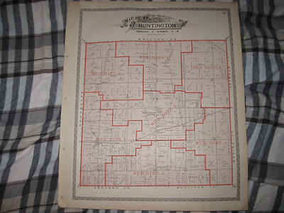
$3.75 Shipping Location: Winter Springs, United States Click Here. Double your traffic. Get Vendio Gallery- Now FREE! Fine antique color lithographed map. Titled Map of Huntington Township. I see Huntington ... moreCentre, and many fascianting areas, the railroads, and more. The map shows the home and land owners, districts, tracts, named railroads and much more. This is an antique map and not a reprint or reproduction. Fine period color lithography, nice outside ornate border, printed on thick paper, with no printing on reverse. The map is from the very rare 1896 American Atlas of Lorain County Ohio. The map is a fascinating and historic period look at this area at this time. The map shows the home and land owners, railroads, and much more. The photo wont show the full beauty of the map. The map is in nice shape, tight and clean. The size of the map is 15.5" by 18.5" Winning bidder pays $3.75 shipping domestic, more foreign. Payment I accept the following forms of payment: PayPal Click to View Image Album Shipping& Handling US Shipping. $3.75 USPS First-Class Mail® International Shipping. $11.50 USPS First-Class Mail International FREE scheduling. Supersized images and templates. Get Vendio Sales Manager. FREE scheduling. Supersized images and templates. Get Vendio Sales Manager.
Buy It Now
Free Shipping Location: Schertz, United States This Map was removed from an 1888 CRAM ATLAS and is in good acceptable condition. The map is not " new " or in " new " condition, it was printed in 1888. ... moreThe map is not dated. Study the photos carefully, this is the actual map you will receive.

Buy It Now
$3.50 Shipping Location: Clarkston, United States Rare Map Collection This DVD is part of our Historic Map and Atlas Collection. We have dozens of Atlas maps on DVD and CD ranging from the 1500s to the ... more1900s covering many areas and topics. Please Check our Ebay Store for what's available. FOR MANY MORE EDUCATIONAL CD TITLES ON THIS AND MANY OTHER SUBJECTS PLEASE VISIT OUR EBAY STORE VERY LARGE HIGH RESOLUTION MAP COLLECTION ON DVD! please see full table of contents and sample illustrations below) This DVD Contains 152 Maps of Washington state Including 18 PANORAMIC MAPS of various Washington Cities These are scans of the ORIGINAL maps by various Cartographers. on DVD System requirements PC or Mac compatible. Files are simple PDF files with a basic HTML interface(just like viewing a webpage) Works with ALL versions of Windows. Maps of Washington 0041039 Asher& Adams 1874 Washington. 0149058 Colton. G.W. 1856 Washington And Oregon. 1070022 U.S. General Land Office 1866 Washington Territory. 2212243 Vandermaelen. Philippe, 1795-1869 1827 Partie des Etats Unis. Amer. Sep. 38. 2449088 Stieler. Adolf 1875 Vereinigte Staaten Von Nord-Amerika In 6 Blattern. Bl. 1. 2544009 Holdredge. Sterling M. 1866 Washington. 2905030 Johnson. A.J. 1860 Washington And Oregon. 3461000 U.S. General Land Office 1879 Washington Territory. 3565151 Rand McNally and Company 1897 Washington. 3825009 Rogers. Henry Darwin; Johnston, Alexander Keith, 1804-1871 1857 Territories Of Washington And Oregon. 4476002 Espinosa y Tello. J. 1802 Carta Esferica de los Reconocimientos Hechos en la Costa N.O. 4520044 Rand McNally and Company 1879 Washington. 4653000 Anderson. O.P. and Co. 1890 City Of Seattle And Environs. 5215001 Rand McNally and Company 1925 Rand McNally Official 1925 Auto Trails Map Washington Oregon. 5370034 Cram Atlas Company 1875 Washington. 5392001 Northern Pacific Railroad Company 1888 Land grant W. Wash. N. Oregon. ct000263 Gill(J.K. Co. J.K. Gill& Cos. map of Washingtonter. Published/Created: S.l. 1878. ct000267 Under a black cloud! Published/Created: S.l. 1883] ct
Buy It Now
$6.95 Shipping Location: Dover, United States Issued 1908, Chicago by Rand McNally. Short edge tear nicely closed on reverse with archival tape and now almost invisible when viewing map. Large, oversized ... moreearly 20th century color lithographed map, composed of two sheets as issued.
Buy It Now
Free Shipping Location: Monroe, United States Very good shape for the age 120 years old.
Buy It Now
$7.00 Shipping Location: Rockville, United States This map is from the "STANDARD ATLAS OF DODGE COUNTY - NEBRASKA". Map of the State, United States and World. Compiled and published by George A. Ogle ... more& Co., Publishers & Engravers, Chicago. I would be happy to include a copy if requested.
Buy It Now
Free Shipping Location: Newport, United States Color plate. On glossy paper. Minor wear and tear to the paper. a pretty image.
Buy It Now
Free Shipping Location: Sayville, United States Rare Original 1895 Map of Indiana by Rand McNally. A finely detailed and brilliantly colored lithograph that shows towns. Cities, counties and railroads. ... moreMeasures approximately 15.75" by 11.75" This is a very attractive vintage map that will look great matted& framed. See photo's. Free Shipping to anywhere in the US. Your order will always ship within ONE BUSINESS DAY. Well packaged in a sturdy waterproof mailer and sent with a delivery confirmation. I ship worldwide. Froo www.froo.com | Froo Cross Sell. Free Cross Sell, Cross promote, eBay Marketing, eBay listing Apps, eBay Apps, eBay Application.
Buy It Now
Free Shipping Location: Newport, United States Map of Nevada. Color plate. On glossy paper. Minor wear and tear to the paper. a pretty image.
Buy It Now
$4.95 Shipping Location: Reading, United States INSET MAP OF VICINITY OF SPRINGFIELD LOWER-LEFT.
Buy It Now
$4.99 Shipping Location: Fairview, United States Illustrated Historical Atlas of the State of Indiana, published in Chicago, 1876. A copy of the title page is included with the map for authenticity. ... moreIt is a steel plate engraved map with lithograph color.
Buy It Now
$8.00 Shipping Location: United States The size of the map is a large 18" by 30".
Buy It Now
$6.00 Shipping Location: Corunna, United States A. Ogle & Co. Chicago in 1911.
Buy It Now
Free Shipping Location: Sayville, United States Plate 50 from the 1897/1902 Century Atlas.
Buy It Now
$5.99 Shipping Location: Bodega Bay, United States Color lithograph by The Century Company shows details, such as cities, towns, counties, lakes, rivers, railroads, and elevation. Measures 12” x 16”. Vintage ... moreoriginal very detailed not a reprintSee photos for more details.
Buy It Now
$4.15 Shipping Location: Saco, United States
Buy It Now
$4.99 Shipping Location: Fairview, United States Illustrated Atlas of Cuyahoga County Ohio, published in Philadelphia by Titus & Simmons, 1874. A copy of the title page is included with the map for authenticity. ... moreAn Authentic Antique Map: Not a Reproduction!
Buy It Now
$4.00 Shipping Location: United States This is an antique 1872 map and not a reprint or reproduction. The map is in excellent condition. The map is printed on thick fine paper, with no printing ... moreon reverse. This is an antique map and not a reprint or reproduction.
Buy It Now
$4.99 Shipping Location: Fairview, United States Illustrated Atlas of Cuyahoga County Ohio, published in Philadelphia by Titus & Simmons, 1874. A copy of the title page is included with the map for authenticity. ... moreThere is tonal ageing, light edge wear, a few handling smudges and browning, see the pics for more on condition.
Buy It Now
$6.00 Shipping Location: Greenacres, United States Genuine original antique color lithographed plat map of two areas on opposite sides of Cleveland in Cuyahoga County, Ohio, printed more than 120 years ... moreago.
Buy It Now
Free Shipping Location: Schertz, United States This Map was removed from an 1888 CRAM ATLAS and is in good acceptable condition. The map is not " new " or in " new " condition, it was printed in 1888. ... moreThe map is not dated. Study the photos carefully, this is the actual map you will receive.
Buy It Now
$4.95 Shipping Location: Reading, United States
Buy It Now
$6.00 Shipping Location: United States The size of the map is a large 18" by 30". FREE scheduling, supersized images.
Buy It Now
$4.50 Shipping Location: United States There is a detailed handcolored Key, corresponding to the map itself. Fascianting, detailed and very attractive period map of this area. From the very ... morerare 1903 Mueller Atlas of Orange County New York.
Buy It Now
$35.00 Shipping Location: Bath, United States Lithograph, 31" x 43.5", plus margins. Overprinted in red, with spot and outline color by hand. Showing all of Virginia, Maryland, West Virginia, and ... moreDelaware, this map spans from eastern Kentucky and Tennessee in the west to Maryland, New Jersey and New York City in the east, and from North Carolina in the south to Ohio and Pennsylvania in the north.
Buy It Now
$4.50 Shipping Location: United States One side is City of Bangor (Penobscot Co.) and Town of Brewer, reverse is City of Ellsworth, Hancock County. This is also a very detailed attractive period ... moremap. This is an antique map and not a reprint or reproduction.
Buy It Now
$3.75 Shipping Location: Winter Springs, United States Printed on thick paper, with no printing on reverse. The handcoloring on the map is period to the map, this is before color printing. The map is from ... morethe very rare 1875 Titus, Simmons and Titus Atlas of Athens County Ohio.
Buy It Now
$4.69 Shipping Location: Greenacres, United States It is dated 1901 in the lower corner.
Buy It Now
$4.69 Shipping Location: Greenacres, United States Original 1900 antique color lithographed map of Wyoming, printed more than 120 years ago. This map was published by George Franklin Cram, Chicago in 1900.
Buy It Now
$12.75 Shipping Location: Akron, United States Original Antique Map from Rand, McNally & Co.’s “Indexed Atlas of the World”, c. 1898. Published in New York & Chicago: From Rand, McNally’sIndexed Atlas ... moreof the World. Very large color-printed map with original color.
Buy It Now
$5.00 Shipping Location: United States The size of the map is a large 18" by 30". FREE scheduling, supersized images.
Buy It Now
Free Shipping Location: Sayville, United States An attractive and colorful map. See photo's.
Buy It Now
$3.75 Shipping Location: Winter Springs, United States Printed on thick paper, with no printing on reverse. The handcoloring on the map is period to the map, this is before color printing. The map is from ... morethe very rare 1875 Titus, Simmons and Titus Atlas of Athens County Ohio.
Buy It Now
$6.00 Shipping Location: Greenacres, United States This map would make an impressive display in your den or office.
Buy It Now
$4.99 Shipping Location: Fairview, United States Illustrated Atlas of Cuyahoga County Ohio, published in Philadelphia by Titus & Simmons, 1874. A copy of the title page is included with the map for authenticity. ... moreThere is light tonal ageing, light edgewear and a few handling smudges, mainly around the margins, see the pics for more on condition.
Buy It Now
$5.75 Shipping Location: Malden, United States Great OLD Map from the "COLLIER'S WORLD ATLAS & GAZETTEER". World War II. Very Educational. See what the City used to look like! If There Is A Particular ... moreCity, State Or Country You Need, Let Us Know.
Buy It Now
$4.59 Shipping Location: Greenacres, United States Original fold-out 1920 Washington pocket map, printed more than 100 years ago.
Buy It Now
Free Shipping Location: Sayville, United States THE CENTURY COMPANY ATLAS MAP PLATE#27 SOUTH DAKOTA 1897 VINTAGE The Century Atlas Company of New York City map plate#27 South Dakota circa 1897. Measures ... more11 3/4 X 16 1/4 inches in size(30 X 41cm) Map is an authentic original in good condition as shown in photos. Map printed on high quality paper suitable for framing.
Buy It Now
$6.00 Shipping Location: Corunna, United States
Buy It Now
Free Shipping Location: Monroe, United States ORIGINAL ANTIQUE 1916 COLOR MAP OF THESTATE OF WISCONSIN. MAP HAS A SCALE BELOW TITLE. DATE - 1916, NOT ON MAP. MAP IS BEAUTIFULLY COLORED AND VERY DETAILED.
Buy It Now
$4.95 Shipping Location: Reading, United States
Buy It Now
Free Shipping Location: Carefree, United States ORIGINAL ANTIQUE 1885 MAP OF NEW YORK. DATE-1885, NOT ON MAP. MAP HAS SCALE WITH POPULATION INFO AND AREA IN SQUARE MILES BELOW TITLE.
Buy It Now
$3.95 Shipping Location: Clarkston, United States Indian land cessions in the. Smithsonian Institution. Eighteenth annual report. 1896-1897. Title from cover. State of Kansas, 1884; compiled from the ... moreofficial records of the General Land Office and other sources under supervision of G.P. Strum, Principal Draughtsman, photo lith & print by Julius Bien & Co.

Buy It Now
$3.95 Shipping Location: Clarkston, United States Rare Map Collection This DVD is part of our Historic Map and Atlas Collection. We have dozens of Atlas maps on DVD and CD ranging from the 1500s to the ... more1900s covering many areas and topics. Please Check our Ebay Store for what's available. FOR MANY MORE EDUCATIONAL CD TITLES ON THIS AND MANY OTHER SUBJECTS PLEASE VISIT OUR EBAY STORE VERY LARGE HIGH RESOLUTION MAP COLLECTION ON DVD! please see full table of contents and sample illustrations below) This DVD Contains 234 Maps of Michigan Including 45 PANORAMIC MAPS of various Iowa Cities These are scans of the ORIGINAL maps by various Cartographers. on DVD System requirements PC or Mac compatible. Files are simple PDF files with a basic HTML interface(just like viewing a webpage) Works with ALL versions of Windows. Maps of Michigan Map of Michigan showing the Toledo. Ann Arbor, North Michigan Railway and connecting lines. 1886, Map of the northwestern states. Shewing[sic] what proportion lies north of the parallel of South Bend of Lake Michigan. It will be seen at a glance. That the unbroken line of communication with the Atlantic seaboard, and the only winter route for northern Indiana, northern Illinois, Michigan, Iowa, Wisconsin, and Minnesota, will be by the Michigan Southern Railway, and south shore of Lake Erie. 1850, Railroad map of Michigan prepared for the commissioner of railroads. c1874, Skeleton map. Showing the position and connections of the Michigan Southern Rail Road(from Toledo to Chicago) with the several great rail road routes to the Atlantic seaboard and New York City via the south shore of Lake Erie. 1850, Official map of Michigan. Railroad, township and sectional, prepared under the direction of the commissioner of railroads. 1855, A map of part of the continent of North America: between the 35th and 51st degrees of north latitude. And extending from 890 degrees of west longitude to the Pacific Ocean/ compiled from the authorities of the best informed travellers by M. Lewis; copied by Nicholas King, 1805. Carte de la riviere Longue
|
|
|
|