Buy It Now
$28.91 Shipping Location: TUNBRIDGE WELLS, United Kingdom This is a decorative hand-coloured copper engraved map of Northern Italy by Emanuel Bowen (1694 - 1767) from 'A Complete System of Geography' published ... morein London in 1747. The full title reads: "A New and Accurate Map of the NORTHERN PARTS OF ITALY Comprehending SAVOY, PIEMONT, MILAN, PARMA, MANTUA, MODENA, TUSCANY with the Republicks of VENICE, GENOA and LUCCA.
Buy It Now
$6.95 Shipping Location: Dover, United States Issued c. 1777, London for Bankes. Map by Thomas Bowen. Mid-18th century engraved folio sheet map, with attractive hand color. Any age flaws mostly minor ... moreand easy to overlook or forgive.
Buy It Now
$6.95 Shipping Location: Dover, United States Issued 1855 Gotha by Justus Perthes for Stieler. Map by Stulpnagel. Nicely detailed oversize mid-19th century engraved map with original hand color.
Buy It Now
$18.70 Shipping Location: Dover, United States Scarce late 19th century puzzle map, with the original box which has the original paper label "New York" on the side panel. Issued Utica, New York by ... moreC. E. Hartman. Dissected Map of the United States and of Each State in Counties.
Buy It Now
$4.95 Shipping Location: Dover, United States Late 19th century antique color lithographed map. Issued c. 1874, Leipzig by A. Brockhaus. Map by H. Lange. Original center fold as issued. Nordwestliches ... moreDeutschland, Niederlande und Belgien.
Buy It Now
$31.37 Shipping Location: YORK, United Kingdom He was heir to and then head of the rising House of Habsburg. Charles V (24 February 1500 – 21 September 1558) was Holy Roman Emperor and Archduke of ... moreAustria from 1519 to 1556, King of Spain from 1516 to 1556, and Lord of the Netherlands as titular Duke of Burgundy from 1506 to 1555.
Buy It Now
$6.95 Shipping Location: Dover, United States Issued 1874, Glogau by Flemming. Mid 19th century color lithographed map. Original center fold as issued.
Buy It Now
$6.95 Shipping Location: Dover, United States Part of Watertown. Issued 1889, Boston by George H. Walker & Co. Original center fold as issued.
Buy It Now
$6.95 Shipping Location: Dover, United States Issued 1853, Edinburgh by A. & C. Black. Italy (North Part). Mid 19th century lithographed map with original hand color.
Buy It Now
$6.95 Shipping Location: Dover, United States Issued 1848, Philadelphia by Cowperthwaite for S.A. Mitchell. Lovely 19th century engraved and lithographed map with original hand color. Italy (North ... morePart).
Buy It Now
$5.95 Shipping Location: Chiefland, United States
Buy It Now
$6.95 Shipping Location: Dover, United States Issued 1885, Glogau by C. Flemming. Uncommon and very detailed 19th century German color lithographed map with original outline hand color.
Buy It Now
$6.95 Shipping Location: Dover, United States Issued c. 1950, Paris. Map by Koch. Advertising on reverse.
Buy It Now
$6.95 Shipping Location: Dover, United States Issued 1864, Philadelphia by Butler. Map by J.H. Young. Engraved by E. Yeager. Mid 19th century engraved map with attractive original hand color.
Buy It Now
$11.85 Shipping Location: Dover, United States Alaska is utterly unrecognizable. Mid 18th century engraved map with attractive hand color. Issued 1752-79, Paris by De L'Isle.
Buy It Now
$11.85 Shipping Location: Dover, United States Issued 1708, Amsterdam by De La Feuille. Any age flaws mostly minor and easy to overlook or forgive. Early 18th century engraved map with attractive hand ... morecolor. Twelve decorative city plans and a prospect view of Munich greatly enhance visual appeal.
Buy It Now
$6.95 Shipping Location: Dover, United States Issued 1856, Paris by Dupuich and Levasseur. Engraved by Laguillermie & Rainaud. Dept. de la Seine. Lovely large decorative mid-19th century map with ... moreoriginal hand color. Decorative vignettes surrounding map greatly enhance visual appeal.
Buy It Now
$13.80 Shipping Location: MANCHESTER, United Kingdom This map is from Universal Hand-Atlas by Dr K. Sohr, F. Hantke and Dr. Heinrich Berghaus published by C. Flemming in Glogau, Germany, 1854. This interesting ... moremap is an original antique which is over 165 years old.
Buy It Now
$12.00 Shipping Location: Poughkeepsie, United States Greenland, Canada, Iceland, France, Germany, Italy, Scotland, England, Ireland, English Channel, Irish Sea, Paris, Sweeden, Denmark, Belgium, Algeria, ... moreTunisia, Sicily, Spain, Protugal. ANTIQUE ORIGINAL MAPTERRITORY NAUTICAL CHART.
Buy It Now
$6.95 Shipping Location: Dover, United States Polen u. West Russland. Late 19th century color lithographed map.
$25.00 Shipping Location: Perugia, Italy Jodocus Hondius II (1594-1629) & Henricus Hondius (1597-1651). Joannes Janssonius (Arnhem, 1588-1664), son of the Arnhem publisher Jan Janssen, married ... moreElisabeth Hondius, daughter of Jodocus Hondius, in Amsterdam in 1612.
$25.00 Shipping Location: Perugia, Italy The Atlas Universel was the crowning glory of the Robert de Vaugondy firm's atlas production. To minimize his fiscal risk, Boudet sold the atlas first ... moreby subscription using a large prospectus, receiving in the process over 1100 pre-orders.
Buy It Now
$6.95 Shipping Location: Clinton Township, United States The condition for peace was acceptance of Christianity, under penalty of death. Charlemangne’s 782 Capitulatio de partibus Saxoniae prescribed laws for ... moreSaxons which included being baptized. Failure to do so was punishable by death.
Buy It Now
$30.00 Shipping Location: Paris VI, France Edition : Torino, 1859. Detailed folding map of northern Italy lithographed by Giordana e Salussolia. Condition : good condition, on linen. This map shows ... moreprecisely the relief of the mountains and, a rare thing, indicates the altitude not only of the mountains but also of the cities on the localities themselves.
Buy It Now
$5.50 Shipping Location: Dover, United States (Asia, India, Pakistan, Northern India, Baluchistan, Nepal, Punjab, Bombay, Uttar Pradesh, Calcutta, Religion, Catholicism, Dioceses, Archdioceses, Missions). ... moreNorth India - Pakistan. Original center fold as issued.
Buy It Now
$6.95 Shipping Location: Dover, United States A Plan of the City of Manheim. Excellent antique turn of the 18th/19th century engraved city plan. Key locates opera house, horse stables, cannon foundry, ... moreconvents, Jesuits, market, barracks for military, hospital, and Jewish areas.
Buy It Now
$6.00 Shipping Location: Coldwater, United States Vintage Europe National Geographic maps - lot of (5)Europe and the Near East - June 1943Europe and the Near East - June 1949Western Europe - December ... more1950Central Europe - September 1951Northern Europe - August 1954Please review photos for additional description
Buy It Now
$25.00 Shipping Location: Belvedere Tiburon, United States In 1612 he married Elisabeth de Hondt, the daughter of Jodocus Hondius. The chart, which is distinctly nautical in both appearance and nature, depicts ... morethe British Isles almost in their entirety and is oriented with east at the top.
Buy It Now
$10.04 Shipping Condition: Unspecified Location: LONDON, United Kingdom The map runs from the North of the Adriatic to the Danube. It was bounded by the Danube to the north, Raetia and Vindelicia to the west, Pannonia to the ... moreeast and southeast, and Italia (Venetia et Histria) to the south.
Buy It Now
$11.85 Shipping Location: Dover, United States Issued 1777, London. Map by Thomas Bowen. Folio sheet 18th century engraved map with attractive hand color. A large portion of the central interior around ... morethe equator is "Unknown Country", with a prominent apocryphal Mountains of the Moon range shown as the source of the Nile.
Buy It Now
$6.95 Shipping Location: Dover, United States Issued c. 1815, United Kingdom. Early 19th century engraved map.
Buy It Now
$13.80 Shipping Location: MANCHESTER, United Kingdom He based his atlases on the plates used by Edward Weller for his Weekly Dispatch Atlas. This hand coloured map is from The Complete Atlas of The World ... moreby G.W. Bacon, published in London, 1891. This is an original antique, over 130 years old.
Buy It Now
$6.95 Shipping Location: Northampton, United States We offer these 2 adjoined antique hand colored maps of Italy. Titled: Northern Italy and Southern Italy. Kingdom of Naples, I.Sardinia and Malta. From ... moreJohnson's 1864 New Illustrated Family Atlas with Physical Geography. These engraved maps measure 18 x 26-1/2 in (full sheet). Publ Johnson & Ward, New York, No. 119 Fulton Street, 1864. Margins are lightly soiled. Clean interiors. Colors are bright. Please see our photos for more details. Click on images to enlarge. Pictures of the Atlas title page and cover is for reference only. A photocopy of the former will be included. **** International Buyers: We comply with all International and U.S. Customs regulations. Import duties, taxes and other fees, if applicable, are your responsibility. We ship worldwide.
Buy It Now
$6.95 Shipping Location: Dover, United States Issued 1798, London by (likely) Kitchin. The Seven United Provinces from the Best Authorities. Late 18th century engraved map with attractive hand color.
Buy It Now
$6.95 Shipping Location: Dover, United States Issued 1855, Liverpool by George Philip & Sons. Ancient Germany. Oversized mid 19th century engraved historical map with original hand color. Original ... morecenter fold as issued.
Buy It Now
$6.95 Shipping Location: Dover, United States Issued c. 1865, Paris by Dufour. Engraved by Gh. Scarce, lovely antique engraved folio map with original hand color. Overall, however, the map remains ... moreclean and well-preserved.
Buy It Now
$6.95 Shipping Location: Dover, United States Natick -Sherborn. Issued 1889, Boston by George H. Walker & Co.
Buy It Now
$4.13 Shipping Location: Malvern, United States However, the mythical island of Frisland still appears between Iceland and Greenland.
Buy It Now
$11.85 Shipping Location: Dover, United States Issued 1661, Nuremburg by Dapper. Engraved by C. Vastean. Rare mid 17th century copper engraved coastal view of this historical port city.
Buy It Now
$13.85 Shipping Location: Dover, United States
Buy It Now
$4.69 Shipping Location: Greenacres, United States Original 1794 antique engraved map of northwestern Russia — from the Gulf of Bothnia to the Urals, south to Riga and Kirov. It is uncolored, as issued, ... moreand there's a tiny spot in the right margin, outside of the image area.
Buy It Now
$6.95 Shipping Location: Dover, United States Issued c. 1886, Philadelphia by S.A. Mitchell. Fine 19th century engraved (lithographed) map, with original hand color.
Buy It Now
$6.95 Shipping Location: Dover, United States Issued 1846, Edinburgh by A.K. Newman of London / Orr & Sons, Glasgow. Netherlands - Dutch Provinces.
Buy It Now
Free Shipping Location: Columbia, United States Map title : England I, North, to South of Yorkshire. Published : London : Published by the Society, and Chapman and Hall, 1844. Publisher : London : Published ... moreby the Society, and Chapman and Hall, 1844.
Free Shipping Location: Hong Kong SAR China Origin: China.
Buy It Now
$6.95 Shipping Location: Dover, United States Issued 1885, Glogau by C. Flemming. Uncommon and very detailed 19th century German color lithographed map with original outline hand color.
Buy It Now
$8.50 Shipping Location: Boonton, United States Helvetiae Descriptio. Aegidio Tschvdo Avct. TSCHUDI, Aegidicus. Oriented with south to the top, the map extends from Lakes Como and Maggiore down north ... moreto Lake Constance. This map marked considerable progress in the mapping of Switzerland, including as it does significant cities and locales.
$18.08 Shipping Location: COLERAINE, United Kingdom Measures 96cm x 61cm. Dated 1978. Very good condition except for two brown marks as shown in the photos. Double sided. 3c0.RcmdId ViewItemDescV4,RlogId ... morep4%60bo7%60jtb9%3Feog4d71f%2B%3E3c0-1492a181605-0x10b-
Buy It Now
$6.95 Shipping Location: Clinton Township, United States The condition for peace was acceptance of Christianity, under penalty of death. One side of the block bears a faint saltire and the other plain. Surface ... moretextured from burial. On a gilt Sterling silver neck chain, gift boxed with certificate of authenticity.
Buy It Now
$5.45 Shipping Location: New Haven, United States Alpacca silver, also known as German silver, was developed in 1823 as the result of a German competition held with the goal of developing an alloy tha ... morehad the most visual similarity to silver.
Buy It Now
$6.95 Shipping Location: Dover, United States Issued 1855 Gotha by Justus Perthes for Stieler. Nicely detailed oversize mid-19th century engraved map with original hand color.
Buy It Now
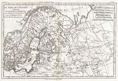
$15.00 Shipping Location: Brooklyn, United States 1780 Raynal and Bonne Map of Northern Europe and European Russia WE SELL ONLY ORIGINAL ANTIQUE MAPS- NOT REPRODUCTIONS Title: Le Nord de L'Europe. ... moreContenant Le Danemark, La Norwege; La Suede et La Laponie avec la Majeure Partie de al Russie Europeenne. Description: A fine example of Rigobert Bonne and Guillaume Raynal’s 1780 map of Northern Europe and European Russia. Covers the modern day countries of Norway. Sweden, Finland, Denmark, and Finland as well as parts of Russia(including Moscow) Poland, Lithuania, Latvia, Estonia. Highly detailed, showing towns, rivers, some topographical features and political boundaries. Drawn by R. Bonne for G. Raynal’s Atlas de Toutes les Parties Connues du Globe Terrestre, Dressé pour l'Histoire Philosophique et Politique des Établissemens et du Commerce des Européens dans les Deux Indes. Size: Printed area measures 9 inches high by 13 inches wide. Condition: Very good. Original centerfold. Platemark visible. Blank on verso. Shipping: Shipping rates are not negotiable. Items are shipped within three business days of receiving payment. We are happy to consolidate shipping where possible. The following shipping options are available: 1. USPS Domestic Express Mail(35 USD) USA Only. 2. FedEx Ground or Home Delivery(15 USD) USA Only. 1- 10 days. If your address is a P.O.Box and cannot ship FedEx we will ship USPS Priority and. While we ship promptly, recent postal personnel cutbacks mean that delivery may take up to 1 month. 3. DHL International EXPRESS(40- 50 USD) 4. We can use your Federal Express Account. Insurance: All shipments are insured privately against loss and damage. All of our shipments require a signature. If you have any questions please feel free to email us through eBay or contact us by telephone at 646-320-8650. Additional Services Conservation Framing Services: Geographicus recommends basic conservation framing services for any antique paper. Read about it here. We do not offer this service. Antique Map Restoration Services: Geographicus can
Buy It Now
$4.79 Shipping Location: Atlanta, United States Full color. Perfect for framing.
Buy It Now
$6.95 Shipping Location: Dover, United States Issued 1855 Gotha by Justus Perthes for Stieler. Map by Stulpnagel. England und Wales. Nicely detailed oversize mid-19th century engraved map with original ... morehand color.
$15.00 Shipping Location: Perugia, Italy Gall and Inglis (1810 - 1960) were Edinburgh based publishers. They were also ordinance survey publishers. Striking and highly detailed unusual 1850 approx. ... moreGall & Inglis's original colored lithographic.
Buy It Now
$6.95 Shipping Location: Dover, United States Issued c. 1795-1806, Paris by Delamarche. Map by Vaugondy, revised and reissued by Delamarche. Engraved by Dussy. Late 18th/ early 19th century engraved ... moremap with original outline hand color. Dictionary of Mapmakers, vol.
Buy It Now
$3.65 Shipping Location: United States Bloomfb.y and Published 1817 by A. Constable & Co, Edinburgh. I like how the year produced is right in the title, it dates the map nicely, esp. Very finely ... moreengraved, printed on thick paper, no printing on reverse.
Buy It Now
$6.95 Shipping Location: Dover, United States Issued 1855 Gotha by Justus Perthes for Stieler. Map by Bar. Nicely detailed oversize mid-19th century engraved celestial star map with original hand ... morecolor.
Buy It Now
$6.95 Shipping Location: Dover, United States Issued 1902, Chicago by George Cram. Early 20th century color lithographed map. Original center fold as issued.
Buy It Now
$6.95 Shipping Location: Dover, United States Issued c. 1855, Paris by Gustave Barba. May by A.H. Dufour. Engraved by Schieble. Mid 19th century lithographed map with original hand color.
|