Buy It Now
$7.95 Shipping Location: Dover, United States Issued 1864, New York by Johnson & Ward. Johnson's Washington, Oregon, and Idaho. Uncommon mid 19th century lithographed map, with original hand color.
Buy It Now
$18.95 Shipping Location: YORK, United Kingdom 1881 GERMAN ATLAS MAP This is from a series of maps produced for the GERMAN LANGUAGE atlas Allgemeiner Handatlas Published 1881 THIS LISTING IS FOR THE ... moreSINGLE MAP SHOWN Approximate size of FOLD-OUT sheet: 21 inches by 16 inches ****CONDITION**** PLEASE VIEW IMAGES TO SEE ANY HANDLING/AGE MARKS /REPAIRS/ DAMAGE/EXTENT OF MARGINS etc Please message with any questions regarding this item .
Buy It Now
$6.95 Shipping Location: Dover, United States Late 19th century color lithographed city plan. New York City (Northern & Southern Part). Many piers are also identified as to what specific lines are ... moreusing them.
Buy It Now
$6.95 Shipping Location: Dover, United States Issued 1875 Gotha by Justus Perthes for Stieler. Map by Stulpnagel. Very detailed 19th century engraved map with original outline hand color.

Buy It Now
$6.00 Shipping Location: Santa Barbara, United States Vintage 1939 Official New York World's Fair Pictorial Map by Tony Sarg Vintage 1939 Official New York World's Fair Pictorial Map by Tony Sarg. ... moreA great piece of history from America's 2nd largest world fair. Very bright and colourful. This fold out map is in good condition for it's age. It has been folded and has a crease down the center. And ther e is some wear and scuffing on the front and back. Some pages are also coming loose from their stapled binding. 10 pages. And 2 large pages that can be unfolded. Measures 11-1/4" x 11-1/4" and opens to 11-1/4" x 45" 221. There is a 25% restocking fee on all items returned without authorization. Including but not limited to: unclaimed items, refused items, non-deliverable, incorrect addresses, and refused at customs. Shipping payments are non-refundable on items returned without authorization. In all cases it is solely at our discretion to issue a refund, whether it be monetary or store credit refund. We ship Tuesday to Friday. Payment: Please pay via PayPal. Attention Canadian Buyers: By LAW we are required to collect GST/HST and PST on all items purchased and shipped to a Canadian address. Please do not bid unless you are willing to respect this requirement. Payment must be received within 7 days of the close of auction. If payment isn't received within 7 days. The auction will be revoked and a Non-Paying Bidder alert will be filed. Please don't ask us to mark the item as anything other than what it is for customs. We appreciate your business. But we really don't want to put ourselves on the line for you beyond getting your purchase to you in a timely manner. Import duties, taxes and charges are not included in the item price or shipping charges. These charges are the buyer’s responsibility. Please check with your country’s customs office to determine what these additional costs will be prior to bidding/buying. Shipping: Packages are usually shipped within 48 hours of payment receipt(excluding Saturday/Sunday) Shipping cos
Buy It Now
$6.95 Shipping Location: Dover, United States Issued 1885, Glogau by C. Flemming. Uncommon and very detailed 19th century German color lithographed map with original outline hand color. Original center ... morefold as issued. Dictionary of Mapmakers, vol.
Buy It Now
Free Shipping Location: Anaheim, United States Typically that map at hand, the one being looked at, is in the center box. Scale: 1:100,000 (100K). feature within the bounds of the map, which frequently ... moreis a community, town, or city. The map covers a specific amount of area.
Buy It Now
$14.99 Shipping Location: Ivanhoe, Australia Buchon, Jean Alexandre 1791 – 1849. Buchon was an ardent Liberal and took an active part in party struggles under the Restoration, while throwing himself ... moreinto the historical regeneration then taking place.
Buy It Now
$6.95 Shipping Location: Dover, United States Issued c. 1850's, New York by J. Bien.
Buy It Now
Free Shipping Location: Medford, United States USGS topographic map FITCHBURG Massachusetts 1988 1:25,000. Typically that map at hand, the one being looked at, is in the center box. Includes FITCHBURG ... moreLEOMINISTER GARDNER WESTMINISTER SOUTH ASHBURNHAM HUBBARDSTON.
Buy It Now
Free Shipping Location: Medford, United States USGS topographic map BOSTON NORTH Massachusetts 1985 1:25,000. Typically that map at hand, the one being looked at, is in the center box. One Printed ... moreMap Sheet that is production folded. CONDITION:Lightly used, good condition, clean, intact, no markings, slight soiling at edges of folded map, a few isolated short separations at folds.
Buy It Now
Free Shipping Location: Anaheim, United States Typically that map at hand, the one being looked at, is in the center box. Scale: 1:100,000 (100K). The City of Reno is in the Southwest corner of the ... moremap sheet. feature within the bounds of the map, which frequently is a community, town, or city.
Buy It Now
Free Shipping Location: Anaheim, United States Typically that map at hand, the one being looked at, is in the center box. feature within the bounds of the map, which frequently is a community, town, ... moreor city. The map covers a specific amount of area.
Buy It Now
Free Shipping Location: Anaheim, United States Typically that map at hand, the one being looked at, is in the center box. feature within the bounds of the map, which frequently is a community, town, ... moreor city. The map covers a specific amount of area.
Buy It Now
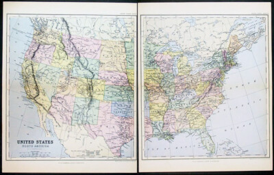
$9.99 Shipping Location: Ivanhoe, Australia Helpful Links: Company Details- About ME View seller's other items Cartographer's Profile Ask Seller a q uestion Return Policy We have over 2.000 ... moreitems for sale on our Ebay stores site. Please click here to enter the stores and use the search engine to the left to search specifically for maps. Prints, Atlases on the Classical Images Stores. Thank you United States of North America click image to enlarge Th ese two separate original antique lithograph maps of the United States of America- engraved by W& AK Johnston- was published by W&R Chambers in 18 70. Ref: M&B; Tooley) Please note all items auctioned are genuine. We do not sell reproductions. A Certificate of Authenticity(COA) can be issued on request. Condition Report General Description: Paper thickness and quality: Heavy and stable Paper color: off white Age of map color: Original Colors used: Yellow. Green, pink, blue General color appearance: Authentic Paper size: 1 3 i n x 10 in( 3 30mm x 255 mm) Each Margins: Min 1/2in(12mm) Imperfections: Margins: None Plate area: None Verso: None Overall Quality(in Bold) Perfect/ Fine/Very Good/Good/Fair/Poor Payment Methods Visa MasterCard Bankcard* PayPal Please contact me to discuss other forms of payment Please also contact me before the end of the auction if you would like to discuss payment by installments over an agreed period Australian buyers please add 10% GST* Please email your CC# Expiry Date, full name on card& shipping address in two separate emails or alternatively you can fax or phone to the numbers below. Shipping Worldwide Australia Air Mail Courier1 Courier2* Express Insurance $8.00 US, $ 30.00 US, $12.00 US 2.75% min $6.00 US, $ 6.00 US, 2.75% min $4.00 US, Courier#2: Available for all items 11in x 8 1/2in(280mm x 215mm) or smaller flat or folded along original folds. Airmail shipping from Australia to Europe or the US takes approx. 5-7 days. EMS courier will take 3-5 days. There will be only one shipping charge per 10 maps or prints purchased. We can
Buy It Now
$22.78 Shipping Location: Dover, United States Mapping Trans-Mississippi West, 915. Mapping the West, pp. 158-9. Of note for recording the then still vast areas officially "unexplored". Light uniform ... morepaper age toning, original fold lines, slight paper creasing at lower left as seen, overall paper retains flexibility and integrity, remaining clean - a pleasing and well preserved visual example.
Buy It Now
$6.95 Shipping Location: Dover, United States Late 19th century color lithographed map. Western Half of Texas - Eastern Half of Texas.
Buy It Now
Free Shipping Location: Anaheim, United States Typically that map at hand, the one being looked at, is in the center box. Scale: 1:100,000 (100K). feature within the bounds of the map, which frequently ... moreis a community, town, or city. The map covers a specific amount of area.
Buy It Now
$12.70 Shipping Location: Union, United States Don't let this find get away. Year: Late 1800s to early 1900s. Here are the details Condition: Sealed in plastic on foam board. Varying degrees of creasing, ... morewear, and toning.

Buy It Now
$3.95 Shipping Location: Clarkston, United States Click Here. Double your traffic. Get Vendio Gallery- Now FREE! FOR MANY MORE EDUCATIONAL CD TITLES ON THIS AND MANY OTHER SUBJECTS NO ADDITIONAL SHIPPING ... moreON MULTIBLE CD ORDERS-ONLY $3.50 FOR ANY NUMBER OF CDs SHIPPED TO THE SAME ADDRESS IN THE US. ONLY $4.50 FOR ANY NUMBER TO ANYWHERE ELSE IN THE WORLD VERY LARGE HIGH RESOLUTION MAP COLLECTION ON CD-ROM! please see full table of contents and sample illustrations below) This CD Contains 56 Maps of The Polar regions Antarctica. Artic, North Pole South Pole These are scans of the ORIGINAL maps on CD-ROM System requirements PC or Mac compatible. Files are simple JPEG images with a basic HTML interface(just like viewing a webpage) Works with all versions of Windows including 3.1. 95, 98, 2000 or XP. Features of this CD-ROM This auction is for a CD-ROM of the maps listed in electronic form. NOT the maps themselves. These maps are VERY high resolution and can be printed at FULL SCALE or LARGER for framing and display. The results are very high quality and convincing. For a sample map please: WARNING! This is a LARGE file(5 Megabytes) if you are using a slow connection it can take some time to load. 0149009 Colton. G.W. 1856 Northern Regions. 0149010 Colton. G.W. 1856 Southern Regions. 0346001 Jefferys. Thomas 1776 Chart containing part of the Icy Sea. Greenland. Islands about Baffins Bay and part of Hudsons Bay. 0346005 Jefferys. Thomas 1776 The Russian Discoveries 0523001 Mitchell. Samuel Augustus 1839 World. Equatorial Projection and Polar Projection. 1007082 Thomson. John 1822 Arctic Regions. 12 NOVA ZEMBLA Johannes van Keulen 1680 Contemporary map users were intrigued by a map of the island in the Arctic Ocean because of the remembrance of the rigours of the arctic winter suffered by the first Dutch arctic explorer Willem Barendtsz(c. 1550-1597) During his last visit to the island in 1597 Barendtsz got stuck in the ice and. While he was unprepared, he and his crew had to stay the winter in Nova Zembla. 1801002 Desmarest. Nicolas, 1725-1815; Bory d
Buy It Now
Free Shipping Location: San Antonio, United States Travel back in time with this antique original 1877 state map of North and South Carolina, printed using lithography technique. The map comes from an ... moreauthentic Mitchell Atlas and features all colors that are original. The size of the map is 12" x 15" and is suitable to be framed. This North and South Carolina map is a perfect addition to any antique collection or an excellent gift for history enthusiasts. It is a great opportunity to own a piece of history from the United States of America. Don't miss out on the chance to own this unique and valuable piece.
Buy It Now
$44.99 Shipping Location: Ivanhoe, Australia Moreover, \\\'their frequent use of eighteenth century sources, often from the 1740s, provided their atlas with up-to-date information. Second state of ... morethe early de Vaugondy map of the British colonies, with changes after the 1763 Treaty of Paris, with Virginia & Carolina extended to the Mississippi and Pennsylvania extended to Lake Erie.
Buy It Now
Free Shipping Location: Anaheim, United States Typically that map at hand, the one being looked at, is in the center box. feature within the bounds of the map, which frequently is a community, town, ... moreor city. The map covers a specific amount of area.
Buy It Now
$5.95 Shipping Location: Dover, United States Issued c. 1865, Amsterdam by G.L. Funke. Mid 19th century color lithographed map. Original center fold as issued.
Buy It Now
Free Shipping Location: Anaheim, United States Typically that map at hand, the one being looked at, is in the center box. Scale: 1:100,000 (100K). Woodland areas. feature within the bounds of the map, ... morewhich frequently is a community, town, or city.
Buy It Now
$5.95 Shipping Location: Florence, United States This antique c-map reveal Southeast is a unique addition to any collection. With intricate details of the region, this North America map is perfect for ... morehistory buffs and map enthusiasts alike. The piece showcases the Southeastern region of the United States and is beautifully crafted with vibrant colors and fine lines. The map is a true representation of the region and would make a great display piece in any home or office. It is in excellent condition and will be shipped securely to ensure safe arrival. Add this stunning antique map to your collection today.
Buy It Now
Free Shipping Location: RICHMOND, United Kingdom Printed in 1875. Condition: Used - Good. Format: Sheet map - full size. Age: See Map Title. For example, a fault can be as minor as discolouration or ... moreas serious as a complete failure, as long as the item has been subject to normal usage.
Buy It Now
Free Shipping Location: Schertz, United States This Map was removed from an 1909 Rand McNally Atlas and is in good condition. This map is dated in fine print. This map in not new or in new condition. ... moreIt was printed in 1909. Including Hundreds of RareCivil War.
Buy It Now
$18.95 Shipping Location: YORK, United Kingdom AN ORIGINAL ANTIQUE MAP OVER 100 YEARS OLD This is from a collection of maps produced for KEITH JOHNSTON'S HANDY ROYAL ATLAS 1915 THIS LISTING IS FOR ... moreTHE SINGLE MAP SHOWN This FOLD-OUT map measures approximately 18 1/2 inches by 14 1/2 inches (470mm x 370mm) ****CONDITION**** PLEASE VIEW IMAGES TO SEE ANY HANDLING/AGE MARKS /REPAIRS/DAMAGE/EXTENT OF MARGINS/TRIMMING etc Please message with any questions regarding this item.
Buy It Now
Free Shipping Location: Anaheim, United States Typically that map at hand, the one being looked at, is in the center box. Scale: 1:100,000 (100K). feature within the bounds of the map, which frequently ... moreis a community, town, or city. The map covers a specific amount of area.
Buy It Now
Free Shipping Location: Anaheim, United States Typically that map at hand, the one being looked at, is in the center box. Scale: 1:100,000 (100K). feature within the bounds of the map, which frequently ... moreis a community, town, or city. The map covers a specific amount of area.
$25.00 Shipping Location: Perugia, Italy It was engraved by John Walker of J. and C. Walker. Date: 1834 ( dated ). The border between the United States and Canada in the Pacific Northwest is ... moreset firmly at the Columbia River - recognizing, British claims.
Buy It Now
$8.00 Shipping Location: Salt Lake City, United States Author: Stieler, Adolph. Inset map at lower left labeled "Nordostl Theil Verein Staaten" [Northeast part of the United States] that shows the Eastern ... moreSeaboard, from North Carolina to Maine. Canada is labeled "Hudsons Bay Lander.".
Buy It Now
$9.97 Shipping Condition: Unspecified Location: LONDON, United Kingdom PROVENANCE: "Stanford's London Atlas of Universal Geography", folio edition. London, Edward Stanford, Geographer to Her Majesty. 55 Charing Cross, S.W. ... moreLarge (folio) antique atlas map, 1894. DATE PRINTED: 1894.
Buy It Now
$6.95 Shipping Location: Dover, United States Issued 1853, New York by Daniel Burgess & Co. Map No. 8 United States. Mid 19th century engraved map with original hand color.
Buy It Now
Free Shipping Location: Anaheim, United States Typically that map at hand, the one being looked at, is in the center box. feature within the bounds of the map, which frequently is a community, town, ... moreor city. The map covers a specific amount of area.
Buy It Now
$5.95 Shipping Condition: New Location: Las Vegas, United States “Vibrant and bright! Pic does not do it justice.looks amazing!”. Each of our prints are custom reproductions printed on 68lb Heavyweight Enhanced Matte ... moreArt Paper. These Historic Art Prints are suitable for framing, mounting or direct display on any wall!
Buy It Now
Free Shipping Location: Anaheim, United States Typically that map at hand, the one being looked at, is in the center box. Index to topographic and other Map Coverage and. feature within the bounds ... moreof the map, which frequently is a community, town, or city.
Buy It Now
Free Shipping Location: Anaheim, United States Typically that map at hand, the one being looked at, is in the center box. Scale: 1:100,000 (100K). feature within the bounds of the map, which frequently ... moreis a community, town, or city. The map covers a specific amount of area.
Buy It Now
$6.95 Shipping Location: Dover, United States Issued 1833, New York by E. & G.W. Blunt. Engraved by Hooker. Entrance to the Chesapeake Bay Reduced from the Surveys Made by D.P. Adams and Others by ... moreOrder of the Navy Commissioners of the U.S. Early 19th century engraved coastal survey with lovely hand color.
Buy It Now
Free Shipping Location: Anaheim, United States Typically that map at hand, the one being looked at, is in the center box. 60' Arc Minutes equals 1° Degree. So a 30' by 60' (minutes) is also a ½° by ... more1° (degree). feature within the bounds of the map, which frequently is a community, town, or city.
Buy It Now
Free Shipping Location: Anaheim, United States Typically that map at hand, the one being looked at, is in the center box. Woodland areas. feature within the bounds of the map, which frequently is a ... morecommunity, town, or city. The map covers a specific amount of area.
Buy It Now
$6.95 Shipping Location: Dover, United States Issued 1892, Chicago by the People's Publishing Co. Late 19th century color lithographed state map. Counties outlined in red.
Buy It Now
$6.95 Shipping Location: Dover, United States Issued 1873, New York by J. David Williams. Map of Delaware, Maryland, Virginia, West Virginia, North Carolina, Kentucky, Tennessee, Ohio, and Indiana. ... moreLate 19th century lithographed map with lovely original hand color.
Buy It Now
Free Shipping Location: Anaheim, United States Typically that map at hand, the one being looked at, is in the center box. Scale: 1:100,000 (100K). feature within the bounds of the map, which frequently ... moreis a community, town, or city. The map covers a specific amount of area.
Buy It Now
$6.05 Shipping Location: Belvedere Tiburon, United States An inset provides a closer look from the Eastern Seaboard out to Texas and the Northwest Territory. Published in Paris, a second inset focuses on the ... moreAntilles.
Buy It Now
Free Shipping Location: Anaheim, United States Typically that map at hand, the one being looked at, is in the center box. Scale 1:250,000 (250K). Map data 1957 - Printed 1981. feature within the bounds ... moreof the map, which frequently is a community, town, or city.
Buy It Now
Free Shipping Location: Anaheim, United States Typically that map at hand, the one being looked at, is in the center box. feature within the bounds of the map, which frequently is a community, town, ... moreor city. The map covers a specific amount of area.
Buy It Now
$6.95 Shipping Location: Dover, United States Issued 1858, Philadelphia by S. Augustus Mitchell. Mid 19th century antique engraved map with original hand color. Map of the State of Texas.
Buy It Now
Free Shipping Location: Anaheim, United States Typically that map at hand, the one being looked at, is in the center box. Scale: 1:100,000 (100K). feature within the bounds of the map, which frequently ... moreis a community, town, or city. The map covers a specific amount of area.
Buy It Now
$5.00 Shipping Location: Dunkirk, United States This is an original 1951 Montana Official State Highway Commission Road Map in folding format. The map was created in the United States of America and ... moreis a North America map. It was produced by the Montana State Highway Commission and is a valuable antique item for collectors of maps, atlases, and globes. This map is vintage. We try very hard to take photos of any imperfections, tears, or discoloration. Please see all pictures for details and contact us for any further information, thank you.
Buy It Now
$6.95 Shipping Location: Dover, United States Maine - Lewiston Quadrangle. Issued 1912, Washington by U.S. Geological Survey. Early 20th century lithographed topographical chart. Map backed on linen. ... moreStill, very clean and nice looking, the map remains worthy of display.
Buy It Now
Free Shipping Location: Anaheim, United States Typically that map at hand, the one being looked at, is in the center box. Scale: 1:100,000 (100K). feature within the bounds of the map, which frequently ... moreis a community, town, or city. The map covers a specific amount of area.
Buy It Now
$5.95 Shipping Location: Dover, United States Columbia Falls Quadrangle Maine - Washington County. Still, very clean and nice looking, the map remains worthy of display. Issued 1941/1955, Washington ... moreby U.S. Geological Survey. Mid 20th century lithographed topographical chart.
Buy It Now
$6.95 Shipping Location: Dover, United States Chatham Quandrangle, Massachusetts - Barnstable County. Old fold lines, likely as issued since many topo charts were sent folded folded like this inside ... moremanilla sleeves. Great map for display. Large and detailed mid 20th century color topographical chart of this coastal Massachusetts location.
Buy It Now
$6.95 Shipping Location: Dover, United States Issued 1873, New York by J. David Williams. Late 19th century lithographed map with lovely original hand color.
Buy It Now
$5.95 Shipping Location: Dover, United States Still, very clean and nice looking, the map remains worthy of display. Mid 20th century lithographed topographical chart. Issued 1953-59, Washington by ... moreU.S. Geological Survey.
Buy It Now
Free Shipping Location: Anaheim, United States Usually used with large flat areas. Typically that map at hand, the one being looked at, is in the center box. feature within the bounds of the map, which ... morefrequently is a community, town, or city. The map covers a specific amount of area.
Buy It Now
$6.95 Shipping Location: Dover, United States Issued c. 1880's-90, United States, by likely Cram. Late 19th century color lithographed map. This map version appeared only briefly and is note worthy ... morefor the level of detail.
Buy It Now
$6.95 Shipping Location: Dover, United States Issued 1852 Philadelphia by S.A. Mitchell. Engraved by JH Young. Possibly cerographically engraved.
|