Buy It Now
$7.00 Shipping Location: Rockville, United States (NOTE: There is a 3" tear along the folded seam at the top and another 1" tear on the tittle at the bottom. Up for sale is a great, original, ANTIQUE ... moresteel engraving from the THE OFFICIAL ATLAS OF KANSAS - 1887. ).
Buy It Now
$15.00 Shipping Location: Key Biscayne, United States José María de la Torre y de la Torre (1815-73) was a Cuban geographer, archaeologist, historian, and educator. De la Torre’s 1849. This is an original ... more( not a reproduction ) map of Havana of 1857 extracted from "Album Pintoresco de la Isla de Cuba' of Jose M. de la Torre y de la Torre based on his original work of 1849.
Buy It Now
$6.00 Shipping Location: Rockville, United States Map of the State, United States and World. Compiled and published by George A. Ogle & Co., Publishers & Engravers, Chicago. It has been cut along the ... moreleft edge from when it was separated from the Atlas.
Buy It Now
$6.95 Shipping Location: Dover, United States Shelburne Falls Franklin Co. Massachusetts 1871 Beers linen backed city plan. Shelburne Falls. Issued 1871, New York by F.W. Beers & Co. Engraved by Neuman ... more& lithographed by C. Hart. Late 19th century linen backed lithographed map with original hand color.
Buy It Now
$4.00 Shipping Location: Freeport, United States P. 58 & 59. Glare & reflections are due to nature of the scan.
Buy It Now
Free Shipping Location: Denver, United States Map of Racine and Kenosha Counties (with) Plans of the Cities/Towns of Racine, Kenosha and Elroy (Juneau County) (Wisconsin). The Plan of Racine occupies ... morethe left half of the sheet with Kenosha occupying most of the right half and a small map of Elroy below.
Buy It Now
$6.00 Shipping Location: Denver, United States An advanced, essentially complete chart of the mouth of the York River and main region of the Mobjack Bay. Minor features include the mouths of Sarah’s ... moreCreek, and the Severn, Ware and North Rivers. Notes on sailing directions, tides, and abbreviations for bottom materials occupy the peripheries of the chart.
Buy It Now
$4.95 Shipping Location: Akron, United States Original Antique Map from Rand, McNally & Co.’s “Indexed Atlas of the World”, c. 1892. Color-printed map with original color. CLEVELAND, Ohio IN THE 1890’s. ... moreThis unusually detailed map depict the city ofCleveland, Ohio as it was known in the 1890’s.
Buy It Now
$11.00 Shipping Location: Orange, United States An original map, dating to 1869 of Bristol CT, located in Hartford County. Note that the map includes property owners, and the location of their property. ... moreA closeup is shown from one typical area. Original 1869 atlas map.
Buy It Now
$6.95 Shipping Location: Dover, United States Needham's Cor, and Part of Peabody. (Essex County- Massachusetts). Issued Philadelphia, 1872 by D.G. Beer. Smith Farm. Lovely mid-19th century antique ... morelithographed map with original hand color. In VG or better condition, minor light surface age wear and toning as typical, overall the sheet and printed image remains clean and well preserved.
Buy It Now
Free Shipping Location: Denver, United States For these then relatively young Wisconsin counties and towns. By 1881, Wisconsin had begun to recover from the crippling economic Panic of 1873 – the ... moreworst US depression until 1929 – making the publication of a third state atlas economically viable even following tepid public reception to the previous Walling/Tackabury and Snyder/Van Vechten Wisconsin atlases.
Buy It Now
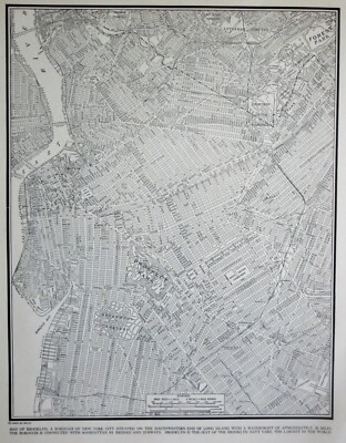
$5.75 Shipping Location: Malden, United States Beautiful Vintage 1942 Brooklyn Atlas City Map NYC New York City A Wonderful Gift! Great OLD Map from the"COLLIER'S WORLD ATLAS& GAZETTEER" ... moreCopyright 1942 71 Years Old! The Actual Page! NOT a Copy! Brooklyn, New York City. NY(Contact Us For More Scans) This Map Measures About 10 3/4 x 14 1/8" Map Shows Points of Interest. Brooklyn College. Parks, Cemetaeries, Bridges, Navy Yard, Naval Hospital, Parade Grounds. Etc. On The Back Is A Picture of The Empire State Building Very Educational. See what the City used to look like! It Will Look GREAT When Matted& Framed World War II Black& White A Nice Gift! A GREAT House Warming Gift! The Perfect Gift! It Will Look GREAT Matted& Framed Teachers& Politicians LOVE Them! Super For a Local Business or Office! Shipping by 1st Class Mail We Will Combine Shipping on Up To 4 Maps for the same shipping fee Email Us With Any Questions or For an International Shipping Quote Check out my other items! Be sure to add me to your favorites list! Thanks For Looking! International Buyers– Please Note: Import duties. Taxes, and charges are not included in the item price or shipping cost. These charges are the buyer's responsibility. Please check with your country's customs office to determine what these additional costs will be prior to bidding or buying. Certain images and/or photos used in this template are the copyrighted property of JupiterImages and are being used with permission under license.
Buy It Now
$6.80 Shipping Location: Eagle, United States Presented is an authentic, old engraving taken from a dis-bound plat book published in 1874. Original hand color. Reverses to more engravings of farms ... moreand public buildings of prominent citizens.
Buy It Now
$6.95 Shipping Location: Dover, United States Issued 1868, New York by F.W. Beers. Uncommon and detailed mid 19th century lithographed city plan map with original hand color. This fragile map will ... morerequire careful handling, but remains worthy of framing and display.

Buy It Now
$24.05 Shipping Location: Tilton, United States thanks for checking out one of my items. If you like this you will probably like other items i have, i get tons of stuff in diverse fields of collecting ... moreand use. NOTE: i will always combine items to save you shipping cost. THIS ITEM IS-this is one great map from Bacon's large scale MAP OF LONDON and suburbs. In eighteen double sheets, on the scale of nine inches to a mile. with all the streets in the metropolis and suburbs; all public buildings, railways and stations, all churches, chapels and board school. hand colored, 9 inch scale you are considering one map. The map shown, the paper is aprox 16 by 27 inches, with the printed map a bit smaller(as you can see in the pics) maps 13-18 area all on the most reast and west sides of Longdon. the paper is thin, and shows some edge wear, zoom in on the pics for good detail, very hard to find in this larger scale. i have many from this book available, it is not dated but comes from the late 1800's. AWESOME, if you choose more than one, you will only pay the shipping price once. note: the last picture shows the title page from the book this map came from. It is NOT included in the offering, it is for referance only. TERMS AND CONDITIONS 1. Paypal users must be verified. And have a confirmed address. 2. Payment must be received within 5 days. Or sale is voided, and item may be relisted. 3.Shipping is usually done by USPS or Fed Ex. I may switch shipping carrier and methods at any time. 4.Seller assumes no responsibitlity with regards to loss. Damage of property, or personal injury. 5. Bidder must be 18 years or older to participate in this auction. 6.By placing a bid. You are accepting these terms and conditions. LOCATION- box( loose in blue map book. Upstairs) Powered by The free listing tool. List your items fast and easy and manage your active items.
Buy It Now
$6.95 Shipping Location: Dover, United States Published 1907, Venice by Libreria Rosen. (Old Books, 20th Century Books, Travel, Tourism, Italy, Venice, Detailed City Plan). Flaws seen and/ or described ... morehave been taken into account. Publisher's pictorial paper wrappers, large folding color lithographed city plan.
Buy It Now
$23.09 Shipping Location: EPSOM, United Kingdom Bacon's New Map of London & Illustrated Guide- a large folded cloth map size 100 x 77cm. London between 14 May and 31 October 1908. It was the first in ... morethe series of the White City Exhibitions. Dated to 1908 as it shows theFranco-British Exhibition.
Buy It Now
$25.00 Shipping Location: Belvedere Tiburon, United States Rancho San Antonio, which was granted to Luis Maria Peralta for his services to the Spanish Crown in the late 18th and early 19th century. Peralta was ... moreinitially a regular soldier, serving as a corporal of the guard at the Missions of Santa Clara, San José, and Santa Cruz.
Buy It Now
$6.80 Shipping Location: Eagle, United States Presented is an authentic, old engraving taken from a dis-bound plat book published in 1874. Original hand color. Reverses to more engravings of farms ... moreand public buildings of prominent citizens.
Buy It Now
$6.00 Shipping Location: Denver, United States Principally a preliminary hydrographic map, this chart presents the shoreline topography in outline and hydrography in dashed contours showing the general ... morecharacter of the bottom. Of special historical interest, the Gosport Navy Yard and Fort Norfolk are located and identified.
Buy It Now
$4.00 Shipping Location: Freeport, United States ORIGINAL 1929 Brooklyn Bedford Stuyvesant Map New York City NYC. Glare & reflections are due to nature of the scan.
Buy It Now
$4.95 Shipping Location: Dover, United States Issued for a 1939 World's Fair publication, printed with unrelated text on the reverse. Charming little mid-20th century pictorial map worthy of framing ... morefor display. Issued 1939, New York, art work by Norman Reeves.
Buy It Now
$12.75 Shipping Location: Akron, United States Original Antique Map from Rand, McNally & Co.’s “Indexed Atlas of the World”, c. 1898. Published in New York & Chicago: From Rand, McNally’sIndexed Atlas ... moreof the World. Very large color-printed map with original color.
Buy It Now
Free Shipping Location: Lincoln, United States The title page reads in part Also features are 16 pages devoted to the 1893 World’s Columbian Exposition with illustrations of the main buildings, a map ... moreof the fair grounds and more. Also included is a detailed index.
Buy It Now
$4.95 Shipping Location: Dover, United States (Essex County- Massachusetts). Issued Philadelphia, 1872 by D.G. Beer. Lovely mid-19th century antique lithographed map with original hand color. In VG ... moreor better condition, minor light surface age wear and toning as typical, overall the sheet and printed image remains clean and well preserved.
Buy It Now
$5.00 Shipping Location: Canada Here is a 16 by 8 early bicycle map of Mass. The copyright says 1896. map appears to be of that age graphically and is in good shape. bidding begins at.99. ... moreThanks for looking! Posted with
Buy It Now
$4.69 Shipping Location: Greenacres, United States Paul map is on the other side. The coverage area extends from the State University Farm and Lake Phalen south to Pike Island.
Buy It Now
$11.00 Shipping Location: Orange, United States I am offering an original 1869 hand colored map from the Baker and Tilded atlas. The map will show the location of homeowners with their names. School ... moreand church location, and other information. Let me know what town your interested in and if I have one I will list it. It will be mailed in a new mailing tube with delivery confirmation for $8.75. Map has some very light spotting, this is not uncommon for maps this old, please study photo.
Buy It Now
$11.85 Shipping Location: Dover, United States The Tarbell-Watters Co. Inc., Wholesale Distributers of Motor Car Necessities, 1926. Issued between 1899 and 1930. All are attractive and well-preserved ... moreexamples. Short video captures condition much better than words.
Buy It Now
$15.00 Shipping Location: Saint Louis, United States Armand Joseph Lallemand (c. 1810 - 1871) was an engraver and map publisher based in Paris during the mid-19th century. Map is in FRENCH Language.
Buy It Now
$6.95 Shipping Location: Dover, United States Issued 1864, NY. Lithographed by George Hayward. Fulton Ferry, New York. Built of Iron 1863. Charming little mid-19th century color lithographed print. ... more(New York City- Manhattan- urban river transportation views of mid-19th century).
Buy It Now
$15.00 Shipping Location: Bridgewater, United States 22" x 29" c 1940 US Military Map of the historic area in Southeastern Massachusetts which includes buildings, roads places of interest and topography. ... moreIncluded are parts of Middleborough, Halifax, East Bridgewater, Bridgewater, Raynham, Taunton, West Bridgewater. It was created in preparation of potential defensive purposes relating to World War 2.
$4.13 Shipping Location: Richland, United States Map is in colour and has vertical centre fold. sheet size is 49 x 61cm. Sheet is clean, bright and crisp. Scale 1:4,000,000. Includes : Kuwait, Bahrain, ... moreStrait of Hormuz, Qatar, Arabia, parts of Iraq, Iran, Egypt, Sudan, Red Sea, Persian Gulf and Gulf of Oman.
Buy It Now
$4.95 Shipping Location: Dover, United States Issued for a 1939 World's Fair publication, printed with unrelated text on the reverse. Charming little mid-20th century pictorial map worthy of framing ... morefor display. Issued 1939, New York, art work by Norman Reeves.
Buy It Now
$8.70 Shipping Location: Bellefonte, United States "1929 Topographic / Geologic Map of Greensburg Quadrangle". 15 N Water St, Lewisburg, PA 17837. It initially served as a tavern and inn for river travelers ... morealong the Susquehanna. The multi-digit number in red, usually on the bottom of the piece, was added and used by the museum.
Buy It Now
$4.29 Shipping Location: Greenacres, United States The map was compiled by Geographische Anstalt Wagner & Debes, Leipzig, Germany and published by Karl Baedeker, 1911. This is an original, authentic antique ... moremap,not a reproduction or modern reprint.
Buy It Now
$4.95 Shipping Location: Dover, United States Issued for a 1939 World's Fair publication, printed with unrelated text on the reverse. Charming little mid-20th century pictorial map worthy of framing ... morefor display. Issued 1939, New York, art work by Norman Reeves.
Buy It Now
$4.95 Shipping Location: Dover, United States Charming little mid-20th century pictorial map worthy of framing for display. Issued for a 1939 World's Fair publication, printed with unrelated text ... moreon the reverse.

Buy It Now
$24.05 Shipping Location: Tilton, United States thanks for checking out one of my items. If you like this you will probably like other items i have, i get tons of stuff in diverse fields of collecting ... moreand use. NOTE: i will always combine items to save you shipping cost. THIS ITEM IS-this is one great map from Bacon's large scale MAP OF LONDON and suburbs. In eighteen double sheets, on the scale of nine inches to a mile. with all the streets in the metropolis and suburbs; all public buildings, railways and stations, all churches, chapels and board school. hand colored, 9 inch scale you are considering one map. The map shown, the paper is aprox 19 1/2 by 27 inches, with the printed map a bit smaller(as you can see in the pics)the paper is thin, and shows some edge wear, zoom in on the pics for good detail, very hard to find in this larger scale. i have many from this book available, it is not dated but comes from the late 1800's. AWESOME, if you choose more than one, you will only pay the shipping price once. note: the last picture shows the title page from the book this map came from. It is NOT included in the offering, it is for referance only. TERMS AND CONDITIONS 1. Paypal users must be verified. And have a confirmed address. 2. Payment must be received within 5 days. Or sale is voided, and item may be relisted. 3.Shipping is usually done by USPS or Fed Ex. I may switch shipping carrier and methods at any time. 4.Seller assumes no responsibitlity with regards to loss. Damage of property, or personal injury. 5. Bidder must be 18 years or older to participate in this auction. 6.By placing a bid. You are accepting these terms and conditions. LOCATION- box( loose in blue map book. Upstairs) Powered by The free listing tool. List your items fast and easy and manage your active items.
Buy It Now
$9.99 Shipping Location: Ivanhoe, Australia Using prints from Germany. Date: - 1855. New Harmony, town, Posey county, southwestern Indiana, U.S. It is located on the Wabash River at the Illinois ... moreborder, 28 miles (45 km) northwest of Evansville.
Buy It Now
$6.95 Shipping Location: Dover, United States Uncommon late 19th century lithographed tourist city plan with attractive hand color. Issued 1875, London. Any age flaws mostly minor and easy to overlook ... moreor forgive.
Buy It Now
$4.99 Shipping Location: Fairview, United States It is from Charles Savage'sThe World Geographical, Historical and Statistical, published in New York by Ensign, Bridgman & Fanning, 1855. A facsimile ... morecopy of the title page is included for authenticity.
Buy It Now
$4.95 Shipping Location: Dover, United States Issued for a 1939 World's Fair publication, printed with unrelated text on the reverse. Charming little mid-20th century pictorial map worthy of framing ... morefor display. Issued 1939, New York, art work by Norman Reeves.
Buy It Now
$8.95 Shipping Location: Latham, United States Prior to that, it was known as the President’s House. It was also the 150th anniversary of the adoption of the U.S. Constitution, and Germany had invaded ... morePoland to start World War II. Original 32 " x 23.75" Full-Color Map -- Authentic 1939 Depiction .
Buy It Now
$8.50 Shipping Location: Croatia Tehran is the successor to the ancient Iranian capital of Rayy, which was destroyed by the Mongols in AD 1220; traces of Rayy--where the conqueror Alexander ... morethe Great halted while pursuing Darius III, king of Persia, in 330 BC--are still to be found south of Tehran.
Buy It Now
$4.00 Shipping Location: Freeport, United States P. 46 & 47. Glare & reflections are due to nature of the scan.
Buy It Now
$4.95 Shipping Location: Dover, United States (Essex County- Massachusetts). Issued Philadelphia, 1872 by D.G. Beer. Lovely mid-19th century antique lithographed map with original hand color. In VG ... moreor better condition, minor light surface age wear and toning as typical, overall the sheet and printed image remains clean and well preserved.
Buy It Now
$6.05 Shipping Location: Oradell, United States YOU ARE BIDDING ON AN ORIGINAL 1928 N.C.WYETH PRINT"MAP OF DISCOVERY WESTERN HEMISPHERE" A MARVELOUS OLD PRINT FOR FRAMING. MEASURES A LARGE ... more18.5" X 16.75" ORIGINALLY FOLDED TO FIT 1928 NATIONAL GEOGRAPHIC MAGAZINE GREAT COLOR UTILIZE THE SUPER SIZE AND ZOOM FEATURES TO GET A CLOSE LOOK. SEE MY OTHER PRINTS. CIVIL WAR ART AND BOOKS AUCTIONS* I DO COMBINE SHIPPING WILL BE MAILED FLAT AND SEVERAL LAYERS OF HARD BACKING SUPPORT. ANY QUESTIONS PLEASE ASK BEFORE BIDDING. PAYMENT DUE BY 4TH DAY AFTER AUCTION ENDS. I WILL COMBINE WON AUCTIONS TO SAVE YOU SHIPPING COSTS.
Buy It Now
$9.97 Shipping Condition: Unspecified Location: LONDON, United Kingdom 'The City of London showing wards'. Title of map:'The City of London showing wards'. PROVENANCE: "Bacon's Large Scale Atlas of London and Suburbs"; Printed ... moreand Published by G.W. Bacon & Co., Ltd, London [1934 edition].
Buy It Now
$6.00 Shipping Location: Santa Barbara, United States 1849 Map of the City of Washington, D.C., Georgetown, Samuel Augustus Mitchell A nicely colored and engraved map plan of Washington D.C. and Georgetown ... morein 1849. A nicely colored and engraved map plan of Washington D.C. and Georgetown in 1849.
Buy It Now
$8.70 Shipping Location: Bellefonte, United States "1921 Topographic / Geologic Map of Freeport Quadrangle". 15 N Water St, Lewisburg, PA 17837. It initially served as a tavern and inn for river travelers ... morealong the Susquehanna. The multi-digit number in red, usually on the bottom of the piece, was added and used by the museum.
Buy It Now
$4.00 Shipping Location: Winter Springs, United States Printed on fine paper, with no printing on reverse. This is an antique map and not a reprint or reproduction. The handcoloring on the map is period to ... morethe map, this is before color printing. The map is from the very rare 1875 Beers Atlas of Tioga County Pennsylvania.
Buy It Now
$6.05 Shipping Location: Belvedere Tiburon, United States The perspective looks from the Pacific towards the Atlantic, and in the lower left corner, we find a small colored vignette depicting a Panamanian landscape. ... moreWhile the French endeavors were less than successful, Peverelli’s view was not.
Buy It Now
$53.85 Shipping Location: New Bern, United States 1800 Colored. This is an authentic, original map in excellent condition.

Buy It Now
$5.75 Shipping Location: Malden, United States Vintage 1940 WWII Atlas City Map of San Francisco. California An Awesome Christmas Gift! Great OLD Map from the"COLLIER'S WORLD ATLAS& GAZETTEER" ... moreCopyright 1940 World War II Era 73 Years Old! The Actual Page! NOT a Copy! San Francisco. California(Contact Us For More Scans) This Map Measures About 10 3/4 x 14 1/8" Map Shows Points of Interest. Cemetaries, Parks, Golf Courses, The Lick Old Ladies Home. Civic Center, Mountains, Twin Peaks, Mt. Sutro, Golden Gate, Ferry Building& Routes, Etc. Very Educational. See what the City used to look like! WWII Black& White The Edges Are Yellowed From Age. There Is a 3 1/4" Tear In The Bottom Margin on The Far Left(photo#5) It Can Be Hidden When Matted& Framed. It Will look great Matted& Framed See All Pics A Nice Gift! A GREAT House Warming Gift! The Perfect Anytime Gift! Teachers& Politicians LOVE Them! Super For a Local Business or Office! Shipping by 1st Class Mail We Will Combine Shipping on Up To 4 Maps for the same shipping fee Email Us With Any Questions or For an International Shipping Quote Check out my other items! Be sure to add me to your favorites list! Thanks For Looking! International Buyers– Please Note: Import duties. Taxes, and charges are not included in the item price or shipping cost. These charges are the buyer's responsibility. Please check with your country's customs office to determine what these additional costs will be prior to bidding or buying. Certain images and/or photos used in this template are the copyrighted property of JupiterImages and are being used with permission under license. 1?RcmdId ViewItemDescV4,RlogId p4%60bo7%60jtb9%3Feog4d72f%2B%3E%3B1%3F-1418b4be7b3-0x104-
Buy It Now
$4.00 Shipping Location: Freeport, United States ORIGINAL 1929 Brooklyn Prospect Heights Map New York City NYC Plate# 114 Vintage& Original 10.5 X 12 inch plate from Belcher Hyde's 1929 Desk ... moreAtlas. Double sided. Some pages are excellent. But others have major tears that have been repaired with tape, I removed dark tape and replaced with archival tape. Also. There may be brokers notes on some maps. Maps are color coded. Show every lot dimension, hydrants, building material. Suitable for local history. Research or display, very informative maps Glare& reflections are due to nature of the scan Satisfaction Guaranteed! Powered by The free listing tool. List your items fast and easy and manage your active items.
Buy It Now
$21.25 Shipping Location: Coventry, United States ( bordered by Rosebank Avenue & Chalkstone Ave. ). ( northern section, bordering Chalkstone Ave. ). ( no longer in existence ; this was on the grounds ... moreof what is now the Nathanael Greene Middle School, near Chalkstone Ave ).
Buy It Now
$100.00 Shipping Location: Vincentown, United States This map is sure to add undeniable character to any room and is the ultimate patriotic talking point. Unique features of this map include now extinct ... morestructures such as the Penna Hospital for the Insane in West Philadelphia and Windmill/Smith Island in the Delaware River.
Buy It Now
$15.00 Shipping Location: Cyprus Aquisgranum Vulgo Old map Aachen Germany by Guicciardini 1613. Title: Aquisgranum Vulgo…. 31 x 23 cm. For the complete Map and Print collection see our ... moreonline site. Condition: Very good. 40 x 31 cm.

Buy It Now
$24.05 Shipping Location: Tilton, United States thanks for checking out one of my items. If you like this you will probably like other items i have, i get tons of stuff in diverse fields of collecting ... moreand use. NOTE: i will always combine items to save you shipping cost. THIS ITEM IS-this is one great map from Bacon's large scale MAP OF LONDON and suburbs. In eighteen double sheets, on the scale of nine inches to a mile. with all the streets in the metropolis and suburbs; all public buildings, railways and stations, all churches, chapels and board school. hand colored, 9 inch scale you are considering one map. The map shown, the paper is aprox 16 by 27 inches, with the printed map a bit smaller(as you can see in the pics) maps 13-18 area all on the most reast and west sides of Longdon. the paper is thin, and shows some edge wear, zoom in on the pics for good detail, very hard to find in this larger scale. i have many from this book available, it is not dated but comes from the late 1800's. AWESOME, if you choose more than one, you will only pay the shipping price once. note: the last picture shows the title page from the book this map came from. It is NOT included in the offering, it is for referance only. TERMS AND CONDITIONS 1. Paypal users must be verified. And have a confirmed address. 2. Payment must be received within 5 days. Or sale is voided, and item may be relisted. 3.Shipping is usually done by USPS or Fed Ex. I may switch shipping carrier and methods at any time. 4.Seller assumes no responsibitlity with regards to loss. Damage of property, or personal injury. 5. Bidder must be 18 years or older to participate in this auction. 6.By placing a bid. You are accepting these terms and conditions. LOCATION- box( loose in blue map book. Upstairs) Powered by The free listing tool. List your items fast and easy and manage your active items.
|