Buy It Now
$5.00 Shipping Location: Canada DATE OF ISSUE: 1912. ORIGIN OF THE MAP: "Norway, Sweden, and Denmark", 10th edition, published in Leipzig, Germany by Karl Baedeker, London, T. Fisher ... moreUnwin and New York, Charles Scribner's Sons.
Buy It Now
$5.00 Shipping Location: Canada DATE OF ISSUE: 1903. ORIGIN OF THE MAP: "Norway, Sweden and Denmark", 8th edition, published by Karl Baedeker in Leipzig, Germany and Dulau and Co, London, ... moreEngland.
Buy It Now
$9.99 Shipping Location: Ivanhoe, Australia Norwege, Suede et Danemark par Delamarche 1838. This original copper-plate engraved antique map was published by Charles Delamarche in 1838 - dated in ... moretitle. Delamarche, Charles-Francois 1740 - 1817.
Buy It Now
$4.00 Shipping Location: Rockville, United States Up for sale is a nice Johnson Map circa 1865. The back of this Johnson map is blank.
Buy It Now
$7.65 Shipping Location: Rochester, United States Map is an authentic original in good condition as shown in photos.
Buy It Now
$13.71 Shipping Location: MANCHESTER, United Kingdom This interesting map is an original antique which is over 120 years old.
Buy It Now
$5.00 Shipping Location: Canada DATE OF ISSUE: 1909. ORIGIN OF THE MAP: "Norway, Sweden, and Denmark", 9th edition, published in Leipzig, Germany by Karl Baedeker, London, T. Fisher ... moreUnwin and New York, Charles Scribner's Sons.
Buy It Now
Free Shipping Location: Netherlands Description: Published by the Depot de la Marine, dated 1855. The text by J.M. Hacq and V. Carre. Artists and Engravers: Made by 'Jacobs' after an anonymous ... moreartist.
Buy It Now
Free Shipping Location: RICHMOND, United Kingdom Likely is part of : Johnston, Alexander Keith, 1804-1871. Royal Atlas of Modern Geography. Map Publisher;Edinburgh : W. & A.K. Johnston. Used - Good. ... moreHand coloured map. Double sheet with a fold marks down the middle.
Buy It Now
$5.00 Shipping Location: Canada DATE OF ISSUE: 1912. ORIGIN OF THE MAP: "Norway, Sweden, and Denmark", 10th edition, published in Leipzig, Germany by Karl Baedeker, London, T. Fisher ... moreUnwin and New York, Charles Scribner's Sons.
Buy It Now
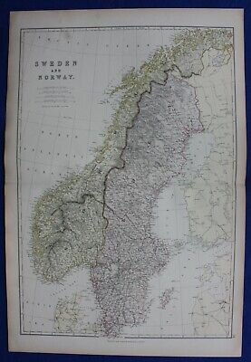
$11.84 Shipping Location: ILKLEY, United Kingdom SWEDEN& NORWAY. SCANDINAVIA, Blackie. original antique colour map 1882, SWEDEN& NORWAY. SCANDINAVIA, Blackie. original antique colour map 1882 ... moreSWEDEN and NORWAY Published 1882 by Blackie& Son. Glasgow, Edinburgh& London, in"Blackie's Comprehensive Atlas" An attractive good sized steel engraved antique map of Sweden and Norway with early colour printing. Fine condition. P rinted on heavy grade paper with centre fold as issued. Blank verso. Approx. 20" x 13.5" 500mm x 340mm) map area only with good margins beyond. Please see also close up image. A GENUINE ANTIQUE MAP GUARANTEED OVER 150 YEARS OLD FROM LINDISFARNE PRINTS FD313 We do not deal in reproductions. Facsimiles or copies of any kind. SHIPPING UK £2.50 via Royal Mail First Class Post Europe GBP £2.95 via Royal Mail Airmail Rest of the World GBP £3.95 via Royal Mail Airmail Two items are shipped for a single charge. Free shipping worldwide if three items or more purchased Closeups, Shipping Process, Two items are always combined for shipping and three items or more are shipped free of charge. Worldwide"Please see item description for postage costs" Payment Options, All major Credit and debit cards via PAYPAL. Personal cheque drawn on UK banks only. Postal Orders from UK post offices only. Bank transfer- please email for details. About Us, Lindisfarne Prints is a small family business specialising in genuine antique maps and prints at affordable prices.Established in 1995 and trading online since 2000. We pride ourselves on accurate descriptions, good communications, rapid service and fair prices. We are proud to maintain a 100% positive feedback rating which we hope reflects this.To avoid confusion, no item less than 100 years old is ever offered for sale. We do not deal in reproductions, facsimiles or modern copies of any kind. So please buy with confidence in the safe knowledge that authenticity is unfailingly assured. Return Policy, Customer satisfaction is paramount and any item not exactly
Buy It Now
$9.97 Shipping Condition: Unspecified Location: LONDON, United Kingdom 'North West and North Coast Of NorwayTrondhjem -Torghatten- Bode- Lofoten'. Title of map (not printed on the page):'North West and North Coast Of NorwayTrondhjem ... more-Torghatten- Bode- Lofoten'. Antique colour map; Scale 1:1,500,000, 1885.
Buy It Now
$6.95 Shipping Location: Dover, United States Issued c.1830, Paris, by M. Lapie. Insets of Iceland and Faore Islands. Fine oversized early 19th century engraved map with original outline hand color.

Buy It Now
$9.96 Shipping Location: GLASGOW, United Kingdom SOUTHERN SCANDINAVIA Sweden. Norway, Denmark- Vintage Map 1922 by Bartholomew Print Description: SOUTHERN SCANDINAVIA Sweden. Norway, Denmark- Vintage ... moreMap 1922 by Bartholomew Size: The Size of the print/map not including margins is approximately 21.25x16.25 inches. Cartographer: Map by John Bartholomew. Provenance: Published by the Times. Printing House Square, London 1922. Taken From The Times Survey Atlas of the World by Bartholomew Authenticity: This is a guaranteed genuine antique print. We do not deal in facsimiles or reproductions of any kind. Condition: Excellent; Suitable for framing. We grade all prints individually into four levels- Excellent. Very Good, Good, and Fair. Generally prints in excellent condition are free from foxing, rips,tears or folds. Very Good prints may have some minor foxing or spotting, however this will mainly be confined to the margins. Good and fair may have more general foxing. We try to represent all the images to the best of our ability, and we ask you to check the above scans before purchasing Payment: PayPal is our only accepted method of payment. We accept PayPal payments from buyers all over the world. PayPal is the safest. Easiest and quickest way to make online purchases. If you are purchasing multiple items, please add all the items to your shopping basket before proceeding to the checkout. If you do not already have a PayPal account, simply click on the'Buy It Now' button and follow the eBay checkout instructions. You will then be able to enter your card details in order to pay via PayPal even if you do not already have a PayPal account. Paying via PayPal also ensures that your purchase is fully protected and guaranteed. Returns Policy: If for any reason you are not satisfied with your order we will gladly accept a return for refund or credit. If you wish to return goods you MUST inform us within 14 days of receipt of your order. Please do not return goods without prior consent. All returns must be received in perfect re-saleable condition in order for refunds
Buy It Now
$20.46 Shipping Location: SALISBURY, United Kingdom This is a nice large double page atlas map from g.w. bacon of the 127 the strand london !
Buy It Now
$9.99 Shipping Location: Rosanna, Australia At 14, Kitchin apprenticed under Emanuel Bowen, under whom he mastered the art of engraving. From 1858 or so Kitchin was the engraver to the Duke of York, ... moreand from about 1773 acquired the title, \\\'Royal Hydrographer to King George III.
Buy It Now
$4.99 Shipping Location: Fairview, United States It is from Charles Savage'sThe World Geographical, Historical and Statistical, published in New York by Ensign, Bridgman & Fanning, 1855. A facsimile ... morecopy of the title page is included for authenticity.
Buy It Now
$6.23 Shipping Location: DERBY, United Kingdom SWEDEN, DENMARK, NORWAY. THIS ENGRAVING / PRINT IS OVER 210 YEARS OLD, AND. ORIGINAL HAND COLOUR. ORIGINAL ANTIQUE MAP. NOTA MODERN COPY. IMAGE SIZE 10.5 ... moreX 8.25 ins 26.67 X 20.955 cms.
Buy It Now
Free Shipping Location: Praha 41, Czech Republic The map is in Czech language and includes these states: Norway, Sweden, Finland, Denmark, Latvia, Estonia, Iceland. Condition: This map is in good condition ... morewith normal signs of use.
Buy It Now
$4.00 Shipping Location: Rockville, United States Up for sale is a nice Johnson Map circa 1865. The back of this Johnson map is blank.
Buy It Now
$4.99 Shipping Location: Fairview, United States A facsimile copy of the title page is included for authenticity. It is blank on reverse. Condition: The map is in Fair to Good condition, blank on reverse. ... moreThe pics are of the actual map. An Authentic Antique Map: Not a Modern Reproduction!
Buy It Now
$9.99 Shipping Location: Ivanhoe, Australia This original hand coloured copper-plate original antique map by Sydney Hall was published in the 1830 edition ofHalls General Atlas published by Longman ... more& co., London. (Ref: Tooley; M&B). Hall, Sydney 1788 - 1831.

Buy It Now
$9.96 Shipping Location: GLASGOW, United Kingdom SWEDEN and NORWAY Simple Conic Projection- Vintage Map 1956 by Bartholomew Print Description: SWEDEN and NORWAY Simple Conic Projection- Vintage Map 1956 ... moreby Bartholomew Size: The Size of the print/map not including margins is approximately 22x17 inches. Cartographer: Map by John Bartholomew. Provenance: Taken From The Times Atlas of the World Mid-Century Edition. Published by The Times Publishing Company Ltd. Printing House Square, London 1956. Authenticity: This is a guaranteed genuine antique print. We do not deal in facsimiles or reproductions of any kind. Condition: Excellent; Suitable for framing. We grade all prints individually into four levels- Excellent. Very Good, Good, and Fair. Generally prints in excellent condition are free from foxing, rips,tears or folds. Very Good prints may have some minor foxing or spotting, however this will mainly be confined to the margins. Good and fair may have more general foxing. We try to represent all the images to the best of our ability, and we ask you to check the above scans before purchasing Payment: PayPal is our only accepted method of payment. We accept PayPal payments from buyers all over the world. PayPal is the safest. Easiest and quickest way to make online purchases. If you are purchasing multiple items, please add all the items to your shopping basket before proceeding to the checkout. If you do not already have a PayPal account, simply click on the'Buy It Now' button and follow the eBay checkout instructions. You will then be able to enter your card details in order to pay via PayPal even if you do not already have a PayPal account. Paying via PayPal also ensures that your purchase is fully protected and guaranteed. Returns Policy: If for any reason you are not satisfied with your order we will gladly accept a return for refund or credit. If you wish to return goods you MUST inform us within 14 days of receipt of your order. Please do not return goods without prior consent. All returns must be received in perfect re-saleable condition in order fo
Buy It Now
Free Shipping Location: Monroeville, United States Published by - G. F. Cram, Chicago. Date - 1884. Condition - Very Nice, one edge has a small jam in the border only. Source - New Geographical Cyclopedia, ... moreA Complete Illustrated Family Atlas of the World.
Buy It Now
$9.97 Shipping Location: POOLE, United Kingdom A GENUINE ORIGINAL COPPER ENGRAVED MAP PRODUCED FOR. SWEDEN & NORWAY. THIS COPPER ENGRAVED MAP IS IN GOOD CONDITION WITH LATER HAND COLOURING. THERE IS ... moreA FEINT CENTREFOLD CREASE AS PUBLISHED. THIS IS A GENUINE ANTIQUE MAP OVER 300 YEARS OLD.
Buy It Now
Free Shipping Location: Monroeville, United States Date - 1860. Publisher - Johnson and Browning. Type - hand-colored, blank-back. Condition - Very Nice, tiny edge chunk missing right side in blank border ... moreonly.
Buy It Now
$4.99 Shipping Location: Fairview, United States There is a date of 1881 on the bottom left corner in small print just inside the border of the map. The labeling language is in German. Overall a beautiful ... moremap in great condition. An Original Antique Map: Not a Modern Reproduction!
Buy It Now
$4.99 Shipping Location: Fairview, United States It is from an 1882 edition of McNally's System of Geography, a copy of the title page is included. It is not mounted nor matted, being sold as a single ... moresheet as seen in the first pic. Condition: It is in Fair overall condition for its age with overall tonal ageing, text on reverse.

Buy It Now
$15.00 Shipping Location: Croatia Sohr_62 1848 Sohr Berghaus map SWEDEN AND NORWAY(62) Map titled Schweden und Norwegen. Page size 34 x 42 cm. No fold, original coloring. From Sohr. Berghaus: ... moreHand-Atlas, 4th edition, Glogau and Leipzig, 1848(full title: Vollstandiger Hand-Atlas der neueren Erdbeschreibung uber alle Theile der Erde in 82 Blattern herausgegben von Dr. K. Sohr. 4t. Auflage vermehrt und verbessert durch Dr. Heinrich Berghaus. Professor u. Director der geograph. Kunstschule zu Potsdam. Glogau und Leipzig 1848. Druck u. Verlag von C. Flemming) Buyer pays shipping at cost. I prefer payment by PayPal. But I'll also accept any other payment method and currency(except direct payment by credit card) that is convenient for buyer. I combine shipping of multiple items. IMPORTANT NOTE ABOUT SHIPPING: Price quoted with auction is for surface mail to European countries. Please don't pay before you receive invoice from me. If shipping address is within Europe I recommend surface mail. You don't gain much time with airmail, it is just more expensive.
Buy It Now
$9.97 Shipping Location: POOLE, United Kingdom AN ACCURATE MAP OF SWEDEN, DENMARK AND NORWAY BY THOMAS BOWEN c1789 THIS COPPER ENGRAVED MAP IS IN GOOD CONDITION WITH A CLEAR IMPRESSION AND HAND COLOUR. ... moreTHIS IS A GENUINE ANTIQUE MAP OVER 230 YEARS OLD THE MAP MEASURES APPROX 10.5 x 8 ins (26.5 x 20 cms) PLUS GOOD MARGINS. THOMAS BOWEN (1733-1790) WAS THE SON OF EMANUEL BOWEN AND BECAME A MAPMAKER, ENGRAVER AND PRINTSELLER WORKING IN LONDON.
Buy It Now
$12.00 Shipping Location: Poland Date of issue: 1780. THIS IS AN ORIGINAL MAP, NOT A RECENT COPY OR REPRODUCTION. Origin of the map: "Initeraire ou Voyages de Mr. L'Abbe De Feller.", ... morepubl. by F.Lemarie, Lyon (France). HAND COLOURED.
Buy It Now
$5.61 Shipping Location: United Kingdom This antique map, created by Barlow in 1807, showcases the beautiful countries of Sweden, Norway, Finland, Denmark and Iceland. It is a breathtaking piece ... moreof history, dating back to the 19th century. The intricate details and cartographic accuracy make this map a true gem for collectors and enthusiasts alike. With its original antique features, this map is a testament to the remarkable craftsmanship of its era. The countries and regions are beautifully illustrated, with a stunning level of detail that captures the essence of the landscape. This Barlow creation is a unique and invaluable collectable, sure to be cherished for generations to come.
Buy It Now
$4.99 Shipping Location: Fairview, United States Atlas Universel et Classigue de Geographie by MM. Drioux and Ch. Leroy, published in Paris in 1882, a facsimile copy of the title page is included. It ... moreis printed on good paper with original hand coloring, blank on the reverse with a centerfold.
Buy It Now
$5.00 Shipping Location: Canada DATE OF ISSUE: 1903. ORIGIN OF THE MAP: "Norway, Sweden and Denmark", 8th edition, published by Karl Baedeker in Leipzig, Germany and Dulau and Co, London, ... moreEngland.
Buy It Now
$6.80 Shipping Location: Richmond, United States This Map is in Good Pre-owned Condition. This one has a special Distoguide in it. The front and back of the map has a harder cover.
Buy It Now
$16.70 Shipping Location: GIRVAN, United Kingdom Outline coloured map of SWEDEN, NORWAY and DENMARK by F. S. Weller. Centre fold. Size 11" x 9".
Buy It Now
$5.00 Shipping Location: Canada DATE OF ISSUE: 1909. ORIGIN OF THE MAP: "Norway, Sweden, and Denmark", 9th edition, published in Leipzig, Germany by Karl Baedeker, London, T. Fisher ... moreUnwin and New York, Charles Scribner's Sons.
Buy It Now
$16.84 Shipping Location: GIRVAN, United Kingdom Double-sided antique map. Side 1 NORWAY & SWEDEN. Side 2 DENMARK. Published by W & A K Johnston. Size 12" x 9.5" (approx).
Buy It Now
$6.90 Shipping Location: Jasper, United States Known for being one of the oldest and most respected publishing houses in Germany, the Bibliographisches Institut specialized in authoritative reference ... moreworks. The map's condition is as shown in the pictures.
Buy It Now
$12.00 Shipping Location: France Paris 1812. ORIGINALearly 19th century map. (I will join a copy of title page). Image size. Get Supersized Images & Free Image Hosting.
Buy It Now
$3.75 Shipping Location: Winter Springs, United States Very rare and important period map. This is an antique 1824 map and not a reprint or reproduction. Very fine antique 1824 handcolored Finley map, titled, ... morein fancy antique lettering, Denmark, Sweden, and Norway, many fascianting areas.
Buy It Now
$5.00 Shipping Location: Canada ORIGIN OF THE MAP: "Norway, Sweden, and Denmark", 10th edition, published in Leipzig, Germany by Karl Baedeker, London, T. Fisher Unwin and New York, ... moreCharles Scribner's Sons.
Buy It Now
$9.97 Shipping Location: POOLE, United Kingdom JOHN SENEX c1740. GENUINE CO PPER ENGRAVED MAP WITH HAND COLOUR. SWEDEN, DENMARK. THIS 1740 MAP IS IN GOOD CONDITION WITH A CLEAR IMPRESSION AND HAND ... moreCOLOUR. THIS IS A GENUINE ANTIQUE MAP OVER 270 YEARS OLD.
Buy It Now
$6.23 Shipping Location: BATH, United Kingdom Blank on the reverse. Fold as issued. Map area is in good condition for age, engravings are clear. Slight wear to the margins. Lithographic map with hand ... moreline colouring. Page size is 41.5cm by 33.5cm.
Buy It Now
$5.00 Shipping Location: Canada DATE OF ISSUE: 1922.
Buy It Now
$6.95 Shipping Location: Dover, United States Issued 1860, Philadelphia by S. Augustus Mitchell. There are many variant issues of this map, with differing borders and interior details. Mid 19th century ... moreantique engraved map with original hand color.
Buy It Now
$4.99 Shipping Location: Fairview, United States Petit Atlas Universel de Geographie Moderne, published in Paris by Chez Hachette, 1840. The title of the atlas and the date both appear in the title block. ... moreThe date on the actual map is 1835, while the atlas was published in 1840, a copy of the atlas title page is included for authenticity.
Buy It Now
$5.00 Shipping Location: Galena, United States Publication: New York: S. Augustus Mitchell, Jr., 1860. Boldly colored and with lovely floral border. Hand colored. Very good. Mild age toning and faint ... moresoiling. Autograph Collector magazine and after more than 25 years remains book reviewer for.
Buy It Now
$6.80 Shipping Location: Rochester, United States Atlas pages are authentic originals in very good condition as shown in photos.
Buy It Now
$9.96 Shipping Location: GLASGOW, United Kingdom We do not deal in facsimiles or reproductions of any kind.
Buy It Now
Free Shipping Location: Columbia, United States A beautiful 1855 first edition Colton map. Title : Sweden and Norway. Size: ~14in x 17in (35cm x 43cm).
Buy It Now
$8.72 Shipping Location: BATH, United Kingdom Sweden, Norway & Denmark by Claude Buffier 1746. Claude Buffier (1661 - 1731) was a French Philosopher, Historian and teacher. He was born in Poland to ... moreFrench parents who resettled in Rouen soon after he was born.
Buy It Now
$12.00 Shipping Location: Poland Date of issue: 1843. THIS IS AN ORIGINAL MAP, NOT A RECENT COPY OR REPRODUCTION. Origin of the map: "Stieler's Schul-Atlas.", publ. by Perthes Justus, ... moreGotha (Germany). HAND COLORED.
Buy It Now
$5.00 Shipping Location: Canada DATE OF ISSUE: 1903. ORIGIN OF THE MAP: "Norway, Sweden and Denmark", 8th edition, published by Karl Baedeker in Leipzig, Germany and Dulau and Co, London, ... moreEngland.
Buy It Now
$11.84 Shipping Location: ILKLEY, United Kingdom Illustrations by J. Marchant. Date: 1851.
Buy It Now
$5.00 Shipping Location: Canada DATE OF ISSUE: 1903. ORIGIN OF THE MAP: "Norway, Sweden and Denmark", 8th edition, published by Karl Baedeker in Leipzig, Germany and Dulau and Co, London, ... moreEngland.
Buy It Now
$3.65 Shipping Location: United States Fine antique 1859 handcolored map, showing Russia, Norway, Sweden, Lapland, Turkey and more, interesting and detailed period map, much has changed since ... morethis map was made. Attractive with the fine period handcoloring.
$14.88 Shipping Location: WORCESTER, United Kingdom This vintage map features the beautiful countries of Sweden and Norway. Measuring 8 inches by 6 inches, this map is a genuine antique from an old atlas ... moreand is perfect for collectors and enthusiasts alike. The lithography technique used in printing this map is of high quality, giving it intricate details and vibrant colours. The exact date range is unknown, I had to put something in the box to satisfy ebay but I don’t know the date. The map is in its original vintage condition and is a rare find for anyone interested in antique maps.
Buy It Now
$6.90 Shipping Location: Frankfort, United States TWO SIDED 13.5" x 10.5" MAP. THIS IS OVER 120 YRS OLD MAP.CONDITION OF PAPER IS NOT PERFECT.CHECK ALL PHOTOS CAREFULLY BEFORE PUCHASE.
Buy It Now
$5.00 Shipping Location: Costa Mesa, United States Act fast on this one!
|