Buy It Now
$4.95 Shipping Location: Bar Harbor, United States West Indies. This map is from "Hammond's Handy Atlas of the World with new Census 1915. Original Antique Hammond Map. Image Size: 5.0" x 7.0" (12.6 cm ... morex 17.6 cm).
Buy It Now
Free Shipping Location: Netherlands Description: First published in Paris in 1750 as part of 'Le Neptune Francois ou Recueil des Cartes Marines', published by Departement de la Marine. State: ... moreMost probably an early ed. of this map, still lacking the seal of the Depot de la Marine. Artists and Engravers: Made by an anonymous engraver after 'Jacques Nicolas Bellin'. Cartographer: Jacques-Nicolas Bellin (1703-1772) was a French hydrographer and geographer. He is considered the greatest 18 th. c. French hydrographer and for 50 years he was associated with the 'Depot des cartes et Plans' (Depot de la Marine) as the First hydrographer of the French Royal Navy. His maps were constantly updated with the latest information and their execution magnificent.
Buy It Now
$4.95 Shipping Location: Bar Harbor, United States West Indies. Hammond Atlas Map of. C. S. Hammond & Co. 1917 Original Antique. Handy Atlas of the World.
Buy It Now
$5.00 Shipping Location: Canada DATE OF ISSUE: 1908.
Buy It Now
$22.57 Shipping Location: NORWICH, United Kingdom Fine (F) : Should have no flaws, a perfect copy of a used book. Suitable for reading, but not necessarily a good gift copy. Near Fine (NF): May show a ... moresmall flaw, such as shelf wear, but nearly perfect and unread.
Buy It Now
$6.95 Shipping Location: Arlington, United States F. Cram's Unrivaled Atlas of the World. I will work hard to make sure you are satisfied and you can always start a case if you are not happy with my response.
Buy It Now
$17.00 Shipping Location: New York, United States This is the lowest-priced copy available on the market. The detail in Florida and the Caribbean is quite remarkable. Remarkable detail is given in southern ... moreFlorida, although not necessarily in accurate fashion.
Buy It Now
$22.58 Shipping Location: LONDON, United Kingdom Map of the West Indies published by John Thomson. Sheet size: 32.5 x 25 cm. Excellent condition.

Buy It Now
$4.59 Shipping Location: Greenacres, United States 1947 Map WEST INDIES CENTRAL AMERICA Cuba Costa Rica Panama Canal Puerto Rico Handsome color lithographed large-format fold-out map of the countries of ... morethe Caribbean. Including Mexico, Central America, and the West Indies, printed more than 65 years ago. The map opens to a generous 25" x 41" And the coverage area extends from San Diego, California to the island of Trinidad, off the coast of Venezuela. There are inset maps of St. Croix, St. Thomas& St. John, St. Lucia, Exuma(Bahamas Islands) Trinidad, Antigua, Bermuda Islands, Jamaica, Panama Canal Zone, Cuba and Puerto Rico. The scans below give a closer look: The map shows the Pan American Highway. Including sections proposed or under construction. Other details include principal railways, roads, canals, ruins, and airports with scheduled transportation service. The map is drawn on a scale of 1:6.000,000, or 94.7 miles to the inch. It was lithographed by A. Hoen& Company, Baltimore and published by the National Geographic Society as a supplement to the October 1947 National Geographic Magazine. Condition: This map is in very good condition. Bright and clean, with no marks. Rips, or tears. It is blank on the back, with no printing on the reverse side. This is an original. Authentic 1947 map, printed just two years after the Second World War, not a reproduction or modern reprint. And it is fully guaranteed to be genuine. We are pleased to offer it with our unconditional. Money-back guarantee. SHIPPING: We gladly ship anywhere in the World. And we use sturdy, professional packing materials to assure safe delivery. The shipping charges are as follows: Within the United States. Including Alaska, Hawaii, and APO addresses: $2.79 To Canada or Mexico: $8.79 To all other international destinations: $12.99(These charges reflect recent increases made by the United States Postal Service for international delivery. We will appreciate your prompt payment for this item. If you need more time or have any other questions about making your payment. Or if you may
Buy It Now
$16.00 Shipping Location: Poland Date of issue: 1920. THIS IS AN ORIGINAL MAP, NOT A RECENT COPY OR REPRODUCTION. Origin of the map: Vivien de Saint-Martin & F. Schrader, "Atlas Universel ... morede Geographie.", publ. HAND COLOURED.
Buy It Now
$18.19 Shipping Location: GLOSSOP, United Kingdom Publish date: January 1970. Format: Folded flat map.
Buy It Now
$33.52 Shipping Location: Seubersdorf, Germany Paris 1754. original copper engraving map by Bellin from 1754 - sheet size approx. 25 x 38 cm - in good condition | original copper engraved map by Bellin ... morefrom 1754 - in good condition. | This is an original! - No emphasis! - No copy! -- This is an original! No copy! - No reprint!Order number: 263399.
Buy It Now
Free Shipping Location: Sayville, United States
Buy It Now
$4.99 Shipping Location: Fairview, United States It is by Felix Ansart, from his. a copy of the title page is included. The title of the atlas and F. Ansart appear in the upper margin. Beautiful Color! ... moreAtlas Historique et Geographique Ancien Et Moderne (Paris, circa 1860).
Buy It Now
$5.00 Shipping Location: Canada DATE OF ISSUE: 1911. ORIGIN OF THE MAP: "Stieler's Atlas of Modern Geography", published in Gotha, Germany by Justus Perthes.
Buy It Now
$5.00 Shipping Location: Canada DATE OF ISSUE: 1957.
Buy It Now
$30.00 Shipping Location: Paris VI, France In the bottom, a map of Caribbean with Cuba, Hispaniola, Jamaica and Bahamas. South Florida is represented with Keys islands. Edition: Antwerp, Christophe ... morePlantin, 1579, First Plantin Edition, 16th century.
Buy It Now
$4.95 Shipping Location: Dover, United States Issued 1885, Chicago by Tunison. Late 19th century lithographed map with original hand color. Map is set within decorative border, as is the title.
Buy It Now
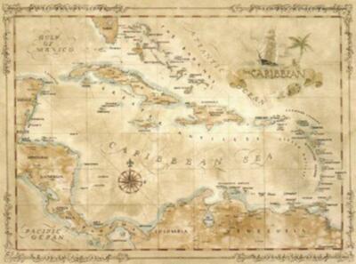
Free Shipping Location: Sheridan, United States Fine Caribbean Maps and Prints One Treasure Limited © offers unique and collectible maps. These"Old World Style" maps capture the past ... moreyet chart the exotic destinations of today. We have been in business for over 20 years. The collection is composed of over forty different maps taken from original watercolor paintings. They are meticulously printed on quality parchment paper. One Treasure Limited owns the originals of all our maps. So these prints are made specifically by us. Caribbean II Bordered by the United States. Mexico, Central America, and South America, the Caribbean Sea covers almost a million square miles. Its warm waters reach an average depth of 8,448 feet. The lush, windswept islands of the Caribbean are home to more than twenty-five million people. Its larger islands include Cuba, Haiti, the Dominican Republic, Jamaica, and Puerto Rico. Size: 27" x 20" Please contact us before leaving negative feedback; give us a chance to resolve your problem. Once you leave positive feedback for us. We will leave positive feedback in return asap. On Apr-01-07 at 18:50:09 PDT. Seller added the following information: On Jun-09-11 at 09:48:44 PDT. Seller added the following information:
$25.00 Shipping Location: Perugia, Italy The idea was to solidify an overland path to the Pacific for the Confederate States. While the Colorado Territory was established in 1861, it does not ... moreappear on this map. At least it doesn't appear in the right place.
Buy It Now
$18.22 Shipping Location: YORK, United Kingdom
Buy It Now
$8.00 Shipping Location: Jacksonville, United States A beautiful and colorful map from the Mitchell New General Atlas, published in 1865, the map was originally entered in to Congress in 1860. The map is ... moremuch more attractive in person than this first picture I have uploaded, I will endeavor to add a better picture later this week.
Buy It Now
$18.95 Shipping Location: YORK, United Kingdom An original antique map over 130 years old from: Letts's complete popular atlas - 1st edition Highly detailed with original lithographic colour Approximate ... moresize: 17 inches x 14 inches ****CONDITION**** PLEASE VIEW IMAGES TO SEE ANY HANDLING/AGE MARKS /REPAIRS/DAMAGE/EXTENT OF MARGINS etc Please message with any questions regarding this item (Letts 3 - 1881 general).
Buy It Now
$4.99 Shipping Location: Fairview, United States Stieler's Hand Atlas, published in Gotha by Justus Perthes. The publisher is stated in the bottom center, the title of the atlas is in the upper right ... morecorner and the printing details in the bottom left margin.
Buy It Now
$10.04 Shipping Condition: New Location: LONDON, United Kingdom 'Greater Antilles inset Jamaica'. Title of map:'Greater Antilles inset Jamaica'. AUTHENTICITY: This is an authentic historic print, published at the date ... morestated above. It is not a modern copy. CONDITION: Good; suitable for framing.
Buy It Now
$18.95 Shipping Location: YORK, United Kingdom This single page map measures approximately 16 inches by 13 inches This is one of a series of maps produced for the German Atlas: Handatlas fur das Deutsche ... moreHaus 1943 Printed during WW2 and reflecting the world as seen by the German gains. As is typical with the German maps of this era, there is a superior level of detail. Please note that any text will be in German ****CONDITION**** PLEASE VIEW IMAGES TO SEE ANY HANDLING/AGE MARKS /REPAIRS/DAMAGE/EXTENT OF MARGINS etc Please message with any questions regarding this item.
Buy It Now
$23.00 Shipping Location: Turkey This map is from Ottoman Atlas, pressed by Ottoman Military Publication.
Buy It Now
$20.08 Shipping Location: HEXHAM, United Kingdom Victorian coloured map of CUBA and JAMAICA taken from GW Bacon's 1897 Popular Atlas Of The World. Published in London. Insets include Kingston, Havanna, ... morethe Leeward Islands and The Lesser Antilles.
Buy It Now
$11.92 Shipping Location: ILKLEY, United Kingdom Provenance: 'Handy Royal Atlas of Modern Geography exhibiting the present condition of geographical discovery and research in the several Countries, Empires, ... moreand States of the World', W. & A.K. Johnston, Edinburgh and London, 1896.
Buy It Now
$54.46 Shipping Location: San Diego, United States Antique West Indies George F. Cram Chicago Il. An educated guess dates this map from the late 1800s to the early 1900s. Subtle color tinting to ocean ... moreand land masses. White mat. Wire at back for wall hanging.
Buy It Now
$18.76 Shipping Location: YORK, United Kingdom AN ORIGINAL ANTIQUE MAP This map is from a series produced for BACON'S ATLAS OF THE WORLD Published by: Bacon's Geographical Establishment 1912 THIS LISTING ... moreIS FOR THE SINGLE MAP SHOWN This single page map measures approximately 9 inches x 13 inches ****CONDITION**** PLEASE VIEW IMAGES TO SEE ANY HANDLING/AGE MARKS /REPAIRS/DAMAGE/EXTENT OF MARGINS etc Please message with any questions regarding this item.
Buy It Now
$52.70 Shipping Location: SPALDING, United Kingdom Source: The Weekly Dispatch Atlas - c1863. Genuine antique print - not a modern copy.
Buy It Now
$18.81 Shipping Location: YORK, United Kingdom THIS IS AN ORIGINAL ANTIQUE MAP OVER 100 YEARS OLD: Map produced & printed by: Bacon's Geographical Establishment in 1912 for: BACON'S ATLAS of the WORLD ... more(commercial and library) This FOLD-OUT map measures approximately 19 inches by 13 inches (485mm x 335mm) ****CONDITION**** PLEASE VIEW IMAGES TO SEE ANY HANDLING/AGE MARKS/REPAIRS/ DAMAGE/EXTENT OF MARGINS etc Please message with any questions regarding this item.
Buy It Now
$18.81 Shipping Location: YORK, United Kingdom This antique map is one of a series produced for: The Commercial and Library Atlas of the World Publisher: G.W. Bacon & Co. Ltd, London Publication Date: ... more1907 This listing is for the single map shown Approximate size of fold-out sheet 20 1/2 inches x 13 inches ****CONDITION**** PLEASE VIEW IMAGES TO SEE ANY HANDLING/AGE MARKS /REPAIRS/DAMAGE/EXTENT OF MARGINS etc  Please message with any questions regarding this item.
Buy It Now
$4.00 Shipping Location: Ferndale, United States This is a 1939 map of Cuba on one side and the West Indies on the other, Cuba, Jamaica, Bahamas, Dominican Republic and other islands. The map is from ... morea Collier World Atlas. I save you the hassle of finding the shirt or item by doing the work for you.
Buy It Now
$18.81 Shipping Location: YORK, United Kingdom Beautiful large antique Victorian map on quality paper Good condition and rescued from a disbound Atlas: The Comprehensive Atlas & Geography of the World ... more**FEATURES SUPERB DETAIL** Published by W G Blackie & Son London 1882 This single fold sheet measures approximately 21 1/2 inches by 14 1/2 inches (550mm x 370mm) Printed on quality paper ****CONDITION**** PLEASE VIEW IMAGES TO SEE ANY HANDLING/AGE MARKS /REPAIRS/DAMAGE/EXTENT OF MARGINS etc Please message with any questions regarding this item BEST OFFERS PLEASE FOR A QUICK SALE AT A FAIR PRICE If you like the item, but do not like the price, then make a realistic offer to us using the MAKE OFFER BUTTON Powered by eBay Turbo Lister.
Buy It Now
$18.76 Shipping Location: YORK, United Kingdom AN ORIGINAL ANTIQUE MAP OVER 135 YEARS OLD This is from a collection of maps produced for KEITH JOHNSTON'S HANDY ROYAL ATLAS 1881 THIS LISTING IS FOR ... moreTHE SINGLE MAP SHOWN This FOLD-OUT map measures approximately 18 1/2 inches by 14 1/2 inches (470mm x 370mm) ****CONDITION**** PLEASE VIEW IMAGES TO SEE ANY HANDLING/AGE MARKS /REPAIRS/DAMAGE/EXTENT OF MARGINS/TRIMMING etc Please message with any questions regarding this item.

Buy It Now
Free Shipping Location: Sheridan, United States Fine Caribbean Maps and Prints One Treasure Limited© offers unique and collectible maps. These" Old World Style" maps capture the past ... moreyet chart the exotic destinations of today. We have been in business for over 20 years. Our collection is composed of over forty different maps taken from original watercolor paintings. They are meticulously printed on quality parchment paper. One Treasure Limited owns the original paintings of all our maps. So these prints are made specifically by us. Grand Caymans Art Map Our Grand Caymans Art Map is a stylistic version of our Grand Caymans map with beautiful oceanic depictions. Size: 24" x 18" Please contact us before leaving negative feedback; give us a chance to resolve your problem. Once you leave positive feedback for us. We will leave positive feedback in return asap. On Mar-26-07 at 17:30:46 PDT. Seller added the following information: On Sep-23-08 at 13:33:06 PDT. Seller added the following information:
Buy It Now
$18.95 Shipping Location: YORK, United Kingdom AN ORIGINAL ANTIQUE MAP APPROXIMATELY 125 YEARS OLD This is from a collection of maps produced for Bacons Complete Atlas of the World 1891 THIS LISTING ... moreIS FOR THE SINGLE MAP SHOWN ****CONDITION**** PLEASE VIEW IMAGES TO SEE ANY HANDLING/AGE MARKS /REPAIRS/DAMAGE/EXTENT OF MARGINS/TRIMMING etc Please message with any questions regarding this item.
Buy It Now
$18.95 Shipping Location: YORK, United Kingdom This antique map is one of a series produced for: BACON'S POPULAR ATLAS of the WORLD 1898 Map produced & printed by: Bacon's Geographical Establishment ... moreTo find the approximate size of this print please check against the 1 inch scale shown ****CONDITION**** PLEASE VIEW IMAGES TO SEE ANY HANDLING/AGE MARKS /REPAIRS/DAMAGE/EXTENT OF MARGINS etc Please message with any questions regarding this item.
Buy It Now
$25.00 Shipping Location: Cyprus Isola Cuba Nova, Girolamo Ruscelli 1574. Details: Girolamo Ruscelli was an Italian polymath, who lived during the 16th century. Ruscelli was primarily ... moreknown for his work as a writer, editor, and publisher.
Buy It Now
$18.76 Shipping Location: YORK, United Kingdom An antique map on quality paper printed in 1919 for The Victory Atlas of The World This is a particularly large format map 25 inches by 19 1/2 inches ... more(635mm x 500mm) Begun immediately after the end of WWI and takes into accout all the changes that resulted from the global conflict. Because of its large size, it has many place names not normally on such maps. ****CONDITION**** PLEASE VIEW IMAGES TO SEE ANY HANDLING/AGE MARKS /REPAIRS/DAMAGE/EXTENT OF MARGINS etc Please message with any questions regarding this item BEST OFFERS PLEASE FOR A QUICK SALE AT A FAIR PRICE If you like the item, but do not like the price, then make a realistic offer to us using the MAKE OFFER BUTTON Powered by eBay Turbo Lister.

Buy It Now
$10.04 Shipping Condition: Unspecified Location: LONDON, United Kingdom THE ANTILLES OR WEST INDIA ISLANDS. And Caribbean Sea; inset table of population by island Antique steel engraved map with original outline hand colouring(coloring) ... more1844 Title of map: THE ANTILLES OR WEST INDIA ISLANDS. And Caribbean Sea; inset table of population by island' The image below shows an enlarged cross section from the centre of the map to show the level of printed detail: DATE PRINTED: This map was originally published by Baldwin& Cradock in 1835; this date is printed on the map. This edition of the map was printed and published by Chapman& Hall in 1844. IMAGE SIZE: Approx 32.5 x 40.5cm. 12.75 x 15.75 inches(Large) ARTIST/CARTOGRAPHER/ENGRAVER: Engraved by J& C Walker PROVENANCE: Maps of the Society for the Diffusion of Useful Knowledge" Published by Chapman& Hall, London, under the superintendance of the Society for the Diffusion of Useful Knowledge TYPE: Antique steel engraved map with original outline hand colouring(coloring) VERSO: There is nothing printed on the reverse side. Which is plain CONDITION: Good; suitable for framing. Please check the scan for any blemishes prior to making your purchase. Virtually all antiquarian maps and prints are subject to some normal aging due to use and time which is not obtrusive unless otherwise stated. I offer a no questions asked return policy- see below. AUTHENTICITY: This is an authentic historic print. Published at the date stated above. I do not offer reproductions. It is not a modern copy. The term'original' when applied to a print means that it was printed at the first or original date of publication; it does not imply that the item is unique. Print' means any image created by applying an inked block to paper or card under pressure by any method including wood engraving, steel engraving, copperplate, wood cut and lithography. REMARKS: FRANCE: Gravures et Cartes anciennes. DEUTSCHLAND: Alte Lankarten und Stadt ansichten. ITALIA: Stampe e Mappe antiche. ESPAÑA: Mapas antiquos y impresiones antiguas. E and OE. For
Buy It Now
$18.95 Shipping Location: YORK, United Kingdom Beautiful ANTIQUE MAP on quality paper very good condition and rescued from a disbound. KEITH JOHNSTON'S ROYAL ATLAS 1880. THIS MAP IS AN ORIGINAL- ... moreOVER 135 YEARS OLD This FOLD-OUT map measures approximately. 23 inches by 19 inches(585mm x 483mm) FANTASTIC DETAIL ~ CONSIDERED SUPERIOR TO ALL OTHER UK ATLAS MAPS FROM THE PERIOD. sUPERB HAND COLOURED DETAILS. It is difficult to photograph these large maps and show the level of detail and superb hand coloured detailing. Please view close up to see the quality of this map. A superb map in very good condition MINOR HANDLING/AGE MARKS AT EXTREMITIES. Please message with any questions regarding this item. BEST OFFERS PLEASE FOR A QUICK SALE AT A FAIR PRICE If you like the item. But do not like the price, then make a realistic offer to us using the MAKE OFFER BUTTON. Powered by 1.RcmdId ViewItemDescV4,RlogId p4%60bo7%60jtb9%3Fuk.rp73%28b0g%60%60%3E1-14badca6de1-0x107-
Buy It Now
$18.76 Shipping Location: YORK, United Kingdom AN ORIGINAL ANTIQUE MAP OVER 100 YEARS OLD This is from a collection of maps produced for KEITH JOHNSTON'S HANDY ROYAL ATLAS 1903 THIS LISTING IS FOR ... moreTHE SINGLE MAP SHOWN This FOLD-OUT map measures approximately 18 1/2 inches by 14 1/2 inches (470mm x 370mm) ****CONDITION****Â PLEASE VIEW IMAGES TO SEE ANY HANDLING/AGE MARKS /REPAIRS/DAMAGE/EXTENT OF MARGINS/TRIMMING etc Please message with any questions regarding this item.
Buy It Now
$10.00 Shipping Location: Cyprus West Indies Old map Caribbean islands by Thomas Kitchin 1771. Title: West Indies, Drawn from the latest & best Authorities by The. Condition: Nice map ... morein very good condition, verso blanco.
Buy It Now
$6.00 Shipping Location: Greenacres, United States Bowen, 1788.". It was published inA New Royal, Authentic and Complete System of Universal Geography, by Thomas Bankes, Edward Warren Blake, Alexander ... moreCook, and Thomas Bowen; printed for C. Cooke, No. 17, Pater-Noster Row, London; 1789.
Buy It Now
$173.38 Shipping Location: Township of Washington, United States Also includes the eastern part of Cuba. A double-page map of Santo Domingo with four integral coastal profiles at the top. A double-page sea-chart of ... morethe Turks and Caicos Islands and part of the northern coastline of Santo Domingo.
Buy It Now
$18.82 Shipping Location: CHICHESTER, United Kingdom Title: Maiorica. A compass rose orients the map with southeast at top. Date: 1576. Color: Uncoloured. Mildly age toned. Technique: Copperplate. Size (h ... morex w): approx. 28 x 19.5 cm, (sheet).
Buy It Now
$18.81 Shipping Location: YORK, United Kingdom This antique map is one of a series produced for: BACON'S NEW GENERAL ATLAS of the WORLD Publisher: Bacon's Geographical Establishment Publication Date: ... more1900 This listing is for the single map shown Approximate size of sheet 20 inches x 14 inches ****CONDITION**** PLEASE VIEW IMAGES TO SEE ANY HANDLING/AGE MARKS /REPAIRS/DAMAGE/EXTENT OF MARGINS etc Please message with any questions regarding this item.
Buy It Now
$21.33 Shipping Condition: Unspecified Location: LONDON, United Kingdom PROVENANCE: London. Published at the Admiralty under the Superintendence of Captain G.H. Richards, R.N., F.R.S., Hydrographer. Pedro Bank by Lieutenant ... moreA. Carpenter R.N. 1880. Soundings in the vicinity of Jamaica from surveys by H.M.S. "Vidal" 1954-1857 with additions and corrections to 1960.
Buy It Now
$15.00 Shipping Location: Cyprus Cuba, Hispaniola. Title: Cuba Insula – Hispaniola Insula. 18 x 23.5 cm.
Buy It Now
$18.76 Shipping Location: YORK, United Kingdom Justus Perthes (1749 - 1812) was one of the most important German cartographic engravers of the 19th century. Perthes began his publishing empire with ... morethe 1784 issue of the famed survey of European nobility known as the Almanac de Gotha. In 1817 Perthes switched his focus to cartographic publishing. From 1817 to 1890 the Perthes firm would issue thousands of maps for more than 20 different atlases. Along with the visionary editors Stieler, Peterman, Meyer and Spruner, the Perthes firm pioneered the Hand Atlas. He also produced a number of important wall maps and case maps. Perthes maps are admired for their steel plate engraving, incredible detail, dedication to accuracy, and fine colorization. The Justus Perthes firm continues to produce maps and atlases to this day. This map is from the.

Buy It Now
$10.04 Shipping Condition: Unspecified Location: LONDON, United Kingdom THE ANTILLES OR WEST INDIA ISLANDS. And Caribbean Sea; inset table of population by island Antique steel engraved map with original outline hand colouring(coloring) ... more1844 Title of map: THE ANTILLES OR WEST INDIA ISLANDS. And Caribbean Sea; inset table of population by island' The image below shows an enlarged cross section from the centre of the map to show the level of printed detail: DATE PRINTED: This map was originally published by Baldwin& Cradock in 1835; this date is printed on the map. This edition of the map was printed and published by Chapman& Hall in 1844. IMAGE SIZE: Approx 32.5 x 40.5cm. 12.75 x 15.75 inches(Large) ARTIST/CARTOGRAPHER/ENGRAVER: Engraved by J& C Walker PROVENANCE: Maps of the Society for the Diffusion of Useful Knowledge" Published by Chapman& Hall, London, under the superintendance of the Society for the Diffusion of Useful Knowledge TYPE: Antique steel engraved map with original outline hand colouring(coloring) VERSO: There is nothing printed on the reverse side. Which is plain CONDITION: Good; suitable for framing. Please check the scan for any blemishes prior to making your purchase. Virtually all antiquarian maps and prints are subject to some normal aging due to use and time which is not obtrusive unless otherwise stated. I offer a no questions asked return policy- see below. AUTHENTICITY: This is an authentic historic print. Published at the date stated above. I do not offer reproductions. It is not a modern copy. The term'original' when applied to a print means that it was printed at the first or original date of publication; it does not imply that the item is unique. Print' means any image created by applying an inked block to paper or card under pressure by any method including wood engraving, steel engraving, copperplate, wood cut and lithography. REMARKS: FRANCE: Gravures et Cartes anciennes. DEUTSCHLAND: Alte Lankarten und Stadt ansichten. ITALIA: Stampe e Mappe antiche. ESPAÑA: Mapas antiquos y impresiones antiguas. E and OE. For
Buy It Now
$18.76 Shipping Location: YORK, United Kingdom AN ORIGINAL ANTIQUE MAP This map is from a collection produced for BLACK'S GENERAL ATLAS OF THE WORLD THIS LISTING IS FOR THE SINGLE MAP SHOWN Approximate ... moresize: 17 inches x 12 inches ****CONDITION**** PLEASE VIEW IMAGES TO SEE ANY HANDLING/AGE MARKS /REPAIRS/DAMAGE/EXTENT OF MARGINS etc Please message with any questions regarding this item 1897 B.
Buy It Now
$16.00 Shipping Location: Poland Date of issue: 1902 (dated map). THIS IS AN ORIGINAL MAP, NOT A RECENT COPY OR REPRODUCTION. by Habenicht H., publ. by Perthes Justus, Gotha (Germany). ... moreHAND COLORED.
Buy It Now
$18.81 Shipping Location: YORK, United Kingdom AN ORIGINAL ANTIQUE PRINT ALMOST 130 YEARS OLD This print is from a collection of maps produced for Bartholomews Handy Reference Atlas of the World 1887 ... moreTHIS LISTING IS FOR THE SINGLE MAP SHOWN Â Approximate size of map: 212mm x 175mm ****CONDITION**** PLEASE VIEW IMAGES TO SEE ANY HANDLING/AGE MARKS /REPAIRS/DAMAGE/EXTENT OF MARGINS etc Please message with any questions regarding this item BEST OFFERS PLEASE FOR A QUICK SALE AT A FAIR PRICE If you like the item, but do not like the price, then make a realistic offer to us using the MAKE OFFER BUTTON Powered by eBay Turbo Lister.

Buy It Now
$18.76 Shipping Location: YORK, United Kingdom Beautiful ANTIQUE MAP on quality paper EXCELLENT condition and rescued from a disbound KEITH JOHNSTON'S HANDY ROYAL ATLAS 1896 THIS MAP IS AN ORIGINAL- ... moreOVER 115 YEARS OLD AND NOT A REPRODUCTION THIS MAP WAS PRODUCED IN 1896 PRINTED ON THICK PAPER WITH VIBRANT OUTLINE COLOUR"The Handy Royal Atlas Of Modern Geography Exhibiting The Present Condition Of Geographical Discovery And Research In The Several Countries. Empires And States Of The World by Keith Alexander Johnston. This DOUBLE PAGE FOLD-OUT map measures approximately 18 1/2 inches by 14 1/2 inches(470mm x 370mm) PLEASE VIEW IMAGE TO SEE HANDLING& AGE RELATED MARKS Printed on quality paper The map is free from any text or image on the reverse A superb map in excellent condition Please message with any questions regarding this item(Handy Royal Atlas 1896) BEST OFFERS PLEASE FOR A QUICK SALE AT A FAIR PRICE If you like the item. But do not like the price, then make a realistic offer to us using the MAKE OFFER BUTTON Powered by
Buy It Now
$18.95 Shipping Location: YORK, United Kingdom AN ORIGINAL ANTIQUE MAP OVER 110 YEARS OLD This map is from a series produced for: BACON'S POPULAR ATLAS of the WORLD 1905 THIS LISTING IS FOR THE SINGLE ... moreMAP SHOWN Â Approximate size of FOLD OUT sheet: 21 inches x 13 1/2 inches (530mm x 340mm) ****CONDITION**** PLEASE VIEW IMAGES TO SEE ANY HANDLING/AGE MARKS /REPAIRS/DAMAGE/EXTENT OF MARGINS etc Please message with any questions regarding this item BEST OFFERS PLEASE FOR A QUICK SALE AT A FAIR PRICE If you like the item, but do not like the price, then make a realistic offer to us using the MAKE OFFER BUTTON 1905.
Buy It Now
$18.76 Shipping Location: YORK, United Kingdom AN ORIGINAL ANTIQUE MAP This map is from a collection produced for BLACK'S GENERAL ATLAS OF THE WORLD Published by Adam & Charles Black, London 1882 THIS ... moreLISTING IS FOR THE SINGLE MAP SHOWN To find the approximate size of this map please check against the 1 inch scale shown ****CONDITION**** PLEASE VIEW IMAGES TO SEE ANY HANDLING/AGE MARKS /REPAIRS/DAMAGE/EXTENT OF MARGINS etc Please message with any questions regarding this item BEST OFFERS PLEASE FOR A QUICK SALE AT A FAIR PRICE If you like the item, but do not like the price, then make a realistic offer to us using the MAKE OFFER BUTTON.
|