|
|
Order by: Available to: This site contains affiliate links for which I may be compensated
|
Buy It Now
Free Shipping Location: Bremerton, United States The map shows typical natural aging and wear from use with a ragged edge where it was removed from the atlas. You could even use it as wrapping paper ... morefor a small gift.
Buy It Now
$6.00 Shipping Location: North Wales, United States 1884 ANTIQUE SURVEY MAP-IMPROVEMENT OF ROMERLY MARSH, GA-US CORPS OF ENGINEERS ORIGINAL ANTIQUE ATLAS MAP PLEASE SEE PHOTOS AS PART OF THE DESCRIPTION ... moreCONDITION: MAP IS IN GOOD CONDITION. FOXING PRESENT. SIZE: APPROXIMATELY 6" X 6.5" SHIPPING: U.S. FIRST CLASS RATE - $6.00 - ANY ITEM WHICH SELLS FOR OVER $100 WILL REQUIRE INSURANCE WE COMBINE SHIPPING FOR MULTIPLE WINS. THANK YOU FOR YOUR INTEREST IN OUR AUCTIONS!.
Buy It Now
$8.77 Shipping Location: United Kingdom Very fine, bright hand colour as issued.
Buy It Now
$14.99 Shipping Location: Ivanhoe, Australia Corfu or Kerkyra is a Greek island in the Ionian Sea. The island is part of the Corfu regional unit, and is administered as a single municipality, which ... morealso includes the smaller islands of Ereikoussa, Mathraki and Othonoi.
Buy It Now
$7.00 Shipping Location: North Wales, United States 1901 ANTIQUE CRAM ATLAS MAP-NORTHWEST ONTARIO-CANADA-EXCELLENT DETAIL ORIGINAL ATLAS MAP PLEASE SEE PHOTOS AS PART OF THE DESCRIPTION CONDITION: MAP IS ... moreIN GOOD CONDITION. SIZE: APPROXIMATELY 14" X 22" SHIPPING: U.S. FIRST CLASS RATE - $8.00 - ANY ITEM WHICH SELLS FOR OVER $100 WILL REQUIRE INSURANCE WE COMBINE SHIPPING FOR MULTIPLE WINS. THANK YOU FOR YOUR INTEREST IN OUR AUCTIONS!.
Buy It Now
$6.95 Shipping Location: Dover, United States Issued 1797, London by Cadell & Davies. Engraved by Neele. Late 18th century engraved historical map with attractive hand color. Original fold lines as ... moreissued. Any age flaws mostly minor and easy to overlook or forgive.
Buy It Now
$8.75 Shipping Location: GLASGOW, United Kingdom This Auction is for an Unframed ORIGINAL ANTIQUE MAP NOT a reproduction as detailed below. I have many additional maps from this volume Please see my ... morestore for what is available. The prints are much sharper that the image shown here. Taken from: The Cambridge Modern History Volume 14(Atlas Volume) Published 1912 Map Size 9 X 6 inches WE HAVE MANY HISTORIC MAPS. PRINTS AND OTHER ITEMS ON MANY DIFFERENT SUBJECTS Please check out store for additonal products IF YOU ARE UNHAPPY WITH YOUR PURCHASE SIMPLY RETURN IT AND WE WILL REFUND YOUR MONEY. Powered by The free listing tool. List your items fast and easy and manage your active items.
Buy It Now
$7.00 Shipping Location: Rockville, United States Up for sale is an original, ANTIQUE MAP from the ATLAS OF THE COUNTY OF SUFFOLK, MASSACHUSETTS. This map is titled - S.W. PART OF WARD 16 DORCHESTER. ... moreThere is a fold down the middle from where it was originally bound.
Buy It Now
$11.00 Shipping Location: Rockville, United States Up for sale is a beautiful, colored map of Genoa published c1846. Very nice view of the city from the middle of the 19th century. Overall nice condition. ... moreOne edge is rough cut from its removal from binding.
Buy It Now
$8.75 Shipping Location: GLASGOW, United Kingdom Provenance: Taken From the Encyclopaedia Britannica, 13th Edition. We grade all prints individually into four levels - Excellent, Very Good, Good, and ... moreFair. Good and fair may have more general foxing.
Buy It Now
$10.00 Shipping Location: GLASGOW, United Kingdom Provenance: Taken from the Cambridge Modern History Atlas. Published at The University Press, Cambridge 1912. We do not deal in facsimiles or reproductions ... moreof any kind. We grade all prints individually into four levels - Excellent, Very Good, Good, and Fair.
Buy It Now
$10.00 Shipping Location: GLASGOW, United Kingdom Provenance: Taken from The Universal Atlas. Published for the Atlas Publishing Co by Cassel & Co, London 1893. We do not deal in facsimiles or reproductions ... moreof any kind. We grade all prints individually into four levels - Excellent, Very Good, Good, and Fair.
Buy It Now
$8.75 Shipping Location: GLASGOW, United Kingdom Provenance: Taken from The Imperial Gazetteer of Scotland, published by A. Fullarton 1872. We do not deal in facsimiles or reproductions of any kind.
Buy It Now
$10.00 Shipping Location: GLASGOW, United Kingdom Provenance: Taken From the Harmsworth New Atlas. We do not deal in facsimiles or reproductions of any kind. We grade all prints individually into four ... morelevels - Excellent, Very Good, Good, and Fair.
Buy It Now
$118.95 Shipping Location: WOODBRIDGE, United Kingdom 99 years old. Good Condition. South-Eastern Section.

Buy It Now
$24.05 Shipping Location: Tilton, United States thanks for checking out one of my items. If you like this you will probably like other items i have, i get tons of stuff in diverse fields of collecting ... moreand use. NOTE: i will always combine items to save you shipping cost. THIS ITEM IS-this is one great map from Bacon's large scale MAP OF LONDON and suburbs. In eighteen double sheets, on the scale of nine inches to a mile. with all the streets in the metropolis and suburbs; all public buildings, railways and stations, all churches, chapels and board school. hand colored, 9 inch scale you are considering one map. The map shown, the paper is aprox 16 by 27 inches, with the printed map a bit smaller(as you can see in the pics) maps 13-18 area all on the most reast and west sides of Longdon. the paper is thin, and shows some edge wear, zoom in on the pics for good detail, very hard to find in this larger scale. i have many from this book available, it is not dated but comes from the late 1800's. AWESOME, if you choose more than one, you will only pay the shipping price once. note: the last picture shows the title page from the book this map came from. It is NOT included in the offering, it is for referance only. TERMS AND CONDITIONS 1. Paypal users must be verified. And have a confirmed address. 2. Payment must be received within 5 days. Or sale is voided, and item may be relisted. 3.Shipping is usually done by USPS or Fed Ex. I may switch shipping carrier and methods at any time. 4.Seller assumes no responsibitlity with regards to loss. Damage of property, or personal injury. 5. Bidder must be 18 years or older to participate in this auction. 6.By placing a bid. You are accepting these terms and conditions. LOCATION- box( loose in blue map book. Upstairs) Powered by The free listing tool. List your items fast and easy and manage your active items.
Buy It Now
$10.00 Shipping Location: GLASGOW, United Kingdom Provenance: A plate taken from the Comprehensive Atlas & Geography of the World, compiled and engraved from the most authentic sources, under the supervision ... moreof WG Blackie. Published by Blackie and Son 1883.
Buy It Now
$10.00 Shipping Location: GLASGOW, United Kingdom Map Title: NEW SOUTH WALES Australia, Antique Map c1890 by W&A. K Johnston. We do not deal in facsimiles or reproductions of any kind.

Buy It Now
$24.05 Shipping Location: Tilton, United States thanks for checking out one of my items. If you like this you will probably like other items i have, i get tons of stuff in diverse fields of collecting ... moreand use. NOTE: i will always combine items to save you shipping cost. THIS ITEM IS-this is one great map from Bacon's large scale MAP OF LONDON and suburbs. In eighteen double sheets, on the scale of nine inches to a mile. with all the streets in the metropolis and suburbs; all public buildings, railways and stations, all churches, chapels and board school. hand colored, 9 inch scale you are considering one map. The map shown, the paper is aprox 19 1/2 by 27 inches, with the printed map a bit smaller(as you can see in the pics)the paper is thin, and shows some edge wear, zoom in on the pics for good detail, very hard to find in this larger scale. i have many from this book available, it is not dated but comes from the late 1800's. AWESOME, if you choose more than one, you will only pay the shipping price once. note: the last picture shows the title page from the book this map came from. It is NOT included in the offering, it is for referance only. TERMS AND CONDITIONS 1. Paypal users must be verified. And have a confirmed address. 2. Payment must be received within 5 days. Or sale is voided, and item may be relisted. 3.Shipping is usually done by USPS or Fed Ex. I may switch shipping carrier and methods at any time. 4.Seller assumes no responsibitlity with regards to loss. Damage of property, or personal injury. 5. Bidder must be 18 years or older to participate in this auction. 6.By placing a bid. You are accepting these terms and conditions. LOCATION- box( loose in blue map book. Upstairs) Powered by The free listing tool. List your items fast and easy and manage your active items.
Buy It Now
$6.95 Shipping Location: Dover, United States Thematically focused on the system within the country. Issued 1882, Edinburgh by Johnston. Ireland to Illustrated the Criminal Condition of the People.
Buy It Now
$4.28 Shipping Location: France MAP OF VOLCANIC DISTRIVBUTION. UNDATED WORLD MAP / 19TH CENTURY.
Buy It Now
$6.95 Shipping Location: Dover, United States Issued c. 1745 London by Tindall. Engraved by J. Basire. Mid 18th century detailed engraved battle related city plan.
Buy It Now
$4.50 Shipping Location: Slingerlands, United States This is an Army Map Service map(AMS V743) of Benndale(printed 1948. Based on 1943 aerial photography) This map shows the De Soto National Forest and is ... morebisected by the Black Creek, Red Creek and Pascagoula River. nbsp; This was developed by the military as part of the effort associated with World War II and was distributed to select libraries after the war. This map is suitable for framing and guaranteed original. 22x29 1:50,000 Shipping is for US addresses and I will combine shipping. These maps have been stored flat since printing and will be shipped in a sturdy shipping tube. Look for my other similar maps of the area. I will combine shipping if you buy multiple maps.
Buy It Now
$3.25 Shipping Location: United States Fascianting map, much has changed, the detail is interesting. The superb handcoloring is period to the map, this is before color printing. The size of ... morethe map is 5" by 6". FREE scheduling, supersized images.
Buy It Now
Free Shipping Location: Bellflower, United States FISK AND SEE AUSTRALIA. ORIGINAL MAP CIRCA 1880'S TO EARLY 1900'S NO DATE. THIS MAP IS FOLDED DOWN THE MIDDLE AND HAS 3 HOLE PUCHES AS SEEN IN THE PICTURE. ... moreFOR SIZE THE MAP IS PHOTOGRAPHED NEXT TO A CARPENTERS SQUARE.
Buy It Now
$3.65 Shipping Location: United States The map has many interesting areas, and much has changed since 1876. The beautiful handcoloring on the map is period to the map, this is before color ... moreprinting. The map has printing on reverse, but the paper is so thick you cant see it looking at the map itself.
Buy It Now
$3.75 Shipping Location: United States The fine handcoloring is period to the map, this is before color printing. Printed on thick paper, with no printing on reverse. The size of the map is ... more9.75" by 13". FREE scheduling, supersized images.
Buy It Now
$4.50 Shipping Location: Slingerlands, United States This is an Army Map Service map of Galway New York from the 1940's showing north to Bill Pond. 22x29 1:25,000.
Buy It Now
$4.50 Shipping Location: Slingerlands, United States 22x29 1:25,000.
Buy It Now
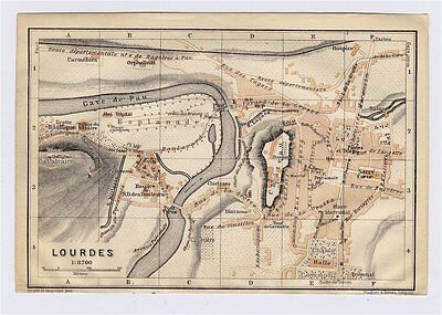
$5.00 Shipping Location: Canada 1914 ORIGINAL ANTIQUE CITY MAP OF LOURDES/ MIDI-PYRENEES/ FRANCE This original antique map gives you an opportunity to examine in exquisite detail a piece ... moreof history. Once matted and framed. This map would make a perfect gift for a family member or friend they'll cherish forever. Origin of the map: Southern France including Corsica- Handbook for Travellers" 6th edition, published by Karl Baedeker in Leipzig, Germany, Dulau& Co. London, UK, Charles Scribner's Sons, New York, USA. Date of issue: 1914 Size: The sheet measures: 6" x 4" 15.5 x 10 cm) S/H: The map will be shipped by Air Mail. The shipping charge is: USA- 4.00 USD. World- 6.00 USD, Canada- 1.80 USD. The price includes a strong and secure envelope. Attention! We combine shipping costs for multiple items. The HIGHEST VALUE SHIPPING FEE WILL APPLY FIRST and each subsequent item will be shipped FOR FREE. Pay me securely with any major credit card through PayPal! Payment methods: US/Canada Buyers: Paypal. International Buyers: Paypal. Click Here. Double your traffic. Get Vendio Gallery- Now FREE! USED. AN ORIGINAL ANTIQUE MAP.
Buy It Now
$4.50 Shipping Location: Slingerlands, United States This is an Army Map Service map (AMS V882) of Nolte (printed 1947-9 based on 1942 aerial photography). 22x29 1:25,000.
Buy It Now
Free Shipping Location: Monroeville, United States Or send resale number.
Buy It Now
Free Shipping Location: Monroeville, United States Or send resale number.
Buy It Now
Free Shipping Location: Monroeville, United States Or send resale number.
Buy It Now
$10.02 Shipping Condition: Unspecified Location: LONDON, United Kingdom Antique colour map, 1876. DATE PRINTED: 1876. CONDITION: Good; suitable for framing. The map you will receive is in good condition but there may be minor ... morevariations in the condition from that shown in the image.
Buy It Now
$3.50 Shipping Location: Dover, United States Leesville Quadrangle Illinois- 7.5 Minute Series. Year Published: 1965. The map in the photo is the actual map you will receive.
Buy It Now
$11.90 Shipping Location: MANCHESTER, United Kingdom This folding map engraved by Sidney Hall is from "An Atlas of Modern Geography" by Samuel Butler, published by Longman & Co., London, 1839.
Buy It Now
$2.95 Shipping Location: Upton, United States
Buy It Now
$6.00 Shipping Location: Rehoboth Beach, United States EXCELLENT FRANCIS MCNALLY ATLAS MAP - BEAUTIFUL DETAIL. Over 100,000,000 served.
Buy It Now
$7.00 Shipping Location: North Wales, United States 1885 ANTIQUE ENCYCLOPEDIA BRITANNICA MAP-DENMARK-EXCELLENT DETAIL ORIGINAL ANTIQUE ATLAS MAP PLEASE SEE PHOTOS AS PART OF THE DESCRIPTION CONDITION: MAP ... moreIS IN GOOD CONDITION SIZE: APPROXIMATELY 10.5" X 15" SHIPPING: U.S. FIRST CLASS RATE - $7.00. CANADA - $20.00. WORLDWIDE - $25.00 ANY ITEM WHICH SELLS FOR OVER $100 WILL REQUIRE INSURANCE. WE COMBINE SHIPPING FOR MULTIPLE WINS. THANK YOU FOR YOUR INTEREST IN OUR AUCTIONS!.
Buy It Now
$4.89 Shipping Location: Kassel, Germany View of Carrara Original wood engraving from a magazine from 1883 (no reprint- no copy) The size of the stitch (not the leaf) is approx. 19 x 12.5 cm ... moreand is printed on the back. Condition: sheet minimally browned, otherwise good - see scan! Shipping is of course quick and safely packaged! Shipping: - please send an email. Please also note my other offers! Here are more motifs in the shop! I offer other wood engravings and lithographs - use the shop search. Shipping costs only apply once for multiple items purchased! Motives: Province of Massa-Carrara, Italy If combined shipping via eBay doesn't work, I will of course refund the overpaid shipping costs!.
Buy It Now
$3.75 Shipping Location: Winter Springs, United States This is an antique map and not a reprint or reproduction. The handcoloring on the map is period to the map, this is before color printing. The map is ... morefrom the very rare 1907 Standard Atlas of Oneida County New York.
Buy It Now
$16.63 Shipping Location: DRIFFIELD, United Kingdom
Buy It Now
$4.50 Shipping Location: Slingerlands, United States This is an Army Map Service map of Esperance New York from the 1940's showing Sloansville, Burtonsville and the Schoharie Creek. 22x29 1:25,000.
Buy It Now
$20.21 Shipping Location: GLASGOW, United Kingdom Plate from The Times Atlas Published by John Bartholomew & Son, LtdIn excellent condition.
Buy It Now
$4.50 Shipping Location: Slingerlands, United States This is an Army Map Service map (AMS V834) of Dabneys (printed 1947) showing north to Jackson. The map is bisected by the South Anna River. 22x29 1:25,000.
Buy It Now
$4.50 Shipping Location: Slingerlands, United States This is a Army Map Service map (AMS V731) of Sunbury (printed 1946) showing parts of Snyder, Northumberland, Union and Montour Counties. The size is 22" ... morex 29" and scale is 1:50,000.
Buy It Now
Free Shipping Location: Bellflower, United States FRANCE ORIGINAL MAP CIRCA 1880'S TO EARLY 1900'S NO DATE. THIS MAP IS FOLDED DOWN THE MIDDLE AND HAS 3 HOLE PUCHES AS SEEN IN THE PICTURE. FOR SIZE THE ... moreMAP IS PHOTOGRAPHED NEXT TO A CARPENTERS SQUARE.
Buy It Now
$5.00 Shipping Location: Belfast, United States Folding map in color, 19 3/4" x 27 3/4". N.W. section of Chiltern Country, Berkhamsted, Hatfield, Maidenhead. Foot paths in red. Circa 1930. Very Good ... morecondition. No Reserve. ENLARGED PICTURES!
Buy It Now
$12.50 Shipping Location: Boulder, United States Chief of Engineers, October 1886. Shown on this map is the East River, West Channel, Blackwell's Island, Astoria, Harlem Rev., Ward's Island,Negro Point ... moreReef, Heel Tap Rock, among others. Condition: This map is in excellent condition.
Buy It Now
Free Shipping Location: Monroeville, United States Date - 1852. Category - Ancient Geography. Size - about 10.25x12.75", double page as bound in the Atlas, hand-colored. Source - El Globo Atlas Historico ... moreUniversal de Geografia (Spanish), or, The Globe Universal Historical Atlas of Geography.
$14.27 Shipping Location: PETERSFIELD, United Kingdom A good map is a thing of beauty and a joy forever.
Buy It Now
$7.71 Shipping Location: Germany STOCKTON on Tees: Complete view, about the teas, together with 3 further views on 1 sheet. Steel engraving v. Payne, 1843, 10.5 x 17 The other views show: ... moreWynyard Castle in Durham, Naworth Castle in Cumberl. and Netherby Castle in Cumberl. Item number: 17911.
Buy It Now
Free Shipping Location: United States Arkansas, steelengraving, anno 1860, Bibliographisches Institut -edited in Germany, Bibliographisches Institut, Hildburghausen, size of the printed area: ... more11 x 15 cm., only little foxed.
Buy It Now
Free Shipping Location: Schertz, United States Including Hundreds of RareCivil War. The map is not " new " or in " new " condition, it was printed in 1902. The map is not dated. Study the photos carefully, ... morethis is the actual map you will receive.
Buy It Now
$4.50 Shipping Location: Slingerlands, United States This is an Army Map Service map (AMS V834) of Lees Mill (printed 1946) showing Templeton. 22x29 1:25,000.
Buy It Now
$12.52 Shipping Location: GLASGOW, United Kingdom Here is your chance to own one of the beautiful Scottish Loch maps prepared by the Bathymetrical Survey of the Fresh-Water Lochs of Scotland over the ... moreperiod 1897 to 1909. All these century-old maps were published at a scale of three inches to 1 mile, so sheet sizes vary widely.All of the maps indicate the position of soundings (depth measurements) and show submarine contour/shading in deepening shades of blue. The maps which were published first, covering most of the larger, better-known lochs, also show contour/relief shading in various shades of brown for the surrounding landscape.
Buy It Now
$3.65 Shipping Location: Lebanon, United States This is an original map with canvas backing.
Buy It Now
$7.50 Shipping Location: West Palm Beach, United States John Tallis (1817-1876) was a British map publisher. FROM 1851 WRIGHTS UNIVERSAL PRONOUNCING DICTIONARY. ENGRAVINGS ARE EXCELLENT FOR HAND COLORING AND ... moreARE A PERFECT CANDIDATE FOR FRAMING OR MAKING ENLARGED PRINTS FOR UNIQUE DECOR.
Buy It Now
$6.95 Shipping Location: Dover, United States Issued 1846, Edinburgh by A.K. Newman of London / Orr & Sons, Glasgow. Netherlands - Dutch Provinces.
|
|
|
|