|
|
Order by: Available to: This site contains affiliate links for which I may be compensated
|
Buy It Now
$6.95 Shipping Location: Dover, United States Issued 1852, Philadelphia by S. Augustus Mitchell. Engraved by J.H. Young. Mid 19th century antique engraved map with original hand color.
Buy It Now
$6.90 Shipping Location: Jasper, United States Known for being one of the oldest and most respected publishing houses in Germany, the Bibliographisches Institut specialized in authoritative reference ... moreworks. The map's condition is as shown in the pictures.
Buy It Now
Free Shipping Location: Schertz, United States This antique original atlas map, dated 1887, features Mexico, Central America, the Caribbean, Bahama, Texas, and Jamaica. Measuring at 15" x 23", this ... moremap was created by S. Augustus Mitchell and M. Bradley. The size is perfect for framing and displaying in any room of your home or office. In addition to adding a unique touch to your space, purchasing this map also supports the Tunnel to Towers charity with 10% of your purchase being donated. Free shipping is offered within the USA, while shipping costs are calculated for worldwide delivery. Please note that the book cover shown in the picture is for reference purposes only and is not included. This piece is over 130 years old and would make a wonderful addition to any map or antique collection.
Buy It Now
$10.07 Shipping Location: New York, United States (with four insets) 49. Map of the Island of Cuba. Map of the Island of Jamaica. Map of the Bermuda Islands. [pg #48 in upper right corner]. Steel Engraving, ... morehand colored. Single leaf, with center fold.
Buy It Now
$8.95 Shipping Location: Dover, United States Issued 1754, Paris by Bellin. Uncommon mid 18th century engraved map with attractive hand color.
Buy It Now
$6.50 Shipping Location: Eureka, United States
Buy It Now
Free Shipping Location: Schertz, United States This antique political map of Mexico, Central America, and New Granada was printed using copper plate technique in 1855. The hand-colored map measures ... more9x11 inches and was published by R.C. Smith and D. Burgess & Co. It is an original piece and will be shipped free of charge within the USA. Worldwide shipping will be calculated accordingly. The map is perfect for collectors and enthusiasts of antique maps.

Buy It Now
$5.00 Shipping Location: Galena, United States THIS ITEM IS A GENUINE ORIGINAL VINTAGE MAP FROM THE SOURCE/DATE LISTED Title of Map- Mexico. Central America, West Indies, and an inset map of Cuba Date- ... more1877 Source- Intermediate Geography. Eclectic Series of Geographies Issued by- von Steinwehr and Brinton Comments- unrelated text on reverse Size- about 10.25x12.5" Hand-colored Condition- nice. Corner crease upper and lower left Yes! We Do Combine Shipping on Multiple Purchases! NO RESERVE! Happy Bidding! Buyer pays shipping/packing. We use very secure packaging methods and materials. And all shipments within the United States will be made with the protection of the new USPS Parcel shipping category. First Class or Priority. Depending on weight) Note that certain items may be shipped in the USPS Media Mail category. If appropriate. Payment due within 14 days after our initial after auction contact. Pennsylvania residents MUST add applicable SALES TAX or send resale number. Thanks. Good Luck! To See Our Other Auctions and Store Items CLICK HERE! Powered by
$6.00 Shipping Location: Corunna, United States This is a beautiful map with very nice detail.Map is hand colored and is dated 1867. This is an original 156 year old map, not a copy or reprint.
$25.00 Shipping Location: Perugia, Italy Amongst his considerable portfolio were various atlases, many of which focused on the educational publishing market. Weller also published "The Crown ... moreAtlas" in 1871. 'The Weekly Dispatch' newspaper between the years 1856 and 1862 included in each edition a map of a part of the world.

Buy It Now
$5.00 Shipping Location: Galena, United States THIS ITEM IS A GENUINE ORIGINAL VINTAGE MAP FROM THE SOURCE/DATE LISTED Title of Map- Mexico. Central America, West Indies, and an inset map of Cuba Date- ... more1877 Source- Intermediate Geography. Eclectic Series of Geographies Issued by- von Steinwehr and Brinton Comments- unrelated text on reverse Size- about 10.25x12.5" Hand-colored Condition- nice. Corner crease upper and lower left Yes! We Do Combine Shipping on Multiple Purchases! NO RESERVE! Happy Bidding! Buyer pays shipping/packing. We use very secure packaging methods and materials. And all shipments within the United States will be made with the protection of the new USPS Parcel shipping category. First Class or Priority. Depending on weight) Note that certain items may be shipped in the USPS Media Mail category. If appropriate. Payment due within 14 days after our initial after auction contact. Pennsylvania residents MUST add applicable SALES TAX or send resale number. Thanks. Good Luck! To See Our Other Auctions and Store Items CLICK HERE! Powered by
Buy It Now
$4.00 Shipping Location: Fernandina Beach, United States They are previously owned and may show very fine handling marks and shelf wear and will not be perfect. In antique condition with yellowing, staining, ... morespotting and discoloration of paper. It has rounded corners, creases, small tears along edges, ragged edges and is wrinkled.

Buy It Now
$4.19 Shipping Location: Fulton, United States Bartholomew map: WEST INDIES, MEXICO. CENTRAL AMERICA, COLUMBIA This is a detailed antique map of Cuba and the other Caribbean Islands. Mexico and Central ... moreAmerica, more than a century and a quarter ago. It includes Columbia and Venezuela from South America, and shows the Galapagos Islands at the bottom center of the map. It measures 13 x 17.5 inches. And is blank on the back. The map is in Fine condition. The credit lines in small print below the map say: Engraved& Printed in Colours— by J. Bartholomew T. Ellwood Zell. Philadelphia. The map is undated on the plate. But came from an uncommon atlas published in Philadelphia in 1880, which was Volume 5 of Zell’s Popular Encyclopedia. The mapmaker. John Bartholomew was a Fellow of the Royal Geographical Society. The map will be accompanied by 4 text pages. Presenting tables of the West India Islands, and states of Mexico, plus a keys to the many features shown on the map: hundreds of towns, plus numerous rivers, mountains, gulfs, bays and capes, etc. The map will be shipped folded once. As originally published in Zell’s Atlas. SHIPPING/ HANDLING TERMS: Add a flat $ 3.95 for delivery by First Class Mail anywhere in the U.S. Pennsylvania residents. Add 6% tax. International shipping is $ 8.95 to Canada; or $13.95 to all other foreign countries. I normally mail items within 24 hours of receiving payment. All items are returnable for a full refund if the buyer is unsatisfied for any reason. gsrx_vers_476(GS 6.4.4(476)
Buy It Now
$4.95 Shipping Location: Bar Harbor, United States Inter-oceanic canals where rejected since construction would have been too costly. A number proposals were raised consisting of a combinations of railways, ... moreshort canals and the use of rivers and/of lakes.
Buy It Now
$6.95 Shipping Location: Dover, United States Issued 1873, New York by J. David Williams. Late 19th century lithographed map with lovely original hand color. A nice map with a delicate and pleasing ... moreaesthetic quality unique to the era and maker.
Buy It Now
$6.95 Shipping Location: Dover, United States Issued 1860, Glasgow by Blackie & Son. Engraved by J. W. Lowry. Fine oversize mid 19th century engraved map with original outline hand color. Original ... morecenter fold as issued. Dictionary of Mapmakers, vol.
Buy It Now
$6.50 Shipping Location: Weatherly, United States
Buy It Now
$5.95 Shipping Location: Dover, United States Issued 1924, Edinburgh by W & A.K. Johnston. Fine engraved map/print, with lovely hand color.
Buy It Now
$6.95 Shipping Location: Dover, United States Southwest U.S. c. 1852 scarce Duvotenay map. Issued c. 1852, Paris by Duvotenay. Decorative mid-19th century engraved map with original outline hand color.
Buy It Now
$7.00 Shipping Location: New Paltz, United States This beautiful map was taken from an 1894 book entitled The New Family Atlas published by Hilton, Hughes & Co. (Successors to A.T. Stewart & Co). A photo ... moreof the title page is shown but not sold with the map .
Buy It Now
$7.00 Shipping Location: North Wales, United States 1874 MITCHELL ATLAS MAP OF MEXICO, CENTRAL AMERICA, WEST INDIES-HAND COLORED ORIGINAL ANTIQUE ATLAS MAP PLEASE SEE PHOTOS AS PART OF THE DESCRIPTION CONDITION: ... moreMAP IS IN GOOD CONDITION. SIZE: APPROXIMATELY 15" X 23" SHIPPING: U.S. FIRST CLASS RATE - $6.00 - ANY ITEM WHICH SELLS FOR OVER $100 WILL REQUIRE INSURANCE WE COMBINE SHIPPING FOR MULTIPLE WINS. THANK YOU FOR YOUR INTEREST IN OUR AUCTIONS!.
Buy It Now
$6.90 Shipping Location: Frankfort, United States VTG 1897 14.5" x 10.7" TWO SIDED MAP.
Buy It Now
Free Shipping Location: Sayville, United States Rare 1869 Mitchell's Copper-Plate Map of Central America- Hand Colored& Guaranteed original. Measures 12" by 9.5" From the 1869 edition ... moreof Mitchell's New Intermediate Geography. Will look great matted& framed. See photo's. Free Shipping to anywhere in the US. Your order will always ship within ONE BUSINESS DAY. Well packaged in a sturdy waterproof mailer and sent with a delivery confirmation. I ship worldwide.
Buy It Now
Free Shipping Location: Schertz, United States This antique map from 1890 depicts North America, Greenland, Mexico, and Central America. It was created using copper plate printing technique and features ... morebeautiful hand coloring. The map is in its original antique condition and has been meticulously preserved. The cartographer and publisher of this piece is Samuel Augustus Mitchell, a renowned figure in the map-making industry. The map is an atlas map and has a world map view. It is a great addition to any collection or can be used for educational purposes. Free shipping is available for USA orders and shipping costs will be calculated for worldwide orders.
Buy It Now
Free Shipping Location: Schertz, United States This is an Authentic / Original Antique Atlas Map. It is not *NEW* or in *NEW* condition, it was printed in the year indicated. We sell only Old Antique ... moreMaps, not prints, copies or posters. See Photo for best description, this is the actual map you will receive.
Buy It Now
$6.00 Shipping Location: Jacksonville, United States Overall, very good condition.
Buy It Now
Free Shipping Location: Orlando, United States Vintage 1934 Copyright National Geographic Mexico Central America West Indies Map Mexico Central America West Indies Map removed from National Geographic ... moreMagazine?1934 December Issue? Great Collector's Item Would look great as framed art Approx. size: 41 inch x 24 inch Condition: see photos lightly soiled edges and corners show wear map folded many times- random wear holes and tears on these fold lines really nice condition PLEASE VISIT OUR EBAY STORE AND OTHER AUCTIONS! SHIPPING WILL BE $2.00 IN THE CONTINENTAL U.S. WE COMBINE SHIPPING* PLEASE WAIT FOR COMBINED INVOICE PAYMENT MUST BE RECEIVED WITHIN 3 DAYS OF RECEIPT OF INVOICE. MUST HAVE A PAYPAL ACCOUNT TO PURCHASE! BE SURE TO VISIT ALL OUR OTHER AUCTIONS FOR THE BEST IN UNUSUAL COINS. JEWELRY, GEMS, ROUGH GEMS AND MORE! SHIPPING IS $ 2.00 IN THE CONTINENTAL U.S.A. ALL AUCTIONS PAID BY MONDAY 10.00 AM WILL SHIP MONDAY.

Buy It Now
$6.15 Shipping Location: Bar Harbor, United States 1934 MAP OF CENTRAL AMERICA PANAMA COSTA RICA NICARAGUA MEXICO ON REVERSE SIDE This original antique map gives you an opportunity to examine in exquisite ... moredetail a piece of history. If you are interested in the past of this country and its people or have a desire to study where your family may have come from. Then this map gives you a rare look as the area was about 80 years ago. Once matted and framed, this map would make a perfect gift for a family member or friend they'll cherish forever. Origin of the map: Atlas of the World" C. S. Hammond& Co. New York, USA. Date of issue: 1934 Size: The sheet measures 8 3/4" x 6 1/4" 22 x 16 cm) S/H: The map will be shipped by Air Mail as a Letter. The shipping to USA: 4.00 USD. World: 6.00 USD. The price includes a strong, secure envelope. Attention! There is no additional shipping charge for multiple purchases. Pay me securely with any major credit card through PayPal! Payment methods: US/Canada Buyers: Paypal. International Buyers: Paypal. Click Here. Double your traffic. Get Vendio Gallery- Now FREE! USED USED. AN ORIGINAL ANTIQUE MAP. USED.
Buy It Now
$5.95 Shipping Condition: New Location: Las Vegas, United States Year: 1703. “Vibrant and bright! Pic does not do it justice.looks amazing!”. Each of our prints are custom reproductions printed on 68lb Heavyweight Enhanced ... moreMatte Art Paper. These Historic Art Prints are suitable for framing, mounting or direct display on any wall!
Buy It Now
$13.73 Shipping Location: MANCHESTER, United Kingdom This large map is from Black's General Atlas of The World published by Adam & Charles Black, Edinburgh, 1884. This interesting map is an original antique ... morewhich is over 135 years old.
Buy It Now
$6.15 Shipping Location: Cambridge, United States From the 1st Edition Harper's Geography HC Book 1879. In good Victorian antique condition with typical wear/staining and foxing.as seen in pics. Opposite ... moreside may have images or printing related to or unrelated to item shown.
Buy It Now
$44.99 Shipping Location: Ivanhoe, Australia (Par Le Snr. D Anville MDCCXLVI). (I have included an image of the map of the map when it is complete). D Anville, Jean Baptiste Bourguignon 1697-1782. ... moreDate: - 1756. The outnumbered French particularly depended on the Indians.
Buy It Now
Free Shipping Location: Orlando, United States
Buy It Now
$6.50 Shipping Location: Evansdale, United States
Buy It Now
Free Shipping Location: Schertz, United States This is an Authentic / Original Antique Atlas Map. It is not *NEW* or in *NEW* condition, it was printed in the year indicated. We sell only Old Antique ... moreMaps, not prints, copies or posters. See Photo for best description, this is the actual map you will receive.
Buy It Now
$7.00 Shipping Location: Wilmington, United States Not a photocopy or more recent reproduction.
Buy It Now
Free Shipping Location: Schertz, United States Explore the southwestern part of North America with this 1854 Atlas Map of Texas, Mexico, and Central America. This antique original lithographed map ... moremeasures 9" x 11" and features hand-colored details that make it a unique and valuable addition to any collection. The book cover is not included, but is shown for reference purposes only. In addition to its historical significance, purchasing this map also supports a good cause. 10% of your purchase will be donated to the Tunnel to Towers charity. Free shipping and handling is available for customers in the USA, while international shipping rates are calculated at checkout. Don't miss this opportunity to own a piece of history while making a positive impact.
Buy It Now
$4.95 Shipping Location: Dover, United States Issued 1957, Edinburgh by the Geographical Institute. Conic Projection. Original center fold as issued.
Buy It Now
$5.99 Shipping Location: Sahuarita, United States This atlas " The Columbian World's Fair Atlas", was published in 1893 for Wm. M. Warwick. The fair ran from May 1, 1893 to October 30, 1893, and was the ... morefirst World's Fair in Chicago. This is a atlas map, removed from a 1893 publication.
Buy It Now
$9.00 Shipping Location: Cambridge, United States Original print from "Hammond's Standard Atlas and Gazetteer Of The World" Hardcover first edition book 1938. Great antique condition with less than typical ... morepaper wear. One edge is raw cut.
Buy It Now
Free Shipping Location: Schertz, United States This Map was removed from an 1890 Mitchell's School Atlas and is in good acceptable condition. The map is not " new " or in " new " condition, it was ... moreprinted in 1890. The map is not dated. Study the photos carefully, this is the actual map you will receive.
Buy It Now
Free Shipping Location: San Antonio, United States This antique map of Texas, Mexico, Central America, and the Caribbean was printed in 1878 by Samuel Augustus Mitchell. The lithography printing technique ... moreis evident in the high-quality details and original colors of the map. The map measures 15" x 24" and is suitable to be framed, making it a great addition to any antique map collection. The authenticity of this antique original is evident in the date range of 1800-1899 and the fact that it was printed in 1878. This political map provides a glimpse into the past, showing the boundaries of countries and regions during that time. This map belongs in the category of North America maps and is a valuable find for collectors of maps, atlases, and globes.
Buy It Now
Free Shipping Location: Schertz, United States This antique atlas map of Mexico, Central America, and Lower California was created by Samuel Augustus Mitchell in 1890. It features a copper plate printing ... moretechnique with beautiful hand-colored details, showcasing the world map view. The map is an original antique piece from the 19th century, and its date range falls between 1800-1899. In addition to its historical value, this map is a great addition to any collection of world maps, maps, atlases, or antique items. We offer free shipping and handling within the USA, and calculated shipping and handling for worldwide delivery. Don't miss out on the chance to own a piece of history with this Samuel Augustus Mitchell map.
Buy It Now
$5.00 Shipping Location: Wilmington, United States Original Atlas Map not a modern reproduction or copy.
Buy It Now
Free Shipping Location: Monroeville, United States Date - 1869.
Buy It Now
$5.90 Shipping Location: Louisburg, United States
Buy It Now
Free Shipping Location: Schertz, United States This is an Authentic / Original Antique Atlas Map. It is not *NEW* or in *NEW* condition, it was printed in the year indicated. We sell only Old Antique ... moreMaps, not prints, copies or posters. See Photo for best description, this is the actual map you will receive.
Buy It Now
Free Shipping Location: San Antonio, United States Genuine Antique maps"Johnson's Mexico" and"Johnson's Central America" from Johnson's Family Atlas of the World published ... moreby A. J. Johnson. New York, 1870. Bright hand colored maps of Mexico and Central America show lakes, waterways, and mountains in detail. Many cities are named and coastlines are beautifully illustrated with associated islands. Two insets show the Isthmus of Tehuantepec and the Isthmus of Panama. Image is surrounded by an elegant border. Slight age toning. Center fold as issued. Image measures 23" x 16 3/4" THIS IS NOT A REPRODUCTION! All of our items are genuine antiques as described.
Buy It Now
$4.95 Shipping Location: Dover, United States Issued 1867, New York by A.J. Johnson. Uncommon mid 19th century lithographed map with original hand color. Original center fold as issued.
Buy It Now
$5.00 Shipping Location: Canada DATE OF ISSUE: 1908.
Buy It Now
Free Shipping Location: Riverside, United States From the 1882 Edition of Harper & Brothers. Rare & Authentic - 140 Year-Old Color Map. Condition: Edge wear and yellowing due to age. Exquisite Detail. ... more. READY for FRAMING!
Buy It Now
$1.00 Shipping Location: Oakland, United States This road map depicts Mexico and Central America. It was made for AAA in 1978. It has one small fold on the front bottom corner and one small(1/4” tear ... morealong an upper fold line. The front has a couple of“scuffs. There are no markings. Stains, or highlighting. Please see my photos for the details. Please Read the Following Sales Terms and Conditions before Bidding Shipping and Handling: The buyer pays shipping and handling for this item. It will be shipped U.S. Postal Service. First Class Shipping. We ship to the U.S. only– not to other countries. We do not ship to APO or AE addresses. We can only ship to the address provided by PayPal. Payment: We only accept PayPal for payment. We expect payment within 7 days of the end of the auction. We reserve the right to relist an item and inform e-Bay of your non-payment when payment is not received or contact is not made within 7 days of the end of the auction. Satisfaction: This item is sold AS IS. For Your Satisfaction: If you are unhappy with the transaction for any reason. Please contact us before leaving feedback, so we have an opportunity to make things right. We appreciate your business and will try hard to resolve any problems that come up. Our refund policy is to refund if the item was in some way misrepresented. If the item is returned in original condition within 14 days with the buyer paying shipping. We will refund your money. For Our Satisfaction: Please read and follow the eBay rules for bidding. We reserve our auctions for qualified. Registered bidders within the eBay Community. We also reserve the right to cancel bids from bidders with zero or excessive negative feedback and those who have not paid us in the past.
Buy It Now
$5.55 Shipping Location: Bar Harbor, United States Original Map of Mexico. Published by Rand McNally, Atlas of the World, and dated 1895. It is a 5 color map, yellow, pink, green, orange, and lavender. ... moreIt measures about 9" x 12 1/4, and the map without the margins measures 7" x 9 1/2. On the reverse is a map of Central America, and it measures 7" x 9 3/4, without the margins. This is heavy paper, the maps do not show through to the other side, and they are in excellent, clean condition with no foxing. See more maps in my fixed price/store listings in the category, other paper. Please E-mail me with any questions. Buyer pays 2.50 shipping for 1st. paper item. And shipping is FREE for any additional flat paper items not measureing over 12" x 14. California buyer pays sales tax. SATISFACTION GUARANTEED!
Buy It Now
$7.95 Shipping Location: New Providence, United States PRINT DATE : This engraving was printed in 1876; it is not a modern reproduction in any way. The continental coastline is long and irregular. Others include ... morethe Gulf of Saint Lawrence and the Gulf of California.
Buy It Now
$7.25 Shipping Location: Atlanta, United States
Buy It Now
$4.13 Shipping Location: Marion, United States 1892 Mexico & Central AmericaN States Antique Atlas Map Butler's Complete Geography. Nice thick paper and beautiful colors. Was removed from Butler's ... moreComplete Geography book published in 1892. Page measures 12' by 19”. It shows the original staple holes and some edge wear along with some staining at the middle page crease. Once trimmed and framed it would look great.
Buy It Now
Free Shipping Location: North Wales, United States 1879 ANTIQUE GUYOT'S ATLAS MAP-MEXICO, CENTRAL AMERICA, & THE WEST INDIES ORIGINAL ANTIQUE ATLAS MAP PLEASE SEE PHOTOS AS PART OF THE DESCRIPTION CONDITION: ... moreMAP IS IN GOOD CONDITION. SIZE: APPROXIMATELY 10" X 13" SHIPPING: U.S. FIRST CLASS RATE - $7.00 - ANY ITEM WHICH SELLS FOR OVER $100 WILL REQUIRE INSURANCE WE COMBINE SHIPPING FOR MULTIPLE WINS. THANK YOU FOR YOUR INTEREST IN OUR AUCTIONS!.
Buy It Now
$6.95 Shipping Location: Dover, United States Issued 1870, New York by A.J. Johnson. Uncommon mid 19th century lithographed map with original hand color.
Buy It Now
$44.99 Shipping Location: Ivanhoe, Australia (Ref#: - 93518. Par Le Snr. D Anville MDCCXLVI). (I have included an image of the map of the map when it is complete). D Anville, Jean Baptiste Bourguignon ... more1697-1782. Date: - 1756. The outnumbered French particularly depended on the Indians.
Buy It Now
$15.00 Shipping Location: United States BY ETTLING. SAN SALVADOR AND NICARAGUA. ANCIENT ORIGINAL ENGRAVING. SHEET SIZE 34 X 48 CM. IN EXCELLENT STATE OF STORAGE.
|
|
|
|
Central America & Mexico Postcard Type Gruss Aus Map L@@K
If you can't bid don't use Netscape or Firefox. Try using Explorer. FILATELIAMK Buenos Aires. Argentina Special Offer For This Item: SHIPPING FREE! By register mail) Central America& Mexico Postcard Type Gruss Aus Map& Many Views. Canal De Panama, Mexico. L@K. It Has A Very Little Cut In The Bottom& Bends In The Top Corners. See Scan. Payments only by Paypal! Payment is due within 10 days of the auction's close. Only by Paypal. WE SHIP WORLDWIDE If You Have any Question for any item. Please do it from Monday to Friday, I will not answer questions on Saturdays and Sundays. For all questions please send the item number. SHIPPING COSTS WORLDWIDE REGISTERED: Up to 2 postcards = 4 US$- More than 2 postcards please ask 1 Photo = 4 US$- More than 1 photo please ask. Terms And Conditions of Auction or Stores Articles. 1) FILATELIAMK ... moreconcede an approval term and guarantee since the receipt of the merchandises(items) by the buyer to the 7 day of that. After this term I don't accept claims or objections. 2) In the presume that the autorship being incorrect and with the claim made by the buyer inside the term of approval. The sell will be solve like as it establish in item 4, whenever the merchandise(item) would be return to FILATELIAMK in the same conditions that it was at the moment of the auction or buy it now. 3) The term of approval and guarantee is untransferable. This mean that the benefits that are include can't be given to a third and only will be applies to the original buyer which figure in the FILATELIAMK records; are excluded, therefore, the subsequents properties. 4) It's understood and decided in specific that the sell resolution in case that the buyer shows nonconformity inside the term of 7 days setted. It's limited only to the refund of the total exactly paid(without shipping& handling and feescharged by Ebay and Paypal in case that the payment was did through this method) constituting this the only resources of the buyer that substitute to another resources appli
|
|
|
Rare Large 1940 Philips Map of Mexico & Central America
An impressive folio map. Rare 1940 WW2 Era: Mexico and Central America Provenance Philip's International Atlas. Interim Edition. Designed and Complied by George Philip. F.R.G.S. Edited by George Goodall, M.A. London: George Philip& Son. Ltd. The London Geographical Institute, 32 Fleet Street, E.C. 4, 1940. These maps are all originals. I removed them from the atlas myself. Size/ Format In millimetres(and inches) Sheet: 520 x 395(20 ⅜ x 15 ½) Map: 480 x 350(19 x 13 ¾) These maps are printed on one side only of fine. Smooth paper, They were'tipped in' to the atlas so it was easy to remove them without damaging them in any way. Condition The maps are in very good to fine condition. There are no marks. Tears, or blemishes at all. They seem to have almost never been touched by human hands. They are definitely NOT ex-library. ... moreThe paper is crisp and white. Remarks These maps will look great framed. Many are very brightly colored. The atlas documents the many territorial changes during World War 2 by providing an unusual selection of maps. Especially for Eastern Europe, the Pacific and Africa. Despite it's relative youth, complete examples of the atlas from which these maps is scarce and highly sought
|
|
|
HUGE SUPERB ANTIQUE 1922 MEXICO CENTRAL AMERICA THE TIMES ATLAS MAP GORGEOUS NR
Click Here. Double your traffic. Get Vendio Gallery- Now FREE! Huge. Very fine, antique 1922 color lithographed map, titled at top Mexico& Central America. The colors on the map are gorgeous, very vivid and attractive. The map is very finely printed on thick paper, superb period color lithography, no printing on reverse, and in excellent conditon, the map would frame and display quite nicely. The map is large, detailed and attractive, amazing period map. Printed at bottom is The Edinburgh Geographical Institute and John Bartholomew& Son, Ltd. This is from the famous and rare 1922 The Time Atlas of the World. Fascianting, detailed period map. Gorgeous map. The size is 18" by 23" Rare. Winning bidder pays $3.75 shipping domestic, more foreign. Payment I accept the following forms of payment: PayPal Click to View Image Album ... moreShipping& Handling US Shipping. $3.75 USPS First-Class Mail® International Shipping. $6.00 USPS First-Class Mail International FREE scheduling. Supersized images and templates. Get Vendio Sales Manager. FREE scheduling. Supersized images and templates. Get Vendio Sales Manager. Win more auctions at the last minute FREE. Learn how.
|
|
|
RARE MAP OF MEXICO -CENTRAL AMERICA 1940 15.5 BY 20.5'' GOOD COLORED MAP!!
Hello! YOU ARE BIDDING ON SCARCE MAP OF MEXICO-CENTRAL AMERICA SIZE OF THE MAP IS 20.5 X 15.5' THE CONDITION OF COUNTRIES ON 1939. BEFORE WW II. PRINTED IN GREAT BRITAIN BY GEORGE PHILLIP& SON. LIMITED, LONDON CA 1940 GOOD CONDITION.SOME WEAR GREAT FOR MATTING AND FRAMING. SCALE IS 1:6.336,000 COLLECTIBLE PIECE! HAPPY BIDDING! We accept Paypal only. Worldwide shipping for additional cost. Contact me before bidding. We accept returns. We combine shipping cost. Ask question for more info. Thank you for shopping. Check my other listings! Check out my! Attention international customers! Since 01/27/2013 the USPS rised all their prices up to 20-25% All international purchases since this date will require additional costs. Please ask us before buying and we will revise your items with correct shipping cost. 1.RcmdId ViewItemDescV4,RlogId ... morep4%60bo7%60jtb9%3Fuk.rp73%28b0g%60%60%3E1-13ce7af86e9-0xf6-
|
|
|
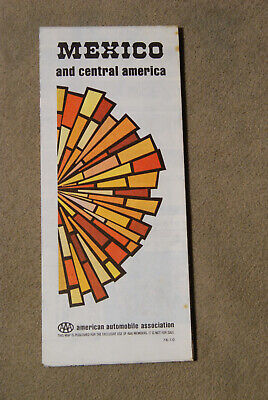
Fall 1973-74 Edition AAA map of Mexico and Central America
This auction is for a Fall 1973-74 Edition of a AAA map for Mexico and Central America. This is a great item to add to any collection. These are also great from genelogy projects. Please see picture for condition of this map. Please email us with any questions. All Sales Final. No Refunds. Happy Bidding!
|
|
|
Rare Large 1922 Times Maps of Mexico & Central America by Bartholomew
A fine antique map from The Times Survey Atlas of the World MEXICO& CENTRAL AMERICA Provenance The Times Survey Atlas and Gazetteer of the World by J.G. Bartholomew Published London: The Times Printing House. 1922. Cartographer J.G. Bartholomew. Cartographer to the King. Size/ Format 22.5" x 17.5" 57.6 cm x 44.8 cm) One fold in the centre. The margins are clean and range form 0.5" to 0.8" 1-2 cm) on all sides. These maps were all'tipped in' to the atlas. Which means they can easily be removed as a single sheet with a fold in the centre. Condition Very good. The colors are bright and fresh. The maps themselves. And the margins, are very clean. There are no tears, stains, discolorations or soiling whatsoever. The atlas from which these maps were removed did NOT spend its life at a public library. It was part ... moreof a private collection and was treated very well. Remarks The publication of the Times Survey Atlas in 1922 was the culmination of six years of painstaking work and. With the combination of political and the physical colour range from dark green to dark brown to indicate elevation, it marked the beginning of the age of'modern cartography. It surpassed any atlas before it in terms of scope(112 double-page folio map) and accuracy. Many of the maps published in this atlas were used in other atlases in many countries as recently as the 1970s. These maps will look great framed and hung individually or, on a large wall, in groups. This edition of The Times Atlas features about thirty polotical maps and about ninety maps that display both physical and political characteristics(the now-familiar use of green and brown to show elevation) Click the image below to see more maps from this atlas
|
|
|
DEC.1939 MAP, NATIONAL GEOGRAPHIC insert, MEXICO, CENTRAL AMERICA & WEST INDIES
Offered is the map insert to the National Geographic monthly issue magazine. Titled"MEXICO,CENTRAL AMERICA& THE WEST INDIES" and document dated on the map as December 1939. Offered is the map only, not including a magazine. This map measures 24 inches tall by 41 inches long. There is writing nor tears nor holes on this map. Either side, but there is surface soil on the fold storage side panel on the plain back side. please see photo's) There are additional margin edge folds near the map title on the colored side. Due to age. Maps have fold lines and some storage and use surface soil on top sides panels and edges, age color yellowing on front and back and in margins, possibly minor margin tears. Larger tears and holes will be specifically mentioned, as specific ink or pen markings on the front or back of the map. There are ... moreneither on this December, 1939 map. From a smoke and pet free. Dry environment. Maps will be shipped between protective wrapping and cardboard and will be shipped flat in their folded positions. If interesting or searching. Additional early years National Geographic maps covering 1937-1944, and 1952 are also offered. Thank you. 336.RcmdId ViewItemDescV4,RlogId p4%60bo7%60jtb9%3Fvo%7B%3Dd70f%2B%3E336-14206b61b46-0xfc-
|
|
|
Vintage National Geographic Map of Mexico Map of Central America c May 1973 EUC
Auction- 1 National Geographic Map of MEXICO with a Map of CENTRAL AMERICA on the flip side. Copyright May 1973. National Geographic Society. Washington DC. Produced by the Cartographic Division of The National Society for The National Geographic Magazine. Melvin Bell Grosvenor. Editor-In-Chief. Clean. Rarely opened if at all. No odors. No stains. No rips. Please see my photos with and without flash. Pardon any glare from my light source. I will ship via USPS First Class Mail in the USA. I will pack with tissue& cardboard to ensure safe delivery. Contact me about shipping rates to International Locations. Welcome to Charmar97CharmarsCupboard! Please bid with confidence. We are long time eBayers with over 900 buying and selling transactions under charmar97. We pack with care and ship promptly from our smoke free home in zip code 88310. ... moreWe ship daily. I do not have much experience with international shipping so please be patient with me. Please email me with any questions. I will respond promptly. Please view our eBay Store. We have Vintage and Antique items with a splash of new merchandise from time to time. I will be putting new items on weekly if not daily. I leave feedback immediately upon receipt of payment. I know buyers and sellers alike cherish feedback. Thank you for viewing and considering this item. ENJOY!
|
|
|
National Geographic Map of Mexico and Central America May 1073 V9
VERY GOOD CONDITION. NO RIPS, NO TEARS, NO WRITING
|
|
|
Vintage 1939 National Geographic Map of Mexico, Central America & West Indies(c)
Vintage 1939 National Geographic Map of Mexico. Central America& West Indies(c) This map is in good condition for it's age. It measures approximately 40 x 24 inches in size. Please be aware that these National Geographic Maps are anywhere from 10 to 90 years old. They are printed on paper that is not acid free and in most cases have not been stored in the best way. So the maps you are buying may be in a condition that reflects both of these facts. The map you get may be worn or lightly torn along the fold lines due to the acidity of the paper and being folded for years. They may also be discolored or mottling spots again due to the acidity of the paper. The borders of the maps may also have small tears. On occasion maps may smell musty from the way they have been stored in the past. When the map is kept in an open area the musty smell ... morewill fade away in time. Any damage that is above and beyond the norm will be disclosed. Payment through Paypal only. Payment is required within four days. I do combine multiple purchases for shipping. If you have bought an item and are going to bid on a future item(s) you must let me know if you want them shipped together. I usually ship by Parcel Post or First Class Postage in order to save money on shipping costs. This does mean that often the delivery time will take longer. If you prefer that your item be shipped by Priority Mail to get it quicker please let me know and I will adjust your invoice accordingly. All items are sold in"as in" condition. Should you have any problem with the item or you feel that it has been misrepresented. Please contact me so that we can reach a mutually satisfactory solution. All overseas shipping must go through EBay's Global Shipping Program. If your feedback score is less than 20 then please contact me before bidding. RcmdId ViewItemDescV4,RlogId p4%60bo7%60jtb9%3Fuk.rp*4a24%60%3C%3E-1440a3ff40e-0xd6-
|
|
|
1953 National Geographic Map of Mexico & Central America 27 x 37" V GOOD cond.
You're bidding on an original vintage March 1953 National Geographic map of Mexico and Central America. The pictures are of the actual map you will get. Map CONDITION: In very nice conditon with no rips. Tears, or perforations. Some small creases. Good sized about 27 x 37" Will be shipped to USA via USPS First Class Mail. P lease check my other auctions. Perfect feedback, tenure with ebay and bid with confidence. Powered by The free listing tool. List your items fast and easy and manage your active items.
|
|
|
Mexico and Central America, West Indies, Vintage Map, 1902
Mexico and Central America. West Indies, Vintage Map, 1902 Click to Enlarge Click to Enlarge Click to Enlarge Here is a vintage map of Mexico and Central America and the West Indies from a 1902 geography book. Complete Geography by H. Justin Roddy, American Book Company. It measures about 9 1/2 inches X 12 inches. There is text on the reverse side. In good condition. Satisfaction guaranteed or your money back. Item must be returned within 14 days for refund. Will accept Paypal. International buyers. Check shipping costs before bidding. Heavy items can be costly to ship. Seller is not responsible for customs delays or costs. inkfrog terapeak. I000000.
|
|
|
1980 & 1994 National Geographic maps of Mexico, Central America & Aztec World
You're bidding on a lot of two original vintage National Geographic maps of Mexico and Central America. The pictures are of the actual maps you will get. Aztec World map is in beautiful mint condition. Travelers map of Mexico is in excellent condition. Maps' DESCRIPTION: The Aztec World Map is from Dec. 1980 and measures about 20 x 26" Flip side has a Mexico/ Central America map. The Traveler's Map of Mexico is also double sided and measures about 20 x 30" The maps will be shipped to USA via USPS First Class Mail. P lease check my other auctions. Excellent feedback, tenure with ebay and bid with confidence. Powered by The free listing tool. List your items fast and easy and manage your active items.
|
|
|
National Geographic Map: Mexico and Central America March 1953 (N53)
Shipping Information National Geographic Map: Mexico and Central America March 1953(N53) Description: Here is a National Geographic map titled Mexico and Central America. Dated March 1953. This particular map has one side. Which is listed below with pictures and descriptions. If you are planning on buying more than one of my maps make sure you read the shipping information below. Important(Please read) One of these maps. Though still quite useable, has more damage than is stated below. This extra damage can be tears along the seam bigger than expected, small holes alon the seams, stains or damage to the corners or edges. Because of this I am willing to take offers on this map less than the stated price. I will only take offers on these damaged maps. Not on the maps in great condition. If you wish to receive more info on the exact damage to ... morethe map you are bidding on send me a message and I will explain it to you in more detail. Click on the thumbnails to see the enlarged pictures. Mexico and Central America- March 1953(37"x27" This is a political map unique in that it combines Mexico and Central America. It shows the expansion of transportation in the region at this time. It has a detailed inset of the Panama Canal zone. Please Note: The vast majority of the maps I have up for sale are in excellent condition and look just as good as the map in the picture. However. Some of these maps, especially the older ones, might have some small defects, such as a small tear or soiling at the seams. I will make every effort to send you the best map I have. If the map does have one of these small defects, I will email you and let you know what the defect is, and give you the option of cancelling the auction or giving you a discount on the shipping cost. N53) This map weighs 50 grams Be sure to check out my page for information on my web site dedicated to helping you find a particular National Geographic map to meet your needs. Shipping Information: If just buying one map the shipping cost will show up in your invo
|
|
|
1928 Lithograph Mexico Map Pacific Ocean Central America Country Gulf XGLA6
Home ~ Affiliations ~ Discounts ~ FAQs ~ Grading and Certification ~ Premium Shipping ~ About Us VINTAGE ART& ADVERTISING CURATED COLLECTIONS 1928 Lithograph Mexico Map Pacific Ocean Central America Country Gulf XGLA6 Details Year: 1928 Type: Original Lithograph Grade: Near Mint/ Very Fine Authentication: Dual Certificates Image: Color Approximate Size(inches) 10 x 8 Approximate Size(cm) 25 x 20 Description and Condition This is an original 1928 color lithograph map of the country of Mexico. CONDITION This 83+ year old Item is rated Near Mint/ Very Fine. Light aging throughout. No creases. No natural defects.No surface rub.No tears. No water damage. To find other items from this specific collection in our eBay store. Please. XGLA6C28 153542_XGLA6_037 Product Pricing& What We Deliver At times we receive inquiries about our pricing. ... moreEspecially for vintage advertising or historical halftone prints, and are asked why our prices are consistently higher than some other sellers of similar items. For the first five years of our business, we asked our primary consumer base what they wanted. Our primary consumers- historical societies, historians, archivists, curators, university professors, historical decorators, and collectors, etc. have diverse and specific needs and we've built our business to accommodate those needs, like no other seller worldwide. Below is what is unique about how and what we offer as the world's leader in print ephemera: Product Packaging. Every product is placed against custom black acid-free board with crystal-clear. Archival protective closures. We are the only sellers in the industry who provide display-quality black boards with every item(which also make exceptional presentations for gift-giving) Oversized engravings are protected by museum quality tubes. Product Pictures. Online digital images to evaluate the original products are imaged high resolution. 100% perpendicular, giving the customer the ability to enlarge and see fine details in every listing. This digital imaging is
|
|
|
1935 Mexico Rand McNally map from Collier’s Atlas, also Central America
1935 vintage Mexico Rand McNally map. Approximately 9" by 12" or 23cm x 30cm, in very good condition with no folds or creases. This is double sided with a map of Central America on the reverse side. The page was removed from a 1935 Collier’s Atlas. It will be mailed flat in a cardboard mailer. It is perfect for being a piece of framed art to be hung for display. We will combine purchases to save on shipping fees. Powered by The free listing tool. List your items fast and easy and manage your active items.
|
|
|
Vintage National Geographic Map "Mexico, Central America, & West Indies" 1954
This 1934 map of Mexico. Central America, and The West Indies by the National Geographic is extremely detailed. The condition is good with small holes where the folds meets. I have listed many NG Maps. Check them out. If you purchase more than one item. There will no additional shipping charge.
|
|
|
1925 Color Map, MEXICO, Central America, Panama Guatemala Honduras 15.5"x 20.25"
Antique Color Map Region: Mexico and Central America, Guatemala. Salvador, Belize, Panama, Costa Rica, Nicaragua, Honduras Date/Publisher: 1925. The London Geographic Institute, George Philip& Son Ltd. Size: approx. 15-1/2" x 20-1/4" Condition: Nice condition. Light wear, light toning, folded in half as shown Please Zoom-in on photos for more details regarding content and condition. ~~ Please be sure to check out my! I'm listing many more Antique Maps& Prints. Shipping is just $0.50 more for each additional map ~~ Thanks for looking at this listing. If you have any questions. Just ask! Payment and Shipping Info: eBay wants payment through PayPal or Cash upon Pickup. Email regarding other options. I ship 5 days a week Mon-Fri and will usually ship within 24 hours of payment clearing. I will be happy to combine shipping ... morewhen possible! When purchasing more than one item just wait for an invoice that will reflect combined shipping savings. If you'd like a quote ahead of time feel free to contact me. Some items cannot be combined. Your satisfaction is extremely important to me. Once you receive your item/s and are happy with them I hope you will consider leaving me positive feedback. As I will be doing the same for you. Thank you for looking. Good luck bidding, and please don't hesitate to contact me with any questions!
|
|
|
MEXICO. Greater Central America Republic-1895 Amapala treaty. JOHNSTON, 1906
Mexico Antique colour map. 1906 Title of map: Mexico' The image below shows an enlarged cross section from the centre of the map to show the level of printed detail: DATE PRINTED: 1906 IMAGE SIZE: Approx 20.0 x 27.0cm. 7.75 x 10.5 inches(Medium) ARTIST/CARTOGRAPHER/ENGRAVER: W. A.K. Johnston. Limited Edinburgh& London PROVENANCE: The Victoria Regina Atlas" Published by W& A.K. Johnston. Ltd, Edinburgh& London: 2nd Edition TYPE: Antique colour map VERSO: There are images and/or text printed on the reverse side of the picture. In some cases this may be visible on the picture itself(please check the scan prior to your purchase) or around the margin of the picture CONDITION: Good; suitable for framing. However. Please note: The image shown may have been taken from a different example of this map than that which is offered ... morefor sale. The map you will receive is in good condition but there may be minor variations in the condition from that shown in the image which may include some light spotting. Please check the scan for any blemishes prior to making your purchase. Virtually all antiquarian maps and prints are subject to some normal aging due to use and time which is not obtrusive unless otherwise stated. I offer a no questions asked return policy- see below. AUTHENTICITY: This is an authentic historic print. Published at the date stated above. I do not offer reproductions. It is not a modern copy. The term'original' when applied to a print means that it was printed at the first or original date of publication; it does not imply that the item is unique. Print' means any image created by applying an inked block to paper or card under pressure by any method including wood engraving, steel engraving, copperplate, wood cut and lithography. REMARKS: FRANCE: Gravures et Cartes anciennes. DEUTSCHLAND: Alte Lankarten und Stadt ansichten. ITALIA: Stampe e Mappe antiche. ESPAÑA: Mapas antiquos y impresiones antiguas. E and OE. Force Majeure. English law shall apply. RETURNS POLICY: I offer a
|
|
|
Authentic Colored 1942 Vintage Map of Mexico & Central America Double Sided
DOUBLE SIDED! On one side of it is a Map of Mexico and the other side is a map of Central America. Take your pick of which side you want to display. You will get the exact print that is shown in the pictures. This is an Authentic colored original map from 1942"not a copy or reprint" This comes from a nicely aged atlas that was past it's prime for use as a"page turning book" It is perfect though for being a piece of framed art to be hung for display. It is approximately 10"x 13" ten inches by thirteen inches) IT DOES NOT COME FRAMED. YOU ONLY RECEIVE THE PAPER THAT IS READY TO BE FRAMED. I am not an expert or claim to be one. I find old treasures and try to put them with someone that will enjoy them again. I try to do the best research that I can. There is no way for me to know everything about everything. ... moreAs this is not a new item. Condition perspectives may vary from person to person. All buyers are strongly advised to inspect the items pictures, descriptions and ask all questions before bidding. All vintage, antique, collectibles, and art items are sold AS-IS. Although I try to express accurate descriptions(I wouldn't get very far as an eBay seller if I didn't) I make no guarantee or warranty of any kind with respect to the physical condition, originality, size, quality, rarity, medium and materials, age, provenance, culture, any unknown repairs or damages, source, or historic significance of any goods. Assume all weights and measurements are approximately what the item is. Buyers must depend on their knowledge and review the merchandise before bidding. YOU ARE BIDDING ON WHAT IS IN THE PICTURES*If you are not happy with your purchase after it arrives. PLEASE contact me before leaving feedback, to try and resolve issue. It isn't told to buyers that negative or neutral feedback affects how much you can sell on here, not just a percentage rating. I do this 12 hours a day, I am human and bound to make a mistake here and there so please just let me know first if you hav
|
|
|
Antique 1903 Double-Sided Color Map of Mexico / Central America Geo F. Cram
~~~~~~~~~~~~~~~~ ~~~~~~~~~~~~~~~~ Thank you for viewing my Map Auction! Satisfaction Guaranteed* ~Rare and Quality Items~ Fast& Free Shipping~ Antique 1903 Double-Sided Color Map of Mexico/ Central America Page Size: 12.4" X 11.2" Mexico Map Size: 11.5" X 9.5" Central America Map Size: 12" X 9.75" Source: This map came from 1903 Cram's Ideal Reference Atlas of the World by Geo. F. Cram. Chicago& New York. ~~~~~~~~~~~~~~~~ ~~~~~~~~~~~~~~~~ If you have any other questions. Do not hesitate to ask! Trusted Ebay Seller Since 2004* Check out my other auctions! ~~~~~~~~~~~~~~~~ ~~~~~~~~~~~~~~~~ Shipping Policy: Shipping is free for 99% of the items I sell. Except in cases where shipping makes up a large part of the purchase price. Books will be mailed either by first class mail(if under 11 ounces) or media ... moremail(if over 10 ounces) unless additional upgrades are purchased. Other items will be mailed via first class or standard mail/priority mail. Sometimes I will upgrade your shipping for free to priority mail in the case of high dollar items. Except in rare situations. I ship either same day or next day depending on when your order comes in. Monday-Friday, my normal cut off for shipping is approximately 8-9 AM EST, but sometimes a little later. On Saturday, the cut-off time varies but is typically around 12 PM EST. I do not ship on Sunday as USPS is closed that day. With any very thin items(maps. Pamphlets, and some books, i.e. I always ship between cardboard and or bubble wrap inside of a plastic mailer to keep bending from occurring. Model cars/hotwheels/matchbox are shipped in boxes. For international shipments. The quoted price is too high 99% of the time, and I will provide a refund before your items ships of the difference. I ship to any country allowable. Payment: If you are unable to pay for your item within a week of purchase. Please contact me to let me know. If not, I will open an unpaid buyer's case. Best Offers: I am more than happy to accept reasonable best offe
|
|
 |