|
|
Order by: Available to: This site contains affiliate links for which I may be compensated
|
Buy It Now
$6.95 Shipping Location: Dover, United States Issued c. 1720, Paris by Anonymous. Early 18th century map with lovely hand color.
Buy It Now
Free Shipping Location: Willow Grove, United States This map image is entirely in Latin and represents the area around Syria and Palestine around 1000 BC. On the reverse side of this map page is text.
Buy It Now
Free Shipping Location: Schertz, United States This 1855 historical map depicts the Roman Empire and Ancient Greece. It was printed using Copper Plate technique and is an Antique Original. The map ... morewas published by R.C. Smith and D. Burgess & Co. The map measures 11x18 inches. Shipping and handling is free within the USA, while the rates are calculated for worldwide delivery.
Buy It Now
$4.99 Shipping Location: Fairview, United States , published in Edinburgh and London 1832, a facsimile copy of the title page is included for authenticity. The map is "Drawn and Engraved by W. Murphy, ... moreEdinburgh," as stated in the upper margin. Condition: The map is in Good to Very Good condition for its age, blank on reverse with tonal ageing and darkening around the edges, see the pic for more on condition.
Buy It Now
Free Shipping Location: Willow Grove, United States This map image may represent the full extent of the Roman Empire and does not seem to represent a specific year. There is a partial map image and text ... moreon the reverse side of this map page.
Buy It Now
$15.07 Shipping Location: Antrim, United States This is a beautifully framed vintage reproduction of an ancient Europe map. Measuring at 9 inches by 12 inches, this wall map is a perfect addition to ... moreany antique or map collection. The lithography printing technique used in creating this piece adds to its authenticity and charm. The map was published by Cunningham Art Products. It features Old World Europe & is bordered by people dressed in Old World clothing. Whether you're a collector or just looking for a unique piece to decorate your home, this map is sure to impress.
Buy It Now
$6.95 Shipping Location: Dover, United States Achaia quce et Hellas. Issued 1683, Amsterdam by Bertus-Bunonis. Late 17th century engraved map with attractive hand color.
Buy It Now
$6.95 Shipping Location: Dover, United States Issued 1683, Paris, for A.M. Mallet. (Old Prints, 17th Century Prints, Asia, Arabian Peninsula, Ancient World, Red Sea, Persian Gulf). The image has a ... morenear folk-art feel, a style unique to this historical era.
Buy It Now
Free Shipping Location: Monroe, United States ORIGINAL 1855 ANTIQUE MAP OF ANCIENT TURKEY. ORIGINAL 1855 HAND-COLORED ANTIQUE MAP OF ANCIENT TURKEY. DATE-1855, NOT ON MAP. REMOVED FROM MARCIUS WILLSON'S ... moreOUTLINES OF HISTORY.
Buy It Now
$5.95 Shipping Location: Dayton, United States This is for an original, authentic map that was carefully removed from a 1832 Atlas titled "An Atlas Of Antient (Ancient) Geography" by Samuel Butler. ... moreFor the age of the map it is in very good condition, slight wear and creases, slight marks.
Buy It Now
$7.53 Shipping Location: BLACKWOOD, United Kingdom A school atlas of English history - S. R. Gardiner 1910. The discovery & mapping of the Great Lakes 'Sweet-Water', 1522-1703 - A. E. MacDonald. Topographic ... moresurveying; including geographic, exploratory, and military mapping. - H Wilson 1905.
Buy It Now
$5.33 Shipping Location: NEWCASTLE UPON TYNE, United Kingdom Understand geological topography – the study of surface shape in relation to mapping. Read about military map reading and sketching as well as map reading ... morefor aviators. Learn about the discovery of the.
Buy It Now
$4.96 Shipping Location: BLACKWOOD, United Kingdom A school atlas of English history - S. R. Gardiner 1910. A sketch of historical geography - K Johnston 1909. Atlas Of Ancient Egypt by The Egypt Exploration ... moreFund 1894. Archeological Atlas of Ohio - W. C. Mills 1914.
Buy It Now
$8.30 Shipping Location: Celina, United States See pictures, lots of wear to book, maps in good shape besides the world map
Buy It Now
$6.95 Shipping Location: Dover, United States Issued 1719, Frankfurt, for A.M. Mallet. The image has a near folk-art feel, a style unique to this historical era. Charming early 18th century copper ... moreengraved print with lovely hand color.
Buy It Now
$8.30 Shipping Location: Celina, United States The maps pictured are all of the maps that are currently in the book, atlas may be missing maps if it’s not pictures there is no guarantee it is in the ... morebook
Buy It Now
$4.96 Shipping Location: BLACKWOOD, United Kingdom A school atlas of English history - S. R. Gardiner 1910. A sketch of historical geography - K Johnston 1909. Atlas Of Ancient Egypt by The Egypt Exploration ... moreFund 1894. Archeological Atlas of Ohio - W. C. Mills 1914.
Buy It Now
$13.68 Shipping Location: Dixon, United States C V Lavoisne; C Gros; Jehoshaphat Aspin; E Paguenaud. Bound with contemporary gilt letter spine over boards. Good condition for being an 1820's copy. ... moreBeautiful marbled paper over boards both outside and inside covers.
Buy It Now
$7.53 Shipping Location: BLACKWOOD, United Kingdom A school atlas of English history - S. R. Gardiner 1910. The discovery & mapping of the Great Lakes 'Sweet-Water', 1522-1703 - A. E. MacDonald. Topographic ... moresurveying; including geographic, exploratory, and military mapping. - H Wilson 1905.
Buy It Now
$28.00 Shipping Location: Taunton, United States Metallicized paper map print of ANCIENT IRELAND, "A Map of the Kingdom of Ireland for Mr. Tindals Continuation of Mr. Rapins History", framed, as shown. ... moreThere is some very interesting detail in this map. An educational tool. Framed, measures approx 21" x 18". *Ships to Continental US *
Buy It Now
$15.55 Shipping Location: Colorado Springs, United States
Buy It Now
$14.99 Shipping Location: Armenia Alain Ducellier. "Alain Ducellier. Still, up 4 week considers normal. Condition: Good Condition: Light age wear. Overall clean & well preserved pages- ... morelike new. For more information regarding book's condition- check provided images or ask us.
Buy It Now
$8.70 Shipping Location: Vero Beach, United States From Black's General Atlas comprehending sixty-one maps engraved in steel in the first style of the art by Sidney Hall, Hughes, etc. Published by Adam ... more& Chas. Black. 12.5" x 17.25"

Buy It Now
Free Shipping Location: Monroeville, United States i000000. 1901 ANCIENT EGYPT THEBEN Antique Map Click to Enlarge Click to Enlarge Original old German map(printed on the both sides)book plate(not a modern ... morereproduction)comes from a German lexicon. The map has been printed by Bibliographisches Institut.Leipzig,Germany in 1901. It looks great when framed. The overall size of this print with margins approx 9 1/2" x 6 1/2" Usually I show on the picture that area of print which will be visible in the frame. Condition can be see from the scan. PLEASE NOTE! FOR MULTIPLE BUYERS. All combined items must be paid once a week. If the items are not paid in a 2 week(14 days) now the eBay assistant will automatically open a case for unpaid item. After reading all of auction. Please ask any and all questions BEFORE bidding! Thank You If you have questions or problems before OR after you receive an item. PLEASE contact us ASAP. We leave feedback for everyone. Once transaction is complete and feedback has been left for us. We believe in and encourage good communication! We work hard to keep our customers happy! We accept returns ONLY if there is a problem(or damage) on the item. Multiple winner safe shipping cost. Shipping is same for 1-3 prints Please allow approximately two-three weeks for delivery from Europe after payment received. Payment must be received up to 7 days. Payment by PayPal. SORRY but we do not accept eChecks. DO NOT DUPLICATE OR COPY! Template Made By: © Inkfrog Template Center Auction Templates. Logos, Store fronts and more! inkfrog terapeak. ``d.RcmdId ViewItemDescV4,RlogId p4%60bo7%60jtb9%3Fvo%7B%3Dd70f%2B%3E%60%60d-14047bbce3a-0x109-
Buy It Now
$5.95 Shipping Location: Dayton, United States This is for an original, authentic map that was carefully removed from a 1932 Atlas titled "An Atlas Of Antient (Ancient) Geography" by Samuel Butler. ... moreFor the age of the map it is in very good condition, slight wear and creases, slight marks on edges.
Buy It Now
Free Shipping Location: Monroe, United States REMOVED FROM MARCIUS WILLSON'S OUTLINES OF HISTORY. GOOD CONDITION, DISCOLORATION, TEXT ON REVERSE.
$9.00 Shipping Location: Slovakia The map has been printed by Bibliographisches Institut,Leipzig,Germany in 1895. DO NOT DUPLICATE OR COPY! Condition can be see from the scan (SEE PICTURE)!!
Buy It Now
$4.99 Shipping Location: Fairview, United States , published in Edinburgh and London 1832, a facsimile copy of the title page is included for authenticity. The map is "Drawn and Engraved by W. Murphy, ... moreEdinburgh," as stated in the upper margin. Condition: The map is in Good condition for its age, blank on reverse with tonal ageing, see the pic for more on condition.
Buy It Now
$101.75 Shipping Location: Sacramento, United States
Buy It Now
$6.95 Shipping Location: Dover, United States Issued 1683, Paris, for A.M. Mallet. The image has a near folk-art feel, a style unique to this historical era. Charming 17th century copper engraved ... moremap with lovely hand color.
Buy It Now
$6.95 Shipping Location: Dover, United States Issued 1683, Paris, for A.M. Mallet. The image has a near folk-art feel, a style unique to this historical era. Charming 17th century copper engraved ... moremap with lovely hand color.
Buy It Now
$5.00 Shipping Location: Georgetown, United States The well-preserved old sheet map is sure to delight those interested in history and geography alike, with its accurate representation of the area in the ... morelate 18th century.
Buy It Now
Free Shipping Location: Monroe, United States ORIGINAL 1855 ANTIQUE MAP OF ANCIENT ATHENS. VERY DETAILED MAP SHOWING ANCIENT ATHENS AND IT'S HARBORS WITH THE SURROUNDING COUNTRY. REMOVED FROM MARCIUS ... moreWILLSON'S OUTLINES OF HISTORY. ORIGINAL 1855 ANTIQUE MAP OF ANCIENT OF ATHENS AND IT'S HARBORS.
Buy It Now
$6.00 Shipping Location: Neuendettelsau, Germany Age: 18th. Sheetsize: 22 x 16.5 cm. Original engraving.
Buy It Now
Free Shipping Location: Monroe, United States ORIGINAL 1855 ANTIQUE MAP OF THE AEGEAN SEA. HAND-COLORED AND VERY DETAILED MAP OF THE AEGEAN SEA, EASTERN GREECE AND WESTERN TURKEY WITH VILLAGES AND ... moreWATERWAYS. MAP HAS SCALE AT LOWER RIGHT CORNER.
Buy It Now
$4.99 Shipping Location: Fairview, United States Atlas of Classical Geography, published in New York; Sheldon & Co., 1871, a copy of the title page is included for authenticity. Condition: The map is ... morein Very Good condition, printed on heavy paper, blank on the reverse with a centerfold as issued.
Buy It Now
Free Shipping Location: North Wales, United States 1828 WOODBRIDGE ANCIENT ATLAS MAP-ITALY, GREECE, ASIA MINOR, SYRIA-HAND COLORED ORIGINAL ANTIQUE ATLAS MAP PLEASE SEE PHOTOS AS PART OF THE DESCRIPTION ... moreCONDITION: MAP IS IN GOOD CONDITION. SIZE: APPROXIMATELY 12.5" X 19" SHIPPING: U.S. FIRST CLASS RATE - FREE SHIPPING - ANY ITEM WHICH SELLS FOR OVER $100 WILL REQUIRE INSURANCE WE COMBINE SHIPPING FOR MULTIPLE WINS. THANK YOU FOR YOUR INTEREST IN OUR AUCTIONS!.
Buy It Now
$16.45 Shipping Location: Vero Beach, United States Original horizontal fold line. Heavy paper, a bit stiff. Age toned. Overall clean and attractive. Engraved with original hand color, piano key border.
Buy It Now
$36.05 Shipping Location: Troy, United States "This beautiful old world map is created in very detailed gold and silver foil. The intricate details and accuracy of the map make it a valuable piece ... moreof history. It is a perfect representation of how the world was viewed before modern technology and exploration.
Buy It Now
$6.95 Shipping Location: Dover, United States Issued 1683, Paris, for A.M. Mallet. Charming 17th century copper engraved map with old hand color. The image has a near folk-art feel, a style unique ... moreto this historical era.
Buy It Now
$4.99 Shipping Location: Fairview, United States It is designed by G.W. Boynton as seen in the bottom right margin. It is feom the Reverend William Jenks'. The Explanatory Bible Atlas and Scripture Gazetteer; ... moreGeographical, Topographical and Historical (Boston: Charles Hickling, 1847).
Buy It Now
$222.80 Shipping Location: Perry, United States Gold Foil Vintage print Fame is in very good condition - no separation or chips, nicks etc.This is a vintage reproduction of an antique mapProfessionally ... moreframed 341/4 x 25 3/4 frame sizeInside size 27 7/8 x 19 1/4see photos for complete description
Buy It Now
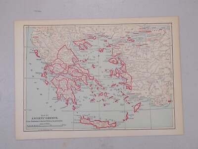
Free Shipping Location: Monroe, United States ORIGINAL 1855 ANTIQUE MAP OF ANCIENT GREECE. VERY DETAILED MAP SHOWING ANCIENT GREECE WITH STATES, VILLAGES AND WATERWAYS. MAP HAS SCALE AT LOWER RIGHT ... moreCORNER. ORIGINAL 1855 ANTIQUE MAP OF ANCIENT GREECE HAND-COLORED BY STATES.
Buy It Now
Free Shipping Location: Bulgaria Map is original from the 1930's of last century. 20 cm x 13 cm.
Free Shipping Location: Schertz, United States Explore the ancient world with this authentic Johnson map of the Roman Empire from 1863. Measuring 18" x 26", this antique original is over 160 years ... moreold and showcases the territories, cities, and boundaries of the Roman Empire. The map is in the format of an atlas and was published by Johnson & Ward, a renowned cartographer and publisher of the time. In addition to owning a piece of history, you can also support the Tunnel to Towers charity as 10% of your purchase will be donated. Free shipping is available within the USA, and calculated shipping is available worldwide. Don't miss this opportunity to own a beautiful and unique piece of cartographic history.
Buy It Now
$4.99 Shipping Location: Fairview, United States Atlas of Ancient and Classical Geography, published in London by J.M. Dent & Co., 1908, a copy of the title page is included for authenticity. An Authentic ... moreAntique Map: Not a Modern Reproduction! Condition: The map is in Very Good to Excellent condition, printed on heavy paper, blank on the reverse with two vertical folds as issued.
Buy It Now
$10.35 Shipping Location: Austin, United States Discover the beauty of Italy's rich history with this Antique 1830 Original Map of Ancient Italy II by Baldwin and Cradock. The map measures 16 inches ... moreby 13.5 inches and features detailed illustrations of the country's cities and regions. Perfect for collectors and lovers of history, this map is an authentic piece from the 1800s, adding a touch of nostalgia to any space. The cartographer/publisher, Baldwin and Cradock, is known for their exceptional quality maps and this piece is no exception. Don't miss out on the opportunity to own a piece of Italy's past.
Buy It Now
$4.95 Shipping Location: Dover, United States Issued 1828, London by S. Arrowsmith. (Asia, India, Ancient World, Ceylon, Sri Lanka). Early 19th century engraved map with original outline hand color. ... moreDictionary of Mapmakers, vol.
Buy It Now
$5.50 Shipping Location: Kissimmee, United States 7x9.5" VG-F. This map shows the regions of ancient Vindelicia, Rhaetia, Noricum, Pannonia, and Illyricum. Here are the mountains, rivers, cities and towns ... moreof these ancient regions. This beautiful map is of great geographical and historical value.
Buy It Now
Free Shipping Location: Monroeville, United States You will only pay Post& Packing on the largest print. All other prints purchased at the same time will be Post& Packing FREE You are bidding on ... morea Genuine Original 1901 Antique Map of. Graecia Antiqua from Chambers Encyclopedia A Dictionary Of Universal Knowledge This is a genuine Double Page Map from the Encyclopedia not a copy or reproduction. Published 1901 The Map is in a good condition for it's age of over 110 years. Slightly yellowed consistent with age and has a diaganol fold from approx 3/4 to left side from bottom to approx 1/2 way along bottom line- off of image- Please see Photos for condition. As this is a double page from the book there is a fold line down the centre of the map where it has been bound into a book. The back is plain there is no text on the reverse- Please see photos for condition. Published Williams& Robert Chambers. Limited London And Edinburgh J.B. Lippincott Company. Philadelphia 1901 A rare opportunity to own a Genuine Vintage Map. Great for collectors or historians, would look great mounted and framed. Approx overall Size of page approx 12" x 10.5" Please see my other listings for more Antique Maps& Prints. You will only pay Post& Packing on the largest print. All other prints purchased at the same time will be Post& Packing FREE The Postage Cost is for Standard Airmail only. If you require Tracking& Insurance please add an extra $8.00 Per Package(Except for Asia where tracking is already include in price shown) Sorry but payment from Overseas buyers by Paypal only* Our Ref LEM936 Powered by The free listing tool. List your items fast and easy and manage your active items. RcmdId ViewItemDescV4,RlogId p4%60bo7%60jtb9%3Fuk.rp*3A%3Cd%3Ff6%3E-14480859fc5-0x10b-
Buy It Now
$4.99 Shipping Location: Fairview, United States Atlas of Ancient and Classical Geography, published in London by J.M. Dent & Co., 1908, a copy of the title page is included for authenticity. An Authentic ... moreAntique Map: Not a Modern Reproduction! Condition: The map is in Very Good to Excellent condition, printed on heavy paper, blank on the reverse with two vertical folds as issued.
Buy It Now
$11.92 Shipping Location: ILKLEY, United Kingdom Title / Subject: Orbis Veteribus Notus. Date: 1851. It shows the extent of the Roman Empire. It has original hand colouring.
Buy It Now
$6.95 Shipping Location: Dover, United States Issued 1683, Paris, for A.M. Mallet. The image has a near folk-art feel, a style unique to this historical era. Charming 17th century copper engraved ... moremap with lovely hand color.

Buy It Now
$8.40 Shipping Location: Skippack, United States 1856 Map Spain or Hispania As Known To The Ancients Long's Classical Atlas. Details Description: An antique 19th century copper engraving and hand ... morecolored map. This is a double page from the Long's Classical Atlas published in 1856. Here is page 7 having a map of Spain or Hispania as it was referred to in ancient times. The map shows Spain starting from the north at its border with Gallia(France) and continuing to the south to the straights of Hercules(today Gibraltar) This map was taken out of a damaged copy of the Long's Classical Atlas(see the last three photos) Which is not part of this sale. This sale is for the map only. These maps would look great once properly framed. They were engraved by GE Sherman Printed by Henry Seibert of New York. The maps show quite a bit of detail and are nicely colored. It shows cities, rivers, mountain ranges, water bodies and longitudinal and latitude lines with London being the zero. The cities are all named after their historic names rather than their modern names. Please carefully review photos as they are part and parcel of our description. Date: 1856. Origin: Printed in New York City. Size: The piece measures ~13" by ~10" Maker: Engraved by GE Sherman Printed by Henry Seibert. Distinguishing Characteristics- Most Interesting About The Piece: A very nice high quality antique map. Condition: The map is in excellent shape with minor foxing along the edges. It does have some water damage around the crease. Which can clearly be seen in the photos. Be that as it may the map is otherwise intact with vivid and fresh colors and would look great once properly framed. Please view photos for additional condition information and to appreciate its quality and beauty. In Closing: Please see photos to appreciate the beauty and condition of this piece. This is truly a nice decorative piece ready for framing to eventually hang on your wall or add to your collection. Our Guarantee Please view our 100% positive feedback and bid with confidence. We guarantee the authenti
Buy It Now
$4.99 Shipping Location: Fairview, United States It is from Migeon's. Paris: J. Migeon, 1877. A copy of the Atlas title page with date is included for authenticity. An Authentic Antique Map: Not a Modern ... moreReproduction! The pics are of the actual map.
Buy It Now
$4.99 Shipping Location: Fairview, United States Atlas of Classical Geography, published in New York; Sheldon & Co., 1871, a copy of the title page is included for authenticity. Condition: The map is ... morein Fair condition, printed on heavy paper, blank on the reverse with a centerfold as issued.
Buy It Now
Free Shipping Location: North Wales, United States 1828 ANTIQUE WOODBRIDGE ANCIENT ATLAS MAP-MIGRATIONS OF BARBAROUS TRIBES-EUROPE ORIGINAL ANTIQUE ATLAS MAP PLEASE SEE PHOTOS AS PART OF THE DESCRIPTION ... moreCONDITION: MAP IS IN GOOD CONDITION. SIZE: APPROXIMATELY 9.5" X 12.5" SHIPPING: U.S. FIRST CLASS RATE - FREE SHIPPING - ANY ITEM WHICH SELLS FOR OVER $100 WILL REQUIRE INSURANCE WE COMBINE SHIPPING FOR MULTIPLE WINS. THANK YOU FOR YOUR INTEREST IN OUR AUCTIONS!.
Buy It Now
Free Shipping Location: Willow Grove, United States This is an ORIGINAL map showing The Empire of Alexander The Great which was taken from a 1901 atlas. Unique to this map is that it indicates the Marches ... moreof Alexander throughout Asia and Africa. (different orientation).
Buy It Now
$6.95 Shipping Location: Dover, United States Issued 1852, Paris by Basset. Map by DuFour. Engraved by Smith. Mid 19th century antique engraved historical map with original outline hand color. Nice ... moredecorative border.
Buy It Now
$6.95 Shipping Location: Dover, United States Issued 1661-94, Wolfenb, Germany for Cluverius. Likely engraved by H. Mosting. Lovely mid to late 17th century engraved map with very attractive hand ... morecolor. Tyrus is most southern city along the coast, about level with Damascus, Syria.
|
|
|
|
The Egyptians National Geographic Wall Map Peoples of the Past Ancient History
Description FOR SALE IS: National Geographic Wall Map FREE SHIPPING-As Pictured-Very Good to Mint condition(varied conditions) I have a lot of different maps listed for sale. If you need specific condition details or for any map, please contact me and request them. I will Also picture the Actual map for you if you like. Please feel free to ask me any questions. I will respond to them asap! Please check my other auctions for similar items! Payment Please make your payment within 5 business days of purchase. Shipping I will always combine shipping on multiple item purchases when possible. Please allow 1 business day for handling. Items generally ship out within 24 hours after payment is received. Contact Us Please contact us through the Ebay Messaging Center. We will always respond in less than 24 hours with detailed answers to all of your ... morequestions and concerns.
|
|
|
1876 LARGE ANTIQUE VICTORIAN MAP PALESTINE ANCIENT DIVISIONS JUDAEA MOUNT SINAI
Beautiful large antique map on quality paper EXCELLENT condition and rescued from a disbound Atlas: BLACK'S GENERAL ATLAS OF THE WORLD 1876 THIS SUPERB VICTORIAN MAP IS AN ORIGINAL- ALMOST 140 YEARS OLD AND NOT A REPRODUCTION*FEATURES SUPERB DETAIL* Published by Adam& Charles Black. London This single page measures approximately 17 3/4 inches by 12 inches(430mm x 305mm) Printed on quality paper EXCELLENT CONDITION ~ VERY MINOR HANDLING& AGE MARKS AT EXTREMITIES Please email with any questions regarding this item(Black's General Atlas 1876} BEST OFFERS PLEASE FOR A QUICK SALE AT A FAIR PRICE If you like the item. But do not like the price, then make a realistic offer to us using the MAKE OFFER BUTTON e5b.RcmdId ViewItemDescV4,RlogId p4%60bo7%60jtb9%3Fuk.rp*b7g%3Ee5b-13d4b85b149-0xf9-
|
|
|
Antique Map c1890-Ancient Italia & Graecia -Gall and Inglis Imperial Globe Atlas
Antique Map c1890-Ancient Italia& Graecia-Gall and Inglis Imperial Globe Atlas Print Description: Antique Map c1890-Ancient Italia& Graecia-Gall and Inglis Imperial Globe Atlas Size: The Size of the print/map not including margins is approximately 13x10.5 inches. Cartographer: Provenance: Taken from Gall and Inglis Imperial Globe Atlas of Modern and Ancient Geography. Authenticity: This is a guaranteed genuine antique print. We do not deal in facsimiles or reproductions of any kind. Condition: Very Good- This map has another map on the reverse side. Suitable for framing. We grade all prints individually into four levels- Excellent. Very Good, Good, and Fair. Generally prints in excellent condition are free from foxing, rips,tears or folds. Very Good prints may have some minor foxing or spotting, however this will mainly be confined ... moreto the margins. Good and fair may have more general foxing. We try to represent all the images to the best of our ability, and we ask you to check the above scans before purchasing Payment: PayPal is our only accepted method of payment. We accept PayPal payments from buyers all over the world. PayPal is the safest. Easiest and quickest way to make online purchases. If you are purchasing multiple items, please add all the items to your shopping basket before proceeding to the checkout. If you do not already have a PayPal account, simply click on the'Buy It Now' button and follow the eBay checkout instructions. You will then be able to enter your card details in order to pay via PayPal even if you do not already have a PayPal account. Paying via PayPal also ensures that your purchase is fully protected and guaranteed. Returns Policy: If for any reason you are not satisfied with your order we will gladly accept a return for refund or credit. If you wish to return goods you MUST inform us within 14 days of receipt of your order. Please do not return goods without prior consent. All returns must be received in perfect re-saleable condition in order for refunds to be granted.
|
|
|
Vintage Framed Zodiac Map of the Ancient World
Vintage Framed Zodiac Map of the Ancient World Click Photos to Enlarge Click to Enlarge Click to Enlarge Click to Enlarge Click to Enlarge Click to Enlarge Click to Enlarge Click to Enlarge Click to Enlarge Description Appears to be some sort of vintage reproduction of an important zodiac map. Really no idea. By the looks of the frame and materials I'd say it was framed at least 40-50 years ago.Measures about 31" by 24 1/2" in the frame. Please ask all questions before bidding. Thanks and good luck! Payment and Shipping PAYMENT TERMS: PAYPAL ONLY. SHIPPING TERMS: Items usually ship within two business days of cleared payment. inkfrog terapeak. I000000. A;06d2.RcmdId ViewItemDescV4,RlogId p4%60bo7%60jtb9%3Fuk.rp73%28%3Ea%3B06d2-13f65cb5470-0xf0-
|
|
|
1880 ~ MAP OF ANCIENT ROME ~ ROMA ANTIQUA ~ ROMANS
A beautiful old print on quality paper EXCELLENT condition and rescued from a disbound book: The National Encyclopedia A Dictionary of Universal Knowledge by writers of eminence in Literature. Science and Art c1880 THIS c1880 PRINT IS AN ORIGINAL APPROXIMATELY 130 YEARS OLD AND NOT A REPRODUCTION This fold-out page measures approximately 12 1/2 inches by 9 5/8 inches(315mm x 244mm) Printed on fine quality paper Free from any text on the reverse PLEASE VIEW IMAGE TO SEE ANY MINOR HANDLING OR AGE MARKS SMALL HOLE AT CENTRE-LINE FROM BINDING STRING A superbly detailed print in very good condition Please email with any questions regarding this item(NATIONAL ENCYCLOPEDIA FOLD OUT) Repeat BEST OFFERS PLEASE FOR A QUICK SALE AT A FAIR PRICE If you like the item. But do not like the price, then make a realistic offer to us using the MAKE OFFER BUTTON
|
|
|
1841 ANCIENT MAP ~ NORTH ITALY CORSICA TUSCANY LOMBARDY HAND COLOURED
AN ORIGINAL ANTIQUE MAP THIS IS AN ORIGINAL MAP AND NOT A LATER REPRODUCTION This item came from a large antique auction lot of Georgian& Victorian maps which included copper plate prints. Steel engravings, woodcuts& lithographs etc. Dates vary between c1780- c1880*Please message with any questions regarding this specific item* This listing is for the single map shown THE DATE OF THIS PRINT If the date is printed on the map or is from a known publication it is shown in the listing title e.g. 1830 If the date is not known it will be estimated and is shown in the listing title e.g. c1880 The size of each map varies so please check against the scale shown which is 1 inch apart(approx 2.5 cm) to find the size of the map and the extent of the margins All are genuine antiques and not modern copies Please message with any questions regarding ... morethis item CONDITION GOOD OR BETTER ~ PLEASE VIEW IMAGE TO SEE ANY HANDLING/AGE MARKS THIS MAP MAY BE A SINGLE or FOLD-OUT PAGE*Please message with any questions regarding this specific item* Guru Maps- 11) BEST OFFERS PLEASE FOR A QUICK SALE AT A FAIR PRICE If you like the item. But do not like the price, then make a realistic offer to us using the MAKE OFFER BUTTON
|
|
|
Vintage BoraBora Island- Maraes- Ancient Sacrificial Altars Map
This is a unique and rare vintage map of the BoraBora Island. It is the Maraes- Ancient Sacrificial Altars- as you can see in the pictures they are marked thru-out the map. I do not know much else about this map- It does have some bends in it from being folded. I have it rolled up to try and roll out some of the marks. The pictures are the best description of this map, as well as its condition. I have two of these maps to sell- both are in the same condition. If you would like to purchase more than one, please contact me thru a message and I will be glad to re-list the two maps together and work out a reasonable price.
|
|
|
1838 DELAMARCHE Map HOMER HESIOD ANCIENT WORLD- French 13 1/3 x 18 3/4 HANDCOLOR
1838 DELAMARCHE Map HOMER HESIOD ANCIENT WORLD- French 13 1/3 x 18 3/4 HANDCOLOR NO RESERVE! IF YOU WIN MORE THAN 1 OF MY AUCTIONS. ONLY 1 SHIPPING FEE WILL BE CHARGED, IF IT IT POSSIBLE TO SHIP ITEMS TOGETHER. HIGHEST SHIPPING COST AMONG UNLIKE ITEMS WILL BE CHARGED. I PACK WELL AND SHIP QUICKLY! Carte de la GEOGRAPHIE PRIMITIVE des GRECS d'apres HOMER et HESIOD. Et DES SYSTEMES GEOGRAPHIQUES d'ERATOSTHENES, d'HIPPARQUE, de STRABON at de PTOLOMEE, par DELAMANCHE 1838- Published 1843(1843- carefully removed from a damaged{I never break intact books} copy of ATLAS De La GEOGRAPHIE. Ancienne, du Moyen-Age, et Moderne. par DELAMANCHE- a Paris. Chez l'Auteur, Successeur se Robert de Vaugondy, Geographe du Roi, Rue du Battoir, No. 7) Beautiful, original(not a copy) 13 1/3 x 18 3/4 inch, hand-colored map, from a steel engraving. ... moreCondition VG(Minor wear, mainly at corners and edges. Some foxing. Center fold as published- see scan) TERMS OF SALE: $3.75 US shipping. Handling. See ad for international shipping rates. Payment in US currency by PAYPAL(just click Paypal logo to pay by any major credit card) preferred. Orders will usually ship in 3-5 business days. I WILL GIVE POSITIVE FEEDBACK WHEN PAYMENT IS RECIEVED. I WOULD GREATLY APPRECIATE YOUR FEEDBACK WHEN YOU RECIEVE THIS ITEM. THANK YOU! On Jul-10-02 at 15:07:29 PDT. Seller added the following information: On Oct-20-02 at 00:58:34 PDT. Seller added the following information: Pay me securely with any major credit card through PayPal! ``d.RcmdId ViewItemDescV4,RlogId p4%60bo7%60jtb9%3Fvo%7B%3Dd70f%2B%3E%60%60d-1403cbfdbc5-0x105-
|
|
|
1838 DELAMARCHE Map PTOLEMY ANCIENT WORLD in French 13 1/3 x 18 3/4 HAND-COLORED
1838 DELAMARCHE Map PTOLEMY ANCIENT WORLD in French 13 1/3 x 18 3/4 HAND-COLORED NO RESERVE! IF YOU WIN MORE THAN 1 OF MY AUCTIONS. ONLY 1 SHIPPING FEE WILL BE CHARGED, IF IT IT POSSIBLE TO SHIP ITEMS TOGETHER. HIGHEST SHIPPING COST AMONG UNLIKE ITEMS WILL BE CHARGED. I PACK WELL AND SHIP QUICKLY! Carte du MONDE Connu Des ANCIENS au TEMPS de PTOLEMEE. Par DELAMANCHE 1838- Published 1843(1843- carefully removed from a damaged{I never break intact books} copy of ATLAS De La GEOGRAPHIE. Ancienne, du Moyen-Age, et Moderne. par DELAMANCHE- a Paris. Chez l'Auteur, Successeur se Robert de Vaugondy, Geographe du Roi, Rue du Battoir, No. 7) Beautiful, original(not a copy) 13 1/3 x 18 3/4 inch, hand-colored map, from a steel engraving. Condition VG(Minor wear, mainly at corners and edges. Some foxing. Center fold as published- see scan) TERMS OF ... moreSALE: $3.75 US shipping. Handling. See ad for international shipping rates. Payment in US currency by PAYPAL(just click Paypal logo to pay by any major credit card) preferred. Orders will usually ship in 3-5 business days. I WILL GIVE POSITIVE FEEDBACK WHEN PAYMENT IS RECIEVED. I WOULD GREATLY APPRECIATE YOUR FEEDBACK WHEN YOU RECIEVE THIS ITEM. THANK YOU! On Jul-10-02 at 15:07:29 PDT. Seller added the following information: On Oct-20-02 at 00:58:34 PDT. Seller added the following information: Pay me securely with any major credit card through PayPal!
|
|
|
Antique Map of Ancient Greece by J. Bartholomew 1877
Antique Map of Ancient Greece by J. Bartholomew 1877. Measures 10.5" by 13" Will frame nicely. Free Shipping to anywhere in the US. Your order will always ship within ONE BUSINESS DAY. Well packaged in a sturdy waterproof mailer and sent with a delivery confirmation.
|
|
|
1997 MERCATOR'S WORLD Map Magazine Darwin Ancient Astronomy Philippines Columbus
1997 MERCATOR'S WORLD Map Magazine Darwin Ancient Astronomy Philippines Columbus Complete. Original issue of Mercator's World— the Magazine of Maps. Exploration, and Discovery. This is the September-October 1997 issue. Volume 2, Number 5, and the cover artwork shows the Farnese Atlas— the oldest known representation of the celestial sphere. The lead article is on ancient astronomy and the early development of celestial mapping. Other stories in the issue include Darwin's voyage on the Beagle. Mapping the Philippines, Christopher Columbus, the Mercator projection, and the Osher Map Library. This magazine measures 10-3/4" x 8-1/2" and has 82 pages. Printed on high-quality glossy paper. The scans below show a few of the inside pages: Mercator's World magazine is must reading for the map collector and this scarce back ... moreissue would be a wonderful addition to your library. Condition: It is in very good. Lightly used condition, bright and clean. With no marks. Rips, or tears. There's a small crimp in the lower corner and some minor wear on the lower edge of the cover. Buy with confidence! We are pleased to offer this issue of Mercator's World with our unconditional. Money-back guarantee. SHIPPING: We gladly ship anywhere in the World. And we use sturdy, professional packing materials to assure safe delivery. The shipping charges are as follows: Within the United States. Including Alaska, Hawaii, and APO addresses: $4.59 To Canada or Mexico: $9.99 To all other international destinations: $14.29(These charges reflect recent increases made by the United States Postal Service for international delivery. We will appreciate your prompt payment for this item. If you need more time or have any other questions about making your payment. Or if you may desire any special services, such as overnight delivery, please contact us. Florida residents add 6.5% sales tax. Be sure to check our auction listings on eBay for other antique and collectible maps and ephemera. Simply click on the link below. Many
|
|
|
1877 Antique Map of Ancient Egypt
ORIGINAL ANTIQUE MAP OR PLAN(It's not a modern copy or reproduction) Issued 1877. From Atlas Universel Sheet measures: Approximate size( inches) 11.81 x 9.06- Approximate size( cm) 30 x 23 Condition Good condition for its age. Please see the picture to determine for yourself. ll of our items are original antique pieces and it is important to keep in mind that many of them have been around for 100 years or more. Shipping Shipping the item will be in a cartoned packed. The shipping fee is the same price for 1-10 items purchased The standard shipping does not cover loss or damage. If you require Traking& Insurance. Please send me a mail. Powered by
|
|
|
MAPPA ANTICA AFRICA CARTINA ANCIENT OLD MAP POPOLAZIONI
MAPPA ANTICA AFRICA CARTINA ANCIENT OLD MAP POPOLAZIONI Tempi di spedizione: 3 giorni lavorativi, Spese di consegna: 11.00€, Assistenza telefonica 0593094038 Modena Viale Giovanni Amendola 625. Tel. 0593094038 P.I. 03110030362 Galleria. Clicca sulla miniatura per ingrandire la foto. Descrizione. 34x46 cm Totale 29x39.5 cm Solo Mappa NO SHIPPING TO RUSSIAN FEDERATION AND UKRAINE EUROPEAN COMMUNITY COUNTRIES € 18 USA AND CANADA € 30 PEOPLE WHO LIVE OUTSIDE THESE COUNTRIES. PLEASE CONTACT ME FOR SHIPPING COSTS, I SHIP WORLWIDE! Pagamento. Pagamenti accettati: PayPal. Bonifico, vaglia, altro Se il pagamento non sarà ricevuto entro questo termine la vendita sarà annullata e sarete segnalati come acquirenti non paganti. Note: se non ricevete l'email con i dati di pagamento entro 48 ore siete pregati di mettervi in contatto direttamente ... morecon noi. pagamento. Comprensivo delle spese di spedizione, dovrà essere effettuato entro: 3 giorni lavorativi Ad oggetto acquistato l'acquirente potrà pagare usando il check point previsto da eBay. O aspettare di ricevere in automatico una e-mail nella quale troverà tutti i dati per effettuare il pagamento con uno dei metodi previsti. Spedizione. Potete ricevere questo prodotto direttamente al vostro recapito tramite una rapida spedizione via corriere: L'assicurazione del pacco è facoltativa. Nel caso non fosse richiesta, il venditore non si assumerà responsabilità per lo smarrimento o il danneggiamento del pacco stesso. Il pacco viaggerà sotto la responsabilità dell'acquirente e il venditore sarà liberato da ogni obbligo dal momento della consegna al corriere. INTERNATIONAL SHIPPING: We ship from Italy to european countries through express courier. Shipping costs are, delivery time is about one week. For shipping charges to other destination outside Europe, please send us an e-mail. Note. Gli oggetti posti in vendita non sono di nostra proprietà. Ma sono di proprietà dei nostri clienti, che si affidano a Ve
|
|
|
Vintage AJ Nystrom AH1 Ancient World/WKH NM25 Europe Phys Pulldown School Map
Vintage A.J. Nystrom AH1 Ancient World/ WKH NM 25 Europe Phys School Pulldown Map. Map measures Approx 4ft wide X 72" high each map top and bottom measuring 36" high. Standard shipping $22.50
|
|
|
1858 Original Antique Longs - Hughes Atlas Map - Ancient Kingdom of Assyria
1858 Longs Classical Atlas Map Ancient Kingdom of Assyria( Babylonia. Mesopotamia, Assyria, Armenia, Albania, etc. Modern Day Countries- Georgia. Iran, Iraq, Armenia, Turkey, etc. Hand Colored Outline Constructed by William Hughes- Edited by George Long This is an original 1858 Engraved Plate- Book Print. Great for Framing! Condition: Good- some over toning and aging with center fold as issued- see pics) Approximate Size(inches) 8.5" x 11.5" Shipping& Handling: Canada- $ 4.50 U.S. U.S.A. $ 6.50 U.S. Combined Shipping Welcome: All Ads- Prints will ship for one single shipping cost- All Ads/Prints/Engravings with shipping cost of $6.50 U.S. or LESS will ship for a combined cost of $6.50 U.S. Email with any questions. Please wait for combined shipping invoice before paying for more than one purchase for combined shipping cost- ... moreDO NOT pay seperately please) Ads-Prints will be shipped within an Acid Free Archival Poly Protector between cardboard and in a Shipping Envelope. Please allow 2 weeks for delivery. Thanks! Thanks For Looking! Please email with any questions.
|
|
|
OLD MAP PRINT ANTIQUE ANCIENT EGYPT ARABIA JORDAN MEDITERRANEAN SEA ETHIOPIA
SCARCE PRINT. SHIPPING COST WORLDWIDE: 7$ REGISTERED SHIPPING COST WORLDWIDE: 9$ SHIPPING COST FOR THE EACH ADDITIONAL PRINT: 1$
|
|
|
1929 Print Antique Sequence Map Ancient Oriental Empire Expansion XEBA9
Home ~ Affiliations ~ Discounts ~ FAQs ~ Grading and Certification ~ Premium Shipping ~ About Us VINTAGE ART& ADVERTISING CURATED COLLECTIONS 1929 Print Antique Sequence Map Ancient Oriental Empire Expansion XEBA9 Details Year: 1929 Type: Relief Line-block Map Grade: Very Fine +++ Authentication: Dual Certificates Image: Color Approximate Size(inches) 7 x 9.5 Approximate Size(cm) 18 x 24 Description and Condition This is an original 1929 color relief line-block antique sequence map depicting the expansion of the Oriental Empires in the Middle East from 1500 BC to 500 BC. CONDITION This 82+ year old Item is rated Very Fine +++. Light aging throughout. Light creasing. Original portfolio crease. No surface rub. No tears. Light moisture wrinkling. To find other items from this specific collection in our eBay store. Please. Keywords specific ... moreto this image: Cartography. Territory, Colony, Colonization, 15th Century, 7th Century, Colonies, Iran, Iranian, Assur, Ancient History, Ancient Cultures, Ancient Civilizations, Assyrian Empire, Greek, Egyptian Empire, Byblos, Damascus, Jerusalem, Aswan, Thebes, Egypt, Sinai, Nineveh, Babylon, Media, Elam, Susa, Sardis, Lydia, Crete. XEBA9C29 179288_XEBA9_056 Product Pricing& What We Deliver At times we receive inquiries about our pricing. Especially for vintage advertising or historical halftone prints, and are asked why our prices are consistently higher than some other sellers of similar items. For the first five years of our business, we asked our primary consumer base what they wanted. Our primary consumers- historical societies, historians, archivists, curators, university professors, historical decorators, and collectors, etc. have diverse and specific needs and we've built our business to accommodate those needs, like no other seller worldwide. Below is what is unique about how and what we offer as the world's leader in print ephemera: Product Packaging. Every product is placed against custom black acid-free board with crystal-clear. Archival protective clo
|
|
|
1821 LARGE ANCIENT MAP of THE ROMAN WALL (HADRIAN'S) BRITAIN (BRITANNIA ANTIQUA)
A superbly detailed antique ancient Produced by James Playfair and Printed in 1821 by Macredie. Skelly& Co from the classical atlas of ancient geography This map is an original over 195 years old This large single page map measures 19 inches x 12 inches(485mm x 305mm) CONDITION: Please view images to see signs of age/handling Please email with any questions regarding this item. BEST OFFERS PLEASE FOR A QUICK SALE AT A FAIR PRICE If you like the item. But do not like the price, then make a realistic offer to us using the MAKE OFFER BUTTON
|
|
|
1821 LARGE ANCIENT MAP OF THE WORLD ACCORDING TO STRABO ASIA EUROPA ARABIA LYBIA
A superbly detailed antique ancient map with original hand coloured details Produced by James Playfair and Printed in 1821 by Macredie. Skelly& Co from the classical atlas of ancient geography This map is an original over 195 years old This large single page map measures 19 inches x 12 inches(485mm x 305mm) CONDITION: Please view images to see signs of age/handling Please email with any questions regarding this item. BEST OFFERS PLEASE FOR A QUICK SALE AT A FAIR PRICE If you like the item. But do not like the price, then make a realistic offer to us using the MAKE OFFER BUTTON:RcmdId ViewItemDescV4,RlogId p4%60bo7%60jtb9%3Fuk.rp73%28e013%3F%3E%3A-146e7b297cb-0x10e-
|
|
|
1899 VICTORIAN MAP ~ PALESTINE ANCIENT & MODERN SHOWING TRIBES JERUSALEM
Beautiful antique MAP on quality paper very good condition and rescued from a disbound Atlas 1899: The Century Atlas of the World THIS MAP IS AN ORIGINAL- APPROXIMATLELY 120 YEARS OLD AND NOT A REPRODUCTION This single page measures approximately 14 1/4 inches by 10 1/2 inches(365mm x 260mm) Printed on quality paper The map will have another image on the reverse FREE FROM ANY FOLDS. CREASES OR TEARS A superb map in very good condition PLEASE VIEW IMAGE FOR ANY MINOR HANDLING/AGE MARKS AT EXTREMITIES Please email with any questions regarding this item(century atlas wr 1899) BEST OFFERS PLEASE FOR A QUICK SALE AT A FAIR PRICE If you like the item. But do not like the price, then make a realistic offer to us using the MAKE OFFER BUTTON Powered by
|
|
|
1850 LARGE HAND COLOURED MAP ~ AEGYPTUS ANTIQUA ANCIENT EGYPT ~ NILE
Beautiful old Victorian map printed on quality paper ~ GOOD condition and rescued from a disbound Atlas: The Edinburgh Imperial Atlas Ancient and Modern Published by Gall& Inglis 1850 THIS MAP IS AN ORIGINAL- OVER 150 YEARS OLD AND NOT A LATER REPRODUCTION The PRINTED AREA of this fold-out map measures approximately 21 1/2 inches x 17 1/2 inches(550mm x 445mm) Printed on quality paper and free of any text on the reverse of the map A superb hand coloured map PLEASE NOTE THERE MAY BE SIGNS OF AGE/HANDLING ~ TAPE REPAIRS TO EDGE TEARS OR CENTRE FOLD Please message if you wish a specific condition report on this map Please email with any questions regarding this item(GALL& INGLIS 1850) BEST OFFERS PLEASE FOR A QUICK SALE AT A FAIR PRICE If you like the item. But do not like the price, then make a realistic offer to us using the MAKE OFFER ... moreBUTTON Powered by
|
|
|
1883 VICTORIAN LETTS MAP ~ ANCIENT PALESTINE HISTORICAL & PHYSICAL JORDAN JUDEA
A beautiful antique map from the disbound atlas: LETTS'S COMPLETE POPULAR ATLAS 1883 Letts. Son& Co. Limited, 33, King William Street, London Bridge, E.C. Factory and works at New Cross, S.E. 1883. SUPERB DETAIL A scarce map ~ Sadly these Letts maps were printed on a thin low grade paper due to the quantity of maps in the atlas to keep the size down THIS VICTORIAN MAP IS AN ORIGINAL OVER 130 YEARS OLD AND NOT A REPRODUCTION This FOLD-OUT map including borders measures approximately 16 inches by 13 1/2 inches(410mm x 345mm) Free from any text on the reverse CONDITION: PLEASE SEE PICTURES TO VIEW ANY AGE RELATED MARKS OR STAINING ~ May have archival tape repairs to edges or centre-fold on rear IF IN ANY DOUBT PLEASE MESSAGE FOR A CONDITION REPORT ON THIS SPECIFIC MAP Please email with any questions regarding this item(Letts 1883) BEST ... moreOFFERS PLEASE FOR A QUICK SALE AT A FAIR PRICE If you like the item. But do not like the price, then make a realistic offer to us using the MAKE OFFER BUTTON Powered by
|
|
|
1850 GALL & INGLIS. Mondo Antico, Ancient World Map..rare Folio map 63 X 52.5 Cm
Descrizione/ Description/ Beschreibung/ Descripciòn/ Descripción_ ATTENZIONE: TRATTASI DI INCISIONE MOLTO RARA E PARTICOLARE. DIFFICILE DA TROVARE SUL MERCATO PER LA SUA RARITA' PREZIOSITA, GRANDEZZA E SOPRATTUTTO PER LA SUA ROBUSTEZZA NELLA CARTA INCISA E NELLA SUA COLORAZIONE ANCORA MOLTO NITIDA E VIVA. LUCENTE, PRIVA DI INBRUNITURE, PRIVA DI MACCHIE E NON COMUNE COME TUTTE LE ALTRE CHE MAGARI SI TROVANO. GRAZIE MOLTISSIMO DELL'ATTENZIONE! antiqua.trinacria_ 1850. Il Mondo Antico- The Ancient World Map. In Vendita una bellissima e molto particolare Mappa Geografica di" GALL- INGLIS. con un'ottima colorazione originale. Carta molto forte e robusta ed in generale una Mappa Geografica veramente molto grande. Ben collocata e dettagliata in ogni punto. Mappa ottima. Perfetta ed originale da collezione. AUTORE: GALL- ... moreINGLIS. EPOCA: EDIZIONE& STAMPA del. 1850. TECNICA: GRANDISSIMO FOLIO/ INCISIONE SU ACCIAIO. MISURE: FORMATO DEL GRANDE DOPPIO FOGLIO: Cm 63.0 x 52,5/ Inch 25.5" x 21.0" Approx. CONDIZIONI: OTTIMA EDIZIONE- PERFETTA SUI DETTAGLI CON AMPIA VISUALIZZAZIONE GEOGRAFICA; CARTA ECCELLENTE. BIANCA, MOLTO PULITA E MOLTO ROBUSTA; MAPPA PERFETTA SOTTO OGNI PUNTO DI VISTA; MAPPA BEN TENUTA CON OTTIMA CONSERVAZIONE; LA COLORAZIONE E' STREPITOSA E MOLTO CURATA IN OGNI SUO PUNTO; MAPPA BEN DISEGNATA E STORICAMENTE DETTAGLIATA IN TUTTO E PER TUTTO; CARATTERISTICHE: MAPPE GEOGRAFICHE TRATTE DA UN'EDIZIONE INGLESE- UK: THE EDIMBURGH IMPERIAL ATLAS OF ANCIENT& MODERN GEOGRAPHY of the WORLD. CONTENENTI LA DESCRIZIONE STORICA. ARTISTICA E ATTUALE DI TUTTO IL GLOBO TERRESTRE E CELESTE; COLORAZIONE MOLTO VIVA. FORTE, PERFETTAE VERAMENTE OTTIMA. NOTE: TRATTASI DI I NCISIONE GEOGRAFICA SU ACCIAIO ORIGINALE! NON VENDIAMO ASSOLUTAMENTE RIPRODUZIONI! ATTENTION: THIS IS AN ORIGINAL INCISION VERY RARE AND PARTICULAR. DIFFICULT TO FIND ON THE MARK
|
|
|
ANTIQUE MAP LANDKARTE ANCIENT ARICA OR LIBYA I HAND COLOURED HISTORY 1840
Antique Hand coloured Map Ancient Africa or Libya Part I published 18th April 1840 Size: 41 x 34.5 cm Will be posted in protective packaging Postage is the basic price but may increase depending on what the final bid is on these photos as Royal Mail only covers them up the value of £20.00. Please wait for invoice before making payment. The buyer will be responsible for any customs charges incurred. Please note that I cannot guarantee that this item comes from a smoke or pet free home
|
|
|
ANTIQUE MAP LANDKARTE ANCIENT AFRICA LYBIA HAND COLOURED 1840 SOCIAL HISTORY
Antique Hand coloured Map showing Ancient Africa or Libya 1st Dec 1840 Size: 41 x 34.5 cm Will be posted in protective packaging Postage is the basic price but may increase depending on what the final bid is on these photos as Royal Mail only covers them up the value of £20.00. Please wait for invoice before making payment. The buyer will be responsible for any customs charges incurred. Please note that I cannot guarantee that this item comes from a smoke or pet free home
|
|
|
Zatta Florida Georgia Carolina USA America 1780 originale ancient map original
Fare clic sulle immagini. Fare clic una volta per ingrandire. Image Hosting- Autore L'incisione è tratta dall'Atlante novissimo" di Antonio Zatta edito fra il 1776 ed il 1785 Titolo Luigiana Inglese. Colla Parte occidentale della Florida, della Giorgia, e Carolina meridionale. Tecnica/Tecnique incisione all'acquaforte originale acquarellata d'epoca original etching with ancient colours Periodo/Period 1780 ca. Condizioni/Condition ottime a parte lievi pieghe very nice apart light folds Dimensioni immagine/picture cm 33 per 42 ca. il foglio/leaf cm 39 per 51 ca. Si tratta di una acquaforte originale del 1780 ca. non di una riproduzione moderna o fotoincisione. L'opera saràaccompagnata da CERTIFICATO DI AUTENTICITA' e ricevuta fiscale. It's an original etching around 1780 not a modern copy or photo. ... moreIt comes with DECLARATION OF ORIGINALITY and bill. Per informazioni tel 333 9467027 Quasi venti anni di esperienza nella vendita di incisioni e libri antichi. Nearly 20 years selling antique prints and books. in america oceania.
|
|
|
VINTAGE COLORED MAP PRINT 024 - ANCIENT EGYPT
VINTAGE PRINT FROM THE BOUND BOOK ENTITLED: MODERN TIMES AND THE LIVING PAST By Henry W. Elson. A.M. Litt.D. Published by: American Book Company. New York ©1930 Each print is accompanied by both Titles and/or Short Descriptions. Each sheet measures approximately 8" W x 5" H. The individual drawing size of this image is 6" W x 3 ¾" H. There may be small tears. Stains or blemishes on the page edges or borders, but, unless otherwise noted, the actual print is in excellent condition. Any minor‘edge’ flaws do not in any way affect either the value of this item or your ability to have a beautifully framed Vintage print. We ship safely and securely within one business day and your item will be sent'flat' via U.S.P.S. First-Class Large Envelope ®(2- 5 Days) We do combine shipping costs. So. Buy as many items ... moreas you would like and pay only one combined shipping charge. OUR RETURN POLICY I am committed to your satisfaction. Return any item for any reason within 14 days. INTERNATIONAL BUYERS- PLEASE NOTE: Import duties. Taxes and charges are not included in the item price or shipping charges. These charges are the buyer's responsibility. Please check with your country's customs office to determine what these additional costs will be prior to bidding/buying. These charges are normally collected by the delivering freight(shipping) company or when you pick the item up– do not confuse them for additional shipping charges. I do not mark merchandise values below value or mark items as"gifts" US and International government regulations prohibit such behavior. Be sure to add me to your Favorites List! Check out my Other Items!
|
|
|
Antique Map OF ANCIENT GREECE 10 X 13 HAMMONDS MAP IN COLOR 1922 93 YEARS OLD
EPHEMERA MAP-C) 1922 ANCIENT GREECE Antique Map 10 X 13 Map In Color FROM A HAMMONDS ATLAS BOOK. BIND WAS TOO FAR GONE TO REPAIR! THERE IS ANOTHER MAP ON REVERSE SIDE. Overall very good Condition.Light yellowing of paper, No rips or tears. Original antique map. SEE PICTURES FOR DETAILS. WILL BE TUBED SHIPPED AND PLASTIC WRAPPED FOR PROTECTION All items in my auctions or buy it now Store items are used& do show normal wear. I will list any defects as I see them and will describe the items the best I can. If there is damage I will list it in the listing. The shipping charges on most of my items will be figured in the cost of the starting price of the item& will be listed as free shipping. Some items are to fragile to know what the total weight will be after packing& will have calculated shipping listed I do charge a $1.50 S&H ... moreCharge on my auctions to help pay for my shipping supplies. I offer a 100% guarantee on all the items I sell as long as they are returned as I sent them to you with the security markings still visible upon receipt of the returned item. Satisfied with the inspection of returned merchandise. I will then refund your monies via the same way you paid for the item. I pack very well and do not skimp on packing supplies. Remember the old airport luggage commercial where the monkeys are throwing the luggage and jumping on it in the luggage loading area. I pack to withstand this type of abuse and this is why I add a $1.50 charge for supplies, in the past years I have sent jardinieres and pedestals in the mail and they have been delivered with no breakage, So rest assured your item will be packed with care, so please pack and return the same way. I do not pay the return shipping costs. These costs will need to be absorbed by you the customer. When buying pottery& glassware there are mfg defects as glaze misses. Straw marks in the glass, the item not being perfectly straight etc. I will try to list any slight flaws to avoid conflict between parties. I will try to the best of my ability
|
|
|
Buffon 1852 Hand Col Map. Carte de 'Ancient continent. Europe, Africa, Asia
Antique Map Published 1852. Brussels for"Oeuvres complètes de Buffon" by the Comte de Buffon. Fine hand colour as issued. Paper Size: 10 x 6.5 inch(26 x 16.5cm)
|
|
|
c1830 GEORGIAN MAP ~ ANCIENT WORLD DESCENDANTS OF NOAH JAPHET EUROPA SHEM HAM
AN ORIGINAL ANTIQUE MAP This print came from a large antique auction lot of Georgian. Early Victorian and later maps Date if known or approximate date as per listing title The size of each print varies so please check against the scale shown which is 2 cm apart This is a genuine antique and not a modern copy*CONDITION* PLEASE VIEW IMAGES TO SEE ANY HANDLING/AGE MARKS/REPAIRS/DAMAGE/EXTENT OF MARGINS& TRIMMING etc* Please message with any questions regarding this item* BEST OFFERS PLEASE FOR A QUICK SALE AT A FAIR PRICE If you like the item. But do not like the price then make a realistic offer to us using the MAKE OFFER BUTTON* GPM Powered by
|
|
|
1780 DATED RIGOBERT BONNE MAP ~ ANCIENT MAP ~ THE BALKANS ~ ILLYRICI MOESIA
AN ORIGINAL RIGOBERT BONNE COPPER PLATE DATED MAP FROM THE 18th CENTURY ATLAS GRENET- ATLAS PORTATIF(Atlas portatif pour servir a l'intelligence des auteurs classiques. Par M. L'abbé Grenet professeur au Collège de Lisieux. Dédié à L'université de Paris. THIS IS AN ORIGINAL ENGRAVING OVER 200 YEARS OLD AND NOT A LATER REPRODUCTION HAND COLOURED ON HAND MADE PAPER The page measures approximately 14 1/2 inches x 10 1/2 inches(370mm x 270mm) This scarce map is a genuine 18th century original Fine quality HAND MADE ~ LAID PAPER free from any text on the reverse. This attractive and important map was produced by Rigobert Bonne. A significant cartographer during the period of late 18th century. Original hand coloured detail. Titled with date of printing. This map will look superb when framed. A scarce and ... morecollectable investment CONDITION EXCELLENT ~ A CLEAN MAP WITH A CRISP IMPRESSION PLEASE VIEW TO SEE ANY MINOR HANDLING/AGE MARKS AT EXTREMITIES PLEASE NOTE: ANY TEXT ON THIS MAP WILL BE IN FRENCH Please email with any questions regarding this item(Grenet) BEST OFFERS PLEASE FOR A QUICK SALE AT A FAIR PRICE If you like the item. But do not like the price, then make a realistic offer to us using the MAKE OFFER BUTTON In 1773 Bonne succeeded Jacques Nicolas Bellin as Royal Cartographer to the King of France(Louis XV& Louis XVI) in the office of the Hydrographer at the Depôt de la Marine. Working in his official capacity. Bonne compiled some of the most detailed and accurate maps of the period. Bonne’s work represents an important step in the evolution of the cartographic ideology away from the decorative work of the 17th and early 18th century towards a more detail oriented and practical aesthetic. With regard to the rendering of terrain Bonne maps bear many stylistic similarities to those of his predecessor, Bellin. However, Bonne maps generally abandon such common 18th century decorative features such as elaborate decorative cartouches, and compass roses. HAND MADE LAI
|
|
|
NATIONAL GEOGRAPHIC MAP THE GREEKS/ANCIENT GREECE - GREAT PEOPLES OF THE PAST
NATIONAL GEOGRAPHIC MAP THE GREEKS/ANCIENT GREECE- GREAT PEOPLES OF THE PAST Offered for your consideration is the NATIONAL GEOGRAPHIC MAP THE GREEKS/ANCIENT GREECE- GREAT PEOPLES OF THE PAST from 1999. I will be happy to send additional pictures and answer your questions about this item. I will be listing 90+ National Geographic maps/inserts during the next few days. PLEASE WAIT FOR AN INVOICE if you buy more than one map/insert so I can save you some shipping cost. Shipping in the U.S. will be $1.25 Buyers outside the U.S. must contact us for shipping charges BEFORE BIDDING and be aware of any customs fees you will have to pay. Cashier’s Check. Cash, or PayPal gladly accepted. Personal check OK if you have at least 10 positive eBay Feedback comments and a 95% positive rating. Non-U.S. buyers please use PayPal for payment. Shipment made ... moreimmediately for Cashier’s Check, cash, or PayPal. Shipment made after personal check clears. Payment expected within 3 days of auction’s end unless you are bidding on multiple items. Payment for multiple items expected within 3 days of invoice. Thanks for looking and good luck. Pay me securely with any major credit card through PayPal!
|
|
|
1892 MAP ~ ANCIENT WORLD ~ ASIA CITERIOR ~ MARE CARPATHIUM LYCIUM
Beautiful Antique Map on quality paper EXCELLENT condition and rescued from a disbound Atlas: ATLAS ANTIQUUS Maps of the ANCIENT WORLD By Dr. Henry Kiepert 1892 THIS MAP IS AN ORIGINAL- APPROXIMATELY 120 YEARS OLD AND NOT A REPRODUCTION PRODUCED BY DIETRICH REIMER IN BERLIN Map dated 1892 This FOLD-OUT map measures approximately 17 1/2 inches by 14 inches(445mm x 355mm) EXCELLENT CONDITION Printed on quality paper Free from any text on the reverse MAP TEXTS& PLACE NAMES ARE IN LATIN Please email with any questions regarding this item(Kiepert 1892 GREY COVER} BEST OFFERS PLEASE FOR A QUICK SALE AT A FAIR PRICE If you like the item. But do not like the price, then make a realistic offer to us using the MAKE OFFER BUTTON
|
|
 |