Buy It Now
$6.95 Shipping Location: Dover, United States Issued 1754, Paris by Bellin. Mid 18th century engraved map with attractive hand color. Original center fold as issued.
Buy It Now
$11.85 Shipping Location: Dover, United States Abissinorum Regnum: Hondius His Map of the Abissine Empire. Issued c. 17th century (c.1630's), likely Amsterdam. Map by Hondius. Any age flaws mostly ... moreminor and easy to overlook or forgive. 17th century engraved map with attractive hand color.
Buy It Now
$11.85 Shipping Location: Dover, United States Issued c. 1750, Paris by Sanson. Engraved by d'Winter. Mid 189th century engraved map with attractive hand color. Original fold lines as issued. Any age ... moreflaws mostly minor and easy to overlook or forgive.
Buy It Now
$12.95 Shipping Location: Dover, United States Mid-18th century engraved map with superior hand color. A very nice looking example.
Buy It Now
$47.21 Shipping Location: MUSSELBURGH, United Kingdom All loose with binding missing. Egypt (1x small edge tears). Ancient Egypt (1x small edge tears). Ancient world. Belgium (7cm tear). Ancient graecia. ... moreAncient Germania.
Buy It Now
$35.92 Shipping Location: FALKIRK, United Kingdom The map itself is generally in good condition, although is slightly marked in places (see photos). The stamp of the Geological Survey is embossed on the ... moretop left margin. A great example of an early hand-coloured Geological map, which would be of interest to the local historian or serious collector.
Buy It Now
$32.15 Shipping Location: FALKIRK, United Kingdom A good example of an early hand-coloured Geological map, which would be of interest to the local historian or serious collector. The map itself is generally ... morein good condition, although is marked in places (see photos).
Buy It Now
$32.15 Shipping Location: FALKIRK, United Kingdom A good example of an early hand-coloured Geological map, which would be of interest to the local historian or serious collector. The map itself is generally ... morein good condition, although is marked in places, has a repaired tear in the bottom left section and the top right corner is missing (see photos).
Buy It Now
$28.56 Shipping Location: WISBECH, United Kingdom CAPTION PRINTED BELOW PICTURE: 'Devonshire'. DATE PRINTED: 1830. TYPE: Antique engraved map with original outline colour. VERSO: There is nothing printed ... moreon the reverse side, which is plain. AUTHENTICITY: This is an authentic historic print, it is not a modern copy.
$36.39 Shipping Location: COLCHESTER, United Kingdom IT IS AT LEAST PARTIALLY HAND COLOURED. PUBLISH ED IN LONDON BY GEORGE PHILIP. ANTIQUE MAP OF. THIS IS A SUPER OLD MAP WHICH HAS BEEN CAREFULLY REMOVED ... moreFROM AN ATLAS WHICH WAS DATED. OTHERWISE A BEAUTIFUL MAP.
Buy It Now
$41.33 Shipping Location: MARKET HARBOROUGH, United Kingdom BY JOHN SPEED C1611 1ST EDITION. 100% ORIGINAL LARGE LEICESTERSHIRE MAP. EARLY HAND COLOUR. LOWER MARGIN EXTENDED NO LOSS TO MAP OR STRAPWORK.
$22.01 Shipping Location: WINCHESTER, United Kingdom 1780 original antique copper plate map, outline hand colour with fold as issued.
Buy It Now
$10.04 Shipping Location: POOLE, United Kingdom TURKEY IN ASIA PUBLISHED BY HENRY TEESDALE DRAWN AND ENGRAVED BY JOHN DOWER c1844 INCLUDING CYPRUS, SYRIA, LEBANON AND ISRAEL. A LARGE FORMAT ENGRAVED ... moreMAP WITH SUPERB BRIGHT ORIGINAL HAND COLOUR. PUBLISHED BY HENRY TEESDALE BRUNSWICK ROW, QUEEN SQUARE, LONDON. 1844 THIS IS A GENUINE ANTIQUE MAP OVER 170 YEARS OLD IN GOOD CONDITION. THERE IS A CENTREFOLD AS PUBLISHED AND A LITTLE LIGHT FOXING. THE MAP MEASURES APPROX 16.25 x 13.25 ins (41 x 34 cms) PLUS GOOD MARGINS. JOHN CRANE DOWER (1791- 1847) WAS AN ENGRAVER, DRAUGHTSMAN, PUBLISHER AND PRINTER WORKING IN PENTONVILLE, LONDON FROM 1820 - 1847.
Buy It Now
$8.95 Shipping Location: Dover, United States Issued c. 1655, Venice by Turrini. Charming, attractive well-preserved 17th century engraved miniature map with lovely hand color. Scarce re-issue of ... moreMarchetti's 1598 plate. Note the distorted and elongated shapes, particularly Arabia, but everywhere else as well.
Buy It Now
$11.85 Shipping Location: Dover, United States 1777 Bowen folio hand color map. Issued 1777, London for Middleton. Map by Thomas Bowen. Very nice 18th century engraved map with attractive hand color.
Buy It Now
$11.85 Shipping Location: Dover, United States Issued 1701, London. Map by Moll. Pleasing early 18th century engraved map with attractive hand color.
Buy It Now
$12.48 Shipping Location: BOURNE END, United Kingdom Sidney Hall (1788?. Published by Chapman & Hall, No 186 Strand Dec 1st 1831. ORIGINAL ANTIQUE MAP OF SCOTLAND SOUTH PART Pl.2 By Sidney Hall c1831. from ... moreHall's engravings. Excellent clean condition with Later Hand Colour highlights the 'Reference to the Hundreds' within the county. ).
Buy It Now
$9.91 Shipping Location: BOURNE END, United Kingdom Large 2 Sheet Map of ENGLAND & WALES c1840 Engraved by Sidney Hall. Engraved On Steel, In The First Style Of The Art, By Sydney Hall. Edinburgh: Adam ... moreAnd Charles Black. Railways already opened are shown in colour while those in progress are shown engraved only.
Buy It Now
$14.43 Shipping Location: NOTTINGHAM, United Kingdom SCILLY ISLES. THIS ENGRAVING / PRINT IS OVER 190 YEARS OLD, AND. ORIGINAL OUTLINE HAND COLOUR. ORIGINAL ANTIQUE MAP. NOT A MODERN COPY. IMAGE SIZE 10 ... moreX 7.5 ins 25.4 X 19.05 cms.
$6.00 Shipping Location: Corunna, United States This map is from A New General Atlas Exhibiting The Five Great Divisions of the Globe drawn and engraved by M. Malte-Brun. Atlas was published by Grigg ... more& Elliot Philadelphia 1832. This is a wonderful hand colored steel engraved map.
Buy It Now
$6.00 Shipping Location: Corunna, United States This is a beautiful map with very nice detail.Map is hand colored and is dated 1863. This is an original 156 year old map, not a copy or reprint.
Buy It Now
$35.92 Shipping Location: FALKIRK, United Kingdom The map itself is generally in good condition, although is slightly marked in places (see photos). The stamp of the Geological Survey is embossed on the ... moretop middle margin, although partly cut off. A great example of an early hand-coloured Geological map, which would be of interest to the local historian or serious collector.
$23.07 Shipping Location: WINCHESTER, United Kingdom Circa 1835 antique map, original hand colour.

Buy It Now
$6.00 Shipping Location: Corunna, United States 1865 JOHNSON'S NEBRASKA. DAKOTA, IDAHO AND MONTANA Map Hand Colored Engraving Click Images to Enlarge An Original Vintage Antique Map: Not a Reproduction! ... moreSee Our Ebay Store for other Antique Items! Free US Shipping on Purchases of $100 value or more! Details Full Title: JOHNSON'S NEBRASKA. DAKOTA, IDAHO AND MONTANA Year: 1865 Publisher/Printer: Johnson and Ward. Engraving style: Hand colored engraving. Condition Grade: Collectible. Very Good condition Authentication: Appraisal Valuation Sheet available Appraised Value: $225.00 Approximate Size(inches) 26 1/4" x 18 1/4" Approximate Size(Cm) 66.6 x 46.4 Description This is an authentic antique map approximatley 148 years old! Circa 1865. Hand Colored steel engraving. Text on reverse. Folding doublepage map with very light wear and splitting at folds. The map is not mounted. Matted or framed and is being sold as a single sheet as shown in the first picture. This map is in Very good condition. Map shows some ocassional darkening at edges but still has strong presence. It is basically as seen in the pics. The pictures shown are of the actual map being sold. Keywords: Colored Engraved. Nebraska, Montana, Wyoming, Idaho, Dakota, Hand Colored, 1865, Color Engraving, Atlas Map CUSTOMER SERVICE& PRICING Our pricing directly reflects the time and careful consideration invested in acquiring and researching the finest quality products for you. The discriminating consumer. We recognize that all of our customers have their own specific needs and wants and we strive to meet these needs whether you are an Historical Institution, University, Library, Society, Archivist, Curator, Decorator, Designer, or Collector. We have structured our business to accommodate these requirements. We sell to a select group of customers from beginning collectors to advanced, seasoned collectors and everyone in between. Our many years of positive feedback from the thousands of loyal customers most often reflects the Quality of our items, Fine packaging, and Great Customer Servic
Buy It Now
$10.04 Shipping Location: POOLE, United Kingdom SOUTH ITALY SARDINIA PUBLISHED BY HENRY TEESDALE DRAWN AND ENGRAVED BY JOHN DOWER c1844 A LARGE FORMAT ENGRAVED MAP WITH SUPERB BRIGHT ORIGINAL HAND ... moreCOLOUR. PUBLISHED BY HENRY TEESDALE BRUNSWICK ROW, QUEEN SQUARE, LONDON. 1844 THIS IS A GENUINE ANTIQUE MAP OVER 170 YEARS OLD IN GOOD CONDITION. THERE IS A CENTREFOLD AS PUBLISHED AND A LITTLE LIGHT FOXING. THE MAP MEASURES APPROX 16.25 x 13.25 ins (41 x 34 cms) PLUS GOOD MARGINS. JOHN CRANE DOWER (1791- 1847) WAS AN ENGRAVER, DRAUGHTSMAN, PUBLISHER AND PRINTER WORKING IN PENTONVILLE, LONDON FROM 1820 - 1847.
Buy It Now
Free Shipping Location: Monroe, United States INTERESTING POLITICAL MAP WITH THE VERY LARGE PRUSSIAN EMPIRE AND THE VERY LARGE AUSTRIAN EMPIRE PRIOR TO IT'S FALL. MAP HAS A SCALE BELOW TITLE AT BOTTOM ... moreRIGHT. INSET MAP AT TOP LEFT OF DENMARK. DATED 1853 AT LOWER LEFT CORNER.
Buy It Now
$35.92 Shipping Location: FALKIRK, United Kingdom The map is generally in very good condition (see photos). It is ideal for framing and would be of interest to local historians/collectors.
Buy It Now
$11.17 Shipping Location: BOURNE END, United Kingdom Original engraved Copperplate in excellent condition. He started his career as a soldier. Decorative engraved Armillary Celestial Sphere (Fig 8). This ... moreastronomical device shows the circles of the celestial sphere, and is used to demonstrate.
Buy It Now
$6.95 Shipping Location: Dover, United States Issued c. 1780, Paris by Bonne. Original center fold as issued. Fine 18th century engraved map with attractive hand color. Any age flaws mostly minor ... moreand easy to overlook or forgive.
Buy It Now
$6.95 Shipping Location: Dover, United States Issued c. 1720, Paris by Anonymous. Early 18th century map with lovely hand color.
Buy It Now
$38.78 Shipping Location: MARKET HARBOROUGH, United Kingdom 100% ORIGINAL LARGE CADIZ TOLEDO SAN SEBASTION MAP. 530MM X 430MM EARLY HAND COLOUR. MAP IN VERY GOOD CONDITION NO TEARS NO REPAIRS.
Buy It Now
$6.95 Shipping Location: Dover, United States Issued 1757, London. Engraved by Jeffrys. Poland, Lithuania and Prussia. Mid 18th century engraved map with attractive hand color.
Buy It Now
$7.00 Shipping Location: Wakefield, United States This is the very desirable first Mitchell's Atlas, not the small school atlas.
Buy It Now
$12.48 Shipping Location: BOURNE END, United Kingdom ORIGINAL ANTIQUE MAP OF MONMOUTHSHIRE By Sidney Hall c1831. Sidney Hall (1788?. Published by Chapman & Hall, No 186 Strand Aug 1st 1831. from Hall's engravings. ... moreExcellent clean condition with Later Hand Colour highlights the 'Reference to the Hundreds' within the county. ).
Buy It Now
$9.91 Shipping Location: BOURNE END, United Kingdom Map of AUSTRIAN DOMINIONS c1840. Engraved by Sidney Hall. Engraved On Steel, In The First Style Of The Art, By Sydney Hall. Edinburgh: Adam And Charles ... moreBlack.
Buy It Now
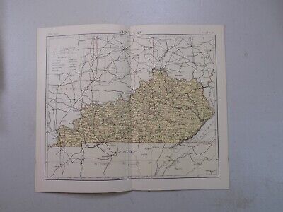
Free Shipping Location: Monroeville, United States Fine Adornment of Tennessee& Kentucky History. Impressive on Any Home or Office Wall. Imaginative Gift. 1882 Map of Kentucky& Tennessee Fine Phillips& ... moreHunt Map. Engraved by E.F. Fisk. Original 1882. 131-ys-old. Map is in Very Good/Excellent condition: No marks. Writings, rips, tears, fraying, or foxing. Single fold as Issued. Not a Reproduction. Original Map Drawn& Engraved by E.F. Fisk for Phillips& Hunt's 1882 Edition of The People's Cyclopaedia of Universal Knowledge. Published by Phillips& Hunt, New York& San Francisco, and Jones Brothers& Company of Cincinnati& St. Louis; William H. Depuy, Editor. E.F. Fisk, Engraver, 1882; a copy of the Title Page of which is Included. An Exceptionally Fine Map for the Collector or Makes Quite an Impressionable Gift for Someone Living in or From Tennessee or Kentucky. I Sell Only Original Maps: No copies or reproductions. Press Here to View My Collection. Impressive On Any Home or Office Wall Dimensions: 10.5" x 13.25" Intricate Detail. Exceptional Color. Handsome Map. 1882 County Populations Listed on Reverse. Great for Family History/Genealogy as Map Shows Towns& Landmarks of 1882. Some of Which No Longer Exist Today. Fine Adornment of Kentucky& Tennessee History. The Auction is for the Map Itself. A Frame is Not Included. The Framed Map Pictured is a Personal 1882 Phillips Hunt Map Featured to Show the Beauty of the Maps when Framed. Free Shipping Special. All Credit& Debit Cards and Electronic Checks Accepted Through Paypal. Please email with any questions. Imaginative& Creative Birthday. Christmas, Graduation. Or Other Special Occasion Gift. Greetings from Historical Savannah. Georgia; founded 1733. Some. To beautify their halls, parlors, chambers, or libraries.loveth, getteth, and useth maps, charts, geographical globes. John Dee. Advisor to Elizabeth I. Press The Link Below To View My Collection. Powered by The free listing tool. List your items fast and easy and manage your active items.
$25.00 Shipping Location: Perugia, Italy Dower was the heir to the more prominent London engraver and mapmaker John Crane Dower, 1791- 1847. 'The Weekly Dispatch' newspaper between the years ... more1856 and 1862 included in each edition a map of a part of the world.
Buy It Now
$9.91 Shipping Location: BOURNE END, United Kingdom ORIGINAL ANTIQUE MAP OF HEREFORDSHIRE By Sidney Hall c1830. Sidney Hall (1788?. Published by Chapman & Hall, No 186 Strand July 1830. from Hall's engravings. ... moreExcellent clean condition with Later Hand Colour highlights the 'Reference to the Hundreds' within the county. ).
Buy It Now
$6.95 Shipping Location: Dover, United States Issued c. 1830, New York by E. & G.W. Blunt. Engraved by Hooker. Cape Ann Harbour. (Massachusetts). Early 19th century engraved coastal map with attractive ... morehand color.
Buy It Now
$6.95 Shipping Location: Dover, United States Issued c. 1862, Paris by Andriveau-Goujon. Very uncommon scarce mid 19th century folio sheet lithographed map with original hand color. Decorative piano ... morekey border. From a rare atlas of this era. 2" split at centerfold base which touches just into the border and is now closed on reverse with archival tape (all but invisible once map is laid open flat).
Buy It Now
$32.41 Shipping Location: FALKIRK, United Kingdom The map itself is generally in good condition, although is slightly marked in places (see photos). The stamp of the Geological Survey is embossed on the ... moretop left margin, although partly cut off. A great example of an early hand-coloured Geological map, which would be of interest to the local historian or serious collector.
Buy It Now
$40.53 Shipping Location: HEATHFIELD, United Kingdom Beatrice Cecilia Peele (1892-1984), usually signing her work as Cecily Peele or BCP, was a British caricaturist, mapmaker, stationer, and illustrator. ... moreIn addition to this, she was also the writer and illustrator of The Encyclopedia of British Bogies, a book of creatures from British folklore.
Buy It Now
$4.99 Shipping Location: Fairview, United States , published in Gotha by Justus Perthes, a copy of the title page is included. The map is dated Ad. Stieler 1832, revised 1846 in small print in the title ... morearea along.Stieler's Hand Atlas appears in the top right margin.
Buy It Now
$37.93 Shipping Location: NORTHWICH, United Kingdom
Buy It Now
$7.00 Shipping Location: Wakefield, United States This is the very desirable first Mitchell's Atlas, not the small school atlas.

Buy It Now
$6.00 Shipping Location: Corunna, United States You are bidding on a very extremely rare and 100% authentic antique hand colored map from the above cartographer/map maker. Region, and year. I sell only ... moreoriginal antique maps. This is NOT a copy or reproduction and is an original antique map from the year shown. General Description: This is a stunning and very detailed map which is hand colored in wonderfully intense colors. Political boundaries as well as individual regions/counties and shows towns. Roads, railways, rivers, lakes, bays, harbors, islands and other important places are shown. The map is in great condition considering the age of the map. The overall size of the map sheet is large at approximately 18 inches by 26 inches. The map is far more beautiful than my pictures show. This map will look wonderful when matted and framed and will be a great addition to your collection. The map is a 100% original and genuine antique map created and printed in the year shown. Payment Terms: US bidders: Terms: PayPal is accepted. Payment is expected within 7 days of the end of the auction. I ship a couple of times per week. All sales are final so bid carefully and ask any questions prior to the end of the auction. I ship these rolled and in strong reinforced heavy tubes. Buyer will pay shipping and handling charges of $8.00 for the US. Insurance starts at $5.00. I will combine the shipping charges if you win more than one item. International bidders: Terms: PayPal is accepted. Payment is expected within 7 days of the end of the auction. All sales are final so bid carefully and ask any questions prior to the end of the auction. I ship these rolled and in strong reinforced heavy tubes. Buyer will pay shipping and handling charges of $10.00. If you want these shipped via Registered mail. Then you need to add another $10.00 for a total shipping charge of $20.00. I will combine the shipping charges if you win more than one item. All Bidders: Bidding on items is your acceptance of these terms and conditions. No exceptions! May God Bless you and your families! ag14,
Buy It Now
$90.73 Shipping Location: MARKET HARBOROUGH, United Kingdom C1627 EDITION. 100% ORIGINAL LARGE KINGDOM OF GREAT BRITAIN MAP. VERY MINOR REPAIR TO LOWER CENTRE FOLD END VERSO. BY JOHN SPEED. MAP IN GOOD CONDITION ... moreNO TEARS.
Buy It Now
$6.00 Shipping Location: Corunna, United States This is a beautiful map with very nice detail.Map is hand colored and is dated 1864. This is an original 156 year old map, not a copy or reprint.
5d 8h 32m 39s 0 bids
$34.99 Now
$4.47 Shipping Location: Sebastian, United States Thomas Kitchin. The inclusion of important mountain ranges is a nice visual touch. There are two apocryphal land masses, one in the Pacific, and one in ... morethe southern Atlantic. Look for Terra Firma, Amazonia, Charcas, Pampas, and Magellanica.
Buy It Now
$11.17 Shipping Location: BOURNE END, United Kingdom ORIGINAL ANTIQUE MAP OF WESTMORELAND c1777-78. Later hand colour, text to verso as issued.
Buy It Now
$10.04 Shipping Location: POOLE, United Kingdom GREECE PUBLISHED BY HENRY TEESDALE DRAWN AND ENGRAVED BY JOHN DOWER c1844 A LARGE FORMAT ENGRAVED MAP WITH SUPERB BRIGHT ORIGINAL HAND COLOUR. PUBLISHED ... moreBY HENRY TEESDALE BRUNSWICK ROW, QUEEN SQUARE, LONDON. 1844 THIS IS A GENUINE ANTIQUE MAP OVER 170 YEARS OLD IN GOOD CONDITION. THERE IS A CENTREFOLD AS PUBLISHED. THE MAP MEASURES APPROX 16.25 x 13.25 ins (41 x 34 cms) PLUS GOOD MARGINS. JOHN CRANE DOWER (1791- 1847) WAS AN ENGRAVER, DRAUGHTSMAN, PUBLISHER AND PRINTER WORKING IN PENTONVILLE, LONDON FROM 1820 - 1847.
Buy It Now
$4.95 Shipping Location: Dover, United States Issued c. 1872, Philadelphia by S.A. Mitchell. 19th century lithographed map, with original hand color. Count Map of Virginia and West Virginia.
Buy It Now
$32.48 Shipping Location: FALKIRK, United Kingdom The map itself is generally in good condition, although is marked in places and has a repaired tear in the bottom left section (see photos). The stamp ... moreof the Geological Survey is embossed at the top left.
$20.55 Shipping Location: THIRSK, United Kingdom Yorkshire, Parts of the East and West RidingsGenuine antique mapOriginal hand colour1808Approx page size 25 x 35.5cmPlease see photos of signs of usePost ... moredaily
Buy It Now
$9.91 Shipping Location: BOURNE END, United Kingdom For: Samuel Butler's " An Atlas of Ancient Geography". Fold as issued, blank to verso. Engraved by Sidney Hall. Published: By Longman & Co, Paternoster ... moreRow c1822. Engraved By Sydney Hall.
Buy It Now
$6.95 Shipping Location: Dover, United States Savannah River from its Mouth to the City of Savannah. Issued 1816, New York by E. & G.W. Blunt. Any age flaws mostly minor and easy to overlook or forgive. ... moreEarly 18th century engraved coastal survey with attractive hand color.
Buy It Now
$37.13 Shipping Location: THIRSK, United Kingdom “The East Riding of Yorkshire”By Robert Morden1695Hand-coloured Large colour cartouche to the right hand side and colour delineations to the county borders, ... moreas well as coloured features on the map like areas of water, mountains, sandbanks, cities etc. York at the far west is shown, down to Barton and Saxbye south of the Humber, and up north to Pickering. Strengthened centrefoldPlease see photos of signs of ageApprox page size 385 x 430mmPost daily
Buy It Now
$10.04 Shipping Location: POOLE, United Kingdom FRANCE PUBLISHED BY HENRY TEESDALE DRAWN AND ENGRAVED BY JOHN DOWER c1844 A LARGE FORMAT ENGRAVED MAP WITH SUPERB BRIGHT ORIGINAL HAND COLOUR. PUBLISHED ... moreBY HENRY TEESDALE BRUNSWICK ROW, QUEEN SQUARE, LONDON. 1844 THIS IS A GENUINE ANTIQUE MAP OVER 170 YEARS OLD IN GOOD CONDITION. THERE IS A CENTREFOLD AS PUBLISHED. THE MAP MEASURES APPROX 16.25 x 13.25 ins (41 x 34 cms) PLUS GOOD MARGINS. JOHN CRANE DOWER (1791- 1847) WAS AN ENGRAVER, DRAUGHTSMAN, PUBLISHER AND PRINTER WORKING IN PENTONVILLE, LONDON FROM 1820 - 1847.
Buy It Now
$11.85 Shipping Location: Dover, United States Issued 1790, London by Trusler. Engraved by Neele. Plan of the City of Copenhagen. Original fold lines as issued. Late 18th century engraved map with ... moreattractive hand color. Any age flaws mostly minor and easy to overlook or forgive.
Buy It Now
$6.95 Shipping Location: Dover, United States Issued c. 1749-850, Paris by Bellin. Mid 18th century engraved map with attractive hand color. Original center fold as issued. Any age flaws mostly minor ... moreand easy to overlook or forgive.
|