|
|
Order by: Available to: This site contains affiliate links for which I may be compensated
|
Buy It Now
$11.99 Shipping Location: Mishawaka, United States This vintage wall map by Willem Janszoon Blaeu from the 1600s features a detailed depiction of Europa and was printed using gold foil. The map is a vintage ... moreoriginal and comes in a format suitable for wall display. The cartographer/publisher of this piece is Willem Blaeu, a renowned figure in the history of cartography. The wood used in the creation of the map adds to its vintage charm and the size of 17 x 14 makes it a perfect addition to any antique collection or wall decor. With a chain hanger.
Buy It Now
$101.75 Shipping Location: Sacramento, United States
Buy It Now
$23.05 Shipping Location: Fort Lauderdale, United States This vintage world map is a true gem for any collector! The large framed Planisphaerium Terrestre is adorned with gold foil and will make a stunning addition ... moreto any room. Its unique design and intricate details make it a perfect conversation starter for guests. The map is classified as a vintage original and is categorized under "Map & Globe Reproductions", "Maps, Atlases & Globes", and "Antiques". Its type is a "World Atlas" and it is in excellent condition. Don't miss your chance to own this beautiful piece of history!
Buy It Now
Free Shipping Location: Orlando, United States Map of the Square and Stationary Earth -Orlando Ferguson-. Its is large and detailed.

Buy It Now
$10.75 Shipping Location: Carmel, United States VINTAGE historical EAST BOSTON MASS 1879 OLD ANTIQUE STYLE MAP art print THIS IS A HIGHLY DETAILED MAP OF BOSTON MASS CIRCA 1879 THIS PRINT MEASURES 18"X ... more24" 46cm x 61cm) THIS MAP HAS GREAT DETAIL SEE PHOTOS BELOW Fine Art Giclee(not a laser print) THIS IS A MODERN REPRINT PRINTED ON FINE ART PAPER not a second or third generation print This will be printed in its full aspect ratio on high quality paper. using ULTRACHROME K3 INKS which are rated up to 125+ years I do not use cheap inks that will fade in a few months very suitable for framing some images may have a thin white border THEARTTIST will not show up on your print PERFECT FOR YOUR HOME. OFFICE, GAME ROOM, MAN CAVE or GARAGE Thank you for looking. PLEASE FEEL FREE TO ASK QUESTIONS. THANKS. You may be interested in on eBay. THANKS FOR LOOKING Payment Instructions I accept PayPal for payment. I prefer PayPal. I require that payment be made within 3 days of the end of auction. Please Email me if you have any questions before you bid. Happy bidding! See PHOTO above to check EXACTLY what youre bidding on Feedback: I take pride in my feedback and strive for 5 Star Service. If you have a problem. Please email me before leaving bad feedback so that we can work something out. Shipping Instructions US Buyers: I use USPS Mail for most shipping needs- Purchases over $250 Will be sent with Signature Conformation International Buyers: International buyers If you need you can contact me prior to bidding to obtain a shipping quote. International buyers can choose how fast they wish delivery by USPS meaning Global Priority. Air Letter Post or Economy Letter Post. All of my shipping charges vary depending on the weight of the item. I will gladly combne Shipping with any of my other auction. drop me an email before bidding and I will try to respond within 24 hours. Important Notice to International Buyers Import duties. Taxes, and charges are not included in the item price or shipping cost. These charges are assessed and collected by your nation's government a

Buy It Now
$10.75 Shipping Location: Carmel, United States HUGE VINTAGE historical EAST BOSTON MASS 1879 OLD ANTIQUE STYLE MAP art print THIS IS A HUGE AND HIGHLY DETAILED MAP OF BOSTON MASS CIRCA 1879 THIS PRINT ... moreMEASURES 35"X 43" 89cm x 109cm) THIS MAP HAS GREAT DETAIL SEE PHOTOS BELOW Fine Art Giclee(not a laser print) THIS IS A MODERN REPRINT PRINTED ON FINE ART PAPER not a second or third generation print This will be printed in its full aspect ratio on high quality paper. using ULTRACHROME K3 INKS which are rated up to 125+ years I do not use cheap inks that will fade in a few months very suitable for framing some images may have a thin white border THEARTTIST will not show up on your print PERFECT FOR YOUR HOME. OFFICE, GAME ROOM, MAN CAVE or GARAGE Thank you for looking. PLEASE FEEL FREE TO ASK QUESTIONS. THANKS. You may be interested in on eBay. THANKS FOR LOOKING Payment Instructions I accept PayPal for payment. I prefer PayPal. I require that payment be made within 3 days of the end of auction. Please Email me if you have any questions before you bid. Happy bidding! See PHOTO above to check EXACTLY what youre bidding on Feedback: I take pride in my feedback and strive for 5 Star Service. If you have a problem. Please email me before leaving bad feedback so that we can work something out. Shipping Instructions US Buyers: I use USPS Mail for most shipping needs- Purchases over $250 Will be sent with Signature Conformation International Buyers: International buyers If you need you can contact me prior to bidding to obtain a shipping quote. International buyers can choose how fast they wish delivery by USPS meaning Global Priority. Air Letter Post or Economy Letter Post. All of my shipping charges vary depending on the weight of the item. I will gladly combne Shipping with any of my other auction. drop me an email before bidding and I will try to respond within 24 hours. Important Notice to International Buyers Import duties. Taxes, and charges are not included in the item price or shipping cost. These charges are assessed and collected by your nation'
Buy It Now
$10.75 Shipping Location: Carmel, United States GIANT VINTAGE 1607 historic JOHN SMITH VIRGINIA MAP OLD ANTIQUE STYLE art print THIS IS A GIANT HIGHLY DETAILED MAP OF VIRGINA AREA CIRCA 1607 THIS PRINT ... moreMEASURES 42"X 54" 107cm x137cm) THIS MAP HAS GREAT DETAIL SEE PHOTOS BELOW THIS IS A MODERN REPRINT PRINTED ON FINE MATTE PAPER This will be printed in its full aspect ratio on high quality paper. using ULTRACHROME K3 INKS which are rated up to 125+ years I do not use cheap inks that will fade in a few months very suitable for framing some images may have a thin white border THEARTTIST will not show up on your print PERFECT FOR YOUR HOME. OFFICE, GAME ROOM, MAN CAVE or GARAGE Thank you for looking. PLEASE FEEL FREE TO ASK QUESTIONS. THANKS. You may be interested in on eBay. THANKS FOR LOOKING Payment Instructions I accept PayPal for payment. I prefer PayPal. I require that payment be made within 3 days of the end of auction. Please Email me if you have any questions before you bid. Happy bidding! See PHOTO above to check EXACTLY what youre bidding on Feedback: I take pride in my feedback and strive for 5 Star Service. If you have a problem. Please email me before leaving bad feedback so that we can work something out. Shipping Instructions US Buyers: I use USPS Mail for most shipping needs- Purchases over $250 Will be sent with Signature Conformation International Buyers: International buyers If you need you can contact me prior to bidding to obtain a shipping quote. International buyers can choose how fast they wish delivery by USPS meaning Global Priority. Air Letter Post or Economy Letter Post. All of my shipping charges vary depending on the weight of the item. I will gladly combne Shipping with any of my other auction. drop me an email before bidding and I will try to respond within 24 hours. Important Notice to International Buyers Import duties. Taxes, and charges are not included in the item price or shipping cost. These charges are assessed and collected by your nation's government and are the buyer's responsibility. Please check with

Buy It Now
$10.75 Shipping Location: Carmel, United States LARGE VINTAGE historic HAWAIIAN SANDWICH ISLANDS 1841 ANTIQUE STYLE MAP print THIS IS A LARGE AND HIGHLY DETAILED MAP OF THE HAWAIAN SANDWICH ISLANDS ... moreCIRCA 1841 THIS PRINT MEASURES 18"X 22" 46cm x56cm) THIS MAP HAS GREAT DETAIL SEE PHOTO BELOW THIS WILL PRINTED ON FINE ART WATERCOLOR PAPER Need this is a different size click the link below to see if I have another size MAPS. This will be printed in its full aspect ratio on high quality paper. using ULTRACHROME K3 INKS which are rated up to 125+ years I do not use cheap inks that will fade in a few months very suitable for framing some images may have a thin white border THEARTTIST will not show up on your print PERFECT FOR YOUR HOME. OFFICE, GAME ROOM, MAN CAVE or GARAGE Thank you for looking. PLEASE FEEL FREE TO ASK QUESTIONS. THANKS. THANKS FOR LOOKING Payment Instructions I accept PayPal for payment. I prefer PayPal. I require that payment be made within 3 days of the end of auction. Please Email me if you have any questions before you bid. Happy bidding! See PHOTO above to check EXACTLY what youre bidding on Feedback: I take pride in my feedback and strive for 5 Star Service. If you have a problem. Please email me before leaving bad feedback so that we can work something out. Shipping Instructions US Buyers: I use USPS Mail for most shipping needs- Purchases over $250 Will be sent with Signature Conformation International Buyers: International buyers If you need you can contact me prior to bidding to obtain a shipping quote. International buyers can choose how fast they wish delivery by USPS meaning Global Priority. Air Letter Post or Economy Letter Post. All of my shipping charges vary depending on the weight of the item. I will gladly combne Shipping with any of my other auction. drop me an email before bidding and I will try to respond within 24 hours. Important Notice to International Buyers Import duties. Taxes, and charges are not included in the item price or shipping cost. These charges are assessed and collected by your nation's governm

Buy It Now
$10.75 Shipping Location: Carmel, United States GIANT VINTAGE historical EAST BOSTON MASS 1879 OLD ANTIQUE STYLE MAP art print THIS IS A GIANT HIGHLY DETAILED MAP OF BOSTON MASS CIRCA 1879 THIS PRINT ... moreMEASURES 43"X 53" 109cm x 135cm) THIS MAP HAS GREAT DETAIL SEE PHOTOS BELOW Fine Art Giclee(not a laser print) THIS IS A MODERN REPRINT PRINTED ON FINE ART PAPER not a second or third generation print This will be printed in its full aspect ratio on high quality paper. using ULTRACHROME K3 INKS which are rated up to 125+ years I do not use cheap inks that will fade in a few months very suitable for framing some images may have a thin white border THEARTTIST will not show up on your print PERFECT FOR YOUR HOME. OFFICE, GAME ROOM, MAN CAVE or GARAGE Thank you for looking. PLEASE FEEL FREE TO ASK QUESTIONS. THANKS. You may be interested in on eBay. THANKS FOR LOOKING Payment Instructions I accept PayPal for payment. I prefer PayPal. I require that payment be made within 3 days of the end of auction. Please Email me if you have any questions before you bid. Happy bidding! See PHOTO above to check EXACTLY what youre bidding on Feedback: I take pride in my feedback and strive for 5 Star Service. If you have a problem. Please email me before leaving bad feedback so that we can work something out. Shipping Instructions US Buyers: I use USPS Mail for most shipping needs- Purchases over $250 Will be sent with Signature Conformation International Buyers: International buyers If you need you can contact me prior to bidding to obtain a shipping quote. International buyers can choose how fast they wish delivery by USPS meaning Global Priority. Air Letter Post or Economy Letter Post. All of my shipping charges vary depending on the weight of the item. I will gladly combne Shipping with any of my other auction. drop me an email before bidding and I will try to respond within 24 hours. Important Notice to International Buyers Import duties. Taxes, and charges are not included in the item price or shipping cost. These charges are assessed and collected by your nation'

Buy It Now
$10.75 Shipping Location: Carmel, United States VINTAGE PANORAMIC 1912 KNICKERBOCKER BEER NEW YORK CITY BIRD'S EYE VIEW WALL MAP THIS IS A HIGHLY DETAILED MAP OF NEW YORK CITY. NY ISSUED BY KNICKERBOCKER ... moreBEER 1912 THIS PRINT MEASURES 18"X 24" 46cm x 61cm) THIS MAP HAS GREAT DETAIL SEE PHOTOS BELOW Fine Art Giclee(not a laser print) THIS IS A MODERN REPRINT PRINTED ON FINE ART PAPER not a second or third generation print This will be printed in its full aspect ratio on high quality paper. using ULTRACHROME K3 INKS which are rated up to 125+ years I do not use cheap inks that will fade in a few months very suitable for framing some images may have a thin white border THEARTTIST will not show up on your print PERFECT FOR YOUR HOME. OFFICE, GAME ROOM, MAN CAVE or GARAGE Thank you for looking. PLEASE FEEL FREE TO ASK QUESTIONS. THANKS. You may be interested in on eBay. THANKS FOR LOOKING Payment Instructions I accept PayPal for payment. I prefer PayPal. I require that payment be made within 3 days of the end of auction. Please Email me if you have any questions before you bid. Happy bidding! See PHOTO above to check EXACTLY what youre bidding on Feedback: I take pride in my feedback and strive for 5 Star Service. If you have a problem. Please email me before leaving bad feedback so that we can work something out. Shipping Instructions US Buyers: I use USPS Mail for most shipping needs- Purchases over $250 Will be sent with Signature Conformation International Buyers: International buyers If you need you can contact me prior to bidding to obtain a shipping quote. International buyers can choose how fast they wish delivery by USPS meaning Global Priority. Air Letter Post or Economy Letter Post. All of my shipping charges vary depending on the weight of the item. I will gladly combne Shipping with any of my other auction. drop me an email before bidding and I will try to respond within 24 hours. Important Notice to International Buyers Import duties. Taxes, and charges are not included in the item price or shipping cost. These charges are assessed and co
Buy It Now
$15.07 Shipping Location: Antrim, United States This is a beautifully framed vintage reproduction of an ancient Europe map. Measuring at 9 inches by 12 inches, this wall map is a perfect addition to ... moreany antique or map collection. The lithography printing technique used in creating this piece adds to its authenticity and charm. The map was published by Cunningham Art Products. It features Old World Europe & is bordered by people dressed in Old World clothing. Whether you're a collector or just looking for a unique piece to decorate your home, this map is sure to impress.
$3.95 Shipping Location: Clarkston, United States Albert Richard 1950 Football Map. This is a reproduction of the original map. 16"x23" and 23"x33". Illustrations of sea creatures and mode of transportation ... moreon upper center of map. Print Size: 11"x16".
Buy It Now
$5.95 Shipping Location: Franklin, United States Ready for framing. Excellent condition.
Buy It Now
$25.00 Shipping Location: Bluffton, United States Single sided, cloth and vinyl map. Will cover a large wall. See pictures for details and condition.
Buy It Now
$6.23 Shipping Location: New Fairfield, United States Vintage Repro Pictorial Map Annapolis MD (1864) Wall Art Poster.
Buy It Now
$16.45 Shipping Location: Santa Paula, United States This stunning vintage reproduction wall map features the New World as seen by Willem Blaeu in the 17th century. The map is beautifully framed and matted ... morewith gold foiling, making it a perfect addition to any collection of antique maps, atlases, and globes. Measuring 19x23 inches, this map is a true treasure for any lover of cartography and history.

Buy It Now
$6.00 Shipping Location: Coral Springs, United States for sale here is lot of printed angling ephemera as follows south west rod licence dated 1977 devon river board rod licence dated 1953 salmon fisheries ... morerod licence ireland cork district dated 1920 george smith& co receipt for a line dated 1948 map of the halsdon estate fishing rights james wright kelso receipt dated 1948 severn river authority rod licence dated 1970 great ouse river authority rod licence dated 1970 map of the willenhall rights of way beats and access routes etc map of coventry and district angling association canal fishing facilities george smith card trade tackle box alex martin receipt for line dated 1954 similar alex martin receipt for fly rod j a j munro aberlour receipt various tackle dated 1957 welland and nene river authority rod licence dated 1970 victor freed receipt dated 1938 plough angling society rules/regs/permit dated 1970/71 royal leamington spa season ticket dated 1970 coventry and district members year book dated 1970/71 rootes social and athletic club members booklet dated 1968 coventry and district angling association members year book dated 1938/39 a similar coventry and district members book dated 1964/65 severn river authouity rod licence dated 1970. anyway please look at the fotos. I dont have the time to send out individual dispatch emails but items are normally posted the day after being paid for, i will post anywhere insured and recorded, and please view my other many listings of vintage items this week.thanks for looking.and i do eventually get round to leaving feedback once they build up to about 300 i do them all at once.
Buy It Now
$14.80 Shipping Location: Henderson, United States
Buy It Now
$10.97 Shipping Location: Brentwood, United States This is a vintage Nova Totivs Terrarvm Orbis Geographica Ac Hydrographica Tabvla map of the world. The frame has scuffs and some scratches check the picture ... morefor details. There is also some discoloration on the brown paper covering the back of the frame. The brown paper also has some tears. The picture including frame measures about 15 X 12.Item 1092
Buy It Now
$5.00 Shipping Location: Redondo Beach, United States Vintage WOODEN Handmade Old World Map Wall Hanging in Latin.
Buy It Now
$16.25 Shipping Location: Manassas, United States Old World Map Wood Wall Plaque Hydrographica Tabula Antiquity Collection 1963 Reproduction.
7d 21h 16m 51s 0 bids
$35.00 Now
$127.10 Shipping Location: Merced, United States This vintage pictorial map of Annapolis, MD from 1864 is a stunning piece of wall art that will bring history to life in any room. Featuring intricate ... moredetails of the city's streets, buildings, and landmarks, this wall map is a beautiful reproduction that captures the charm and character of Annapolis in the mid-19th century. Perfect for lovers of history and antique enthusiasts, this map is a unique addition to any home or office. With its rich colors, fine details, and vintage style, it is sure to be a conversation starter and a treasured piece for years to come.
Buy It Now
$14.75 Shipping Location: Littleton, United States I always leave deep cleaning to new owner. You be the judge. Zoom in on pics. T his is sold as is. I also realize that opinions on the condition of an ... moreitem can vary, depending on the person who is looking at it.
Buy It Now
$39.99 Shipping Location: Southlake, United States To give more context, the Chisholm, Western, Goodnight-Loving & Shawnee Trails are also shown in detail. (You have to request invoice for add nonglare). ... moreImage Size: 32.5" X 22.5. Image Condition:New.
Buy It Now
$5.95 Shipping Location: Daytona Beach, United States The map is in great condition. It measures 22 inches by 16 in. It is reproduced by Hammond Incorporated I am unsure of the age of the print. There's one ... moreslight fold in the bottom right hand corner.
$12.99 Shipping Location: Oklahoma City, United States Flatten the curve?. Good condition for a 1953 map. Pilots would have to constantly adjust the nose of the plane to account for the curve (if there was ... moreone). A snow globe makes much more sense now.
Buy It Now
$5.95 Shipping Location: Franklin, United States Ready for framing. Excellent condition.
Buy It Now
Free Shipping Location: Orlando, United States Map of the Square and Stationary Earth -Orlando Ferguson-.
Buy It Now
$84.48 Shipping Location: Canoga Park, United States This stunning chart map of the Sandwich Islands is a limited edition reprinted. vintage reproduction produced by Printsellers in 1982. Chart of surveyed ... moreand charted in 1778- 1779 by Captain Jamss Cook and Bligh, published 1786. Publisher Alex Ogg, the certification of print is on the back. The map is framed and matted. Featuring the beautiful islands of Hawaii, this wall map was created using offse hand painted printing techniques.
Buy It Now
$15.55 Shipping Location: Stone Mountain, United States Professional framed in Atlanta.
Buy It Now
Location: South Jordan, United States Its intricate design and high-quality printing make it a valuable addition to any collection.
Buy It Now
Free Shipping Location: Gig Harbor, United States It is a wall map format and would make a great addition to any antique or map collection. This item falls under the categories of antiques and map & globe ... morereproductions.
Buy It Now
$10.97 Shipping Location: Brentwood, United States GOLD FOIL ANTIQUE MAP REPRINT FRAMED AND MATTED MAP MEASURES 15' x 11.5' WOOD FRAME MEASURE 24' x 20.5' MAP AND GLASS FRONT IN VERY GOOD ... moreCONDITION FRAME HAS SEVERAL NICKS AND STAIN FADING ALL AROUND MAP IS FULL OF DETAILED COLORFUL DESCRIPTIONS. SUN AND MOON ECLIPSES, ELEMENTS OF THE EARTH. ZODIAC AND MANY OTHER ESOTERIC SYMBOLS WRITTEN IN OLD ENGLISH ACROSS THE TOP IS: A NEW AND ACCVRAT MAP OF THE WORLD DRAWNE ACCORDING TO Y TRUEST DEFCRIPTIONS& BEFT OBFERVATIONS Y HAVE BEENE MADE BY ENGLIFH OR STANGERS 1651 THANKS FOR LOOKING
Buy It Now
$4.99 Shipping Location: Chandler, United States A Penn Print NY reproduction atlas map.
Buy It Now
$29.00 Shipping Location: Greensboro, United States
Buy It Now
$16.25 Shipping Location: Yadkinville, United States This vintage reproduction of Guilielmo Blaeuw's America Nova Tabula map is sure to add a touch of history to any room. The beautifully detailed world ... moremap features a date range from 1800-1899 and is formatted as a wall map for easy display. The cartographer/publisher, Guilielmo Blaeuw, is known for his accurate and detailed maps, and this reproduction is no exception. Perfect for collectors of antique maps or those looking for a unique piece of decor, this vintage reproduction is categorized as an antique and falls under the Maps, Atlases & Globes category. The map is framed and ready to hang, making it a hassle-free addition to any home or office.
$12.00 Shipping Location: Valdese, United States Wood & Brass Map of Bermuda Islands. We use our photos to convey the detailed condition of the item.
$3.95 Shipping Location: Clarkston, United States Print Size: 11"x14". Pictorial, historical map of New York City, including the five. Historical Map of New York City. Various historic events and buildings ... moreare illustrated in small vignettes in. This is a reproduction of the original map.
Buy It Now
$21.95 Shipping Location: Waukesha, United States
Buy It Now
$115.79 Shipping Location: Jeffers, United States ANTIQUE VINTAGE 10 PULL DOWN MAP HANGER WOOD 52” X 21” X 4” You are looking at a rare find!! It is a hanger for 10 pull down maps. I have pictured a map ... morein it so you could see how they fit. You just turn the circle screw to lock them in. It has some paint residue on it and could use some polishing. The hangers on the top are complete. PLEASE LOOK CAREFULLY AT ALL 12 PICTURES AS PART OF THE DESCRIPTION AND TO DETERMINE THE ACTUAL CONDITION.This comes from a smoke free home.Thanks for looking, KarlaG/mh
Buy It Now
$7.25 Shipping Location: Freehold, United States List note - correspondence box.
Buy It Now
$12.50 Shipping Location: Conway, United States
Buy It Now
$2.00 Shipping Location: Toledo, United States From Scholastic magazine. Excellent condition. 38 x 25 in.
Buy It Now
$6.75 Shipping Location: Ringgold, United States Estate find! Lot of (2) Vintage Maps. DAV 1482 Map of the World by C. Ptolemy & 1675 Map from London to Oxford by John Ogilby. Vintage reproductions. ... moreCompliments of Disabled American Veterans. Map of the world has a very small tear at top left. Please see pics. Prints approx. 10x14.

Buy It Now
$6.80 Shipping Location: Coral Springs, United States Vintage 1941 Atlas Map of WWII Japan. China, Taiwan, Chosen(Korea) Thailand, French Indo-China(Viet Nam) A Great Gift! Great OLD Map from the"Collier's ... moreWorld Atlas& Gazetteer" From Early 1941 WWII 73 Years Old! On one side is China With French Indochina& Chosen On the other side Japan& Taiwan(Contact Us For More Pictures) This Map Measures about 10 3/4 x 14 1/8" Great Colors. Map shows The Great Wall of China. The Pacific Ocean, Yellow Sea, South China Sea, Gulf of Tonkin, East China Sea, The Sea of Japan, Inset With Outline of Japan. Taiwan& Ryukyu Islands, Hokkaido and Chishima. Rivers, Mountains, Lakes, Islands, Etc. A Great Addition To Your World War II Collection! A Fantastic Gift For The WWII Buff! A GREAT OLD MAP! Very Educational. See what these parts of the World used to look like! See All Pictures It Will Look GREAT Matted& Framed! A Really Nice Gift! Teachers& Politicians LOVE Them TOO! GREAT For Your Summer Home! A Fantastic House Warming Gift! Super For The Office! Nice Map of"The Old Country" Shipping by 1st Class or Priority Mail We Will Combine Shipping on Up To 4 Maps For The Same Shipping Fee Email Us With Any Questions or For an International Shipping Quote Check out my other items! Be sure to add me to your favorites list! Thanks For Looking! International Buyers– Please Note: Import duties. Taxes, and charges are not included in the item price or shipping cost. These charges are the buyer's responsibility. Please check with your country's customs office to determine what these additional costs will be prior to bidding or buying. g6.RcmdId ViewItemDescV4,RlogId p4%60bo7%60jtb9%3Fuk%601d72f%2B%3Eg6%3E-146e5ed4dd2-0x10d-
Buy It Now
$10.97 Shipping Location: Brentwood, United States This is a vintage Windsor art map of the world. The frame has scuffs and some scratches check the picture for details. The picture including frame measures ... moreabout 15 X 12.
Buy It Now
$19.99 Shipping Location: Bethlehem, United States A NEW & ACCURATE MAP OF THE WORLD. Drawn according to the truest descriptions latest discoveries and best observations and have been made by English or ... morestrangers. 1651 Framed Reproduction measures 23x19”. Plexiglass. Very nice map. Vintage. Depicts some of the greatest explorers of the time. Water, earth, fire, aire. North and South hemisphere. Eclipse of sun and moon. Very detailed. Great for the home or office. See pictures closely. Feel free to ask any questions before purchasing. Please take a look at my other items for sale as I list new items daily. Thanks for shopping nanastreasurebox.
Buy It Now
$6.32 Shipping Location: Cleveland, United States This Vintage Bible Wall Map Poster measures 42x25 1/2 and has a beautiful design that will enhance any room. It is a reproduction of an antique map, perfect ... morefor collectors and enthusiasts of antique maps and globes. The format of this map is a wall map which makes it easy to display on your wall, adding a touch of history and elegance to any space. It's a great addition to any home, office, or classroom and a perfect gift for those interested in history and vintage maps.
Buy It Now
$17.25 Shipping Location: San Jose, United States Wire on back, ready to hang.
$3.95 Shipping Location: Clarkston, United States An explanation of projection at the top of map. An explanation of scale in the lower left corner of map. This is a Reproduction of the Original Map. Map ... moreSize: 11"x16". List of distances to and from various cities around the world at the top of map.
Buy It Now
$24.23 Shipping Location: Hanover, United States Enhance the aesthetic appeal of your living space with this Vintage Blaeu Wall Map. The lithographed wall map showcases a gold foil finish, providing ... morea vintage look to your décor. Measuring 31x26, this reproduction map features the Old and New World, and is framed to perfection. The cartographer of this map is Willem Blaeu, offering a touch of historic elegance to your home. Perfect for a variety of settings, this map will surely captivate your guests and add a fascinating visual element to your wall.
Buy It Now
$8.00 Shipping Location: Lawton, United States Vintage Lawton Oklahoma OK Housing Addition Map 36” X 74”. In excellent condition.
Buy It Now
$9.15 Shipping Location: Tucson, United States Cool looking antique reproduction. One small tear in left side. Good overall. Thin cream colored rolled paper.
Buy It Now
$17.93 Shipping Location: BRADFORD, United Kingdom Near Mint Condition (see the coffee cup in photograph 5 for an idea of scale).
Buy It Now
$106.45 Shipping Location: Tampa, United States VTG Blaeu Wall Map Old & New World Gold Foil Fisnish edition. 30x26 Wall Art Decor. Prop’s beautifully strong & solid piece professionally matted - framed. ... moreMinor scuffs from storage on the frame. Well protected piece of art.Safe Same Day Shipping GUARANTEED
Buy It Now
Free Shipping Location: Fitchburg, United States Brand-New!! This reprint poster/ print shows a birds eye view of Chattanooga, Tennessee from 1871. Size 8.5" x 11" Printed on premium, luster photo paper. ... morePrinted using Canon professional inks for a smudge free, long lasting and vibrant print. Suitable for framing, mounting or direct display. Your print will have borders, the size of which will depend upon the size of the original work. Please note that we print these poster/ prints from very high resolution scans of the original item. These high resolution scans will show any defects in the original materials which include fading,spots and wear and tear. This adds to the authentic feel of the poster, but please check the photo closely if this is a concern for you.
Buy It Now
Free Shipping Location: Fitchburg, United States Brand-New!! This reprint poster/ print shows a birds eye view of Columbia SC from 1872. Size 8.5" x 11" Printed on 44 lb. luster premium presentation ... morepaper (As a guide, common paper is 20lb) Suitable for framing, mounting or direct display. Your print will have borders, the size of which will depend upon the size of the original work. Please note that we print these poster/ prints from very high resolution scans of the original item. These high resolution scans will show any defects in the original materials which include fading,spots and wear and tear. This adds to the authentic feel of the poster, but please check the photo closely if this is a concern for you.
Buy It Now
$107.90 Shipping Location: Sun City, United States BLAEU Wall Map of the Old and New World Gold Foil Framed 24.5 x 30.5
Buy It Now
$42.05 Shipping Location: Reynoldsburg, United States vintage blaeu gold foil framed wall map glass lens wood frame hangs in very good condition!........31 1/2 x 25 1/2.......weighs 7lbs,,,,,,,,.professionally ... morepacked.......
Buy It Now
$40.05 Shipping Location: Portsmouth, United States
|
|
|
|
VINTAGE WORLD Artist Hand Crafted LEATHER Wall MAP w/ANTIQUE Finish COLLECTIBLE
Two Hemispheres of 1630. Suggested Retail: US $1033.95 Leather map. Two Hemispheres of 1630' large) By I make each map with much love and attention to detail. I hope they will become part of your family's history. For generations to come. The world as charted in 1630 offered the adventure of discovery and the promise of new beginnings. Francys Ferreira recaptures the excitement of early navigators with this detailed map replica. The map is inscribed with the Latin text Nova Fotiva Terrarum Orbis Geographica Ac Hydrographica Tabula, for it outlines continents and names regions. As well as charts oceans and seas. Each corner features the face of a renowned personage of the 1630s and the map is embellished with a florid garland border. Ferreira crafts the map of leather and charts the earth's geographical composition with pyrograph ... moretechniques. Includes cedrinho wood rods to enhance the antique appearance of the map. ~This piece is an incomparable work of art which draws the eye with mesmerizing fascination. It provides endless interest as an accent piece and is a prize for the collector. Item Details. Size: With rods: 40.0 inches W x 37.0 inches H. Map: 40.0 inches W x 29.5 inches H. Weight: 5.82 pounds, Materials: Leather and cedrinho wood, Additional Info: Display rod(s) included. Signed by the artist. Photos are representative of the item being offered. But are not necessarily of the exact item you would receive. As is the nature of handcrafted items, there may be very slight variations from one piece to the next. Suggested Retail: US $1033.95 Novica bypasses all traditional middlemen to offer the best prices on the highest quality works direct from the region of origin. Shipping. Shipping to Lower 48 United States Shipping Service, Shipping Cost, Delivery Time, Standard to Lower 48 United States, $7.00 2 to 4 weeks, Expedited to Lower 48 United States, $27.00 3 to 8 days, We will ship to most destinations See chart below for the additional cost of shipping to other destinations: Shipping Destination,
|
|
|
Vintage plan/map of Paris Archival quality Fine Art print reproduction 24" x 31"
This map is created by Jules Leconte who was a French cartographer Published in plan of Paris"Plan Commode de Paris du" around 1928» Size: 24" x 31" 60cm x 80cm) Paper: Hahnemuhle best quality museum class paper with texture. Ink: Ultrachrome ink( that will last up to 80 years indoors) Shipping: Print is shipped in a strong tube for secure shipping and it will be shipped as a priority mail for fast delivery» Items usually ship within 2-3 days from date of completed payment» Delivery takes around 1 Week- Frame is not included and is just to show how great it looks framed!
|
|
|
Vintage World Map by Olaus Magnus LARGE Archival museum class Print 24" x 32"
Olaus Magnus who. As a Swedish patriot, Catholic ecclesiastic, and writer, did pioneering work for the interest of Nordic people. This map also is called"Carta marina" It included a map of Northern Europe with a map of Scandinavia. Which was rediscovered by Oscar Brenner in 1886 in the München state library and shown to be the most accurate depiction of its time. The map is referred to as"carta marina" and consists of 9 parts, and is remarkably large: 125 cm tall and 170 cm wide. Created around 1539. Size: 24" x 32" 60cm x 82cm) Paper: Hahnemuhle best quality museum class paper with texture. Ink: Ultrachrome ink( that will last up to 80 years indoors) Shipping: Print is shipped in a strong tube for secure shipping and it will be shipped as a priority mail for fast delivery» Items usually ship within ... more2-3 days from date of completed payment» Delivery takes around 1 Week- Frame is not included and is just to show how great it looks framed!
|
|
|
Vintage Map of world by Johannes Kepler LARGE archival Fine Art print 24" x 40"
Print reproduction of word map created by Johannes Kepler. Johannes Kepler was a German mathematician. Astronomer and astrologer. He was key figure in astronomy. This word map was published in"Johannes Kepler's book" Created around 1572- highest quality archival reproduction on museum class paper. Size: 24" x 40" 60cm x 100cm) Paper: Hahnemuhle best quality museum class paper with texture. Ink: Ultrachrome ink( that will last up to 80 years indoors) Shipping: Print is shipped in a strong tube for secure shipping and it will be shipped as a priority mail for fast delivery» Items usually ship within 2-3 days from date of completed payment» Delivery takes around 1 Week- Frame is not included and is just to show how great it looks framed!
|
|
|
Vintage Post Route Map-Mississippi 1959
This is a 33 x 48 inch Post Route Map of Mississippi published by order of Postmaster General Arthur E. Summerfeild January 2. 1959. Thanks for looking!
|
|
|
RARE VINTAGE GOWER, MISSOURI, 1923 TOPO MAP
RARE VINTAGE GOWER. MISSOURI, 1923 TOPO MAP Shipping Info | Business Policies | Also Available Description This is a rare vintage map- not a reproduction! Fits between the Clarksdale quadrangle(north) The Kansas City quadrangle(south) and the Dearborn quadrangle(west) which I also have listed! Map is moderately yellowed with age. Map is an original. Is crystal clear. And is in very good condition! Covers latitude 39 degrees 30' to 39 degrees 45' and longitude 94 degrees 30' to 94 degrees 45' Originals are hard to come by anymore. And this is the only one I have, so if you are at all interested, please don’t hesitate to bid. PLEASE NOTE: This map has the Topographic Map Key on the flip side. See general description below. Shipping Info Business Policies Also Available
|
|
|
RARE VINTAGE MOUNT ANGEL, OREGON, 1940 TOPO MAP
RARE VINTAGE MOUNT ANGEL. OREGON, 1940 TOPO MAP Shipping Info | Business Policies | Also Available Description This is a rare vintage map- not a reproduction! crystal clear. And is in very good condition! Covers latitude 45 degrees 00' to 45 degrees 15' and longitude 122 degrees 45' to 123 degrees 00' Originals are hard to come by anymore. And this is the only one I have, so if you are at all interested, please don’t hesitate to bid. Shipping Info Business Policies Also Available
|
|
|
Vintage Saxton's Map of Wiltshire,Somerset 1576 Printed by Taylor Limited 1968
A very neat collectible Vintage Saxton's Map of Wiltshire. 1576 Parte of Somerset Shire Printed by Taylor Limited 1968. It is in good condition it does have a tear in the bottom right corner of the map but the tear does not come in contact with the map drawing itself. It is about 16"x 20" in size. I am not shipping the frame only the map. THe fram is a very thin glass it would break in shipping for sure.
|
|
|
GIANT VINTAGE historic PARIS FRANCE 1736 OLD ANTIQUE STYLE MAP art print
GIANT VINTAGE historic PARIS FRANCE 1736 OLD ANTIQUE STYLE MAP art print THIS IS A LARGE AND HIGHLY DETAILED MAP OF PARIS FRANCE CIRCA 1736 THIS PRINT MEASURES 42"X 54" 107cm x137cm) THIS MAP HAS GREAT DETAIL SEE PHOTOS BELOW THIS IS A MODERN REPRINT PRINTED ON FINE MATTE PAPER This will be printed in its full aspect ratio on high quality paper. using ULTRACHROME K3 INKS which are rated up to 125+ years I do not use cheap inks that will fade in a few months very suitable for framing some images may have a thin white border WANT IT LARGER JUST EMAIL US PERFECT FOR YOUR HOME. OFFICE OR GAME ROOM Thank you for looking. PLEASE FEEL FREE TO ASK QUESTIONS. THANKS. You may be interested in on eBay. THANKS FOR LOOKING Payment Instructions I accept PayPal for payment. I prefer PayPal. I require that payment be made within 3 days of the end ... moreof auction. Please Email me if you have any questions before you bid. Happy bidding! See PHOTO above to check EXACTLY what youre bidding on Feedback: I take pride in my feedback and strive for 5 Star Service. If you have a problem. Please email me before leaving bad feedback so that we can work something out. Shipping Instructions US Buyers: I use USPS Mail for most shipping needs- Purchases over $250 Will be sent with Signature Conformation International Buyers: International buyers If you need you can contact me prior to bidding to obtain a shipping quote. International buyers can choose how fast they wish delivery by USPS meaning Global Priority. Air Letter Post or Economy Letter Post. All of my shipping charges vary depending on the weight of the item. I will gladly combne Shipping with any of my other auction. drop me an email before bidding and I will try to respond within 24 hours. Important Notice to International Buyers Import duties. Taxes, and charges are not included in the item price or shipping cost. These charges are assessed and collected by your nation's government and are the buyer's responsibility. Please check with your country's customs office
|
|
|
Vintage wall Map of London museum class Art print , interior decor 24"x43" 064
Also please take a look on our other vintage map prints- This is archival print reproduction of London city map by Edward Mogg. He was a publisher and engraver who specialised in maps for guides of London and it's surroundings. He also issued road maps of England and Wales. Created in 1807. Size: 24" x 43" 60 cm x 110 cm) Also other sizes are available: 33.5" x 61" 85cm x 154 cm) Contact me for details- Paper: Hahnemuhle archival quality museum class paper with texture. Ink: Ultrachrome ink( that will last up to 80 years indoors) Shipping: Print is shipped in a strong tube for secure shipping and it will be shipped as a priority mail for fast delivery» Items usually ship within 2-3 days from date of completed payment- Frame is not included and is just to show how great it looks framed!
|
|
|
RARE VINTAGE BERLIN, PENNSYLVANIA, 1923 TOPO MAP
RARE VINTAGE BERLIN. PENNSYLVANIA, 1923 TOPO MAP Shipping Info | Business Policies | Also Available Description This is a rare vintage map- not a reproduction! very clear and readable. And is in very good condition! Covers latitude 39 degrees 45' to 40 degrees 00' and longitude 78 degrees 45' to 79 degrees 00' Originals are hard to come by anymore so if you are at all interested. Please don’t hesitate to bid. PLEASE NOTE: This map has the Topographic Map Key on the flip side. See general description below. Shipping Info Business Policies Also Available
|
|
|
LARGE VINTAGE 1607 historic JOHN SMITH VIRGINIA MAP OLD ANTIQUE STYLE art print
LARGE VINTAGE 1607 historic JOHN SMITH VIRGINIA MAP OLD ANTIQUE STYLE art print THIS IS A LARGE HIGHLY DETAILED MAP OF VIRGINA AREA CIRCA 1607 THIS PRINT MEASURES 18"X 24" 46cm x 61cm) THIS MAP HAS GREAT DETAIL SEE PHOTOS BELOW THIS IS A MODERN REPRINT PRINTED ON FINE MATTE PAPER This will be printed in its full aspect ratio on high quality paper. using ULTRACHROME K3 INKS which are rated up to 125+ years I do not use cheap inks that will fade in a few months very suitable for framing some images may have a thin white border THEARTTIST will not show up on your print PERFECT FOR YOUR HOME. OFFICE, GAME ROOM, MAN CAVE or GARAGE Thank you for looking. PLEASE FEEL FREE TO ASK QUESTIONS. THANKS. You may be interested in on eBay. THANKS FOR LOOKING Payment Instructions I accept PayPal for payment. I prefer PayPal. I require that payment ... morebe made within 3 days of the end of auction. Please Email me if you have any questions before you bid. Happy bidding! See PHOTO above to check EXACTLY what youre bidding on Feedback: I take pride in my feedback and strive for 5 Star Service. If you have a problem. Please email me before leaving bad feedback so that we can work something out. Shipping Instructions US Buyers: I use USPS Mail for most shipping needs- Purchases over $250 Will be sent with Signature Conformation International Buyers: International buyers If you need you can contact me prior to bidding to obtain a shipping quote. International buyers can choose how fast they wish delivery by USPS meaning Global Priority. Air Letter Post or Economy Letter Post. All of my shipping charges vary depending on the weight of the item. I will gladly combne Shipping with any of my other auction. drop me an email before bidding and I will try to respond within 24 hours. Important Notice to International Buyers Import duties. Taxes, and charges are not included in the item price or shipping cost. These charges are assessed and collected by your nation's government and are the buyer's responsibility. Please check with y
|
|
|
GIANT VINTAGE 1607 historic JOHN SMITH VIRGINIA MAP OLD ANTIQUE STYLE art print
GIANT VINTAGE 1607 historic JOHN SMITH VIRGINIA MAP OLD ANTIQUE STYLE art print THIS IS A GIANT HIGHLY DETAILED MAP OF VIRGINA AREA CIRCA 1607 THIS PRINT MEASURES 42"X 54" 107cm x137cm) THIS MAP HAS GREAT DETAIL SEE PHOTOS BELOW THIS IS A MODERN REPRINT PRINTED ON FINE MATTE PAPER This will be printed in its full aspect ratio on high quality paper. using ULTRACHROME K3 INKS which are rated up to 125+ years I do not use cheap inks that will fade in a few months very suitable for framing some images may have a thin white border THEARTTIST will not show up on your print PERFECT FOR YOUR HOME. OFFICE, GAME ROOM, MAN CAVE or GARAGE Thank you for looking. PLEASE FEEL FREE TO ASK QUESTIONS. THANKS. You may be interested in on eBay. THANKS FOR LOOKING Payment Instructions I accept PayPal for payment. I prefer PayPal. I require that payment ... morebe made within 3 days of the end of auction. Please Email me if you have any questions before you bid. Happy bidding! See PHOTO above to check EXACTLY what youre bidding on Feedback: I take pride in my feedback and strive for 5 Star Service. If you have a problem. Please email me before leaving bad feedback so that we can work something out. Shipping Instructions US Buyers: I use USPS Mail for most shipping needs- Purchases over $250 Will be sent with Signature Conformation International Buyers: International buyers If you need you can contact me prior to bidding to obtain a shipping quote. International buyers can choose how fast they wish delivery by USPS meaning Global Priority. Air Letter Post or Economy Letter Post. All of my shipping charges vary depending on the weight of the item. I will gladly combne Shipping with any of my other auction. drop me an email before bidding and I will try to respond within 24 hours. Important Notice to International Buyers Import duties. Taxes, and charges are not included in the item price or shipping cost. These charges are assessed and collected by your nation's government and are the buyer's responsibility. Please check with
|
|
|
HUGE VINTAGE 1607 historic JOHN SMITH VIRGINIA MAP OLD ANTIQUE STYLE art print
HUGE VINTAGE 1607 historic JOHN SMITH VIRGINIA MAP OLD ANTIQUE STYLE art print THIS IS A HUGE HIGHLY DETAILED MAP OF VIRGINA AREA CIRCA 1607 THIS PRINT MEASURES 36"X 46" 92cm x 116cm) THIS MAP HAS GREAT DETAIL SEE PHOTOS BELOW THIS IS A MODERN REPRINT PRINTED ON FINE MATTE PAPER This will be printed in its full aspect ratio on high quality paper. using ULTRACHROME K3 INKS which are rated up to 125+ years I do not use cheap inks that will fade in a few months very suitable for framing some images may have a thin white border THEARTTIST will not show up on your print PERFECT FOR YOUR HOME. OFFICE, GAME ROOM, MAN CAVE or GARAGE Thank you for looking. PLEASE FEEL FREE TO ASK QUESTIONS. THANKS. You may be interested in on eBay. THANKS FOR LOOKING Payment Instructions I accept PayPal for payment. I prefer PayPal. I require that payment ... morebe made within 3 days of the end of auction. Please Email me if you have any questions before you bid. Happy bidding! See PHOTO above to check EXACTLY what youre bidding on Feedback: I take pride in my feedback and strive for 5 Star Service. If you have a problem. Please email me before leaving bad feedback so that we can work something out. Shipping Instructions US Buyers: I use USPS Mail for most shipping needs- Purchases over $250 Will be sent with Signature Conformation International Buyers: International buyers If you need you can contact me prior to bidding to obtain a shipping quote. International buyers can choose how fast they wish delivery by USPS meaning Global Priority. Air Letter Post or Economy Letter Post. All of my shipping charges vary depending on the weight of the item. I will gladly combne Shipping with any of my other auction. drop me an email before bidding and I will try to respond within 24 hours. Important Notice to International Buyers Import duties. Taxes, and charges are not included in the item price or shipping cost. These charges are assessed and collected by your nation's government and are the buyer's responsibility. Please check with yo
|
|
|
VINTAGE HAND CRAFTED LEATHER BRAZIL OF 1666 MAP W/ANTIQUE FINISH
You are purchasing one(1) very detailed. Hand-crafted reproduction of a"Brazil of 1666 according to Joao Teixeira Albernas" Leather Wall Map in excellent used condition. An absolutely beautiful COLLECTOR'S ITEM! It measures approx. 18" wide and 25" tall. Includes 2 solid wood rods(top and bottom) with ornate designs to enhance the antique appearance of the map. A perfect addition to your cabin. Lodge or country home. I only accept payment through Paypal and payment is due within 3 days of purchase. There is no reserve price. Highest bids takes it! Posted with
|
|
|
Vintage Reproduction Map of Boston, MA - 1722
A finely detailed reproduction of an antique map engraving. Title"The Town of Boston in New England by Cap' John Bonner 1722. The image is full of dates. Info.street names, buildings, warfs and landmarks that are labeled and identified as they were at that time. The map is framed in an oak frame and matted. Frame size is 15 1/2" x 12 1/2" Image size is 11 7/8" x 8 1/2" Some age discoloration but overall condition is VG. Buyer pays shipping to their location. A $1.00 charge for packing and supplies. I ship with UPS only and prefer payment through Paypal. Thanks for looking and good luck.
|
|
|
Vintage Binghamton NY map 1882 Reproduced 1958
This is nice in a little rough shape. Reproduced for Broome County Historical Society 1958. BID NOW SO YOU DON'T FORGET LATER. I also own a retail store so if the item sells it is pulled from ebay and vice-versa. Will upgrade shipping if you need this item by a certain date.just ask!Please pay within 7 days! Please leave me feedback. I do charge about.75 extra to cover expenses. Such as paper, ink, bubble wrap, gas and such. Will gladly combined shipping! Thanks so much for looking! I can be reached at 607-205-4905, 607-687-0278 if you have any questions or concerns. I do not accept returns because I try to take great pictures and disclose any or all issues,however I do stand by what I sell so if I missed something please feel free to contact me before leaving feedback.Check out my!Be sure to add me to your!
|
|
|
*Vintage New York City Map* - Fifth Ward - Thirteen Election Districts* Map
Vintage New York City-Fifth Ward- Thirteen Election Districts Map- New York City-Hudson street. Broadway, Church, Chambers, Greenwich, Franklin, Canal Street-See Pictures for more details-Beautiful New York City Fifth Ward Map-Measures 33 1/2 inches X 22 inches-Nice Vintage Map-Comes sent rolled up- Would look great framed. Condition:Nice overall for an old nyc map. Has some tears, small rips- See pictures above
|
|
|
GIANT VINTAGE HISTORIC 1689 OLD WORLD COPPER PLATE MAP ANTIQUE STYLE ART PRINT
GIANT VINTAGE HISTORIC 1689 OLD WORLD COPPER PLATE MAP ANTIQUE STYLE ART PRINT THIS IS A GIANT AND HIGHLY DETAILED OLD WORLD MAP FROM AMSTERDAM CIRCA 1689 THIS PRINT MEASURES 38"X 112" 97cm x 78cm) THIS MAP HAS GREAT DETAIL SEE PHOTOS BELOW THIS IS A MODERN REPRINT PRINTED ON FINE MATTE PAPER This will be printed in its full aspect ratio on high quality paper. using ULTRACHROME K3 INKS which are rated up to 125+ years I do not use cheap inks that will fade in a few months very suitable for framing some images may have a thin white border THEARTTIST will not show up on your print WANT IT LARGER JUST EMAIL US PERFECT FOR YOUR HOME. OFFICE OR GAME ROOM Thank you for looking. PLEASE FEEL FREE TO ASK QUESTIONS. THANKS. You may be interested in on eBay. THANKS FOR LOOKING Payment Instructions I accept PayPal for payment. I prefer PayPal. ... moreI require that payment be made within 3 days of the end of auction. Please Email me if you have any questions before you bid. Happy bidding! See PHOTO above to check EXACTLY what youre bidding on Feedback: I take pride in my feedback and strive for 5 Star Service. If you have a problem. Please email me before leaving bad feedback so that we can work something out. Shipping Instructions US Buyers: I use USPS Mail for most shipping needs- Purchases over $250 Will be sent with Signature Conformation International Buyers: International buyers If you need you can contact me prior to bidding to obtain a shipping quote. International buyers can choose how fast they wish delivery by USPS meaning Global Priority. Air Letter Post or Economy Letter Post. All of my shipping charges vary depending on the weight of the item. I will gladly combne Shipping with any of my other auction. drop me an email before bidding and I will try to respond within 24 hours. Important Notice to International Buyers Import duties. Taxes, and charges are not included in the item price or shipping cost. These charges are assessed and collected by your nation's government and are the buyer's responsibil
|
|
|
GIANT VINTAGE ARTIC NORTH POLE ANTIQUE Frederick de Wit STYLE MAP WHALING SCENES
GIANT VINTAGE ARTIC NORTH POLE ANTIQUE Frederick de Wit STYLE MAP WHALING SCENES THIS IS A GIANT AND HIGHLY DETAILED MAP OF VINTAGE ARTIC NORTH POLE Frederick de Wit MAP FROM 1676 IT HAS WONDERFUL WHALING SCENES ON THE OUTER EDGES THIS PRINT MEASURES 37"X 42" 94cm x 107cm) THIS MAP HAS GREAT DETAIL SEE PHOTOS BELOW THIS IS A MODERN REPRINT PRINTED ON SMOOTH FINE ART PAPER This will be printed in its full aspect ratio on high quality paper. using ULTRACHROME K3 INKS which are rated up to 125+ years I do not use cheap inks that will fade in a few months very suitable for framing some images may have a thin white border THEARTTIST will not show up on your print WANT IT LARGER JUST EMAIL US PERFECT FOR YOUR HOME. OFFICE OR GAME ROOM Thank you for looking. PLEASE FEEL FREE TO ASK QUESTIONS. THANKS. You may be interested in on eBay. THANKS ... moreFOR LOOKING Payment Instructions I accept PayPal for payment. I prefer PayPal. I require that payment be made within 3 days of the end of auction. Please Email me if you have any questions before you bid. Happy bidding! See PHOTO above to check EXACTLY what youre bidding on Feedback: I take pride in my feedback and strive for 5 Star Service. If you have a problem. Please email me before leaving bad feedback so that we can work something out. Shipping Instructions US Buyers: I use USPS Mail for most shipping needs- Purchases over $250 Will be sent with Signature Conformation International Buyers: International buyers If you need you can contact me prior to bidding to obtain a shipping quote. International buyers can choose how fast they wish delivery by USPS meaning Global Priority. Air Letter Post or Economy Letter Post. All of my shipping charges vary depending on the weight of the item. I will gladly combne Shipping with any of my other auction. drop me an email before bidding and I will try to respond within 24 hours. Important Notice to International Buyers Import duties. Taxes, and charges are not included in the item price or shipping cost. These charges are assessed
|
|
|
HUGE VINTAGE ARTIC NORTH POLE ANTIQUE Frederick de Wit STYLE MAP WHALING SCENES
HUGE VINTAGE ARTIC NORTH POLE ANTIQUE Frederick de Wit STYLE MAP WHALING SCENES THIS IS A HUGE AND HIGHLY DETAILED MAP OF VINTAGE ARTIC NORTH POLE Frederick de Wit MAP FROM 1676 IT HAS WONDERFUL WHALING SCENES ON THE OUTER EDGES THIS PRINT MEASURES 36"X 31" 92cm x 79cm) THIS MAP HAS GREAT DETAIL SEE PHOTOS BELOW THIS IS A MODERN REPRINT PRINTED ON SMOOTH FINE ART PAPER This will be printed in its full aspect ratio on high quality paper. using ULTRACHROME K3 INKS which are rated up to 125+ years I do not use cheap inks that will fade in a few months very suitable for framing some images may have a thin white border THEARTTIST will not show up on your print WANT IT LARGER JUST EMAIL US PERFECT FOR YOUR HOME. OFFICE OR GAME ROOM Thank you for looking. PLEASE FEEL FREE TO ASK QUESTIONS. THANKS. You may be interested in on eBay. THANKS ... moreFOR LOOKING Payment Instructions I accept PayPal for payment. I prefer PayPal. I require that payment be made within 3 days of the end of auction. Please Email me if you have any questions before you bid. Happy bidding! See PHOTO above to check EXACTLY what youre bidding on Feedback: I take pride in my feedback and strive for 5 Star Service. If you have a problem. Please email me before leaving bad feedback so that we can work something out. Shipping Instructions US Buyers: I use USPS Mail for most shipping needs- Purchases over $250 Will be sent with Signature Conformation International Buyers: International buyers If you need you can contact me prior to bidding to obtain a shipping quote. International buyers can choose how fast they wish delivery by USPS meaning Global Priority. Air Letter Post or Economy Letter Post. All of my shipping charges vary depending on the weight of the item. I will gladly combne Shipping with any of my other auction. drop me an email before bidding and I will try to respond within 24 hours. Important Notice to International Buyers Import duties. Taxes, and charges are not included in the item price or shipping cost. These charges are assessed and
|
|
|
HUGE VINTAGE HISTORIC 1689 OLD WORLD COPPER PLATE MAP ANTIQUE STYLE ART PRINT
HUGE VINTAGE HISTORIC 1689 OLD WORLD COPPER PLATE MAP ANTIQUE STYLE ART PRINT THIS IS A HUGE AND HIGHLY DETAILED OLD WORLD MAP FROM AMSTERDAM CIRCA 1689 THIS PRINT MEASURES 36"X 31.5" 92cm x 78cm) THIS MAP HAS GREAT DETAIL SEE PHOTOS BELOW THIS IS A MODERN REPRINT PRINTED ON FINE MATTE PAPER This will be printed in its full aspect ratio on high quality paper. using ULTRACHROME K3 INKS which are rated up to 125+ years I do not use cheap inks that will fade in a few months very suitable for framing some images may have a thin white border THEARTTIST will not show up on your print WANT IT LARGER JUST EMAIL US PERFECT FOR YOUR HOME. OFFICE OR GAME ROOM Thank you for looking. PLEASE FEEL FREE TO ASK QUESTIONS. THANKS. You may be interested in on eBay. THANKS FOR LOOKING Payment Instructions I accept PayPal for payment. I prefer PayPal. ... moreI require that payment be made within 3 days of the end of auction. Please Email me if you have any questions before you bid. Happy bidding! See PHOTO above to check EXACTLY what youre bidding on Feedback: I take pride in my feedback and strive for 5 Star Service. If you have a problem. Please email me before leaving bad feedback so that we can work something out. Shipping Instructions US Buyers: I use USPS Mail for most shipping needs- Purchases over $250 Will be sent with Signature Conformation International Buyers: International buyers If you need you can contact me prior to bidding to obtain a shipping quote. International buyers can choose how fast they wish delivery by USPS meaning Global Priority. Air Letter Post or Economy Letter Post. All of my shipping charges vary depending on the weight of the item. I will gladly combne Shipping with any of my other auction. drop me an email before bidding and I will try to respond within 24 hours. Important Notice to International Buyers Import duties. Taxes, and charges are not included in the item price or shipping cost. These charges are assessed and collected by your nation's government and are the buyer's responsibili
|
|
|
VINTAGE PANORAMIC 1912 KNICKERBOCKER BEER NEW YORK CITY BIRD'S EYE VIEW WALL MAP
VINTAGE PANORAMIC 1912 KNICKERBOCKER BEER NEW YORK CITY BIRD'S EYE VIEW WALL MAP THIS IS A HIGHLY DETAILED MAP OF NEW YORK CITY. NY ISSUED BY KNICKERBOCKER BEER 1912 THIS PRINT MEASURES 18"X 24" 46cm x 61cm) THIS MAP HAS GREAT DETAIL SEE PHOTOS BELOW Fine Art Giclee(not a laser print) THIS IS A MODERN REPRINT PRINTED ON FINE ART PAPER not a second or third generation print This will be printed in its full aspect ratio on high quality paper. using ULTRACHROME K3 INKS which are rated up to 125+ years I do not use cheap inks that will fade in a few months very suitable for framing some images may have a thin white border THEARTTIST will not show up on your print PERFECT FOR YOUR HOME. OFFICE, GAME ROOM, MAN CAVE or GARAGE Thank you for looking. PLEASE FEEL FREE TO ASK QUESTIONS. THANKS. You may be interested in on eBay. THANKS ... moreFOR LOOKING Payment Instructions I accept PayPal for payment. I prefer PayPal. I require that payment be made within 3 days of the end of auction. Please Email me if you have any questions before you bid. Happy bidding! See PHOTO above to check EXACTLY what youre bidding on Feedback: I take pride in my feedback and strive for 5 Star Service. If you have a problem. Please email me before leaving bad feedback so that we can work something out. Shipping Instructions US Buyers: I use USPS Mail for most shipping needs- Purchases over $250 Will be sent with Signature Conformation International Buyers: International buyers If you need you can contact me prior to bidding to obtain a shipping quote. International buyers can choose how fast they wish delivery by USPS meaning Global Priority. Air Letter Post or Economy Letter Post. All of my shipping charges vary depending on the weight of the item. I will gladly combne Shipping with any of my other auction. drop me an email before bidding and I will try to respond within 24 hours. Important Notice to International Buyers Import duties. Taxes, and charges are not included in the item price or shipping cost. These charges are assessed and co
|
|
|
Vintage Map of Portland - 20x30 Blueprint
This is reproduction print of a 1944 map of Portland. Image is printed om 20x30 archival gloss paper. Image has been colored blue to look like a blueprint. Image is crisp and clear and looks great when framed. Print is shipped in sturdy mailing tube.
|
|
|
AMERICAE SIVE NOVI ORBIS by ORTELIUS VINTAGE MODERN PRINT of HISTORIC 1570 MAP
Up for bids is a vintage modern print. Reproduced by DEEPTONE, of Americae Sive Novi Orbis Nova Descriptio. This map of the Americas was published in Antwerp in 1570 by Abraham Ortelius, one of 53 maps which comprised his"Theatrum Orbis Terrarum" which was in effect the first world atlas. This print was a promotional document for an Exhibition from The University of Chicago's map collection evidently underwritten by The Lakeside Press, R.R. Donnelley& Sons Co. On the back is text detailing the exhibition. I can find no date on the map indicating when it was printed. The print is on matte paper, measures 21" wide x 16" tall and has been folded into quarters with the horizontal fold being less noticeable. It will be shipped folded in half. The map is in excellent condition. I DO NOT offer refunds- except in cases ... moreof gross misrepresentation& I do my best to accurately describe all items- so PLEASE if you have any questions or concerns contact me before bidding or buying& I will reply quickly. I accept just PayPal and payment is expected within 3 days of purchase. I ship only to addresses in the USA. Thanks for looking& good luck.
|
|
|
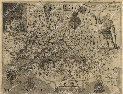
Vintage Map of Virginia by John Smith 1612 Reproduction Antique Print - Last One
Last One! Vintage Map of Virginia by John Smith 1612 Reproduction Antique Print Although the name of Captain John Smith has been known to every student of American history for many generations. It has usually been so as a result of his association with the Indian maiden Pocohontas, or his success in keeping the Jamestown colony alive by obtaining food from the Indians. His achievements as a surveyor and map maker have not been so widely recognized. Yet his map of Virginia was the best available for more than half a century. The small black crosses indicate the limits of Smith's explorations up the river emptying into Chesapeake Bay. Color Print Great item for collectors! Would look Great as Framed Art! Approx. Size: 13 1/2 inches x 10 3/8 inches CONDITION: SEE PHOTOS great condition. No folds SHIPPING WILL BE $6.00 IN THE CONTINENTAL ... moreU.S. PAYMENT MUST BE RECEIVED WITHIN 3 DAYS OF RECEIPT OF INVOICE. MUST HAVE A PAYPAL ACCOUNT TO PURCHASE! THIS IS THE CHANCE OF A LIFETIME! NO INTERNATIONAL SHIPPING ALL AUCTIONS PAID BY MONDAY MORNING 10 AM WILL SHIP MONDAY. WE COMBINE SHIPPING* PLEASE WAIT FOR COMBINED INVOICE
|
|
|
VINTAGE historical EAST BOSTON MASS 1879 OLD WORLD ANTIQUE STYLE MAP print
VINTAGE historical EAST BOSTON MASS 1879 OLD ANTIQUE STYLE MAP art print THIS IS A HIGHLY DETAILED MAP OF BOSTON MASS CIRCA 1879 THIS PRINT MEASURES 18"X 24" 46cm x 61cm) THIS MAP HAS GREAT DETAIL SEE PHOTOS BELOW Fine Art Giclee(not a laser print) THIS IS A MODERN REPRINT PRINTED ON FINE ART PAPER not a second or third generation print This will be printed in its full aspect ratio on high quality paper. using ULTRACHROME K3 INKS which are rated up to 125+ years I do not use cheap inks that will fade in a few months very suitable for framing some images may have a thin white border THEARTTIST will not show up on your print PERFECT FOR YOUR HOME. OFFICE, GAME ROOM, MAN CAVE or GARAGE Thank you for looking. PLEASE FEEL FREE TO ASK QUESTIONS. THANKS. You may be interested in on eBay. THANKS FOR LOOKING Payment Instructions I accept ... morePayPal for payment. I prefer PayPal. I require that payment be made within 3 days of the end of auction. Please Email me if you have any questions before you bid. Happy bidding! See PHOTO above to check EXACTLY what youre bidding on Feedback: I take pride in my feedback and strive for 5 Star Service. If you have a problem. Please email me before leaving bad feedback so that we can work something out. Shipping Instructions US Buyers: I use USPS Mail for most shipping needs- Purchases over $250 Will be sent with Signature Conformation International Buyers: International buyers If you need you can contact me prior to bidding to obtain a shipping quote. International buyers can choose how fast they wish delivery by USPS meaning Global Priority. Air Letter Post or Economy Letter Post. All of my shipping charges vary depending on the weight of the item. I will gladly combne Shipping with any of my other auction. drop me an email before bidding and I will try to respond within 24 hours. Important Notice to International Buyers Import duties. Taxes, and charges are not included in the item price or shipping cost. These charges are assessed and collected by your nation's government a
|
|
|
GIANT VINTAGE historical EAST BOSTON MASS 1879 OLD WORLD ANTIQUE STYLE MAP print
GIANT VINTAGE historical EAST BOSTON MASS 1879 OLD ANTIQUE STYLE MAP art print THIS IS A GIANT HIGHLY DETAILED MAP OF BOSTON MASS CIRCA 1879 THIS PRINT MEASURES 43"X 53" 109cm x 135cm) THIS MAP HAS GREAT DETAIL SEE PHOTOS BELOW Fine Art Giclee(not a laser print) THIS IS A MODERN REPRINT PRINTED ON FINE ART PAPER not a second or third generation print This will be printed in its full aspect ratio on high quality paper. using ULTRACHROME K3 INKS which are rated up to 125+ years I do not use cheap inks that will fade in a few months very suitable for framing some images may have a thin white border THEARTTIST will not show up on your print PERFECT FOR YOUR HOME. OFFICE, GAME ROOM, MAN CAVE or GARAGE Thank you for looking. PLEASE FEEL FREE TO ASK QUESTIONS. THANKS. You may be interested in on eBay. THANKS FOR LOOKING Payment Instructions ... moreI accept PayPal for payment. I prefer PayPal. I require that payment be made within 3 days of the end of auction. Please Email me if you have any questions before you bid. Happy bidding! See PHOTO above to check EXACTLY what youre bidding on Feedback: I take pride in my feedback and strive for 5 Star Service. If you have a problem. Please email me before leaving bad feedback so that we can work something out. Shipping Instructions US Buyers: I use USPS Mail for most shipping needs- Purchases over $250 Will be sent with Signature Conformation International Buyers: International buyers If you need you can contact me prior to bidding to obtain a shipping quote. International buyers can choose how fast they wish delivery by USPS meaning Global Priority. Air Letter Post or Economy Letter Post. All of my shipping charges vary depending on the weight of the item. I will gladly combne Shipping with any of my other auction. drop me an email before bidding and I will try to respond within 24 hours. Important Notice to International Buyers Import duties. Taxes, and charges are not included in the item price or shipping cost. These charges are assessed and collected by your nation'
|
|
|
HUGE VINTAGE historical EAST BOSTON MASS 1879 OLD WORLD ANTIQUE STYLE MAP print
HUGE VINTAGE historical EAST BOSTON MASS 1879 OLD ANTIQUE STYLE MAP art print THIS IS A HUGE AND HIGHLY DETAILED MAP OF BOSTON MASS CIRCA 1879 THIS PRINT MEASURES 35"X 43" 89cm x 109cm) THIS MAP HAS GREAT DETAIL SEE PHOTOS BELOW Fine Art Giclee(not a laser print) THIS IS A MODERN REPRINT PRINTED ON FINE ART PAPER not a second or third generation print This will be printed in its full aspect ratio on high quality paper. using ULTRACHROME K3 INKS which are rated up to 125+ years I do not use cheap inks that will fade in a few months very suitable for framing some images may have a thin white border THEARTTIST will not show up on your print PERFECT FOR YOUR HOME. OFFICE, GAME ROOM, MAN CAVE or GARAGE Thank you for looking. PLEASE FEEL FREE TO ASK QUESTIONS. THANKS. You may be interested in on eBay. THANKS FOR LOOKING Payment Instructions ... moreI accept PayPal for payment. I prefer PayPal. I require that payment be made within 3 days of the end of auction. Please Email me if you have any questions before you bid. Happy bidding! See PHOTO above to check EXACTLY what youre bidding on Feedback: I take pride in my feedback and strive for 5 Star Service. If you have a problem. Please email me before leaving bad feedback so that we can work something out. Shipping Instructions US Buyers: I use USPS Mail for most shipping needs- Purchases over $250 Will be sent with Signature Conformation International Buyers: International buyers If you need you can contact me prior to bidding to obtain a shipping quote. International buyers can choose how fast they wish delivery by USPS meaning Global Priority. Air Letter Post or Economy Letter Post. All of my shipping charges vary depending on the weight of the item. I will gladly combne Shipping with any of my other auction. drop me an email before bidding and I will try to respond within 24 hours. Important Notice to International Buyers Import duties. Taxes, and charges are not included in the item price or shipping cost. These charges are assessed and collected by your nation'
|
|
|
LARGE VINTAGE HISTORIC LONDON ENGLAND 1807 OLD ANTIQUE STYLE MAP FINE ART PRINT
LARGE VINTAGE HISTORIC LONDON ENGLAND 1807 OLD ANTIQUE STYLE MAP FINE ART PRINT THIS IS A LARGE AND HIGHLY DETAILED MAP OF LONDON ENGLAND CIRCA 1807 THIS PRINT MEASURES 24"X 43" 61cm x109cm) THIS MAP HAS GREAT DETAIL SEE PHOTO BELOW THIS WILL PRINTED ON FINE ART WATERCOLOR PAPER This will be printed in its full aspect ratio on high quality paper. using ULTRACHROME K3 INKS which are rated up to 125+ years I do not use cheap inks that will fade in a few months very suitable for framing some images may have a thin white border THEARTTIST will not show up on your print PERFECT FOR YOUR HOME. OFFICE, GAME ROOM, MAN CAVE or GARAGE Thank you for looking. PLEASE FEEL FREE TO ASK QUESTIONS. THANKS. You may be interested in on eBay. THANKS FOR LOOKING Payment Instructions I accept PayPal for payment. I prefer PayPal. I require that payment ... morebe made within 3 days of the end of auction. Please Email me if you have any questions before you bid. Happy bidding! See PHOTO above to check EXACTLY what youre bidding on Feedback: I take pride in my feedback and strive for 5 Star Service. If you have a problem. Please email me before leaving bad feedback so that we can work something out. Shipping Instructions US Buyers: I use USPS Mail for most shipping needs- Purchases over $250 Will be sent with Signature Conformation International Buyers: International buyers If you need you can contact me prior to bidding to obtain a shipping quote. International buyers can choose how fast they wish delivery by USPS meaning Global Priority. Air Letter Post or Economy Letter Post. All of my shipping charges vary depending on the weight of the item. I will gladly combne Shipping with any of my other auction. drop me an email before bidding and I will try to respond within 24 hours. Important Notice to International Buyers Import duties. Taxes, and charges are not included in the item price or shipping cost. These charges are assessed and collected by your nation's government and are the buyer's responsibility. Please check with yo
|
|
|
GIANT VINTAGE MAP OF EUROPE THE ANCIENT WORLD 1794 OLD ANTIQUE STYLE art print
GIANT VINTAGE MAP OF EUROPE THE ANCIENT WORLD 1794 OLD ANTIQUE STYLE art print THIS IS A GIANT HIGHLY DETAILED MAP OF THE ANCIENT WORLD CIRCA 1794 THIS PRINT MEASURES 44"X 61" 111cm x155cm) A large and dramatic composite 1794 map of the world as it was known to the ancients. By J. B. B. D'Anville. Covers all of Europe, Asia Minor, Arabia and India. Much of Northern Africa, and parts of Southeast Asia THIS MAP HAS GREAT DETAIL SEE PHOTO BELOW THIS WILL PRINTED ON FINE ART WATERCOLOR PAPER This will be printed in its full aspect ratio on high quality paper. using ULTRACHROME K3 INKS which are rated up to 125+ years I do not use cheap inks that will fade in a few months very suitable for framing some images may have a thin white border THEARTTIST will not show up on your print PERFECT FOR YOUR HOME. OFFICE, GAME ROOM, MAN CAVE ... moreor GARAGE Thank you for looking. PLEASE FEEL FREE TO ASK QUESTIONS. THANKS. You may be interested in on eBay. THANKS FOR LOOKING Payment Instructions I accept PayPal for payment. I prefer PayPal. I require that payment be made within 3 days of the end of auction. Please Email me if you have any questions before you bid. Happy bidding! See PHOTO above to check EXACTLY what youre bidding on Feedback: I take pride in my feedback and strive for 5 Star Service. If you have a problem. Please email me before leaving bad feedback so that we can work something out. Shipping Instructions US Buyers: I use USPS Mail for most shipping needs- Purchases over $250 Will be sent with Signature Conformation International Buyers: International buyers If you need you can contact me prior to bidding to obtain a shipping quote. International buyers can choose how fast they wish delivery by USPS meaning Global Priority. Air Letter Post or Economy Letter Post. All of my shipping charges vary depending on the weight of the item. I will gladly combne Shipping with any of my other auction. drop me an email before bidding and I will try to respond within 24 hours. Important Notice to International Buyers Imp
|
|
|
1914 LARGE MAP TOUR DE FRANCE BICYCLE RACE ROUTE VINTAGE HISTORICAL
History-Image Photo. Map& Poster Archive Search in titles& descriptions Browse Photographs by Category Historic Posters Historic Maps Shipping& Payment We combine shipping so you only pay one shipping charge regardless of how many items you purchase U.S. $ 5.95 Canada $ 7.50 International $ 10.00 You will receive an email at the close of auction. Click on the payment link to complete payment. We accept Paypal. You can also pay for your purchase over the phone with a credit card: 503) 408-2360 See our Framing work work Who are you buying from? This is an interesting map showing the route of the Tour de France. 1914. Includes area at bottom to write-in the names of the top finishers at each stage, 1914. This was the last race before the outbreak of World War I. From Map: Tour de France Cycliste. 12e Annee 1914. Actual map is much ... moresharper and detailed than the low resolution scanned image used here. Map measures approximately 18" by 24" 46 by 61cm) The map is a modern reprint. It is reprinted(a modern reprint) using premium semi-matte. Japanese paper and Ultrachrome ink, which has an archival rating of 125+ years. For more information about how the maps are made see our Custom Framing& Matting Options We offer a variety of sizes and options for framing your purchase. to see frames and prices Example of map detail: Frequently Asked Questions Is the resolution disappointing? No. Is the simple answer. Because we are dealing with historical pieces from a wide range of regions, creators and time periods, there is variation in the quality. However, we always ask ourselves if we would be pleased with a particular image framed and on display before we add it to our inventory. We do not carry low-quality"snapshots, cheap digital scans or multi-generational prints. When we create a large-format negative at the archive the resulting digital file can easily exceed one gigabyte. The detail is so good that the actual fibers in the paper or cloth of the original map are visible in the print we make.
|
|
|
Extra Large vintage style Antique world Map Art print on fabric, canvas 57"x83"
Also please take a look at our other vintage map prints- Abraham Ortelius(1527-1598) A Dutch-born cartographer, produced the first modern atlas called the Terra Australis. The great mythical southern continent at the time, is at the bottom of the map. The myth of the great southern continent was finally dispelled by the discoveries of Captain James Cook in 1769. Size: 57" x 83" 145 cm x 210 cm) Canvas: Canvas: high quality cotton canvas fabric» Ink: Ecosolvent ink( long lasting vivid colors) Shipping: Print is shipped in a strong tube for secure shipping and it will be shipped as a priority mail for fast delivery» Items usually ship within 2-3 days from date of completed payment» Delivery takes around 1 Week- Frame is not included and is just to show how great it looks framed! di,RcmdId ViewItemDescV4,RlogId p4%60bo7%60jtb9%3Fuk%601d72f%2Bishhov%3C%3Edi-141c7e34e59-0x101-
|
|
|
VINTAGE CALAMUS & SHERMAN RESERVOIRS CONTOUR, TOPO MAP LAKE
THIS IS A CONTOUR MAP OF BOTH LAKE.IT IS IN GOOD CONDITION. PRODUCT OF DEES MAPS 1989
|
|
|
Vintage "The Evergreen Playground" map by Knoll Map Co. Inc. Seattle WA
The map without frame measures about 19 x 32 inches. With frame it measures 21 x 34 inches. It is in perfect condition. There is a small rip in back on the framing but does not effect map. It is gorgeous. I am not certain on the age but does look older in style. I purchased at auction so I don't have much information on it. Check out my!
|
|
|
Vintage Map North South America Art Locket Silver Pendant Necklace Jewelry Gift
North South American Map Art Locket Silver Plate Necklace ~This listing is for a fabulous Altered Art locket ~North South America World Map~. This artful design is made with an archival quality photo applied to a smooth silver plated brass locket with an antiqued patina. A specially formulated UV safe waterproof. Scratch-resistant coating which will last for many years& will not yellow or crack has been hand applied to each pendant. The locket hangs from a softly finished silver plated ball chain necklace that can easily be shortened to your ideal length. A stunning pendant and creative place to keep what you cherish close to your heart ~ Details: Locket- Antique silver plated brass. 32MM Chain- 24" Silver Plated Ball Chain ~ Please Note ~ ~ This listing is for the item that is described only.any other jewelry or clothing that this ... moreitem is displayed with in the photographs are listed in seperate. Individual listings. If you need help locating one of the other items that are displayed with this one please don't hesitate to ask for assistance ~
|
|
|
LARGE VACUUM-FORMED 3D LUNAR RELIEF MAP: MARE IMBRIUM, VINTAGE, RARE, MUST SEE!
LARGE VACUUM-FORMED 3D LUNAR RELIEF MAP: MARE IMBRIUM. VINTAGE, RARE, MUST SEE! Click to Enlarge Click to Enlarge Click to Enlarge Click to Enlarge Click to Enlarge Click to Enlarge Description: This Listing is for a: Vacuum-formed Plastic 3D Lunar Relief Map of the MARE IMBRIUM. This vintage 3D plastic relief map is made using a process know as"vacuum-forming" There a plenty examples of this process on YouTube. The features depicted on the map are located in a region of the Moon's Northwest quadrant. It is called the Mare Imbrium or"Sea of Rains" Using the first photo as a reference. At the 11:00 o' clock position is a hemispherical arcing feature know as the"Jura Mountains" which form the northwestern perimeter of the Sinus Iridum or"Sea of Rainbows" Just to the right of that feature at the ... moreapproximate 12:00 o'clock position is a crater called"Plato" Directly below Plato at the 4:00 o"clock position is another large crater called"Archimedes" Just to the right of Archimedes and sweeping in a downward arc are the"Apennine Mountains" At the 4:00 o"clock position relative to Archimedes and in a valley of the Apennine Mountains. Is the Apollo 15 landing site where the Lunar Module"Falcon" set down on July 30th 1971. Finally. At the 6:00 o"clock position is the crater"Copernicus" I know"rare" is over used and sometimes not applicable is describing an item. So I'll say this is a"quasi-rare" map. I haven't seen a map like this but once in my 12+ years on eBay, and I bought it! The map measures 18 1/4" x 24 5/8" x 1 1/4" Study the photos for condition. It has two small holes that seem to be from possibly mounting. A small chip on one of the corners but that's it. The map surface is impeccably clean, no cracks and slightly yellowed. I planned to completely airbrush this map for surface coloration, shadowing and feature nomenclature but time just got away from
|
|
|
LARGE VINTAGE historic 1898 Brockhaus Map of the Moon OLD ANTIQUE lunar PRINT
LARGE VINTAGE historic 1898 Brockhaus Map of the Moon OLD ANTIQUE lunar PRINT THIS IS A LARGE AND HIGHLY DETAILED LUNAR MAP OF THE MOON CIRCA 1898 THIS PRINT MEASURES 18"X 23" 46cm x58cm) SIMILAR TO SOMETHING YOU MIGHT SEE IN RESTORATION HARDWARE BUT FOR LESS THIS MAP HAS GREAT DETAIL SEE PHOTO BELOW THIS WILL PRINTED ON FINE ART WATERCOLOR PAPER Title: Ubersichtskarte des Mondes. Description: This is a rare and beautiful 1889 Map of the Moon by German lexiconographer F. A Brockhaus. There are for insets of important lunar craters. The Gutenberg group, the Julius Caesar Group, the Plate Crater, and the Guericke, Parry, Bonpland and Fra. Mauro cluster. Other craters and seas on the moons surface are clearly labeled. Publisher: Printed in Leipzig in 1898 for the Brockhaus Konversations– Lexikon Need this is a different size click ... morethe link below to see if I have another size MAPS. This will be printed in its full aspect ratio on high quality paper. using ULTRACHROME K3 INKS which are rated up to 125+ years I do not use cheap inks that will fade in a few months very suitable for framing some images may have a thin white border THEARTTIST will not show up on your print PERFECT FOR YOUR HOME. OFFICE, GAME ROOM, MAN CAVE or GARAGE Thank you for looking. PLEASE FEEL FREE TO ASK QUESTIONS. THANKS. THANKS FOR LOOKING Payment Instructions I accept PayPal for payment. I prefer PayPal. I require that payment be made within 3 days of the end of auction. Please Email me if you have any questions before you bid. Happy bidding! See PHOTO above to check EXACTLY what youre bidding on Feedback: I take pride in my feedback and strive for 5 Star Service. If you have a problem. Please email me before leaving bad feedback so that we can work something out. Shipping Instructions US Buyers: I use USPS Mail for most shipping needs- Purchases over $250 Will be sent with Signature Conformation International Buyers: International buyers If you need you can contact me prior to bidding to obtain a shipping quote. International buyers
|
|
|
Vintage 1784 FIRST 1st French Map of the United States Reproduction BEAUTIFUL
This is a Beautiful Reproduction of the FIRST FRENCH MAP OF THE UNITED STATES Reproduced by S.S. Donnelley& Sons. Lakeside Press Chicago from the Original in The Newberry Library. Chicago, Ill. Deeptone Offset Process Printed Area w/o Border Measures: 21" by 30" An incredible Reproduction with Fascinating Details Please Check the Many Photos to Appreciate the Wonderful Detail and Color throughout this Map. Outside Non-Printed Border Edges have some slight wrinkles at edge(nothing serious) Framed this would be a Tremendous Piece Shipped in a Hard Tube ~ Insured Print is in Excellent Condition! Returns with Full Refund S&H Accepted if not Completely Satisfied! Thank you for reviewing my auction. Please don't hesitate to contact me with any questions you may have regarding this item. All auction Payments are expected by ... morePayPal within 3 days of Auction Close. This Item Comes from a Smoke-Free environment. As Always. Your purchase will be carefully packaged and shipped with the utmost in care. I GUARANTEE SHIPMENT WITHIN 24 HOURS OF PAYMENT RECEIPT EXCEPT FOR SUNDAYS AND HOLIDAYS! PLEASE CHECK MY FEEDBACK.I SHIP FAST! EVERY TIME! Should there be any issue with your purchase please contact me immediately so I may address any questions and maintain your complete satisfaction. I am VERY Happy to Combine Shipping for Multiple Purchases. Please email me and I will give you a quote. Check out my other items! Be sure to add me to your favorites list!
|
|
|
Vintage 8x10" Print, Hawaii / Hawaiian Map of the Sandwich Isles - Blaise Domino
Beautiful keepsake of the Hawaiian Islands. I had it in a frame which is why there was tape on the top backside of the print. In excellent used condition with the exception of a VERY faint crease at the top of the print. Outside of the dotted border, where I removed the tape. Terms: ~ Shipping to the US only. If in Alaska or Hawaii. Shipping costs are higher so please e-mail in advance for exact cost. ~ Payment is expected within 4 days of auction end via PayPal. ~ Refunds will ONLY be given due to misrepresentation of an item-NOT buyer's remorse or negligence in reading the item description. ~ If there's something about the transaction you're not happy with. Please let me know and I'll do what's necessary to rectify the situation. ~ Feedback-If you leave feedback for me I'll be more than happy to do the same for you. ... more~ My home is smoke free and I have dogs.
|
|
|
VINTAGE REPRODUCTION PLAN OF YORKTOWN MAP,OCT.1781 PRINT
VINTAGE REPRODUCTION MAP OF THE SIEGE OF YORKTOWN OCTOBER 1781.THE PRINT MEASURES 20 3/4" X 31" I THINK THE BOARDER HAS BEEN REMOVED.THE PIECE IS A BIT FADED AND A BIT YELLOWED BUT IT IS NOT RIPPED OR CREASED. We will combine shipping where possible. Please examine the photos carefully and message with any questions before bidding. Remember. If there is a"Buy it now" option in addition to auction style bidding, the Buy it Now feature will be locked out by an auction style bid. We go to the Post Office Monday-Saturday unless it's a holiday. Thursday and Friday can be a little dicey, as we both run other businesses, and Thursday-Saturday are busy days at them. However, we do our best to ship ASAP. Generally, if your item is paid for by 10 am Eastern Standard(7am Pacific) We can ship same day. Otherwise, we have 1-day ... moreshipping. Should you have any issues with your purchase or shipment, please message us first before leaving feedback or going to the Resolution Center. Customer Service is an important part of our business. If something about your order is wrong, we will do our best to make it right. Thanks for looking! Customer Service is an important part of our business. If something about your order is wrong, we will do our best to make it right. Thanks for looking! We will combine shipping where possible. Please examine the photos carefully and message with any questions before bidding. Remember. If there is a"Buy it now" option in addition to auction style bidding, the Buy it Now feature will be locked out by an auction style bid. We go to the Post Office Monday-Saturday unless it's a holiday. Thursday and Friday can be a little dicey, as we both run other businesses, and Thursday-Saturday are busy days at them. However, we do our best to ship ASAP. Generally, if your item is paid for by 10 am Eastern Standard(7am Pacific) We can ship same day. Otherwise, we have 1-day shipping. Should you have any issues with your purchase or shipment, please message us first before leaving
|
|
|
LARGE VINTAGE historic HAWAIIAN SANDWICH ISLANDS 1841 ANTIQUE STYLE MAP print
LARGE VINTAGE historic HAWAIIAN SANDWICH ISLANDS 1841 ANTIQUE STYLE MAP print THIS IS A LARGE AND HIGHLY DETAILED MAP OF THE HAWAIAN SANDWICH ISLANDS CIRCA 1841 THIS PRINT MEASURES 18"X 22" 46cm x56cm) THIS MAP HAS GREAT DETAIL SEE PHOTO BELOW THIS WILL PRINTED ON FINE ART WATERCOLOR PAPER Need this is a different size click the link below to see if I have another size MAPS. This will be printed in its full aspect ratio on high quality paper. using ULTRACHROME K3 INKS which are rated up to 125+ years I do not use cheap inks that will fade in a few months very suitable for framing some images may have a thin white border THEARTTIST will not show up on your print PERFECT FOR YOUR HOME. OFFICE, GAME ROOM, MAN CAVE or GARAGE Thank you for looking. PLEASE FEEL FREE TO ASK QUESTIONS. THANKS. THANKS FOR LOOKING Payment Instructions I accept ... morePayPal for payment. I prefer PayPal. I require that payment be made within 3 days of the end of auction. Please Email me if you have any questions before you bid. Happy bidding! See PHOTO above to check EXACTLY what youre bidding on Feedback: I take pride in my feedback and strive for 5 Star Service. If you have a problem. Please email me before leaving bad feedback so that we can work something out. Shipping Instructions US Buyers: I use USPS Mail for most shipping needs- Purchases over $250 Will be sent with Signature Conformation International Buyers: International buyers If you need you can contact me prior to bidding to obtain a shipping quote. International buyers can choose how fast they wish delivery by USPS meaning Global Priority. Air Letter Post or Economy Letter Post. All of my shipping charges vary depending on the weight of the item. I will gladly combne Shipping with any of my other auction. drop me an email before bidding and I will try to respond within 24 hours. Important Notice to International Buyers Import duties. Taxes, and charges are not included in the item price or shipping cost. These charges are assessed and collected by your nation's governm
|
|
|
GIANT VINTAGE historic HAWAIIAN SANDWICH ISLANDS 1841 ANTIQUE STYLE MAP print
GIANT VINTAGE historic HAWAIIAN SANDWICH ISLANDS 1841 ANTIQUE STYLE MAP print THIS IS A GIANT AND HIGHLY DETAILED MAP OF THE HAWAIIAN SANDWICH ISLANDS CIRCA 1841 THIS PRINT MEASURES 41"X 49" 104cm x124cm) THIS MAP HAS GREAT DETAIL SEE PHOTO BELOW THIS WILL PRINTED ON FINE ART WATERCOLOR PAPER Need this is a different size click the link below to see if I have another size MAPS. This will be printed in its full aspect ratio on high quality paper. using ULTRACHROME K3 INKS which are rated up to 125+ years I do not use cheap inks that will fade in a few months very suitable for framing some images may have a thin white border THEARTTIST will not show up on your print PERFECT FOR YOUR HOME. OFFICE, GAME ROOM, MAN CAVE or GARAGE Thank you for looking. PLEASE FEEL FREE TO ASK QUESTIONS. THANKS. THANKS FOR LOOKING Payment Instructions ... moreI accept PayPal for payment. I prefer PayPal. I require that payment be made within 3 days of the end of auction. Please Email me if you have any questions before you bid. Happy bidding! See PHOTO above to check EXACTLY what youre bidding on Feedback: I take pride in my feedback and strive for 5 Star Service. If you have a problem. Please email me before leaving bad feedback so that we can work something out. Shipping Instructions US Buyers: I use USPS Mail for most shipping needs- Purchases over $250 Will be sent with Signature Conformation International Buyers: International buyers If you need you can contact me prior to bidding to obtain a shipping quote. International buyers can choose how fast they wish delivery by USPS meaning Global Priority. Air Letter Post or Economy Letter Post. All of my shipping charges vary depending on the weight of the item. I will gladly combne Shipping with any of my other auction. drop me an email before bidding and I will try to respond within 24 hours. Important Notice to International Buyers Import duties. Taxes, and charges are not included in the item price or shipping cost. These charges are assessed and collected by your nation's gove
|
|
|
HUGE VINTAGE historic HAWAIIAN SANDWICH ISLANDS 1841 ANTIQUE STYLE MAP art print
HUGE VINTAGE historic HAWAIIAN SANDWICH ISLANDS 1841 ANTIQUE STYLE MAP art print THIS IS A HUGE AND HIGHLY DETAILED MAP OF THE HAWAIAN SANDWICH ISLANDS CIRCA 1841 THIS PRINT MEASURES 34"X 41" 86cm x104cm) THIS MAP HAS GREAT DETAIL SEE PHOTO BELOW THIS WILL PRINTED ON FINE ART WATERCOLOR PAPER Need this is a different size click the link below to see if I have another size MAPS. This will be printed in its full aspect ratio on high quality paper. using ULTRACHROME K3 INKS which are rated up to 125+ years I do not use cheap inks that will fade in a few months very suitable for framing some images may have a thin white border THEARTTIST will not show up on your print PERFECT FOR YOUR HOME. OFFICE, GAME ROOM, MAN CAVE or GARAGE Thank you for looking. PLEASE FEEL FREE TO ASK QUESTIONS. THANKS. THANKS FOR LOOKING Payment Instructions ... moreI accept PayPal for payment. I prefer PayPal. I require that payment be made within 3 days of the end of auction. Please Email me if you have any questions before you bid. Happy bidding! See PHOTO above to check EXACTLY what youre bidding on Feedback: I take pride in my feedback and strive for 5 Star Service. If you have a problem. Please email me before leaving bad feedback so that we can work something out. Shipping Instructions US Buyers: I use USPS Mail for most shipping needs- Purchases over $250 Will be sent with Signature Conformation International Buyers: International buyers If you need you can contact me prior to bidding to obtain a shipping quote. International buyers can choose how fast they wish delivery by USPS meaning Global Priority. Air Letter Post or Economy Letter Post. All of my shipping charges vary depending on the weight of the item. I will gladly combne Shipping with any of my other auction. drop me an email before bidding and I will try to respond within 24 hours. Important Notice to International Buyers Import duties. Taxes, and charges are not included in the item price or shipping cost. These charges are assessed and collected by your nation's gove
|
|
|
Vintage Hertz Truck advertising tray old world Adam and Eve Orbis Terrarum map
This is an older advertising tray for Hertz Truck Rentals. It has a paper reproduction of portion of a 1617 old world style map that features Adam and Eve on the bottom. I can't offer much more information than what is shown in the pictures because I haven't been unable to find another one like it. It is about 1.5 high and 8. 25" in diameter. It is in good condition with no issues other than normal wear for an older piece. Thank you for looking. RcmdId ViewItemDescV4,RlogId p4%60bo7%60jtb9%3Feog4d72f%2Bf7%60%3E-144ab4e5684-0x118-
|
|
|
VINTAGE MAP MAGNA BRITANNIAE ET HIBERNIAE TABULA
REALLY COOL MAP I BOUGHT AT AN AUCTION NOT SURE OF AGE. LOOKS OLD IN COLOR MADNA BRITANNIAE ET HIBERMIAE TABULA HAS WEAR FROM BEING FOLDED SO LONG AND WRINKLES MEASURES 16 BY 13 1/2 I AM NEW TO EBAY. WILL TRY TO DESCRIBE ACCURATELY AND PACKAGE CAREFULLY I WILL SHIP ANYWHERE AND ALWAYS COMBINE ITEMS IF SHIPPING IS LESS THAN STATED I WILL ISSUE YOU A REFUND LET ME NO IF YOU HAVE ANY QUESTIONS OR CONCERNS. UNFORTUNATELY WE ALL KNOW HOW IMPORTANT FEEDBACK IS I DO NOT SMOKE BUT HAVE ALOT OF STUFF FROM AUCTIONS AND ESTATE SALES. CANNOT GUARANTEE THEY ARE SMOKE FREE THANK YOU
|
|
|
Carta Marina Olaus Magnus 1539 Map of the Sea Nordic Vintage Style 23x31 XXL
Carta Marina by Olaus Magnus Detailed Specifications This is a Modern Reproduction/ Reprint of a Vintage Map The Carta marina(Latin"map of the sea" or"sea map" Created by Olaus Magnus in the 16th century, is the earliest map of the Nordic countries that gives details and placenames. Only two earlier maps of Scandinavia are known, those of Jacob Ziegler and Claudius Clavus. The map was created in Rome by the Swedish ecclesiastic Olaus Magnus(1490–1557) Who arrived on a diplomatic visit for the Swedish government and stayed on, likely because his brother Johannes Magnus became involved in a religious feud with King Gustav I of Sweden. Wikipedia. We have thousands of maps available. Many of them are not listed here. If you are looking for something specific. Please contact us and we will do everything we can to find what ... moreyou are looking for! Size: 23"x 31" 58cm x 79cm) This map is also available at 17" x 23" 43cm x 58cm) in This map comes with a white border around the image. How are the prints shipped? They are rolled and placed into a rigid shipping tube. Will the size watermark appear on the print that I receive? No. The watermark is only on the image to show the size and will not appear on your print. Is this available in a larger/smaller size. Yes. For smaller or larger sizes. Email us. Powered by The free listing tool. List your items fast and easy and manage your active items. RcmdId ViewItemDescV4,RlogId p4%60bo7%60jtb9%3Fvo%7B%3Dd70f%2Bf%60%60%3E-1451a7737c2-0x10b-
|
|
|
Vintage Wall Hanging Huge Leather MAP Handmade in late 20th Century
This is a listing for vintage hand made leather wall hanging map of South America. The map come with two rods(top and bottom) The map is sign by Alelier Rolando(The map condition issue on the back has some stain and three small holes through the leather on the side and on the top middle rod theirs a hole where i believe it was hung and the bottom the stitching is rip three stitch down and they tried to glue it. See my pictures) The map is huge; Measurement: 46" wide and 37" long. Theirs no damages on the face of the map. I purchase the map at a state sale and i don't know if it comes from a smoke free or a pet free house. According to the previous owner he purchase the map from Brazil in 1968. If you have any question ask i'll do my best to answer. See my listing for other good item. Thank you for viewing. RcmdId ViewItemDescV4,RlogId ... morep4%60bo7%60jtb9%3Feog4d72f%2Bf7%60%3E-145d36df311-0x115-
|
|
|
Vintage Map of the World by Claudius Ptolemy 150 A.D. Ulm Edition 1482 / NR
MAP OF THE WORLD BY CLAUDIUS PTOLEMY 150 A.D. ULM EDITION 1482. REPRODUCED FROM THE ORIGINAL IN EDWARD E. AYER COLLECTION OF THE NEWBERRY LIBRARY. THE MAP MEASURES 10 1/2" X 13 1/2" THE MAP HAS GREAT COLOR AND IS IN VERY GOOD CONDITION. AS SHOWN IN PICTURES. NO RESERVE
|
|
|
Copy Old Moon Map, Antique, Ancient maps, illustration, poster, vintage decor
Old map of the Moon It is a COPY of an old map. Is made on modern paper. SIZE OF POSTER 297* 420 mm(11.7×16,5 inch) REPRINT FROM ORIGINAL POSTER The print will be sealed in a waterproof clear plastic sleeve with sturdy tube box for the shipping. MADE IN RUSSIA Condition is NEW PAYMENT: PAYPAL I accept PAYPAL. Payment must be received within 3 days after the auction is closed. I am not responsible for any customs tax that can be charged in a country of delivery. Please. Get known the customs rules in your country before bidding. I request you NOT to bid/ buy if you are not sure of paying for it. I ship to PayPal's address ONLY. Please make sure your address in PayPal is matched with your shipping address before you pay. SHIPPING: I shall send it during 3 business of days after reception your payment. Please be aware that weekends ... moreare not business days. I SHIP INTERNATIONALLY(WORLDWIDE) I send Registered AIR MAIL. Shipping and Handling for this item is $ 19.99 The delivery of item usually takes up to 10-28 working days due the slow postal services and strict custom clearances. Thank you for visiting! Please take a look at my other auctions!
|
|
|
Old world map, vintage maps, atlas map globe, world map print, wall hanging, 18
This is vintage antique map print. It is a COPY of an old map. Is made on modern paper. SIZE OF POSTER 297* 420 mm(11.7×16,5 inch) REPRINT FROM ORIGINAL POSTER The print will be sealed in a waterproof clear plastic sleeve with sturdy tube box for the shipping. MADE IN RUSSIA Condition is NEW PAYMENT: PAYPAL I accept PAYPAL. Payment must be received within 3 days after the auction is closed. I am not responsible for any customs tax that can be charged in a country of delivery. Please. Get known the customs rules in your country before bidding. I request you NOT to bid/ buy if you are not sure of paying for it. I ship to PayPal's address ONLY. Please make sure your address in PayPal is matched with your shipping address before you pay. SHIPPING: I shall send it during 3 business of days after reception your payment. Please be aware ... morethat weekends are not business days. I SHIP INTERNATIONALLY(WORLDWIDE) I send Registered AIR MAIL. Shipping and Handling for this item is $ 19.99 The delivery of item usually takes up to 10-28 working days due the slow postal services and strict custom clearances. Thank you for visiting! Please take a look at my other auctions!
|
|
|
MAGNIFICENT VINTAGE MOSES PITT 1681 FOIL MAP
RICHLY COLORED AND DETAILED 20"x 16" SOLID OAK FRAMED(23"x19"FOIL MAP FROM AN ORIGINAL ENGRAVING BY MOSES PITT. STUNNING TO LOOK AT AND ADMIRE.WHICH THE MORE I DO, THE LESS I WANT TO SELL IT.PICTURES DO NOT DO IT JUSTICE.THANK YOU
|
|
|
Wall Picture Poster 1700's World Map! 24x36 Vintage Style geography old print
Wall Decor 1700's Poster World Map! 24x36 Vintag Hello there. If it's ok for me to say.Is it just me or am I the only one that likes to gaze at an old map or any map for that purpose. Here we have the wall decor that your home has been craving. It's just flat out interesting to see what the geographical/political provinces were back then. This high quality poster image is approximately 36-Inch by 24-Inch and is suitable for framing. The poster offers a lower cost alternative to a more expensive print or painting. Posters are perfect wall décor for any household or age range. An affordable adorable compliment to your home. I ship the same day and will leave good feedback.You can feel safe as you navigate through the waters of e BAY( you see what I did there? Navigate.waters. e Bay. Whatever floats your boat to put up the sale! ... moreI'm too much.But the map is too little,make this purchase today to add supplement that certain room you've been swaying on the final decision to decorate that wall. Thank you for checking out the page! Have a optimistic day!
|
|
|
Vintage Rare 1908 Adirondack Map Forest, Fish and Game Commision
Very rare 1908 map of the Adirondack Park in New York State. Maps are brittle with some evidence of rips. I did not want to open them. The booklet has 4 maps: one of the entire region and the other 3 are sectional. The booklet had a string to tie it. One sting is intact an the top string is cut short. Please see the pictures. This is a nice piece for any outdoorsman.
|
|
|
framed map of the world claudius ptolemy C 150 Ad Ulmer Edition 1482 Vintage.
You are bidding on a framed map of the world by Claudius Ptolemy. Print is 9" x 12" Decent shape. See photos. Free shipping via USPS. Posted with
|
|
|
Vintage World Map by Edward Wells Fine Art Archival print, 24" x 33"
Untitled Document A Map of the Terraqueous Globe according to the Ancient Discoveries and most general Divisions of it into Contienents and Oceans. Created by Edward Wells in 1700. Paper- Hahnemuhle best quality museum class paper with texture. Ink- Ultrachrome ink( that will last up to 100 years indoors) Border- Without border. Or if specified with ~ 0.2 inch white border for framing( include during checkout) Gift wrapping and greeting card option is available- just leave me a note during checkout(or send a message) that You would like it wrapped as a gift and add a text for the card. Greeting card option for gifts is available- just leave me a note during checkout(or send a message) that You would like as a gift and add a text for the card. Paper- Museum class quality textured paper for the great look and feel of the printed artwork. Ink ... moreand printer- Printed on latest generation Epson printers with water-based Ultrachrome inks( that will last up to 100 years indoors) The colors of the print may slightly vary due to print and monitor calibration differences. Prints are shipped in a strong tube for secure shipping and it will be shipped as a priority mail for fast delivery- Items usually ship within 2-3 days from date of completed payment. Delivery to Europe countries takes from 5 to 10 working days. To USA, Australia, Canada etc. from 10 to 15 working days. Returns- If your item arrives damaged or you are not satisfied with our product.We will work with you to come to an understanding.If not refund will be given as money back. Buyer pays return shipping) If order is delayed because of post office work interference or some force major circumstances. Then new order will be sent to you, while starting an inquiry with post. In this case refund is only possible, when inquiry is complete, that can take up to 45 days. We can make almost any custom sizes for You(if the image quality is acceptable) All prints can also be made as gallery wrapped on wood frame canvas that is ready to be h
|
|
|
LARGE 1794 Samuel Dunn VINTAGE Map of the World in Hemispheres terraqueous globe
LARGE 1794 Samuel Dunn VINTAGE Map of the World in Hemispheres terraqueous globe THIS IS A GIANT AND HIGHLY DETAILED MAP OF THE WORLD A General Map of the World. Or Terraqueouis Globe with all the New Discoveries and Marginal Delineations, Containing the Most Interesting Particulars in the Solar, Starry and Mundane System; an absolutely stunning and monumental double hemisphere wall map of the world by Samuel Dunn THIS PRINT MEASURES 18"X 22" 46cm x 56cm) THIS MAP HAS GREAT DETAIL SEE PHOTO BELOW THIS WILL PRINTED ON FINE ART WATERCOLOR PAPER Need this is a different size click the link below to see if I have another size MAPS. This will be printed in its full aspect ratio on high quality paper. using ULTRACHROME K3 INKS which are rated up to 125+ years I do not use cheap inks that will fade in a few months very suitable for framing ... moresome images may have a thin white border THEARTTIST will not show up on your print PERFECT FOR YOUR HOME. OFFICE, GAME ROOM, MAN CAVE or GARAGE Thank you for looking. PLEASE FEEL FREE TO ASK QUESTIONS. THANKS. THANKS FOR LOOKING Payment Instructions I accept PayPal for payment. I prefer PayPal. I require that payment be made within 3 days of the end of auction. Please Email me if you have any questions before you bid. Happy bidding! See PHOTO above to check EXACTLY what youre bidding on Feedback: I take pride in my feedback and strive for 5 Star Service. If you have a problem. Please email me before leaving bad feedback so that we can work something out. Shipping Instructions US Buyers: I use USPS Mail for most shipping needs- Purchases over $250 Will be sent with Signature Conformation International Buyers: International buyers If you need you can contact me prior to bidding to obtain a shipping quote. International buyers can choose how fast they wish delivery by USPS meaning Global Priority. Air Letter Post or Economy Letter Post. All of my shipping charges vary depending on the weight of the item. I will gladly combne Shipping with any of my other auction. drop me an ema
|
|
|
HUGE 1794 Samuel Dunn VINTAGE Map of the World in Hemispheres terraqueous globe
HUGE 1794 Samuel Dunn VINTAGE Map of the World in Hemispheres terraqueous globe THIS IS A HUGE AND HIGHLY DETAILED MAP OF THE WORLD A General Map of the World. Or Terraqueouis Globe with all the New Discoveries and Marginal Delineations, Containing the Most Interesting Particulars in the Solar, Starry and Mundane System; an absolutely stunning and monumental double hemisphere wall map of the world by Samuel Dunn THIS PRINT MEASURES 34"X 41" 86cm x104cm) THIS MAP HAS GREAT DETAIL SEE PHOTO BELOW THIS WILL PRINTED ON FINE ART WATERCOLOR PAPER Need this is a different size click the link below to see if I have another size MAPS. This will be printed in its full aspect ratio on high quality paper. using ULTRACHROME K3 INKS which are rated up to 125+ years I do not use cheap inks that will fade in a few months very suitable for framing ... moresome images may have a thin white border THEARTTIST will not show up on your print PERFECT FOR YOUR HOME. OFFICE, GAME ROOM, MAN CAVE or GARAGE Thank you for looking. PLEASE FEEL FREE TO ASK QUESTIONS. THANKS. THANKS FOR LOOKING Payment Instructions I accept PayPal for payment. I prefer PayPal. I require that payment be made within 3 days of the end of auction. Please Email me if you have any questions before you bid. Happy bidding! See PHOTO above to check EXACTLY what youre bidding on Feedback: I take pride in my feedback and strive for 5 Star Service. If you have a problem. Please email me before leaving bad feedback so that we can work something out. Shipping Instructions US Buyers: I use USPS Mail for most shipping needs- Purchases over $250 Will be sent with Signature Conformation International Buyers: International buyers If you need you can contact me prior to bidding to obtain a shipping quote. International buyers can choose how fast they wish delivery by USPS meaning Global Priority. Air Letter Post or Economy Letter Post. All of my shipping charges vary depending on the weight of the item. I will gladly combne Shipping with any of my other auction. drop me an email
|
|
|
GIANT 1794 Samuel Dunn VINTAGE Map of the World in Hemispheres terraqueous globe
GIANT 1794 Samuel Dunn VINTAGE Map of the World in Hemispheres terraqueous globe THIS IS A GIANT AND HIGHLY DETAILED MAP OF THE WORLD A General Map of the World. Or Terraqueouis Globe with all the New Discoveries and Marginal Delineations, Containing the Most Interesting Particulars in the Solar, Starry and Mundane System; an absolutely stunning and monumental double hemisphere wall map of the world by Samuel Dunn THIS PRINT MEASURES 42"X 50" 107cm x127cm) THIS MAP HAS GREAT DETAIL SEE PHOTO BELOW THIS WILL PRINTED ON FINE ART WATERCOLOR PAPER Need this is a different size click the link below to see if I have another size MAPS. This will be printed in its full aspect ratio on high quality paper. using ULTRACHROME K3 INKS which are rated up to 125+ years I do not use cheap inks that will fade in a few months very suitable for framing ... moresome images may have a thin white border THEARTTIST will not show up on your print PERFECT FOR YOUR HOME. OFFICE, GAME ROOM, MAN CAVE or GARAGE Thank you for looking. PLEASE FEEL FREE TO ASK QUESTIONS. THANKS. THANKS FOR LOOKING Payment Instructions I accept PayPal for payment. I prefer PayPal. I require that payment be made within 3 days of the end of auction. Please Email me if you have any questions before you bid. Happy bidding! See PHOTO above to check EXACTLY what youre bidding on Feedback: I take pride in my feedback and strive for 5 Star Service. If you have a problem. Please email me before leaving bad feedback so that we can work something out. Shipping Instructions US Buyers: I use USPS Mail for most shipping needs- Purchases over $250 Will be sent with Signature Conformation International Buyers: International buyers If you need you can contact me prior to bidding to obtain a shipping quote. International buyers can choose how fast they wish delivery by USPS meaning Global Priority. Air Letter Post or Economy Letter Post. All of my shipping charges vary depending on the weight of the item. I will gladly combne Shipping with any of my other auction. drop me an em
|
|
|
GREAT BRITAIN / IRELAND 17TH CENTURY VINTAGE HISTORICAL MAP/ OUT OF PRINT NY PUB
Guiljelmo Blaeuw Vintage"Great Britain and Ireland" Map Reproduced by Hammond Map Incorporated"Courtesy of the New York Public Library" Paper Print. Item is Authentic Original Reproduction Item is in Near Mint to Mint Condition Item Measures 24 3/4" X 16 3/8"Guiljelmo Blaeuw b etween 1594 and 1596 as a student of the qualified as an instrument and maker. Once he returned to the. He made country maps and world globes, and as he possessed his own printing works, he was able to regularly produce country maps in an atlas format, some of which appeared in the published in 1635. In 1633 he was appointed map-maker of the. The New York Public Library arranged for these brilliantly detailed examples of historic Travel's reproduced and printed up by Hammond Map Incorporated. These are great c onversational Pieces that ... moreare well over Thirty years old.
|
|
|
1763 HUGE VINTAGE MAP OF EUROPE THE ANCIENT WORLD OLD ANTIQUE STYLE art print
1763 HUGE VINTAGE MAP OF EUROPE THE ANCIENT WORLD OLD ANTIQUE STYLE art print THIS IS A HUGE HIGHLY DETAILED MAP OF THE ANCIENT WORLD CIRCA 1763 THIS PRINT MEASURES 31"X 43" 79cm x109cm) A large and dramatic composite 1763 map of the world as it was known to the ancients. By Jean Baptiste Bourguignon d'Anville(born in Paris July 11, 1697– January 28, 1782) J. B. B. D'Anville. Covers all of Europe, Asia Minor, Arabia and India. Much of Northern Africa, and parts of Southeast Asia THIS MAP HAS GREAT DETAIL SEE PHOTO BELOW THIS WILL PRINTED ON FINE ART WATERCOLOR PAPER Need this is a different size click the link below to see if I have another size MAPS. This will be printed in its full aspect ratio on high quality paper. using ULTRACHROME K3 INKS which are rated up to 125+ years I do not use cheap inks that will fade in a ... morefew months very suitable for framing some images may have a thin white border THEARTTIST will not show up on your print PERFECT FOR YOUR HOME. OFFICE, GAME ROOM, MAN CAVE or GARAGE Thank you for looking. PLEASE FEEL FREE TO ASK QUESTIONS. THANKS. THANKS FOR LOOKING Payment Instructions I accept PayPal for payment. I prefer PayPal. I require that payment be made within 3 days of the end of auction. Please Email me if you have any questions before you bid. Happy bidding! See PHOTO above to check EXACTLY what youre bidding on Feedback: I take pride in my feedback and strive for 5 Star Service. If you have a problem. Please email me before leaving bad feedback so that we can work something out. Shipping Instructions US Buyers: I use USPS Mail for most shipping needs- Purchases over $250 Will be sent with Signature Conformation International Buyers: International buyers If you need you can contact me prior to bidding to obtain a shipping quote. International buyers can choose how fast they wish delivery by USPS meaning Global Priority. Air Letter Post or Economy Letter Post. All of my shipping charges vary depending on the weight of the item. I will gladly combne Shipping with any of
|
|
|
1763 GIANT VINTAGE MAP OF EUROPE THE ANCIENT WORLD OLD ANTIQUE STYLE art print
1763 GIANT VINTAGE MAP OF EUROPE THE ANCIENT WORLD OLD ANTIQUE STYLE art print THIS IS A GIANT HIGHLY DETAILED MAP OF THE ANCIENT WORLD CIRCA 1763 THIS PRINT MEASURES 42"X 58" 107cm x147cm) A large and dramatic composite 1763 map of the world as it was known to the ancients. By Jean Baptiste Bourguignon d'Anville(born in Paris July 11, 1697– January 28, 1782) J. B. B. D'Anville. Covers all of Europe, Asia Minor, Arabia and India. Much of Northern Africa, and parts of Southeast Asia THIS MAP HAS GREAT DETAIL SEE PHOTO BELOW THIS WILL PRINTED ON FINE ART WATERCOLOR PAPER Need this is a different size click the link below to see if I have another size MAPS. This will be printed in its full aspect ratio on high quality paper. using ULTRACHROME K3 INKS which are rated up to 125+ years I do not use cheap inks that will fade in ... morea few months very suitable for framing some images may have a thin white border THEARTTIST will not show up on your print PERFECT FOR YOUR HOME. OFFICE, GAME ROOM, MAN CAVE or GARAGE Thank you for looking. PLEASE FEEL FREE TO ASK QUESTIONS. THANKS. THANKS FOR LOOKING Payment Instructions I accept PayPal for payment. I prefer PayPal. I require that payment be made within 3 days of the end of auction. Please Email me if you have any questions before you bid. Happy bidding! See PHOTO above to check EXACTLY what youre bidding on Feedback: I take pride in my feedback and strive for 5 Star Service. If you have a problem. Please email me before leaving bad feedback so that we can work something out. Shipping Instructions US Buyers: I use USPS Mail for most shipping needs- Purchases over $250 Will be sent with Signature Conformation International Buyers: International buyers If you need you can contact me prior to bidding to obtain a shipping quote. International buyers can choose how fast they wish delivery by USPS meaning Global Priority. Air Letter Post or Economy Letter Post. All of my shipping charges vary depending on the weight of the item. I will gladly combne Shipping with any
|
|
|
Vintage reproduction map of Mexico On Plaque: Nova Hispania Regni Mexicani
Ancient reproduction map of Mexico and the Gulf: Nova Hispania! It is quite interesting to see the changes that have transpired. I'm not sure of the century these reproductions are depicting. But it appears the writing is in Latin. Map is mounted on wood. The back hardware shows this is not a recent production. Sticker on the backs reads: manufactured by ARISTO plaque of Hollywood. I am not sure the type of wood or exact age of plaque. I suspect 1960's But that is just a stab in the dark. The Plaque measure about 13" x 10" Great for a library or den. Great condition. No wear or damage to front. I ship internationally but I do not know about taxes or tariffs in other countries. Please be prepared to pay any additional fees on arrival if required. I will list the sold price as the item's value and mark it as merchandise. ... moreI have been doing this a long time and value my feedback rating. Ask questions if you have them and review my photos. Pictures tell the story. Happy bidding! Posted with
|
|
|
Vintage Map of the World by Claudius Ptolemy Reproduction Antique Print Collect!
Vintage Map of the World by Claudius Ptolemy Reproduction Antique Print Claudius Ptolemy was born c. AD 90– died c. AD 168. Ptolemy was a Roman citizen of Egypt who wrote in Greek. He was a mathematician. Astronomer, geographer, astrologer, and poet(of a single epigram in the Greek Anthology) He lived in Egypt under Roman rule, and is believed to have been born in the town of Ptolemais Hermiou in the Thebaid. This theory, proposed by Theodore Meliteniotes, could be correct, but it is late(ca. 1360) and unsupported. There is no reason to suppose that he ever lived anywhere else than Alexandria, where he died around AD 168. Ptolemy was the author of several scientific treatises. At least three of which were of continuing importance to later Islamic and European science. The first is the astronomical treatise now known as the Almagest(in Greek, ... moreἩ Μεγάλη Σύνταξις, The Great Treatise" originally Μαθηματικὴ Σύνταξις, Mathematical Treatise" The second is the Geography, which is a thorough discussion of the geographic knowledge of the Greco-Roman world. The third is the astrological treatise known sometimes in Greek as the Apotelesmatika(Ἀποτελεσματικά) more commonly in Greek as the Tetrabiblos(Τετράβιβλος"Four books" and in Latin as the Quadripartitum(or four books) in which he attempted to adapt horoscopic astrology to the Aristotelian natural philosophy of his day. Color Print Map of the World by Claudius Ptolemy Reproduced from the original in the Edward E. Ayer Collection of the Newberry Library Great item for collectors This fifteenth century revival of Ptolemy's map shows the extent and character of the known world as conceived by the ancient Greeks. Although some of the outlines are rather crudely drawn. It is possible to recognize the islands and peninsulas of Europe; the Mediterranean, Black and Red seas, the Nile, Indus and Ganges rivers; and numerous other geographical features. Approx. Size: 13 1/2 inches x 10 3/8 inches CONDITION: SEE PHOTOS Like new condition no rips or creases SHIP
|
|
|
Vintage Wall map of United States of America - 24" x 38"
Untitled Document Depicts the entirety of the continental United States along with parts of Canada and Mexico. One of the most attractive American atlas maps of the United States to appear in the mid 19th century. Paper- Hahnemuhle best quality museum class paper with texture. Ink- Ultrachrome ink( that will last up to 100 years indoors) Border- Without border. Or if specified with ~ 0.2 inch white border for framing( include during checkout) Gift wrapping and greeting card option is available- just leave me a note during checkout(or send a message) that You would like it wrapped as a gift and add a text for the card. Greeting card option for gifts is available- just leave me a note during checkout(or send a message) that You would like as a gift and add a text for the card. Paper- Museum class quality textured paper for the great look and ... morefeel of the printed artwork. Ink and printer- Printed on latest generation Epson printers with water-based Ultrachrome inks( that will last up to 100 years indoors) The colors of the print may slightly vary due to print and monitor calibration differences. Prints are shipped in a strong tube for secure shipping and it will be shipped as a priority mail for fast delivery- Items usually ship within 2-3 days from date of completed payment. Delivery to Europe countries takes from 5 to 10 working days. To USA, Australia, Canada etc. from 10 to 15 working days. Returns- If your item arrives damaged or you are not satisfied with our product.We will work with you to come to an understanding.If not refund will be given as money back. Buyer pays return shipping) If order is delayed because of post office work interference or some force major circumstances. Then new order will be sent to you, while starting an inquiry with post. In this case refund is only possible, when inquiry is complete, that can take up to 45 days. We can make almost any custom sizes for You(if the image quality is acceptable) All prints can also be made as gallery wrapped on wood f
|
|
|
Vintage Road Map from London to Oxford by john Ogilby Reproduction Antique Print
Vintage Road Map from London to Oxford by John Ogilby 1675 Reproduction Antique Print John Ogilby(also Ogelby. Oglivie) John Ogilby was born in November 1600– died September 4. 1676. Ogilby was a Scottish translator, impresario and cartographer. Best known for publishing the first British road atlas, he was also a successful translator, noted for publishing his work in handsome illustrated editions. Color Print Road map from London to Oxford by John Ogilby 1675 Reproduced from the original in the Rand McNally& Company Collection Great item for collectors With the aid of this early road map it is possible to re-live a seventeenth century trip by stagecoach from London to Oxford. Traveling at the rate of about four miles an hour. You will be able to identify every feature of the changing landscape. From a topside seat you can follow every ... moreturn of the road, anticipate the bridges to be crossed, and watch for distant castles and churches. Ogilby's road maps were the first to be based upon accurate surveys and measured distances. Approx. Size: 13 1/2 inches x 10 3/8 inches CONDITION: SEE PHOTOS great condition no folds. 1 1/2 inch tear on right side edge SHIPPING WILL BE $5.00 IN THE CONTINENTAL U.S. PAYMENT MUST BE RECEIVED WITHIN 3 DAYS OF RECEIPT OF INVOICE. MUST HAVE A PAYPAL ACCOUNT TO PURCHASE! THIS IS THE CHANCE OF A LIFETIME! NO INTERNATIONAL SHIPPING ALL AUCTIONS PAID BY MONDAY MORNING 10 AM WILL SHIP MONDAY. WE COMBINE SHIPPING* PLEASE WAIT FOR COMBINED INVOICE
|
|
|
Vintage Reproduction Domesday England 1086 Framed Map 1984 Gold Leaf Frame
Vintage Domesday England 1086 Reproduction map. by J S Garnons Williams 1984. Gold Leaf frame with red borders. Perfect for vintage decoration! Very good clean condition. All S/H quoted is for the 48 contiguous United States only. We will gladly combine shipping. Just let us know when you are ready for a combined invoice. Please note: all of our eBay items are also available for viewing and purchase at our Denver antique store Art District Antiques. If an item is purchased at the shop before receiving any bids. The eBay listing will be ended early. Conversely, if an item is purchased on eBay, it will be removed from store inventory.
|
|
|
Vintage World Map, Olaus Magnus, LARGE Archival museum class Print, Carta marina
Untitled Document Olaus Magnus who. As a Swedish patriot, Catholic ecclesiastic, and writer, did pioneering work for the interest of Nordic people. This map also is called"Carta marina" It included a map of Northern Europe with a map of Scandinavia, which was rediscovered by Oscar Brenner in 1886 in the München state library and shown to be the most accurate depiction of its time. The map is referred to as"carta marina" and consists of 9 parts, and is remarkably large: 125 cm tall and 170 cm wide. Created around 1539. Size- 24" x 32" 60 cm x 81 cm) Paper- Hahnemuhle best quality museum class paper with texture. Ink- Ultrachrome ink( that will last up to 100 years indoors) Border- Without border. Or if specified with ~ 0.2 inch white border for framing( include during checkout) Gift wrapping and greeting ... morecard option is available- just leave me a note during checkout(or send a message) that You would like it wrapped as a gift and add a text for the card. Greeting card option for gifts is available- just leave me a note during checkout(or send a message) that You would like as a gift and add a text for the card. Paper- Museum class quality textured paper for the great look and feel of the printed artwork. Ink and printer- Printed on latest generation Epson printers with water-based Ultrachrome inks( that will last up to 100 years indoors) The colors of the print may slightly vary due to print and monitor calibration differences. Prints are shipped in a strong tube for secure shipping and it will be shipped as a priority mail for fast delivery- Items usually ship within 2-3 days from date of completed payment. Delivery to Europe countries takes from 5 to 10 working days. To USA, Australia, Canada etc. from 10 to 15 working days. Returns- If your item arrives damaged or you are not satisfied with our product.We will work with you to come to an understanding.If not refund will be given as money back. Buyer pays return shipping) If order is delayed because of post office work interfer
|
|
|
France 17th Century Vintage Map Out Of Print NYC Public Library Authorized Litho
Guiljelmo Blaeuw Vintage"French" Map Reproduced by Hammond Map Incorporated"Courtesy of the New York Public Library" Paper Print. Item is Original Vintage authorized print for NY Public Library Item Measures 24 3/4" X 16 3/8" Item is in Near Mint to Mint Condition(C9-C10) We grade our posters according to the Iguide Universal 10-Point Grading Scale: C10 Mint- Investment quality. No perceptible flaws of any kind. C9 Near Mint- Investment quality. Minor flaw on an otherwise unused item. C8 Excellent- Investment quality. A few minor defects. Pin holes. Small tears,etc. C7 Very Good to Excellent- Fine. Several defects. Still a very nicely preserved item. C6 Very Good- The typical used item in average condition. Several defects C5 Good to Very Good- A heavily-worn item. C4 Good- Below average but still suitable for ... moredisplay. C3 Fair- Heavily worn. But yet still complete. C2 Poor to Fair- An extremely worn. Possibly even incomplete item. C1 Poor- The lowest grade. Representing items in the lowest possible condition. It is Not a Reprint. Giclee Print nor Ink Jet Print but the Original Authorized Hammond Map Offset Lithograph Kept Flat. In a Smoke, Dust, and UV Light Free storage facility for over 40 years that has allowed the Colors to retain their Brilliancy without fading. Item will be shipped double tubed( the poster is wrapped around one tube in order to avoid kinks and any damage that might happen in handling; the second tube is on the outside for extra protection during shipping) Double tubing would cost extra. But we provide it free for our customers. Customer comments have shown they truly appreciate this free extra care. Following your purchase. Please take a moment to leave us your feedback- Thanks Guiljelmo Blaeuw b etween 1594 and 1596 as a student of the qualified as an instrument and maker. Once he returned to the. He made country maps and world globes, and as he possessed his own printing works, he was able to regularly produce country maps in an atlas format, some of which ap
|
|
|
VINTAGE FRAMED French Map of Louisiana Carte de la Louisiane AND MISSISSIPPI
YOU ARE BIDDING ON A FRAMED MAP OF CARTE DE LA LOUISIANE ET DU COURS DU MISSISSIPPI. FRAME IS NOT IN TO GOOD OF SHAPE. IT IS KIND OF WARPED AND HAS SCUFFS. MAP IS NOT COVERED BY GLASS OR ANYTHING. MAP IT SELF IS IN GOOD SHAPE. FRAME MEASURES 45" X 37" AND MAP IS 31" X 24" THANKS.
|
|
|
Vintage wall Map of London, museum class Art print, Interior decor, Edward Mogg
Untitled Document Edward Mogg was a publisher and engraver who specialised in maps for guides of London and it's surroundings. He also issued road maps of England and Wales. Created in 1807. Size- 24" x 43" 60 cm x 110 cm) Paper- Hahnemuhle best quality museum class paper with texture. Ink- Ultrachrome ink( that will last up to 100 years indoors) Border- Without border. Or if specified with ~ 0.2 inch white border for framing( include during checkout) Gift wrapping and greeting card option is available- just leave me a note during checkout(or send a message) that You would like it wrapped as a gift and add a text for the card. Greeting card option for gifts is available- just leave me a note during checkout(or send a message) that You would like as a gift and add a text for the card. Paper- Museum class quality textured paper ... morefor the great look and feel of the printed artwork. Ink and printer- Printed on latest generation Epson printers with water-based Ultrachrome inks( that will last up to 100 years indoors) The colors of the print may slightly vary due to print and monitor calibration differences. Prints are shipped in a strong tube for secure shipping and it will be shipped as a priority mail for fast delivery- Items usually ship within 2-3 days from date of completed payment. Delivery to Europe countries takes from 5 to 10 working days. To USA, Australia, Canada etc. from 10 to 15 working days. Returns- If your item arrives damaged or you are not satisfied with our product.We will work with you to come to an understanding.If not refund will be given as money back. Buyer pays return shipping) If order is delayed because of post office work interference or some force major circumstances. Then new order will be sent to you, while starting an inquiry with post. In this case refund is only possible, when inquiry is complete, that can take up to 45 days. We can make almost any custom sizes for You(if the image quality is acceptable) All prints can also be made as gallery wrapp
|
|
|
Vintage Nautical Map Chart Of Chesapeake Bay Entrance From 1978
Nice vintage nautical map chart of the Chesapeake Bay Entrance published in August of 1978. This beautiful antique map measures approximately 44"x36" and is in good condition. It would make a beautiful framed piece of art so please see photos for details. Will ship flat and folded where original folds are and thanks for looking. I also have other maps listed and many unlisted so please email me requests.
|
|
|
Vintage Clarks Hill Reservoir Copper Map Press Plate
Vintage Lake Strom Thurmond formerly known as Clarks Hill Reservoir"Clarks Hill Dam" pre 1988 Copper map press plate Overall plate size: horizontal 5 3/4" Vertical left side 5 1/2" Vertical right side 5 3/4"
|
|
|
Vintage Planisphaerium Caeleste Map Framed Repro. G C Eimmarti, Daniel Devreaux
Planisphaerium Caeleste vintage reproduction Map with Allegorical figures Engraving of the map was done by Daniel Devreaux. Its origin comes from the celestial planisphere of Georg Christiph Eimmarti(1720) and Daniel Devreaux redrew it and recoloured in 1979. He may also have modified elements which were not in the original map. This map I have listed is a reproduction of Daniels original redraw/recolor. The age is in a timeframe of 1979-2000. I think it may be closer to or around the 1979 timeframe because of the ribbed markings left by the acidity from the cardboard backing(which I was informed takes many years for that to happen) but I cannot give an exact date of when this reproduction was made because I am not an expert in this field. I was able to verify that this is indeed one of Daniels reproductions. And I also verified the watermarks ... moreon the paper used for the map are from Lana Papier in France and their mill has been in business for over 400 years. The paper seems to be of high quality. This map was professionaly and custom framed many years ago by The Howard Co. Inc. Which is stamped on the back panel. The frame is old so it has wear and scratches. Please view all photos for the condition. The glass is in great condition with no cracks or damage. The map itself while in the frame is roughly 15 1/2 x 17 5/8 the Frame size is roughly 19 5/8 x 17 3/8. I have never removed the map or any of the frame backing. The map itself from visual inspection through the glass has no ripping, tearing or creasing. The map does have discoloration as you can see along the edges, which happens during the aging process and also the slight"ribbed" look, which I was informed happens after many years when a cardboard backing is used during framing. This is such a beautiful reproduction map and would look great in an office, library or anywhere in your home! I will package and ship the map very protectively the business day after payment is received and it will be insured and require a signature upon delivery. My item
|
|
 |