|
|
Order by: Available to: eBay Affiliate Links
|
Buy It Now
$12.45 Shipping Location: Fort Myers, United States This vintage spinning zodiac globe is a unique addition to any collector's collection. Crafted in Italy, this globe features a stylish brown color and ... moreshowcases the world and celestial globes. The date range and year are unknown, adding to the mystery and allure of this piece. It is a vintage original and perfect for those who appreciate antique maps, atlases, and globes. Whether used as a decorative piece or for educational purposes, this desk/tabletop globe will surely impress any guest.
Buy It Now
$11.00 Shipping Location: Rockville, United States Up for sale is a beautiful, colored map of Toulon published c1846. Very nice view of the city from the middle of the 19th century. Overall nice condition. ... moreOne edge is rough cut from its removal from binding.
Buy It Now
$5.00 Shipping Location: Canada DATE OF ISSUE: 1922.
Buy It Now
$7.00 Shipping Location: Rockville, United States This map is from the "STANDARD ATLAS OF GRAND FORKS COUNTY - NORTH DAKOTA". Map of the State, United States and World. Compiled and published by George ... moreA. Ogle & Co., Publishers & Engravers, Chicago.
Buy It Now
Free Shipping Location: Augusta, United States FREE: Acid-free date card (a modern lithographic copy) included with your map. "An Authentic Original Map Not A Reproduction".
Buy It Now
$5.95 Shipping Condition: New Location: United States Brigham City / Great Salt Lake 1875. Salt Lake City 1875. Year: 1875. Ogden 1875. Salt Lake City, Utah. Salt Lake City 1870. Salt Lake City 1891. These ... moreHistoric Art Prints are suitable for framing, mounting or direct display on any wall!
$8.00 Shipping Location: North Wales, United States 1907 WARRANTEE ATLAS OF LAWRENCE COUNTY, PENNSYLVANIA-MAP OF LITTLE BEAVER TP. ORIGINAL ANTIQUE ATLAS MAP PLEASE SEE PHOTOS AS PART OF THE DESCRIPTION ... moreCONDITION: MAP IS IN GOOD CONDITION. SIZE: APPROXIMATELY 14" X 21" SHIPPING: U.S. FIRST CLASS RATE - $7.00 - ANY ITEM WHICH SELLS FOR OVER $100 WILL REQUIRE INSURANCE WE COMBINE SHIPPING FOR MULTIPLE WINS. THANK YOU FOR YOUR INTEREST IN OUR AUCTIONS!.
$9.00 Shipping Location: North Wales, United States 1907 WARRANTEE ATLAS OF LAWRENCE CO., PA-MAP OF WILMINGTON & WASHINGTON TP. ORIGINAL ANTIQUE ATLAS MAP PLEASE SEE PHOTOS AS PART OF THE DESCRIPTION CONDITION: ... moreMAP IS IN GOOD CONDITION. SIZE: APPROXIMATELY 14" X 21" SHIPPING: U.S. FIRST CLASS RATE - $7.00 - ANY ITEM WHICH SELLS FOR OVER $100 WILL REQUIRE INSURANCE WE COMBINE SHIPPING FOR MULTIPLE WINS. THANK YOU FOR YOUR INTEREST IN OUR AUCTIONS!.
$25.00 Shipping Location: Perugia, Italy Le Rouge was born in Hanover Germany as Georg Ludwig, where he was educated and employed as a military engineer and surveyor. He assisted his father on ... morea large-scale plan of Darmstadt, which he completed following his father's death in 1726.
Buy It Now
Free Shipping Location: Augusta, United States FREE: Acid-free date card (a modern lithographic copy) included with your map. "An Authentic Original Map Not A Reproduction".
$6.00 Shipping Location: Llano, United States LEE'S COLONELS BY ROBERT K. KRICK 1992 4TH EDITION, REVISED HARDBACK. PUBLISHED BY PRESS OF MORNINGSIDE HOUSE, INC. HEAVY BOOK. NOT EX-LIB.
Buy It Now
$4.13 Shipping Location: Valatie, United States Condition: Map has wear from age around the edges. Pages are in good condition. No observed tears. New inventory added daily!
Buy It Now
$4.00 Shipping Location: Harborton, United States It is in very good condition - note very light creasing and there is another map on the reverse side.
Buy It Now
$54.95 Shipping Location: Winter Haven, United States Printed using the lithography technique, this map features intricate details and stunning colors that will add a touch of elegance to any room. Its large ... moresize of 40/30 makes it a great centerpiece, while the gold foil adds a touch of glamour and sophistication.
Buy It Now
Free Shipping Location: China Swivel Globe encourages inquisitive children to explore and think big. Type: Rotating + LED Light. First pull out the upper end of the globe first, then ... moreslowly pull out the lower end of the globe. Research all the regions of the world with the globe.

Buy It Now
$7.00 Shipping Location: Rockville, United States Up for sale is a great. Large, antique map of a small set of blocks in N.W. DC. This map has property specific detail of the area between Q Street and ... moreT Street and stretches from 16th Street to 13th Street. This area is currently known at the Shaw neighborhood(named after Union Colonel Robert Gould Shaw, the commander of the 54th Massachusetts Volunteer Infantry during the Civil War. Blake Street in the upper left-hand corner(Area 191) and Pierce Place(Area 206) are now called Swann Street. This area still consists of mostly row houses. The Washington City Orphan Asylum(Area 239) and the Washington Hopsital for Foundlings(Area 207) are no longer in existence today. This map measures approximately 28 1/2 x 22 1/2 inches. Including the border area. Property specific detail. Map is in color. VERY RARE. This map is from the Real Estate Plat-Book of Washington. District of Columbia. Vol. 1. Comprising the entire North-West Section from the Original Plats of Squares& Subdivisions and Additions upon record in the office of the Surveyor of the City of Washington" Constructed under the direction of and published in 1892 by Griffith M. Hopkins, in Philadelphia, Pennsylvania. Maps this early and showing this much detail of Washington D.C. are VERY SCARCE. The map has fantastic coloring to it. Lots of color coding to represent various attributes(white/stone building. Pink/brick building, yellow/frame building, if it looks like an envelope/a stable or shed, and black& white dotted/green house etc. Map in generally good condition(not perfect but pretty nice condition) Some browning and small chips or creases at edges. Map is blank on the reverse side. There is a crease up the middle where it was originally bound. The map has some small tears and chips around the edges. A brown square stain can be found on the top right edge and the top left edge of the map. Caused by the original binding. There are a few pencil marks left by a previous owner. There are some black smudges in the left hand border. There are so
Buy It Now
$4.00 Shipping Location: Harborton, United States The map features sketches of people, animals, vegetation, industry, buildings and more. Art by Jacques Liozu.
Buy It Now
$5.95 Shipping Condition: New Location: Las Vegas, United States New Orleans 1851. New Orleans 1851 (different). Year: 1851. New Orleans, Louisiana. New Orleans 1885. These Historic Art Prints are suitable for framing, ... moremounting or direct display on any wall! “Vibrant and bright!
Buy It Now
$5.95 Shipping Condition: New Location: Las Vegas, United States Year: 1865. This map by Egbert Viele, is a classic Topogaphical map of the city of New York and Manhattan Island. Originally prepared for the Council ... moreof Hygiene and Public Health, this map will make a conversation piece worth owning!
$7.00 Shipping Location: North Wales, United States 1886 WARREN'S SCHOOL ATLAS-MAP OF UNITED STATES-INDIAN TERRITORY-HAND COLORED ORIGINAL ANTIQUE ATLAS MAP PLEASE SEE PHOTOS AS PART OF THE DESCRIPTION ... moreCONDITION: MAP IS IN GOOD CONDITION. SIZE: APPROXIMATELY 14" X 21" SHIPPING: U.S. FIRST CLASS RATE - $7.00 - ANY ITEM WHICH SELLS FOR OVER $100 WILL REQUIRE INSURANCE WE COMBINE SHIPPING FOR MULTIPLE WINS. THANK YOU FOR YOUR INTEREST IN OUR AUCTIONS!.
$8.50 Shipping Location: Croatia (1875-94), great work of Elisee Reclus. The mud wall was torn down in 1957, and only three gates remain. Kuwait University opened in 1966; the city's ... morehistorical museum exhibits artifacts from Faylakah island.
Buy It Now
$5.95 Shipping Condition: New Location: United States Butte City, Montana. Butte City 1884. Year: 1884. Missoula 1884. These Historic Art Prints are suitable for framing, mounting or direct display on any ... morewall! “Vibrant and bright! Pic does not do it justice.looks amazing!”.
Buy It Now
$4.00 Shipping Location: Harborton, United States This is an antique New Jersey map which was carefully removed from a Rand McNally atlas published in 1941. ANTIQUE NEW JERSEY STATE MAP. It is in very ... moregood condition - note light creasing and there is another map on the reverse side.
Buy It Now
$4.00 Shipping Location: Harborton, United States Art by Jacques Liozu. The map features sketches of people, animals, vegetation, industry, buildings and more.
$7.83 Shipping Location: Indiana, United States California State USGS Topographical Geological Geologic Survey Quadrangle Topo Topographic Map. Picture details are best viewed on a computer.
Buy It Now
$3.95 Shipping Location: Gurnee, United States DATE PRINTED: 1939.
Buy It Now
$10.00 Shipping Location: Montrose, United States Publisher: Higgins Belden & Co. Date: 1875.
Buy It Now
Free Shipping Location: Anaheim, United States USGS Map Code: 33082-A2-TM-250. Typically that map at hand, the one being looked at, is in the center box. 1 x 2 DEGREE (1x2°) QUADRANGLE SHOWING So the ... morearea the entire map covers is basicaly to the south.
Buy It Now
$8.70 Shipping Location: United Kingdom Very fine, bright hand colour as issued.
Buy It Now
$3.00 Shipping Location: Rockville, United States Up for sale is a Beautiful Antique Art Print entitled "GENERAL OFFICERS, 1835" by William Walton (c) 1891 by G.B. This is one of a series of prints that ... morewere included in "Edition De Luxe - The Army And Navy Of The United States - 1776-1891".
Buy It Now
Free Shipping Location: India Material Brass,Wood. This Is A Reproduction Item, Not Sold As Antique. Good Piece Of Collection. Best For Gift.
Buy It Now
$6.84 Shipping Location: HORNCASTLE, United Kingdom County map of Durham printed circa 1860 for Barclay's Universal Dictionary. Hand painted district borders.
Buy It Now
$3.00 Shipping Location: Charlottesville, United States ANTIQUE MINIATURE TEXAS STATE MAP. This is an antique Texas map which was carefully removed from a very small atlas. Note there is unrelated text on the ... morereverse side.
Buy It Now
$5.95 Shipping Condition: New Location: Las Vegas, United States Portland 1890. Portland, Oregon. Year: 1890. Portland 1879. Oregon City 1850s. These Historic Art Prints are suitable for framing, mounting or direct ... moredisplay on any wall! “Vibrant and bright! Pic does not do it justice.looks amazing!”.
Buy It Now
$13.60 Shipping Location: Essexville, United States Vintage H. Chein & Co. world globe. Good graphics with some slight discoloration along the seam of the equator. Also some small dents in globe (Over: ... moreMexico, France, Australia, the Chinese Republic and Persia). Please review photos and ask any questions prior to purchase.
Buy It Now
$4.13 Shipping Location: Milwaukee, United States VTG 1953 National Geographic Fold-Out Historical Map of the United States, Stamped & Dated, Full Color with Historical Events Listed. Measures 40"W x ... more26"L. Good preowned condition, fold marks present and a few wear holes noted at creases, no tears noted. Some yellowing of map from age. See photos. No international returns accepted. Shipped via USPS Media Mail.
Buy It Now
$5.95 Shipping Condition: New Location: United States Year: 1898. Milwaukee, Wisconsin. Milwaukee 1898. Milwaukee 1854. Milwaukee 1872. Milwaukee 1879. Milwaukee 1882. These Historic Art Prints are suitable ... morefor framing, mounting or direct display on any wall!
Buy It Now
$13.39 Shipping Location: BECCLES, United Kingdom You're bidding on an original vintage April 1949 National Geographic map of Europe and the Near East. The pictures are of the actual map you will ... moreget. Map CONDITION: The map measures approx. 28 1/2 x 32" and is in mint condition! Will be shipped to USA via USPS First Class Mail. P lease check my other auctions. Perfect feedback, tenure with ebay and bid with confidence. Powered by The free listing tool. List your items fast and easy and manage your active items.
Buy It Now
$6.95 Shipping Location: Dover, United States Issued 1744, London, likely by J. Senex. Scarce little mid 18th century engraved map with attractive hand color.

Buy It Now
$5.00 Shipping Location: Canada 1910 ANTIQUE MAP OF ENVIRONS OF LIEGE/ NAMUR/ DINANT/ HUY/ ANDENNE/ BELGIUM This original antique map gives you an opportunity to examine in exquisite ... moredetail a piece of history. Once matted and framed. This map would make a perfect gift for a family member or friend they'll cherish forever. Origin of the map: Belgium and Holland" 14th edition, published in Leipzig, Germany by Karl Baedeker, London, T. Fisher Unwin and New York, Charles Scribner's Sons. Date of issue: 1910 Size: The sheet measures: 6" x 4" 15 x 10 cm) S/H: The map will be shipped by Air Mail. The shipping charge is: USA- 2.00 USD. World- 4.00 USD, Canada- 1.00 USD. The price includes a strong and secure envelope. Attention! We combine shipping costs for multiple items. The HIGHEST VALUE SHIPPING FEE WILL APPLY FIRST and each subsequent item will be shipped FOR FREE. Pay me securely with any major credit card through PayPal! Payment methods: US/Canada Buyers: Paypal. International Buyers: Paypal. Click Here. Double your traffic. Get Vendio Gallery- Now FREE! 265ae.RcmdId ViewItemDescV4,RlogId p4%60bo7%60jtb9%3Fuk.rp73%28%3E%3F265ae-140f0674fdf-0xfd-
Buy It Now
$4.95 Shipping Location: Willow Grove, United States This is an ORIGINAL Brooklyn map taken from a 1920 atlas. There are images and text on the reverse side of this map page.
Buy It Now
$5.95 Shipping Condition: New Location: Las Vegas, United States Year: 1879. Albany 1879. Brooklyn 1879. Canton 1885. These Historic Art Prints are suitable for framing, mounting or direct display on any wall! New York ... moreCity 1879. New York City 1879 (2). “Vibrant and bright!
Buy It Now
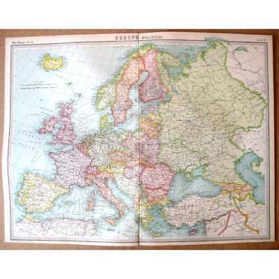
$9.93 Shipping Location: GLASGOW, United Kingdom This Auction is for an Unframed MODERN REPRINT of an Antique Map as detailed below. This map is reproduced on specially coated. Matte finish, paper for ... moresharper print quality and colors that are vivid. These maps are created from VERY high resolution uncompressed TIFF files(averaging 200+ megabytes) and are much sharper that the image shown here. Approximate Image Size 16.5 X 21.5 inches, Original Atlas Title Mapping of the world. The Edinburgh Geographical Institute. John Bartholomew& Son, Ltd. The Times" atlas. London: The Times, 1922) WE HAVE MANY HISTORIC REPRINT MAPS AND OTHER ITEMS ON MANY DIFFERENT SUBJECTS Please check out store for additonal products NO ADDITIONAL SHIPPING ON MULTIBLE ITEM ORDERS-FREE SHIPPING BY MAIL(GENERALLY 2 TO 5 DAY DELIVERY) FOR ANY NUMBER OF MAPS SHIPPED IN THE US. SHIPPING IS $15 FOR THE FIRST AND $1 FOR EACH FOR ADDTIONAL MAPS TO ANYWHERE ELSE IN THE WORLD. WE SHIP ALL MAPS ROLLED IN A MAILING TUBE TO PROTECT THE MAP. IF YOU ARE UNHAPPY WITH YOUR PURCHASE SIMPLY RETURN IT AND WE WILL REFUND YOUR MONEY. Ad copyright 2013 All Rights Reserved Powered by The free listing tool. List your items fast and easy and manage your active items.
Buy It Now
$4.95 Shipping Location: Willow Grove, United States This is an ORIGINAL INDIANA State map taken from a 1942 atlas. There is a map image and text on the reverse side of this map page.
Buy It Now
$5.95 Shipping Location: Phoenix, United States Headline prohibition new 1933 12 x 18.
Buy It Now
$5.95 Shipping Condition: New Location: Las Vegas, United States A beautiful map of the history of the New York City area. Commissioned in 1932 by the National City Bank of New York, this brightly colored map highlights ... morekey historical events and locations that took place in and around New York City, including Manhattan, Bronx, Queens, and Brooklyn.
Buy It Now
$4.95 Shipping Location: Willow Grove, United States This is an ORIGINAL Italy map taken from a 1945 atlas. There is text and a map on the reverse side of this map page.
Buy It Now
$4.00 Shipping Location: Harborton, United States Art by Jacques Liozu. The map features sketches of people, boats, industry, buildings and more.

Buy It Now
$3.99 Shipping Location: Spokane, United States MAPS COLLECTION PENNSYLVANIA VINTAGE PANORAMIC MAP COLLECTION 207 MAPS IN JPEG FORMAT ON 1 DVD-ROM The panoramic map was a popular cartographic form used ... moreto depict U.S. and Canadian cities and towns during the late nineteenth and early twentieth centuries. Known also as bird's-eye views. Perspective maps, and aero views, panoramic maps are non photographic representations of cities portrayed as if viewed from above at an oblique angle. Although not generally drawn to scale, they show street patterns, individual buildings, and major landscape features in perspective. Victorian America's panoramic maps differ dramatically from the Renaissance city perspectives. The post-Civil War town views are more accurate and are drawn from a higher oblique angle. Small towns as well as major urban centers were portrayed. Panoramic mapping of urban centers was unique to North America in this era. Most panoramic maps were published independently. Not as plates in an atlas or in a descriptive geographical book. Preparation and sale of nineteenth-century panoramas were motivated by civic pride and the desire of the city fathers to encourage commercial growth. Many views were prepared for and endorsed by chambers of commerce and other civic organizations and were used as advertisements of a city's commercial and residential potential. HERE ARE INCLUDED HIGH DETAILED MAPS. SAMPLE BELOW HAS BEEN REDUCED IN SIZE SO THAT THE PAGE COULD LOAD IN A REASONABLE TIME. YOU WILL RECEIVE HIGH QUALITY JPEGS THAT ARE IN THE THOUSANDS OF PIXEL SIZES IN WIDTH AND HEIGHT AND AT 300 DPI. YOU CAN ZOOM IN AND FIND FINE DETAIL OF STREETS. HOUSES AND MORE. WE HAVE PAINSTAKINGLY RE-DIGITIZED THESE TO BRING OUT THE FULL BEAUTY AND DETAIL OF THESE MAPS. THIS GREAT COLLECTION INCLUDES 207 PENNSYLVANIA MAPS IN JPEG FORMAT RE-DIGITIZED FROM THE ORIGINALS. ALL FOR ONE LOW PRICE. THE LARGEST COLLECTION FOR SALE. COMPARE ANYWHERE. A WEALTH OF KNOWLEDGE AND HISTORY AT YOUR FINGERTIPS. GREAT FOR RESEARCH. JUST LOOK AT THE MAPS INCLUDED Alburtis Allentown
Buy It Now
Free Shipping Location: Monroeville, United States An ORIGINAL antique color map of the WESTERN HEMISPHERE published by George Cram for Gaylord Watson's ILLUSTRATED ATLAS of the WORLD. 1885. The continents ... moreare individually colored. The map measures 11 by 14 inches. Perfect for matting and framing. This ORIGINAL antique map is guaranteed over 120 years old. I do not sell reproductions. Discounted shipping too. NO international shipping! NO exceptions. I ship all items within 2 business days but the Post Office can sometimes be very slow delivering them. If there is a delay in your receiving an item please send me an email and I will track it down. I also have a 100% refund policy if you are unhappy with an item for ANY reason. Just email me I am very easy to work with. On Oct-19-07 at 13:06:06 PDT. Seller added the following information:
Buy It Now
$3.00 Shipping Location: Charlottesville, United States ANTIQUE MINIATURE TEXAS STATE MAP. This is an antique Texas map which was carefully removed from a very small atlas. Note there is unrelated text on the ... morereverse side.
Buy It Now
Free Shipping Location: Willow Grove, United States This map page was taken from a 1947 atlas. There is text and a map image on the reverse side of this map page.
Buy It Now
$5.95 Shipping Condition: New Location: Las Vegas, United States Year: 1867. Each of our prints are custom reproductions printed on 68lb Heavyweight Enhanced Matte Art Paper. These Historic Art Prints are suitable for ... moreframing, mounting or direct display on any wall!
Buy It Now
$6.05 Shipping Location: Salem, United States Vintage 1970’s Memorabilia with Maps And Postcards Of The Grand Canyon.
Buy It Now
$3.11 Shipping Location: HORNCASTLE, United Kingdom
Buy It Now
$3.11 Shipping Location: HORNCASTLE, United Kingdom
Buy It Now
$3.11 Shipping Location: HORNCASTLE, United Kingdom
Buy It Now
$16.70 Shipping Location: Dallas, United States Published by interior geological survey, Reston, Virginia 1980.
Buy It Now
$4.87 Shipping Location: Celina, United States See pictures, lots of wear to cover corners and edges, foxing and staining to pages, see pictures
Buy It Now
Free Shipping Location: Augusta, United States "AN AUTHENTIC ORIGINAL MAP NOT A REPRODUCTION".
|
|
|
|