|
|
Order by: Available to: This site contains affiliate links for which I may be compensated
|
Buy It Now
$14.60 Shipping Location: Port Jefferson, United States Along bottom of all except M7: Series M[1-7] - Hoffman-La Roche Inc., Nutley 10, N. J. M7 Typvs Orbis Terrarvm - bottom edge cut off where M7 identification ... morewould be. Included are 2 extra free copies, both with bottom edge cut off: M3 and M4.
Buy It Now
$6.90 Shipping Location: Clearlake, United States A New Map Of The World with Captain Cook's Tracks, his discoveries and those of the other circumnavigators Published in May 1794 By Laurie & Whittle Reprinted ... moreby Bruce McGaw Graphics 1992
Buy It Now
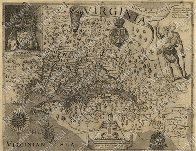
$10.75 Shipping Location: Carmel, United States GIANT VINTAGE 1607 historic JOHN SMITH VIRGINIA MAP OLD ANTIQUE STYLE art print THIS IS A GIANT HIGHLY DETAILED MAP OF VIRGINA AREA CIRCA 1607 THIS PRINT ... moreMEASURES 42"X 54" 107cm x137cm) THIS MAP HAS GREAT DETAIL SEE PHOTOS BELOW THIS IS A MODERN REPRINT PRINTED ON FINE MATTE PAPER This will be printed in its full aspect ratio on high quality paper. using ULTRACHROME K3 INKS which are rated up to 125+ years I do not use cheap inks that will fade in a few months very suitable for framing some images may have a thin white border THEARTTIST will not show up on your print PERFECT FOR YOUR HOME. OFFICE, GAME ROOM, MAN CAVE or GARAGE Thank you for looking. PLEASE FEEL FREE TO ASK QUESTIONS. THANKS. You may be interested in on eBay. THANKS FOR LOOKING Payment Instructions I accept PayPal for payment. I prefer PayPal. I require that payment be made within 3 days of the end of auction. Please Email me if you have any questions before you bid. Happy bidding! See PHOTO above to check EXACTLY what youre bidding on Feedback: I take pride in my feedback and strive for 5 Star Service. If you have a problem. Please email me before leaving bad feedback so that we can work something out. Shipping Instructions US Buyers: I use USPS Mail for most shipping needs- Purchases over $250 Will be sent with Signature Conformation International Buyers: International buyers If you need you can contact me prior to bidding to obtain a shipping quote. International buyers can choose how fast they wish delivery by USPS meaning Global Priority. Air Letter Post or Economy Letter Post. All of my shipping charges vary depending on the weight of the item. I will gladly combne Shipping with any of my other auction. drop me an email before bidding and I will try to respond within 24 hours. Important Notice to International Buyers Import duties. Taxes, and charges are not included in the item price or shipping cost. These charges are assessed and collected by your nation's government and are the buyer's responsibility. Please check with
Buy It Now
$14.95 Shipping Location: Trenton, United States Estate Find; Antique Wood frame encases this Road map from London to Oxford by John Ogilby. 1675. States"Reproduced from the original in the Rand ... moreMcNally& Company collection" Frame is dark wood and black 18" x 15" Beautiful piece of art and history. Frame does have some vintage marks. Check out pictures.
Buy It Now
$10.00 Shipping Location: Ukraine Southern Italy., 1581 (published). Hand Color. In 1547 he entered the Antwerp guild of St Luke as. mappemonde ", an eight-sheet map of the world. geographica ... more(issued by the Plantin press at Antwerp and republished as. ).
Buy It Now
$53.91 Shipping Location: Morganville, United States
Buy It Now
$15.23 Shipping Location: CLEVEDON, United Kingdom
Buy It Now
$10.75 Shipping Location: Carmel, United States THIS IS A GIANT AND HIGHLY DETAILED MAP OF PORTER COUNTY INDIANA CIRCA 1876. THIS MAP HAS GREAT DETAIL SEE PHOTO BELOW. THEARTTIST will not show up on ... moreyour print. I do not use cheap inks that will fade in a few months.
Buy It Now
$10.75 Shipping Location: Carmel, United States THIS IS A HUGE HIGHLY DETAILED MAP OF THE WORLD CIRCA 1589. I usually carry 3 sizes Large, Huge, and Giant. THIS WILL PRINTED ON FINE ART WATERCOLOR PAPER. ... moreTHIS MAP HAS GREAT DETAIL SEE PHOTO BELOW. THEARTTIST will not show up on your print.
Buy It Now
$60.90 Shipping Location: Simi Valley, United States Vintage Framed Gold Foil Blaeu Wall Map Willem Janszoon Wood frame 19x23.
Buy It Now
$22.37 Shipping Location: DEAL, United Kingdom Reproduction Map of Jerusalem circa 1650 by Thomas Fuller on Matt Poly Canvas size 17" x 17" including a 1" border.
Buy It Now
$5.35 Shipping Location: Saint Joseph, United States Gilbert Grosvenor, Editor. Holes in Folds and Rough Edges.
Buy It Now
$16.00 Shipping Location: Czech Republic
Buy It Now
$15.58 Shipping Location: Kyogle, Australia PRINTED ON 100% QUALITY SATIN PHOTO PAPER WITH AT LEAST AN EXTRA 1cm WHITE EDGE. Want this onto canvas ?. antique old map of the world. We use the best ... moreprinters for printing art and photography using 12 different inks.

Buy It Now
$20.94 Shipping Location: Rosny Park, Australia High Quality Giclee Art Print on Canvas Total Size including Border: 59.4cm x 48.4cm Border Size: 1cm around image. White Media: High Quality Cotton Canvas ... morePrint Quality: High resolution. Long lasting archival inks Our Digital Prints are high quality reproductions individually printed on special large format printers. These beautiful digital reproductions are virtually unparalleled in quality and range of colour and are at the leading edge of fine art printmaking. Our archival 10 colour pigment ink has a colour permanence rating in excess of 100 years(when properly cared for and displayed in acceptable lighting) This art print displays sharp. Vivid images with a high degree of colour accuracy. A member of the versatile family of art prints. This high quality reproduction represents the best of both worlds; quality and affordability. This beautiful reproduction can be printed on either an premium grade art paper(contact us immediately once purchased to specify art paper. Canvas is the default media) or canvas, the choice is yours. With brilliant colour and a high level of detail, our reproductions are an excellent option for the art lover. All of our canvas prints are sprayed with a UV varnish which will both enhance the print and also make it's life last longer. Need It In Another Size? Nearly all of our products are available in multiple size formats ranging from A4 to Giant(way beyond A1) Please contact us via email if you require a quote on a size to suit your needs. Alternatively you can check our eBay store for other sizes. Shipping and Packing Our products are delivered with a cellophane wrap and rolled into a secured tube or envelope(sandwiched between cardboard stiffeners to eliminate damage) Shipping is free within Australia. For international sales please contact us prior to purchase to arrange a quote for delivery.
Buy It Now
$50.01 Shipping Location: LEIGH, United Kingdom This antique reproduction lithographic map titled 'Orbis Terrarum Descriptio Duobis Planis Hemisphaeriis 1632' showcases a county map of the world from ... morethe period of 1600-1699. The map is a wall format and printed using the offset lithographic technique. This masterpiece is a perfect addition to any antique maps or globes collection and will surely impress any admirer of cartography. The map accurately depicts the world as it was known in the early 17th century and is a beautiful representation of the art and science of map-making.
Buy It Now
$10.75 Shipping Location: Carmel, United States CIRCA 1720. THIS IS A GIANT HIGHLY DETAILED MAP OF THE WORLD. I usually carry 3 sizes Large, Huge, and Giant. THIS WILL PRINTED ON FINE ART WATERCOLOR ... morePAPER. THIS MAP HAS GREAT DETAIL SEE PHOTO BELOW.
Buy It Now
$5.35 Shipping Location: Saint Joseph, United States
Buy It Now
$49.05 Shipping Location: MAIDSTONE, United Kingdom This vintage glass-framed print features a beautiful Blaeu wall map in stunning silver foil. The piece is a perfect addition to any antique collection, ... morewith a format that is both visually appealing and historically significant. Whether you're a map enthusiast or simply looking for a unique piece of decor, this print is sure to impress. Its fine details and quality craftsmanship make it a true gem, and the perfect conversation starter for any home or office. Add a touch of old-world charm to your space with this one-of-a-kind vintage print.
Buy It Now
$10.50 Shipping Location: Ferris, United States Old World Antique Map Reverse Glass Wooden Frame Art Wall Hanging. Shipped with USPS Parcel Select Ground.
Buy It Now
$46.91 Shipping Location: CANTERBURY, United Kingdom REPRODUCTION Antique County Map of Kent , England by John Speed . This is interesting map of KENT has been reproduced from a ORIGINAL 1610 Edition. The ... moreORIGINAL was hand coloured. Published on a good quality thin card ,suitable for mounting and framing. SIZE: 12 X 17INS. ROLLED AND SUPPLIED IN A CARDBOARD TUBE.
Buy It Now
$10.75 Shipping Location: Carmel, United States CIRCA 1771. THIS IS A GIANT HIGHLY DETAILED MAP OF. I usually carry 3 sizes Large, Huge, and Giant. THIS MAP HAS GREAT DETAIL SEE PHOTO BELOW. THEARTTIST ... morewill not show up on your print. This will be printed in its full aspect ratio on high quality paper.
Buy It Now
$10.75 Shipping Location: Carmel, United States THIS IS A GIANT AND HIGHLY DETAILED CIVIL WAR IMAGE OF RICHMOND VIRGINIA CIRCA 1863. This will be printed in its full aspect ratio on high quality paper. ... moreTHIS MAP HAS GREAT DETAIL SEE PHOTO BELOW. THEARTTIST will not show up on your print.
Buy It Now
$10.75 Shipping Location: Carmel, United States THIS IS A GIANT AND HIGHLY DETAILED LUNAR MAP OF THE MOON CIRCA 1880. 1880 EDITION. THIS FASCINATING MAP DEPICTS THE MOON. THIS MAP HAS GREAT DETAIL SEE ... morePHOTO BELOW. THEARTTIST will not show up on your print.
Buy It Now
$122.15 Shipping Location: Palm Bay, United States VINTAGE FRAMED OLD WORLD MAP PUZZLE 36x18 inch COLLECTIBLE WALL ART. Shipped with USPS Priority Mail. In great condition. Very sturdy frame. Dont know ... moreage or history but it appears to be old. My guess the map might be 1970s-1990s. The date on the back is 7/10. So i dont know if it was assemble in 2010 or August 10th of a certain year. All the pieces are intact. The bottom center piece is the only piece that looks loose( pictured). A broderview brand puzzle. There is writing on the back that says "Completed by Colin Steppic And Grandpa 7/10". Please view the photo gallery to appreciate. Thanks for looking

Buy It Now
Free Shipping Location: Fairlee, United States THIS UNIQUE MAP OF BOSTON IS LARGE. APPROX. 37-1/2" X 28" AND HAS BEEN FOLDED IN ITS ENVELOPE FOR MANY YEARS. IT IS SIGNED COPYRIGHT 1926 BY ... moreHOUGHTON MIFFLIN COMPANY ALL RIGHT RESERVED" THE ENVELOPE IS WORN, WEATHERED AND TORN, BUT STILL INTACT, AND THE MAP IS IN VERY GOOD CONDITION WITH AGE APPROPRIATE WEAR AND WEATHERING AROUND THE EDGES INCLUDING A FEW SMALL TEARS AND LIGHT WEAR IN THE CREASES WHERE IT HAS BEEN FOLDED. IT IS STILL INTACT AND I DO NOT SEE ANY TEARS, STAINS OR HOLES IN THE BODY OF THE MAP. IT IS MADE OF PAPER AND BECAUSE OF ITS AGE I CONSIDER IT VERY FRAGILE. IT IS VERY NICELY DESIGNED, WITH WONDERFUL, DETAILED AND COLORFUL ARTWORK. THANKS FOR LOOKING. PLEASE EMAIL WITH ANY QUESTIONS NOT ADDRESSED BY THE PHOTOS AND TEXT BEFORE PLACING A BID. BUYER TO PAY FOR SHIPPING, AND INSURANCE IS REQUIRED. PAYMENT IS DUE WITHIN 3 DAYS. I SHIP PRIORITY MAIL BECAUSE IT IS SAFER, FASTER, AND THE BOX IS FREE. EBAY SHIPPING CALCULATOR IS NOT ALLOWING FOR INSURANCE SO PLEASE WAIT FOR MY INVOICE BEFORE MAKING PAYMENT. SORRY, I DO NOT SHIP INTERNATIONAL.
Buy It Now
$10.75 Shipping Location: Carmel, United States CIRCA 1755. THE BRITISH COLONIES IN. THIS IS A HUGE HIGHLY DETAILED MAP OF. I usually carry 3 sizes Large, Huge, and Giant. THIS MAP HAS GREAT DETAIL ... moreSEE PHOTO BELOW. A COLONIAL ERA MAP. THEARTTIST will not show up on your print.
Buy It Now
$15.23 Shipping Location: CLEVEDON, United Kingdom
Buy It Now
$6.95 Shipping Location: Arlington, United States A New Map of Germanie Color Godfery Richard Robert Greene Reproduction Map. I will work hard to make sure you are satisfied and you can always start a ... morecase if you are not happy with my response.
Buy It Now
$6.95 Shipping Location: Carmel, United States THIS IS A LARGE AND HIGHLY DETAILEDASTRONOMICAL AND COSMOGRAPHICAL CHART BY M. VUILLEMIN CIRCA 1852. THIS CHART HAS GREAT DETAIL SEE PHOTO BELOW. PREPARED ... moreBY M. VUILLEMIN AND J. G. BARBIE DU BOCAGE. THIS WILL PRINTED ON FINE ART WATERCOLOR PAPER.
Buy It Now
$7.96 Shipping Location: Carmel, United States A Brockhaus. There are for insets of important lunar craters, the Gutenberg group, the Julius Caesar Group, the Plate Crater, and the Guericke, Parry, ... moreBonpland and Fra. Mauro cluster. Other craters and seas on the moons surface are clearly labeled.
Buy It Now
$10.75 Shipping Location: Carmel, United States PRINTED ON BLACK IN A BLUEPRINT STYLE. CIRCA 1910. THE CITY OF NEW YORK. THIS MAP HAS GREAT DETAIL SEE PHOTO BELOW. THIS IS A LARGE AND HIGHLY DETAILED ... moreMAP OF. THIS WILL PRINTED ON FINE ART WATERCOLOR PAPER.

Buy It Now
$20.94 Shipping Location: Rosny Park, Australia High Quality Giclee Art Print on Canvas Total Size including Border: 59.4cm x 48.3cm Border Size: 1cm around image. White Media: High Quality Cotton Canvas ... morePrint Quality: High resolution. Long lasting archival inks Our Digital Prints are high quality reproductions individually printed on special large format printers. These beautiful digital reproductions are virtually unparalleled in quality and range of colour and are at the leading edge of fine art printmaking. Our archival 10 colour pigment ink has a colour permanence rating in excess of 100 years(when properly cared for and displayed in acceptable lighting) This art print displays sharp. Vivid images with a high degree of colour accuracy. A member of the versatile family of art prints. This high quality reproduction represents the best of both worlds; quality and affordability. This beautiful reproduction can be printed on either an premium grade art paper(contact us immediately once purchased to specify art paper. Canvas is the default media) or canvas, the choice is yours. With brilliant colour and a high level of detail, our reproductions are an excellent option for the art lover. All of our canvas prints are sprayed with a UV varnish which will both enhance the print and also make it's life last longer. Need It In Another Size? Nearly all of our products are available in multiple size formats ranging from A4 to Giant(way beyond A1) Please contact us via email if you require a quote on a size to suit your needs. Alternatively you can check our eBay store for other sizes. Shipping and Packing Our products are delivered with a cellophane wrap and rolled into a secured tube or envelope(sandwiched between cardboard stiffeners to eliminate damage) Shipping is free within Australia. For international sales please contact us prior to purchase to arrange a quote for delivery.

Buy It Now
$10.75 Shipping Location: Carmel, United States HUGE VINTAGE historical EAST BOSTON MASS 1879 OLD ANTIQUE STYLE MAP art print THIS IS A HUGE AND HIGHLY DETAILED MAP OF BOSTON MASS CIRCA 1879 THIS PRINT ... moreMEASURES 35"X 43" 89cm x 109cm) THIS MAP HAS GREAT DETAIL SEE PHOTOS BELOW Fine Art Giclee(not a laser print) THIS IS A MODERN REPRINT PRINTED ON FINE ART PAPER not a second or third generation print This will be printed in its full aspect ratio on high quality paper. using ULTRACHROME K3 INKS which are rated up to 125+ years I do not use cheap inks that will fade in a few months very suitable for framing some images may have a thin white border THEARTTIST will not show up on your print PERFECT FOR YOUR HOME. OFFICE, GAME ROOM, MAN CAVE or GARAGE Thank you for looking. PLEASE FEEL FREE TO ASK QUESTIONS. THANKS. You may be interested in on eBay. THANKS FOR LOOKING Payment Instructions I accept PayPal for payment. I prefer PayPal. I require that payment be made within 3 days of the end of auction. Please Email me if you have any questions before you bid. Happy bidding! See PHOTO above to check EXACTLY what youre bidding on Feedback: I take pride in my feedback and strive for 5 Star Service. If you have a problem. Please email me before leaving bad feedback so that we can work something out. Shipping Instructions US Buyers: I use USPS Mail for most shipping needs- Purchases over $250 Will be sent with Signature Conformation International Buyers: International buyers If you need you can contact me prior to bidding to obtain a shipping quote. International buyers can choose how fast they wish delivery by USPS meaning Global Priority. Air Letter Post or Economy Letter Post. All of my shipping charges vary depending on the weight of the item. I will gladly combne Shipping with any of my other auction. drop me an email before bidding and I will try to respond within 24 hours. Important Notice to International Buyers Import duties. Taxes, and charges are not included in the item price or shipping cost. These charges are assessed and collected by your nation'
Buy It Now
$10.75 Shipping Location: Carmel, United States THIS IS A LARGE HIGHLY DETAILED MAP OF THE WORLD CIRCA 1589. I usually carry 3 sizes Large, Huge, and Giant. THIS WILL PRINTED ON FINE ART WATERCOLOR ... morePAPER. THIS MAP HAS GREAT DETAIL SEE PHOTO BELOW. THEARTTIST will not show up on your print.
Buy It Now
$43.09 Shipping Location: SKIPTON, United Kingdom 24 pages
Buy It Now
$4.28 Shipping Location: Houston, United States
Buy It Now
$22.00 Shipping Location: Ferris, United States This exquisite piece of art is a must-have for collectors and enthusiasts of novelty maps. The wall map comes in a wooden frame and features an Old World ... moreAntique design that is both intricate and captivating. The map is a contemporary reproduction with unknown origins, adding to its allure and mystery. Ideal for decorating any space, it is sure to impress guests and spark conversations. Purchase this unique piece today and elevate your home decor.
Buy It Now
$10.75 Shipping Location: Carmel, United States CIRCA 1755. THE BRITISH COLONIES IN. I usually carry 3 sizes Large, Huge, and Giant. THIS IS A LARGE HIGHLY DETAILED MAP OF. THIS MAP HAS GREAT DETAIL ... moreSEE PHOTO BELOW. A COLONIAL ERA MAP. THEARTTIST will not show up on your print.
Buy It Now
$5.95 Shipping Location: Jacksonville, United States
Buy It Now
$25.00 Shipping Location: Murrieta, United States This vintage reproduction wall map by Willem Blaeu is a stunning addition to any collection. The map measures 30.5\" x 26.5\" and features beautiful gold ... morefoil detailing. Created in 1647, this world atlas map is a perfect representation of the time period from 1960-1980. The vintage frame adds an extra touch of authenticity to this already unique piece. Ideal for antique enthusiasts or anyone looking for a beautiful and historical wall decoration.
Buy It Now
Free Shipping Location: United States 1705 Vintage Paris Map Old world style Style historic old world Map A city plan of Paris France Street map Fine Art Print WALL Poster\nThis is a Highly ... moredetailed map of Paris France Circa 1705THIS MAP HAS GREAT DETAIL SEE PHOTOS P A P E R \nArchival quality Ultrasmooth fine art matte paper 250gsm.\n\n I N K\nGiclee print with Epson Ultrachrome inks that will last up to 108 years indoors. S I Z E\nYou can choose Your preferred size in listing size menu\n11" x 14" / 28 x 36 cm\n16" x 20" / 40 x 50 cm\n18" x 24" / 50 x 61 cm\n24" x 30"/ 61" x 76"cm\n30" x 40" / 76 x 101 cm\n36" x 48" / 91 x 122 cm\n42" x 50" / 109 x 142 cmThis Fine Art Print has been reproduced from the original source .
Buy It Now
$20.94 Shipping Location: Rosny Park, Australia This art print displays sharp, vivid images with a high degree of colour accuracy. With brilliant colour and a high level of detail, our reproductions ... moreare an excellent option for the art lover. Nearly all of our products are available in multiple size formats ranging from A4 to Giant (way beyond A1).
Buy It Now
$3.99 Shipping Location: Chandler, United States 23" x 18" reproduction map, especially reproduced for KLM Royal Dutch Airlines. Good condition.
Buy It Now
$20.94 Shipping Location: Rosny Park, Australia This art print displays sharp, vivid images with a high degree of colour accuracy. With brilliant colour and a high level of detail, our reproductions ... moreare an excellent option for the art lover. Nearly all of our products are available in multiple size formats ranging from A4 to Giant (way beyond A1).
Buy It Now
$10.75 Shipping Location: Carmel, United States THIS IS A LARGE AND HIGHLY DETAILED MAP OF PARIS FRANCE CIRCA 1736. THIS IS A MODERN REPRINT PRINTED ON FINE MATTE PAPER. THIS MAP HAS GREAT DETAIL SEE ... morePHOTOS BELOW. This will be printed in its full aspect ratio on high quality paper.
Buy It Now
$10.75 Shipping Location: Carmel, United States THIS IS A LARGE AND HIGHLY DETAILED MAP OF PARIS FRANCE CIRCA 1705. PLAN DE PARIS. THIS IS A MODERN REPRINT PRINTED ON FINE MATTE PAPER. THIS MAP HAS ... moreGREAT DETAIL SEE PHOTOS BELOW. THEARTTIST will not show up on your print.
Buy It Now
$12.43 Shipping Location: DEAL, United Kingdom PLANISPHAERI COELESTE REPRODUCTION MAP. This map has signs of ageing and other marks associated with its age and adds to the overall appearance of the ... moremap. Reproduction Antique Map first published in 1670 by the.
Buy It Now
$45.93 Shipping Location: STAFFORD, United Kingdom And Docklands Light Railway. 2005 Map of Londons Curvy Underground ( The Tube ). From an original 2005 illustration by J. Roberts. Overall size 13.9"x ... more9.". ( 33.5 x 23 cm ). A very collectable reproduction on card of the.

Buy It Now
$10.75 Shipping Location: Carmel, United States VINTAGE PANORAMIC 1912 KNICKERBOCKER BEER NEW YORK CITY BIRD'S EYE VIEW WALL MAP THIS IS A HIGHLY DETAILED MAP OF NEW YORK CITY. NY ISSUED BY KNICKERBOCKER ... moreBEER 1912 THIS PRINT MEASURES 18"X 24" 46cm x 61cm) THIS MAP HAS GREAT DETAIL SEE PHOTOS BELOW Fine Art Giclee(not a laser print) THIS IS A MODERN REPRINT PRINTED ON FINE ART PAPER not a second or third generation print This will be printed in its full aspect ratio on high quality paper. using ULTRACHROME K3 INKS which are rated up to 125+ years I do not use cheap inks that will fade in a few months very suitable for framing some images may have a thin white border THEARTTIST will not show up on your print PERFECT FOR YOUR HOME. OFFICE, GAME ROOM, MAN CAVE or GARAGE Thank you for looking. PLEASE FEEL FREE TO ASK QUESTIONS. THANKS. You may be interested in on eBay. THANKS FOR LOOKING Payment Instructions I accept PayPal for payment. I prefer PayPal. I require that payment be made within 3 days of the end of auction. Please Email me if you have any questions before you bid. Happy bidding! See PHOTO above to check EXACTLY what youre bidding on Feedback: I take pride in my feedback and strive for 5 Star Service. If you have a problem. Please email me before leaving bad feedback so that we can work something out. Shipping Instructions US Buyers: I use USPS Mail for most shipping needs- Purchases over $250 Will be sent with Signature Conformation International Buyers: International buyers If you need you can contact me prior to bidding to obtain a shipping quote. International buyers can choose how fast they wish delivery by USPS meaning Global Priority. Air Letter Post or Economy Letter Post. All of my shipping charges vary depending on the weight of the item. I will gladly combne Shipping with any of my other auction. drop me an email before bidding and I will try to respond within 24 hours. Important Notice to International Buyers Import duties. Taxes, and charges are not included in the item price or shipping cost. These charges are assessed and co
Buy It Now
$20.94 Shipping Location: Rosny Park, Australia This art print displays sharp, vivid images with a high degree of colour accuracy. With brilliant colour and a high level of detail, our reproductions ... moreare an excellent option for the art lover. Nearly all of our products are available in multiple size formats ranging from A4 to Giant (way beyond A1).
Buy It Now
Free Shipping Location: South China, United States Get Supersized Images & Free Image Hosting.
Buy It Now
$20.94 Shipping Location: Rosny Park, Australia Our Digital Prints are high quality reproductions individually printed on special large format printers. These beautiful digital reproductions are virtually ... moreunparalleled in quality and range of colour and are at the leading edge of fine art printmaking.
Buy It Now
$40.45 Shipping Location: Carpentersville, United States BLAEU WALL MAP Gold Foil New Old World Framed Nautical Exploration Vtg Wall Art. Fram has some wear. Comes as pictured. Measures 26.25" x 30.25" Displays ... moreGreat.
Buy It Now
$10.75 Shipping Location: Carmel, United States THIS IS A LARGE AND HIGHLY DETAILED MAP OF PARIS FRANCE CIRCA 1550. This MAP is a modern reprint and will be printed in its full aspect ratio on high ... morequality matte paper. THIS IS A MODERN REPRINT PRINTED ON FINE MATTE PAPER.
Buy It Now
$10.75 Shipping Location: Carmel, United States THIS IS A LARGE AND HIGHLY DETAILED MAP OF PARIS FRANCE CIRCA 1550. This MAP is a modern reprint and will be printed in its full aspect ratio on high ... morequality matte paper. THIS IS A MODERN REPRINT PRINTED ON FINE MATTE PAPER.
Buy It Now
$18.18 Shipping Location: Kyogle, Australia PRINTED ON 100% QUALITY SATIN PHOTO PAPER WITH AT LEAST AN EXTRA 1cm WHITE EDGE. Want this onto canvas ?. antique old map of the world. We use the best ... moreprinters for printing art and photography using 12 different inks.
Buy It Now
$20.94 Shipping Location: Rosny Park, Australia Our Digital Prints are high quality reproductions individually printed on special large format printers. These beautiful digital reproductions are virtually ... moreunparalleled in quality and range of colour and are at the leading edge of fine art printmaking.

Buy It Now
$25.00 Shipping Location: Portland, United States Pretty vintage foil foil world map(reproduction? Overall measurement including frame is approximately 14 x 16" Double matted in a navy blue and rusty ... moreburgundy maroon. Wood frame in decent vintage condition. Some bubbling to the print. From what I can tell, or it could be an optical illusion? Nice piece. PLEASE READ! About Me: I only offer things that I love and would buy. Use, or display myself, and I want my buyers to be delighted with all purchases, big or small. I like the quirky, the kitsch, the mod, retro and vintage.generally anything I find cool or interesting, or sometimes simply nostalgic. I do this“for fun” not as a regular job, so please understand that I am not an expert! I do my best to thoroughly research everything before listing, but I'm not perfect. If you have ANY questions or concerns, please contact me prior to purchasing. My items: I check over my items thoroughly and try and list any unusual imperfections. Please view all of the pictures provided along with the written description for the best results. Feel free to ask any questions or for more pictures! That being said. Nearly ALL ITEMS ARE VINTAGE! This means they are USED. And thus show signs of use, generally speaking. I will not add every little TYPICAL sign of use in the listing. If there is a defect or a break, chip, crack, etc. I do my very best to describe it and/or detail it in the photos. If I missed something it is certainly not intentional, so please let me know ASAP. Purchasing or Making an Offer and Payment: I know you want a deal! I try and research all of my items to ensure I am not charging an unreasonable amount. In fact. I err on the side of caution and try and list my items for LESS than the comparable items. Therefore. While I am happy to receive REASONABLE offers, my idea of reasonable is NOT 50% of the asking price. Once you've purchased your item. Please pay within 3 business days via Paypal, or let me know if you need a little extra time. We all do at some point and I am happy to accommodate. Please
Buy It Now
$15.58 Shipping Location: Kyogle, Australia Want this onto canvas ?. PRINTED ON 100% QUALITY SATIN PHOTO PAPER WITH AT LEAST AN EXTRA 1cm WHITE EDGE. modern map of the world. We use the best printers ... morefor printing art and photography using 12 different inks.
|
|
|
|
1858 map of Rindge New Hampshire published in 1981
In 1981 a company named Old Maps carefully reproduced the 1858 map of Cheshire County New Hampshire on a fine quality stock of paper. The size of the map is about 14x17 inches. This is how that town was laid out just prior to the Civil War. The original map was wall sized and very large. This is likely the first printing of the individual town format. The map shows the location of homes. Buildings and businesses and lists the old family names. This is a great source of information for genealogy research. If your family lived here in 1858, it is likely your family name should be on this map. It was made from a portion of the Cheshire County wall map dated 1858. The map was published by Smith and Morley of Philadelphia and was based on an actual survey by L. Fagan. We normally ship maps in a tube via US postal service in a shipping tube. Should ... moreyou purchase more than one map. We will not charge any more for shipping than the 1st initial shipping fee. Powered by The free listing tool. List your items fast and easy and manage your active items.
|
|
|
DURAND, GAINES, BYRON, LENNON, MICHIGAN, TOPO 1922 MAP
DURAND. GAINES, BYRON, LENNON, MICHIGAN, TOPO 1922 MAP Shipping Info | Business Policies | Also Available Description crystal clear. And is in mint condition! Shipping Info Business Policies Also Available g.RcmdId ViewItemDescV4,RlogId p4%60bo7%60jtb9%3Fuk%601d72f%2Bjw%60hquvg%3Eg-13f24e12139-0xf3-
|
|
|
ELKINS, BEVERLY, COALTON, WEST VIRGINIA, 1907 TOPO MAP
ELKINS. BEVERLY, COALTON, WEST VIRGINIA, 1907 TOPO MAP Shipping Info | Business Policies | Also Available Description loaded with the locations of dozens of old schools! Other locations of interest include Stonecoal School. Goff School, Kaufman Church, Roaring Creek Junction, Claylick School, Riverdale School, Canfield School, Arnold Hill, Lick Church, Hazelwood School, Pleasant View School, Elkhorn School, Valley Bend, Wilson School, Valley Bend Church, Glade Run School, Thomas School, Burnt Bridge, Mt. Vernon School, Roaring Creek, Rich Mountain School, Tyre School, and many many more! Of particular interest are the 1900 railroad lay-outs(the Western Maryland Railroad- Durbin Branch, the Western Maryland Railroad- Belington Branch, the Western Maryland Railroad- Huttonsville Branch, and the Coal and Coke Railroad- North Division) Listed ... moreas the WEST VIRGINIA- ELKINS QUADRANGLE. This is an authentic 1907 survey(edition of May 1909) U.S.G.S. Topographical Map reproduced in black and white and distributed by the Midcontinent Map Company until my father bought them out back in the mid'80s. These maps are not available anywhere else! If you are a serious relic hunter these maps can be invaluable! Shows the individual buildings, all roads, railways, and the topography of the land at the time of the survey. Shows towns that no longer exist and the then current layout of all creeks and waterways. A great tool for locating ghost towns and Civil War campsites! Actual map size is 16 5/8" X 20 1/8" with viewable portion being 13 3/4" X 17 1/2" The scale is 1/62500 which is approximately 1 mile equals 1 inch. Has a map company stamp in the border. This map is a more modern copy, is crystal clear. And is in mint condition! Covers latitude 38 degrees 45' to 39 degrees 00' and longitude 79 degrees 45' to 80 degrees 00' Covers the northwest quadrant of the 30 minute Beverly quadrangle which I also have listed. I do not have any other adjoining quadrangles available for this map at this tim
|
|
|
Historical Maps of ISRAEL Antique Judaica Poster Reprints (3) - 1586, 1663, 1750
Historical Maps of ISRAEL Antique Judaica Poster Reprints(3) 1586. 1663, 1750 Sports Poster Warehouse Item#AAC-ISRAELTRIO Description*NOTE: We will end all auctions early as soon as a minimum bid is placed(kind of like"Buy It Now" but you need to wait for us to close the auction for you) We offer UNLIMITED COMBINED SHIPPING on all items! View our full selection of thousands of posters. Prints, pennants and banners and SAVE BIG on shipping! To take advantage of combined shipping, do not make your payment until you receive a COMBINED INVOICE from us sometime in the subsequent hours) Add a beautiful dose of artistic. Historic, political and spiritual significance to your walls with these vintage classic maps of The Holy Land! Reproduced to perfection from original source maps(the originals are worth tens of thousands of dollars each) ... morethis poster combo features three spectacular maps of Israel from the late Renaissance and early Enlightenment eras of Europe. First, Types of Geography and Famous Places in the Kingdom of Judah and Israel, dated 1586, and credited to the Royal Geographer of Belgium Abraham Ortelius. With text in Latin, it displays the Mediterranean coast from Sidon in the North to Rhinocorura in the South, with the political borders of the lands of Galilee, Samaria, and Judea, and the natural mountainous barriers that separated the lands of the Jewish tribes from the lands of the Arabs. Second, The Promised Land for the Sons of Israel, credited to Nicolaus Vilscher of Amsterdam circa 1663, a Dutch map that situates West at the top as it charts the tribal territories of the Jews, and includes countless biblical details including the path of the 40-year Exodus from Rameses to the Land of Milk and Honey, and accurate illustrations of the Holy Temple in Jerusalem and the Ark of the Covenant. Third, Judea or The Holy Land, Divided into the Twelve Tribes, credited to the Royal Geographer of France, Sir Robert de Vaugondy, with an inset view of the ancient"Land of Canaan, The Land Promis
|
|
|
DRUMMOND, HASKELL, COLOMA, MONTANA, 1919 TOPO MAP
DRUMMOND. HASKELL, COLOMA, MONTANA, 1919 TOPO MAP Shipping Info | Business Policies | Also Available Description crystal clear. And is in mint condition! Shipping Info Business Policies Also Available
|
|
|
Vintage Binghamton NY map 1882 Reproduced 1958
This is nice in a little rough shape. Reproduced for Broome County Historical Society 1958. BID NOW SO YOU DON'T FORGET LATER. I also own a retail store so if the item sells it is pulled from ebay and vice-versa. Will upgrade shipping if you need this item by a certain date.just ask!Please pay within 7 days! Please leave me feedback. I do charge about.75 extra to cover expenses. Such as paper, ink, bubble wrap, gas and such. Will gladly combined shipping! Thanks so much for looking! I can be reached at 607-205-4905, 607-687-0278 if you have any questions or concerns. I do not accept returns because I try to take great pictures and disclose any or all issues,however I do stand by what I sell so if I missed something please feel free to contact me before leaving feedback.Check out my!Be sure to add me to your!
|
|
|
TROUT RUN, WILLIAMSPORT, PENNSYLVANIA 1921 TOPO MAP
TROUT RUN. WILLIAMSPORT, PENNSYLVANIA 1921 TOPO MAP Shipping Info | Business Policies | Also Available Description crystal clear. And is in mint condition! Covers latitude 41 degrees 15' to 41 degrees 30' and longitude 77 degrees 00' to 77 degrees 15' Adjoins the Blossburg quadrangle(north) The Warrensville quadrangle(east) the Milton quadrangle(southeast) the Williamsport quadrangle(south) the Lock Haven quadrangle(southwest) and the Waterville quadrangle(west) which I also have listed!EM Shipping Info Business Policies Also Available
|
|
|
SANTA FE, TESUQUE, PECOS, NEW MEXICO, 1889 TOPO MAP
SANTA FE. TESUQUE, PECOS, NEW MEXICO, 1889 TOPO MAP Shipping Info | Business Policies | Also Available Description Old Fort Marcy.Sangre De Cristo Mountains, Baldy Peak, Pena Oscura Hill, Monument Rock, Thompson Peak, Atalaya Mountain, Escobas Peak, Artesian Well, Arroyo Alamos, Gonzales Ranch and more! Of particular interest are the 1889 railroad lay-outs(the Santa Fe Southern Railroad and the Santa Fe Branch of the Atchison, Topeka and Santa Fe Railroad) Listed as the NEW MEXICO- SANTA FE SHEET. This is an authentic 1889 survey U.S.G.S. Topographical Map reproduced in black and white and distributed by the Midcontinent Map Company until my father bought out their inventory back in the mid'80s. These maps are not available anywhere else! If you are a serious relic hunter these maps can be invaluable! Also shows all individual buildings, ... moreroads, railways and the topography of the land at the time of the survey. Shows towns that no longer exist and the then current layout of all creeks and waterways. A great tool for locating ghost towns and Civil War campsites! Actual size of map is 17" X 21" with viewable portion being 14 3/8" X 17 1/2" The scale is 1/125000 which is approximately 1 mile to the half-inch This map is a more modern copy, is crystal clear. And is in mint condition! Shipping Info Business Policies Also Available
|
|
|
TILDEN, ALEXANDER, FRANKLIN, HENRY TEXAS, 1930 TOPO MAP
TILDEN. ALEXANDER, FRANKLIN, HENRY TEXAS, 1930 TOPO MAP Shipping Info | Business Policies | Also Available Description crystal clear. And is in mint condition! Covers latitude 28 degrees 15' to 28 degrees 30' and longitude 98 degrees 30' to 98 degrees 45' Fits between the Mikeska quadrangle(east and southeast) and Fowlerton quadrangle(west) which I also have listed. Shipping Info Business Policies Also Available
|
|
|
DENVER, GOLDEN, MELVIN, COLORADO, 1888 TOPO MAP
DENVER. GOLDEN, MELVIN, COLORADO, 1888 TOPO MAP Shipping Info | Business Policies | Also Available Description This is a special double-sized map. Actual map size is 33" X 20 1/2" with viewable portion being 27 1/4" X 17 1/2" The scale is 1/125000 which is approximately 1 mile equals 1/2 inch. A small portion of the west side of this map is blank. This map is a more modern copy. Is crystal clear and is in mint condition! Shipping Info Business Policies Also Available
|
|
|
BARREDA, OLMITO, CRIGLER, KRETSTON TEXAS, 1936 TOPO MAP
BARREDA. OLMITO, CRIGLER, KRETSTON TEXAS, 1936 TOPO MAP Shipping Info | Business Policies | Also Available Description crystal clear. And is in mint condition! Shipping Info Business Policies Also Available
|
|
|
SALINEVILLE, BERGHOLZ, NORRISTOWN, OHIO, 1905 TOPO MAP
SALINEVILLE. BERGHOLZ, NORRISTOWN, OHIO, 1905 TOPO MAP Shipping Info | Business Policies | Also Available Description crystal clear. And is in mint condition! Shipping Info Business Policies Also Available
|
|
|
LONDONDERRY, PERU, WINHALL STA., VERMONT 1892 TOPO MAP
LONDONDERRY. PERU, WINHALL STA. VERMONT 1892 TOPO MAP Shipping Info | Business Policies | Also Available Description Covers latitude 43 degrees 00' to 43 degrees 15' and longitude 72 degrees 45' to 73 degrees 00' I do not have any adjoining quadrangles at this time. This map is a more modern copy. Is crystal clear and is in mint condition! Shipping Info Business Policies Also Available
|
|
|
BANNISTER, LOUISIANA, 1935 TOPO MAP
BANNISTER. LOUISIANA, 1935 TOPO MAP Shipping Info | Business Policies | Also Available Description crystal clear. And is in mint condition! Shipping Info Business Policies Also Available
|
|
|
SAN JUAN, PHARR, MCALLEN, DONNA, TEXAS, 1914 TOPO MAP
SAN JUAN. PHARR, MCALLEN, DONNA, TEXAS, 1914 TOPO MAP Shipping Info | Business Policies | Also Available Description crystal clear. And is in mint condition! Shipping Info Business Policies Also Available
|
|
|
MILLIKENS BEND, ASHLEY, BARNES, LOUISIANA 1909 TOPO MAP
MILLIKENS BEND. ASHLEY, BARNES, LOUISIANA 1909 TOPO MAP Shipping Info | Business Policies | Also Available Description crystal clear. And is in mint condition! Shipping Info Business Policies Also Available e5b.RcmdId ViewItemDescV4,RlogId p4%60bo7%60jtb9%3Fuk.rp*b7g%3Ee5b-13f24e120d6-0xe2-
|
|
|
LEHIGH, DAYTON, COALVILLE, HARCOURT IOWA, 1921 TOPO MAP
LEHIGH. DAYTON, COALVILLE, HARCOURT IOWA, 1921 TOPO MAP Shipping Info | Business Policies | Also Available Description Covers latitude 42 degrees 15' to 42 degrees 30' and longitude 94 degrees 00' to 94 degrees 15' I do not have any adjoining quadrangles available for this map at this time. Map has Earth Sciences Department Western Connecticut State College stamped in a margin. This map is a more modern copy. Is crystal clear. And is in mint condition! Shipping Info Business Policies Also Available
|
|
|
HUGE BRASS ARMILLARY SPHERE globe, UNIVERSAL WORLD GLOBE 18"
HUGE BRASS ARMILLARY SPHERE globe. UNIVERSAL WORLD GLOBE 18" Item Description. THIS ARMILLARY SHPERE IS MAFE OF SOLID BRASS WITH WOOD BASE NICE NAUTICAL DECOR COLLECTION FOR GRAB An armillary sphere(variations are known as spherical astrolabe. Armilla. Or armil) is a model of the CELESTIAL SPHERE. Made of solid cast brass rings in antique look. The dimensions of this armillary is 18" tall, 9 inches base diameter, The larger rim of the armillary sphere marked This heavy brass armillary is mounted on the beautiful rosewood base. base is covered with felt. This beautiful armillary globe made of solid brass. compass is fitted on the base. ITEM NOT SOLD AS AN ANTIQUE PLEASE FEEL FREE TO CONTACT US FOR MORE DETAIL we are not responsible for any custom/duty. buyers are responsible for custom/duty. THANK YOU. GREAT GIFTS FOR LOVERS. About ... moreOur Armillary Sphere. We are one of the leading manufacturers and exporters of Armillay Sapheres globes. Which are available at client friendly prices to our clients. These products are available in different designs. Sizes, shapes, patterns as well as hardness and we offer these products for different applications. Our products are widely known for their easy usage and these products are available with best quality as well as fine finishes in the competitive market. Payment method. We accept only PayPal. Shipping Details. WE SHIP WORLD WIDE. PLEASE CONTACT US FOR MORE SHIPPING DETAILS. ITEMS SHIP THROUGH FedEx. TNT, Aramex, Air mail. By Maritimeantique Thank You For visit.
|
|
|
REHOBOTH BEACH, BETHANY BEACH, DELAWARE, 1938 TOPO MAP
REHOBOTH BEACH. BETHANY BEACH, DELAWARE, 1938 TOPO MAP Shipping Info | Business Policies | Also Available Description crystal clear. And is in mint condition! Covers latitude 38 degrees 30' to 38 degrees 45' and longitude 75 degrees 00' to 75 degrees 15' Adjoins the Cape Henlopen quadrangle(north) which I also have listed at this time. Shipping Info Business Policies Also Available
|
|
|
1858 map Gilsum, And Marlow NH 1981 printing
Detail of town centers. gilsum. Marlow and PAper Mill Village. In 1981 a company named Old Maps carefully reproduced the 1858 map of Cheshire County New Hampshire on a fine quality stock of paper. The size of the map is about 14x17 inches. This is how that town was laid out just prior to the Civil War. The original map was wall sized and very large. This is likely the first printing of the individual town format. The map shows the location of homes. Buildings and businesses and lists the old family names. This is a great source of information for genealogy research. If your family lived here in 1858, it is likely your family name should be on this map. It was made from a portion of the Cheshire County wall map dated 1858. The map was published by Smith and Morley of Philadelphia and was based on an actual survey by L. Fagan. We normally ship ... moremaps in a tube via US postal service in a shipping tube. Should you purchase more than one map. We will not charge any more for shipping than the 1st initial shipping fee. Powered by The free listing tool. List your items fast and easy and manage your active items. RcmdId ViewItemDescV4,RlogId p4%60bo7%60jtb9%3Fuk.rp*05e54c%3E-13f251bde2b-0xef-
|
|
|
1858 map of Westmorland NH later printing, with extra
Includes map of Westmorland to the town Limits. Has been folded in center. Half sheet with detail of the town center. In 1981 a company named Old Maps carefully reproduced the 1858 map of Cheshire County New Hampshire on a fine quality stock of paper. The size of the map is about 14x17 inches. This is how that town was laid out just prior to the Civil War. The original map was wall sized and very large. This is likely the first printing of the individual town format. The map shows the location of homes. Buildings and businesses and lists the old family names. This is a great source of information for genealogy research. If your family lived here in 1858, it is likely your family name should be on this map. It was made from a portion of the Cheshire County wall map dated 1858. The map was published by Smith and Morley of Philadelphia and was ... morebased on an actual survey by L. Fagan. We normally ship maps in a tube via US postal service in a shipping tube. Should you purchase more than one map. We will not charge any more for shipping than the 1st initial shipping fee. Powered by The free listing tool. List your items fast and easy and manage your active items.
|
|
|
1858 map of Hinsdale NH later printing, with extras
Includes map of Hinsdale to the City Limits. Detail of the center of Hinsdale on a half sheet. In 1981 a company named Old Maps carefully reproduced the 1858 map of Cheshire County New Hampshire on a fine quality stock of paper. The size of the map is about 14x17 inches. This is how that town was laid out just prior to the Civil War. The original map was wall sized and very large. This is likely the first printing of the individual town format. The map shows the location of homes. Buildings and businesses and lists the old family names. This is a great source of information for genealogy research. If your family lived here in 1858, it is likely your family name should be on this map. It was made from a portion of the Cheshire County wall map dated 1858. The map was published by Smith and Morley of Philadelphia and was based on an actual survey ... moreby L. Fagan. We normally ship maps in a tube via US postal service in a shipping tube. Should you purchase more than one map. We will not charge any more for shipping than the 1st initial shipping fee. Powered by The free listing tool. List your items fast and easy and manage your active items.
|
|
|
GOLDEN, COLORADO, 1944 TOPO MAP
GOLDEN. COLORADO, 1944 TOPO MAP Shipping Info | Business Policies | Also Available Description This map is a more modern copy. Is crystal clear and is in mint condition! Shipping Info Business Policies Also Available
|
|
|
LIMERICK, RICHMOND HILL BURROUGHS GEORGIA 1948 TOPO MAP
LIMERICK. RICHMOND HILL BURROUGHS GEORGIA 1948 TOPO MAP Shipping Info | Business Policies | Also Available Description crystal clear. And is in mint condition! Covers latitude 31 degrees 45' to 32 degrees 00' and longitude 81 degrees 15' to 81 degrees 30' Adjoins the Hinesville quadrangle(west) And the Pembroke quadrangle(northwest) which I also have listed. Shipping Info Business Policies Also Available
|
|
|
GRAYLAND, WASHINGTON, 1939 TOPO MAP
GRAYLAND. WASHINGTON, 1939 TOPO MAP Shipping Info | Business Policies | Also Available Description crystal clear. And is in mint condition! Shipping Info Business Policies Also Available
|
|
|
*Vintage New York City Map* - Fifth Ward - Thirteen Election Districts* Map
Vintage New York City-Fifth Ward- Thirteen Election Districts Map- New York City-Hudson street. Broadway, Church, Chambers, Greenwich, Franklin, Canal Street-See Pictures for more details-Beautiful New York City Fifth Ward Map-Measures 33 1/2 inches X 22 inches-Nice Vintage Map-Comes sent rolled up- Would look great framed. Condition:Nice overall for an old nyc map. Has some tears, small rips- See pictures above
|
|
|
PARSONS, KANSAS, 1884 TOPO MAP
PARSONS. KANSAS, 1884 TOPO MAP Shipping Info | Business Policies | Also Available Description not show the individual buildings and schools as most of my maps do. It does show all roads. Waterways and the topography of the land at the time of the survey. Other points of interest are Pumpkin Creek, Snow Creek, Cherry Creek and etc. Of particular importance are the 1884 railroad lay-outs(the Missouri, Kansas and Texas Railroad, the Kansas City, Fort Scott and Memphis Railroad, the Parsons and Pacific Railroad and the St. Louis and San Fransisco Railroad) This map is listed as the KANSAS- PARSONS SHEET. This is an authentic 1884 U.S.G.S. Topographical Map reproduced and distributed by the Midcontinent Map Company until my father bought out their inventory back in the mid'80s. These maps are not available anywhere else! If you are a serious ... morerelic hunter these maps can be invaluable! Map shows every building present when the map was surveyed! Also shows all roads, railways and the topography of the land at the time of the survey. Shows towns that no longer exist and the then current layout of all creeks and waterways. A great tool for locating ghost towns and Civil War campsites! Actual size of map is 17" X 22" with viewable portion being 14" X 17 1/2" The scale is 1/125000 which is approximately 1 mile per half-inch. Fits between the Iola quadrangle(north) The Joplin quadrangle(east) the Vinita quadrangle(south) and the Independence quadrangle(west) which I also have listed! This map is a more modern copy and is in mint condition with the following exception: there is minor tape damage on the original vellum(visible in picture) Shipping Info Business Policies Also Available
|
|
|
BELOIT, KANSAS, 1953 TOPO MAP
BELOIT. KANSAS, 1953 TOPO MAP Shipping Info | Business Policies | Also Available Description Be sure to see the 1891 Beloit. Kansas, 30-minute map which I also have listed! This map is a more modern copy. Is crystal clear. And is in mint condition! Shipping Info Business Policies Also Available
|
|
|
BRACKETT, LAGUNA, CARBONDALE, TEXAS, 1895 TOPO MAP
BRACKETT. LAGUNA, CARBONDALE, TEXAS, 1895 TOPO MAP Shipping Info | Business Policies | Also Available Description Fits between the Nueces quadrangle(north) and the Uvalde quadrangle(east) which I also have listed! This map is a more modern copy. Is crystal clear and is in mint condition! Shipping Info Business Policies Also Available
|
|
|
SPRINGHOPE, HUNTS, BUNN, NORTH CAROLINA, 1902 TOPO MAP
SPRINGHOPE. HUNTS, BUNN, NORTH CAROLINA, 1902 TOPO MAP Shipping Info | Business Policies | Also Available Description crystal clear. And is in mint condition! Covers latitude 35 degrees 45' to 36 degrees 00' and longitude 78 degrees 00' to 78 degrees 15' Fits west of the Rocky Mount quadrangle which I also have listed. Shipping Info Business Policies Also Available
|
|
|
CANAJOHARIE, ST. JOHNSVILLE, NEW YORK, 1898 TOPO MAP
CANAJOHARIE. ST. JOHNSVILLE, NEW YORK, 1898 TOPO MAP Shipping Info | Business Policies | Also Available Description crystal clear. And is in mint condition! Shipping Info Business Policies Also Available
|
|
|
IOWA PARK, WICHITA COUNTY, TEXAS, 1916 TOPO MAP
IOWA PARK. WICHITA COUNTY, TEXAS, 1916 TOPO MAP Shipping Info | Business Policies | Also Available Description crystal clear. And is in mint condition! Covers latitude 33 degrees 52' 30" to 34 degrees 00' and longitude 98 degrees 37' 30" to 98 degrees 45' Fits between the Clara quadrangle(north) The Burkburnett quadrangle(northeast) the West Wichita Falls quadrangle(east) the Fowlkes quadrangle(west) and the Barwise School quadrangle(northwest) which I also have listed. This map is included in the Wichita County 8-map set which is listed in my Ebay Store! Shipping Info Business Policies Also Available k5n.RcmdId ViewItemDescV4,RlogId p4%60bo7%60jtb9%3Fuk%601d72f%2B26rkpg%7C%3Ek5n-13f3362bb83-0xfa-
|
|
|
SAN CARLOS, NEWMAN SPRING, TEXAS, 1895 TOPO MAP
SAN CARLOS. NEWMAN SPRING, TEXAS, 1895 TOPO MAP Shipping Info | Business Policies | Also Available Description not show the individual buildings and schools like most of my maps do. It does show all roads. Railways and the topography of the land at the time of the survey. Shows towns that no longer exist and the then current layout of all creeks and waterways. A great tool for locating ghost towns and military campsites! Actual size of map is 17" X 22" with viewable portion being 15 1/8" X 17 1/2" The scale is 1/125000 which is approximately 1 mile = 1/2 inch. This map is a more modern copy, is crystal clear. And is in mint condition! Shipping Info Business Policies Also Available
|
|
|
GIANT VINTAGE HISTORIC 1689 OLD WORLD COPPER PLATE MAP ANTIQUE STYLE ART PRINT
GIANT VINTAGE HISTORIC 1689 OLD WORLD COPPER PLATE MAP ANTIQUE STYLE ART PRINT THIS IS A GIANT AND HIGHLY DETAILED OLD WORLD MAP FROM AMSTERDAM CIRCA 1689 THIS PRINT MEASURES 38"X 112" 97cm x 78cm) THIS MAP HAS GREAT DETAIL SEE PHOTOS BELOW THIS IS A MODERN REPRINT PRINTED ON FINE MATTE PAPER This will be printed in its full aspect ratio on high quality paper. using ULTRACHROME K3 INKS which are rated up to 125+ years I do not use cheap inks that will fade in a few months very suitable for framing some images may have a thin white border THEARTTIST will not show up on your print WANT IT LARGER JUST EMAIL US PERFECT FOR YOUR HOME. OFFICE OR GAME ROOM Thank you for looking. PLEASE FEEL FREE TO ASK QUESTIONS. THANKS. You may be interested in on eBay. THANKS FOR LOOKING Payment Instructions I accept PayPal for payment. I prefer PayPal. ... moreI require that payment be made within 3 days of the end of auction. Please Email me if you have any questions before you bid. Happy bidding! See PHOTO above to check EXACTLY what youre bidding on Feedback: I take pride in my feedback and strive for 5 Star Service. If you have a problem. Please email me before leaving bad feedback so that we can work something out. Shipping Instructions US Buyers: I use USPS Mail for most shipping needs- Purchases over $250 Will be sent with Signature Conformation International Buyers: International buyers If you need you can contact me prior to bidding to obtain a shipping quote. International buyers can choose how fast they wish delivery by USPS meaning Global Priority. Air Letter Post or Economy Letter Post. All of my shipping charges vary depending on the weight of the item. I will gladly combne Shipping with any of my other auction. drop me an email before bidding and I will try to respond within 24 hours. Important Notice to International Buyers Import duties. Taxes, and charges are not included in the item price or shipping cost. These charges are assessed and collected by your nation's government and are the buyer's responsibil
|
|
|
GIANT VINTAGE ARTIC NORTH POLE ANTIQUE Frederick de Wit STYLE MAP WHALING SCENES
GIANT VINTAGE ARTIC NORTH POLE ANTIQUE Frederick de Wit STYLE MAP WHALING SCENES THIS IS A GIANT AND HIGHLY DETAILED MAP OF VINTAGE ARTIC NORTH POLE Frederick de Wit MAP FROM 1676 IT HAS WONDERFUL WHALING SCENES ON THE OUTER EDGES THIS PRINT MEASURES 37"X 42" 94cm x 107cm) THIS MAP HAS GREAT DETAIL SEE PHOTOS BELOW THIS IS A MODERN REPRINT PRINTED ON SMOOTH FINE ART PAPER This will be printed in its full aspect ratio on high quality paper. using ULTRACHROME K3 INKS which are rated up to 125+ years I do not use cheap inks that will fade in a few months very suitable for framing some images may have a thin white border THEARTTIST will not show up on your print WANT IT LARGER JUST EMAIL US PERFECT FOR YOUR HOME. OFFICE OR GAME ROOM Thank you for looking. PLEASE FEEL FREE TO ASK QUESTIONS. THANKS. You may be interested in on eBay. THANKS ... moreFOR LOOKING Payment Instructions I accept PayPal for payment. I prefer PayPal. I require that payment be made within 3 days of the end of auction. Please Email me if you have any questions before you bid. Happy bidding! See PHOTO above to check EXACTLY what youre bidding on Feedback: I take pride in my feedback and strive for 5 Star Service. If you have a problem. Please email me before leaving bad feedback so that we can work something out. Shipping Instructions US Buyers: I use USPS Mail for most shipping needs- Purchases over $250 Will be sent with Signature Conformation International Buyers: International buyers If you need you can contact me prior to bidding to obtain a shipping quote. International buyers can choose how fast they wish delivery by USPS meaning Global Priority. Air Letter Post or Economy Letter Post. All of my shipping charges vary depending on the weight of the item. I will gladly combne Shipping with any of my other auction. drop me an email before bidding and I will try to respond within 24 hours. Important Notice to International Buyers Import duties. Taxes, and charges are not included in the item price or shipping cost. These charges are assessed
|
|
|
HUGE VINTAGE ARTIC NORTH POLE ANTIQUE Frederick de Wit STYLE MAP WHALING SCENES
HUGE VINTAGE ARTIC NORTH POLE ANTIQUE Frederick de Wit STYLE MAP WHALING SCENES THIS IS A HUGE AND HIGHLY DETAILED MAP OF VINTAGE ARTIC NORTH POLE Frederick de Wit MAP FROM 1676 IT HAS WONDERFUL WHALING SCENES ON THE OUTER EDGES THIS PRINT MEASURES 36"X 31" 92cm x 79cm) THIS MAP HAS GREAT DETAIL SEE PHOTOS BELOW THIS IS A MODERN REPRINT PRINTED ON SMOOTH FINE ART PAPER This will be printed in its full aspect ratio on high quality paper. using ULTRACHROME K3 INKS which are rated up to 125+ years I do not use cheap inks that will fade in a few months very suitable for framing some images may have a thin white border THEARTTIST will not show up on your print WANT IT LARGER JUST EMAIL US PERFECT FOR YOUR HOME. OFFICE OR GAME ROOM Thank you for looking. PLEASE FEEL FREE TO ASK QUESTIONS. THANKS. You may be interested in on eBay. THANKS ... moreFOR LOOKING Payment Instructions I accept PayPal for payment. I prefer PayPal. I require that payment be made within 3 days of the end of auction. Please Email me if you have any questions before you bid. Happy bidding! See PHOTO above to check EXACTLY what youre bidding on Feedback: I take pride in my feedback and strive for 5 Star Service. If you have a problem. Please email me before leaving bad feedback so that we can work something out. Shipping Instructions US Buyers: I use USPS Mail for most shipping needs- Purchases over $250 Will be sent with Signature Conformation International Buyers: International buyers If you need you can contact me prior to bidding to obtain a shipping quote. International buyers can choose how fast they wish delivery by USPS meaning Global Priority. Air Letter Post or Economy Letter Post. All of my shipping charges vary depending on the weight of the item. I will gladly combne Shipping with any of my other auction. drop me an email before bidding and I will try to respond within 24 hours. Important Notice to International Buyers Import duties. Taxes, and charges are not included in the item price or shipping cost. These charges are assessed and
|
|
|
HUGE VINTAGE HISTORIC 1689 OLD WORLD COPPER PLATE MAP ANTIQUE STYLE ART PRINT
HUGE VINTAGE HISTORIC 1689 OLD WORLD COPPER PLATE MAP ANTIQUE STYLE ART PRINT THIS IS A HUGE AND HIGHLY DETAILED OLD WORLD MAP FROM AMSTERDAM CIRCA 1689 THIS PRINT MEASURES 36"X 31.5" 92cm x 78cm) THIS MAP HAS GREAT DETAIL SEE PHOTOS BELOW THIS IS A MODERN REPRINT PRINTED ON FINE MATTE PAPER This will be printed in its full aspect ratio on high quality paper. using ULTRACHROME K3 INKS which are rated up to 125+ years I do not use cheap inks that will fade in a few months very suitable for framing some images may have a thin white border THEARTTIST will not show up on your print WANT IT LARGER JUST EMAIL US PERFECT FOR YOUR HOME. OFFICE OR GAME ROOM Thank you for looking. PLEASE FEEL FREE TO ASK QUESTIONS. THANKS. You may be interested in on eBay. THANKS FOR LOOKING Payment Instructions I accept PayPal for payment. I prefer PayPal. ... moreI require that payment be made within 3 days of the end of auction. Please Email me if you have any questions before you bid. Happy bidding! See PHOTO above to check EXACTLY what youre bidding on Feedback: I take pride in my feedback and strive for 5 Star Service. If you have a problem. Please email me before leaving bad feedback so that we can work something out. Shipping Instructions US Buyers: I use USPS Mail for most shipping needs- Purchases over $250 Will be sent with Signature Conformation International Buyers: International buyers If you need you can contact me prior to bidding to obtain a shipping quote. International buyers can choose how fast they wish delivery by USPS meaning Global Priority. Air Letter Post or Economy Letter Post. All of my shipping charges vary depending on the weight of the item. I will gladly combne Shipping with any of my other auction. drop me an email before bidding and I will try to respond within 24 hours. Important Notice to International Buyers Import duties. Taxes, and charges are not included in the item price or shipping cost. These charges are assessed and collected by your nation's government and are the buyer's responsibili
|
|
|
KANSAS CITY, MISSOURI, 1957 TOPO MAP
KANSAS CITY. MISSOURI, 1957 TOPO MAP Shipping Info | Business Policies | Also Available Description crystal clear. And is in mint condition! Shipping Info Business Policies Also Available
|
|
|
BRECKENRIDGE, YANCEYVILLE, CADDO, TEXAS, 1888 TOPO MAP
BRECKENRIDGE. YANCEYVILLE, CADDO, TEXAS, 1888 TOPO MAP Shipping Info | Business Policies | Also Available Description not show the buildings and schools as most of my maps do. It does show all roads. Railways and the topography of the land at the time of the survey. Shows towns that no longer exist and the then current layout of all creeks and waterways. A great tool for locating ghost towns and Civil War campsites! Actual size of map is 17" X 22" with viewable portion being 14 3/4" X 17 1/2" The scale is 1/125000 which is approximately 1 mile to the half-inch. This map is a more modern copy, is crystal clear and is in mint condition! Shipping Info Business Policies Also Available
|
|
|
SPRINGVILLE, UTAH, 1948 TOPO MAP
SPRINGVILLE. UTAH, 1948 TOPO MAP Shipping Info | Business Policies | Also Available Description crystal clear. And is in mint condition! Covers latitude 40 degrees 07' 30" to 40 degrees 15' and longitude 111 degrees 30' to 111 degrees 37' 30" Fits between the Spanish Fork quadrangle(southwest) and the Provo quadrangle(west) which I also have listed. Shipping Info Business Policies Also Available
|
|
|
WINTON, AHOSKIE, NORTH CAROLINA, 1906 TOPO MAP
WINTON. AHOSKIE, NORTH CAROLINA, 1906 TOPO MAP Shipping Info | Business Policies | Also Available Description Covers latitude 36 degrees 15' to 36 degrees 30' and longitude 76 degrees 45' to 77 degrees 00' Map has Earth Sciences Department Western Connecticut State College stamped in a margin. This map is a more modern copy. Is crystal clear. And is in mint condition! Shipping Info Business Policies Also Available
|
|
|
SHEFFIELD, MASSACHUSETTS - CT - N7, 1885 TOPO MAP
SHEFFIELD. MASSACHUSETTS- CT- N7, 1885 TOPO MAP Shipping Info | Business Policies | Also Available Description crystal clear. And is in mint condition! Covers latitude 42 degrees 00' to 42 degrees 15' and longitude 73 degrees 15' to 73 degrees 30' I also have listed the following adjoining quadrangle: Pittsfield(north) EM Shipping Info Business Policies Also Available
|
|
|
FULTON, MISSOURI, 1887 TOPO MAP
FULTON. MISSOURI, 1887 TOPO MAP Shipping Info | Business Policies | Also Available Description not show the individual buildings like most of my maps do. It does show all roads. Schools, railways and the topography of the land at the time of the survey. Shows towns that no longer exist and the then current layout of all creeks and waterways. A great tool for locating ghost towns and Civil War campsites! Actual size of map is 17" X 24" with viewable portion being 13 3/4" X 17 1/2" The scale is 1/125000 which is approximately 1 mile equals one half-inch. Fits between the Mexico quadrangle(north) The Hermann quadrangle(east) and the Jefferson City quadrangle(west) which I also have listed! This map is a more modern copy. Is crystal clear, and is in mint condition! Shipping Info Business Policies Also Available e5b.RcmdId ... moreViewItemDescV4,RlogId p4%60bo7%60jtb9%3Fuk.rp*b7g%3Ee5b-13f34bf9ff5-0xec-
|
|
|
SHAWNEE, INDIAN TERRITORY, 1906 TOPO MAP
SHAWNEE. INDIAN TERRITORY, 1906 TOPO MAP Shipping Info | Business Policies | Also Available Description Fits between the Chandler quadrangle(north) The Maud quadrangle(south) and the McLoud quadrangle(west) which I also have listed. This map is a more modern copy. Is crystal clear and is in mint condition! Shipping Info Business Policies Also Available
|
|
|
APPLING, LOCO, HOGAN CORNER, GEORGIA 1919 TOPO MAP
APPLING. LOCO, HOGAN CORNER, GEORGIA 1919 TOPO MAP Shipping Info | Business Policies | Also Available Description crystal clear. And is in mint condition! Covers latitude 33 degrees 30' to 33 degrees 45' and longitude 82 degrees 15' to 82 degrees 30' I do not have any adjoining quadrangles for this map at this time. Shipping Info Business Policies Also Available
|
|
|
EDGEHILL, MISSOURI, 1924 TOPO MAP
EDGEHILL. MISSOURI, 1924 TOPO MAP Shipping Info | Business Policies | Also Available Description Fits between the Potosi quadrangle(north) which I also have listed! This map is a more modern copy. Is crystal clear. And is in mint condition! Shipping Info Business Policies Also Available
|
|
|
WOOSTER, SMITHVILLE, STERLING, OHIO, 1901 TOPO MAP
WOOSTER. SMITHVILLE, STERLING, OHIO, 1901 TOPO MAP Shipping Info | Business Policies | Also Available Description crystal clear. And is in mint condition! Shipping Info Business Policies Also Available
|
|
|
Orbis terra compendiosa descriptio ex old map from a book? Nice map
Older looking map I found at a sale. I don't know much about it. it is worn around the edges and has a creases down the middle. So its not it perfect condition by any means but it would look beautiful in a frame on the wall. It measures 20.5" by 14.25 any questions please ask! Posted with
|
|
|
DAVID CITY, BELLWOOD, DWIGHT, NEBRASKA 1895 TOPO MAP
DAVID CITY. BELLWOOD, DWIGHT, NEBRASKA 1895 TOPO MAP Shipping Info | Business Policies | Also Available Description crystal clear. And is in mint condition! Shipping Info Business Policies Also Available
|
|
|
DELPHOS, OTTOVILLE, MIDDLEPOINT, OHIO, 1942 TOPO MAP
DELPHOS. OTTOVILLE, MIDDLEPOINT, OHIO, 1942 TOPO MAP Shipping Info | Business Policies | Also Available Description crystal clear. And is in mint condition! Shipping Info Business Policies Also Available
|
|
|
CAMEL MOUNTAIN, ARENA MALPAIS NEW MEXICO 1917 TOPO MAP
CAMEL MOUNTAIN. ARENA MALPAIS NEW MEXICO 1917 TOPO MAP Shipping Info | Business Policies | Also Available Description crystal clear and is in mint condition! Shipping Info Business Policies Also Available
|
|
|
OLIVE HILL, CLARK HILL, LAWTON, KENTUCKY, 1950 TOPO MAP
OLIVE HILL. CLARK HILL, LAWTON, KENTUCKY, 1950 TOPO MAP Shipping Info | Business Policies | Also Available Description crystal clear. And is in mint condition! Shipping Info Business Policies Also Available
|
|
|
BERMUDA, LOUISIANA, 1937 TOPO MAP
BERMUDA. LOUISIANA, 1937 TOPO MAP Shipping Info | Business Policies | Also Available Description This map is a more modern copy. Is crystal clear. And is in mint condition! Shipping Info Business Policies Also Available
|
|
|
STOCKTON, UTAH, 1955 TOPO MAP
STOCKTON. UTAH, 1955 TOPO MAP Shipping Info | Business Policies | Also Available Description crystal clear. And is in mint condition! Shipping Info Business Policies Also Available
|
|
|
WATERVILLE, ENGLISH CENTER, PENNSYLVANIA 1937 TOPO MAP
WATERVILLE. ENGLISH CENTER, PENNSYLVANIA 1937 TOPO MAP Shipping Info | Business Policies | Also Available Description crystal clear. And is in mint condition! Covers latitude 41 degrees 15' to 41 degrees 30' and longitude 77 degrees 15' to 77 degrees 30' Fits between the Blossburg quadrangle(northeast) The Trout Run quadrangle(east) the Williamsport quadrangle(southeast) the Lock Haven quadrangle(south) and the Howard quadrangle(southwest) which I also have listed! Shipping Info Business Policies Also Available
|
|
|
LYONS, KANSAS, 1889 TOPO MAP
LYONS. KANSAS, 1889 TOPO MAP Shipping Info | Business Policies | Also Available Description Fits south of the Ellsworth Quadrangle which I also have listed! This particular map is a more modern copy. Is crystal clear. And is in mint condition! Shipping Info Business Policies Also Available
|
|
|
SWANTON, WHITEHOUSE, FRANKFORT, OHIO, 1937 TOPO MAP
SWANTON. WHITEHOUSE, FRANKFORT, OHIO, 1937 TOPO MAP Shipping Info | Business Policies | Also Available Description crystal clear. And is in mint condition! Shipping Info Business Policies Also Available
|
|
|
ANIMAS PEAK, NEW MEXICO, 1918 TOPO MAP
ANIMAS PEAK. NEW MEXICO, 1918 TOPO MAP Shipping Info | Business Policies | Also Available Description crystal clear. And is in mint condition! Shipping Info Business Policies Also Available
|
|
|
NEW HAVEN, WALLINGFORD, CONNECTICUT, 1890 TOPO MAP
NEW HAVEN. WALLINGFORD, CONNECTICUT, 1890 TOPO MAP Shipping Info | Business Policies | Also Available Description Fort Hale. Fort Wooster, Rabbit Rock. Mt. Sanford, West Rock Ridge, and many many more! Of particular interest are the 1890 railroad lay-outs(the New York, New Haven, and Hartford Railroad- Northhampton Division, the New York, New Haven, and Hartford Railroad- Shore Line Division, and the New York, New Haven, and Hartford Railroad- Air Line Division) Listed as the CONNECTICUT- NEW HAVEN SHEET. This is an authentic 1890 survey(edition of August 1892, reprinted in 1924) U.S.G.S. Topographical Map reproduced in black and white and distributed by the Midcontinent Map Company until my father bought them out back in the mid'80s. These maps are not available anywhere else! If you are a serious relic hunter these maps can be invaluable! ... moreShows the individual buildings, all roads, railways, and the topography of the land at the time of the survey. Shows towns that no longer exist and the then current layout of all creeks and waterways. A great tool for locating ghost towns and Civil War campsites! Actual map size is 16 1/2" X 21" with viewable portion being 13 1/4" X 19" The scale is 1/62500 which is approximately 1 mile equals 1 inch. Has a university stamp in the margin. This map is a more modern copy, is crystal clear. And is in mint condition! Covers latitude 41 degrees 15' to 41 degrees 30' and longitude 72 degrees 45' to 73 degrees 00' Fits south of the Meriden quadrangle which I also have listed! Shipping Info Business Policies Also Available
|
|
|
c1912 map: Railroads, United States & Canada Canadian Pacific Railway and connec
Map Description: c1912 map Canadian Pacific Railway and connecting lines/ Canadian Pacific Railway. Railroads United States Maps. Railroads Canada Maps. United States. Size: Approximately 2 foot x 18 inches. 61cm x 46cm) Close up of Map Quality: If you're not happy with the map when it arrives. Return it with no questions asked for a full refund of purchase price + S/H! This Map is an Archival Quality Reproduction created directly from the original map using archival inks rated not to fade for 200+ years on premium thick semi matte paper. Actual Map is sharper and much more detailed than image shown. The resolution is of the highest quality. Frame not included. Shipping: Tracking Number& Insurance: included for free for all domestic orders! Packaging: heavy duty poster tube. Combined shipping is free for each additional Map paid for ... moreat the same time. International shipping: only $7.99 no matter how many Maps! END FOOTER/
|
|
|
c1902 Map of Buffalo, Erie Co., New York Buffalo, Erie Co., N.Y. Includes illus.
Map Description: c1902 Buffalo. Erie Co. N.Y. Includes illus. and index to points of interest. Buffalo(N.Y. Aerial views. Cartographer: Landis& Alsop. Size: Approximately 2 foot x 18 inches. 61cm x 46cm) Close up of Map Quality: If you're not happy with the map when it arrives. Return it with no questions asked for a full refund of purchase price + S/H! This Map is an Archival Quality Reproduction created directly from the original map using archival inks rated not to fade for 200+ years on premium thick semi matte paper. Actual Map is sharper and much more detailed than image shown. The resolution is of the highest quality. Frame not included. Shipping: Tracking Number& Insurance: included for free for all domestic orders! Packaging: heavy duty poster tube. Combined shipping is free for each additional Map paid for at the same ... moretime. International shipping: only $7.99 no matter how many Maps! END FOOTER/
|
|
|
c1922 Birds eye map of Monroe, New York Aero-view of Monroe, New York 1923. Orie
Map Description: c1922 Aero-view of Monroe. New York 1923. Oriented with north toward the lower left. Includes text, directory, and location diagram. Cartographer: Hughes& Bailey. Size: Approximately 2 foot x 18 inches. 61cm x 46cm) Close up of Map Quality: If you're not happy with the map when it arrives. Return it with no questions asked for a full refund of purchase price + S/H! This Map is an Archival Quality Reproduction created directly from the original map using archival inks rated not to fade for 200+ years on premium thick semi matte paper. Actual Map is sharper and much more detailed than image shown. The resolution is of the highest quality. Frame not included. Shipping: Tracking Number& Insurance: included for free for all domestic orders! Packaging: heavy duty poster tube. Combined shipping is free for each additional ... moreMap paid for at the same time. International shipping: only $7.99 no matter how many Maps! END FOOTER/
|
|
|
c1918 map: Roads, United States General of transcontinental routes with principa
Map Description: c1918 map General map of transcontinental routes with principal connections. Shows symbols and routes of named highways and trails: Lincoln Highway. National Old Trails Road, Dixie Highway, Pikes Pk. Ocean Ocean Hwy. Yellowstone Trail, Atlantic Highway, Pacific Highway, Meridian Road, Midland Trail, Arrowhead Trail, King of Trails, National Park Park Hwy. Bankhead Highway, Southern National Hwy. Jefferson Highway, Jackson Highway, Old Spanish Trail, Dixie Overland. Relief shown by hachures and spot heights. Roads United States Maps. Size: Approximately 2 foot x 18 inches. 61cm x 46cm) Close up of Map Quality: If you're not happy with the map when it arrives. Return it with no questions asked for a full refund of purchase price + S/H! This Map is an Archival Quality Reproduction created directly from the original map using ... morearchival inks rated not to fade for 200+ years on premium thick semi matte paper. Actual Map is sharper and much more detailed than image shown. The resolution is of the highest quality. Frame not included. Shipping: Tracking Number& Insurance: included for free for all domestic orders! Packaging: heavy duty poster tube. Combined shipping is free for each additional Map paid for at the same time. International shipping: only $7.99 no matter how many Maps! END FOOTER/
|
|
|
c1898 Birds eye map of business district, Chicago Birds-eye-view of the business
Map Description: c1898 Birds-eye-view of the business district of Chicago. Indexed for points of interest. Central business districts. Illinois, Chicago, Maps. Cartographer: Poole Brothers. Size: Approximately 2 foot x 18 inches. 61cm x 46cm) Close up of Map Quality: If you're not happy with the map when it arrives. Return it with no questions asked for a full refund of purchase price + S/H! This Map is an Archival Quality Reproduction created directly from the original map using archival inks rated not to fade for 200+ years on premium thick semi matte paper. Actual Map is sharper and much more detailed than image shown. The resolution is of the highest quality. Frame not included. Shipping: Tracking Number& Insurance: included for free for all domestic orders! Packaging: heavy duty poster tube. Combined shipping is free for each ... moreadditional Map paid for at the same time. International shipping: only $7.99 no matter how many Maps! END FOOTER/
|
|
|
c1912 Asheville North Carolina, Bird's Eye Map Asheville, Buncombe Co. N.C. 1912
Map Description: c1912 map Asheville. Buncombe Co. N.C. 1912. Drawn by T. M. Fowler. Charles Hart, lithographer. Birds eye view. Size: Approximately 2 foot x 18 inches. 61cm x 46cm) Close up of Map Quality: If you're not happy with the map when it arrives. Return it with no questions asked for a full refund of purchase price + S/H! This Map is an Archival Quality Reproduction created directly from the original map using archival inks rated not to fade for 200+ years on premium thick semi matte paper. Actual Map is sharper and much more detailed than image shown. The resolution is of the highest quality. Frame not included. Shipping: Tracking Number& Insurance: included for free for all domestic orders! Packaging: heavy duty poster tube. Combined shipping is free for each additional Map paid for at the same time. International shipping: ... moreonly $7.99 no matter how many Maps! END FOOTER/
|
|
|
c1897 Philadelphia Naval Shipyard, Pennsylvania League Island U.S. Navy Yard Phi
Map Description: c1897 map League Island U.S. Navy Yard Philadelphia/ Webster& Hunter. Also shows warships. Horse drawn carriages, personal figures, and city skyline at horizon. Size: Approximately 2 foot x 18 inches. 61cm x 46cm) Close up of Map Quality: If you're not happy with the map when it arrives. Return it with no questions asked for a full refund of purchase price + S/H! This Map is an Archival Quality Reproduction created directly from the original map using archival inks rated not to fade for 200+ years on premium thick semi matte paper. Actual Map is sharper and much more detailed than image shown. The resolution is of the highest quality. Frame not included. Shipping: Tracking Number& Insurance: included for free for all domestic orders! Packaging: heavy duty poster tube. Combined shipping is free for each additional ... moreMap paid for at the same time. International shipping: only $7.99 no matter how many Maps! END FOOTER/
|
|
|
c1885 Map of Gouverneur, New York Gouverneur, N.Y. Published & drawn by L. R. Bu
Map Description: c1885 Gouverneur. N.Y. Published& drawn by L. R. Burleigh. Beck& Pauli, litho. Birds-eye-view. Includes index to points of interest and inset. Cartographer: Burleigh, L. R. Lucien R. 1853?1923. Size: Approximately 2 foot x 18 inches. 61cm x 46cm) Close up of Map Quality: If you're not happy with the map when it arrives. Return it with no questions asked for a full refund of purchase price + S/H! This Map is an Archival Quality Reproduction created directly from the original map using archival inks rated not to fade for 200+ years on premium thick semi matte paper. Actual Map is sharper and much more detailed than image shown. The resolution is of the highest quality. Frame not included. Shipping: Tracking Number& Insurance: included for free for all domestic orders! Packaging: heavy duty poster tube. Combined ... moreshipping is free for each additional Map paid for at the same time. International shipping: only $7.99 no matter how many Maps! END FOOTER/
|
|
|
1929 map: Indians of North America & South States Catawba deerskin "A map, somet
Map Description: 1929 map Catawba deerskin map"A map. Sometimes known as the Catawba Deerskin Map, describing the situation of the several nations of the Indians to the north west of South Carolina. This map describing the scituation sic of the several nations of Indians to the NW of South Carolina was coppyed sic from a draught drawn& painted on a deer skin by an Indian Cacique and presented to Francis Nicholson Esqr. Governor of South Carolina by whom it is most humbly dedicated to his Royal Highness George, Prince of Wales. Size: Approximately 2 foot x 18 inches. 61cm x 46cm) Close up of Map Quality: If you're not happy with the map when it arrives. Return it with no questions asked for a full refund of purchase price + S/H! This Map is an Archival Quality Reproduction created directly from the original map using archival ... moreinks rated not to fade for 200+ years on premium thick semi matte paper. Actual Map is sharper and much more detailed than image shown. The resolution is of the highest quality. Frame not included. Shipping: Tracking Number& Insurance: included for free for all domestic orders! Packaging: heavy duty poster tube. Combined shipping is free for each additional Map paid for at the same time. International shipping: only $7.99 no matter how many Maps! END FOOTER/
|
|
|
1924 map of Subways, New York, New York Routes of the Interborough Rapid Transit
Map Description: 1924 Routes of the Interborough Rapid Transit Company. Size: Approximately 2 foot x 18 inches. 61cm x 46cm) Close up of Map Quality: If you're not happy with the map when it arrives. Return it with no questions asked for a full refund of purchase price + S/H! This Map is an Archival Quality Reproduction created directly from the original map using archival inks rated not to fade for 200+ years on premium thick semi matte paper. Actual Map is sharper and much more detailed than image shown. The resolution is of the highest quality. Frame not included. Shipping: Tracking Number& Insurance: included for free for all domestic orders! Packaging: heavy duty poster tube. Combined shipping is free for each additional Map paid for at the same time. International shipping: only $7.99 no matter how many Maps! END FOOTER/
|
|
|
1924 Birds eye map of Absecon, New Jersey 1924. Aero-view of Absecon, New Jersey
Map Description: 1924 Aero-view of Absecon. New Jersey 1924. Includes illus. directory, and 2 views. Birds-eye-view. Oriented with north toward the lower right. Cartographer: Cinquin, Rene. Size: Approximately 2 foot x 18 inches. 61cm x 46cm) Close up of Map Quality: If you're not happy with the map when it arrives. Return it with no questions asked for a full refund of purchase price + S/H! This Map is an Archival Quality Reproduction created directly from the original map using archival inks rated not to fade for 200+ years on premium thick semi matte paper. Actual Map is sharper and much more detailed than image shown. The resolution is of the highest quality. Frame not included. Shipping: Tracking Number& Insurance: included for free for all domestic orders! Packaging: heavy duty poster tube. Combined shipping is free for each ... moreadditional Map paid for at the same time. International shipping: only $7.99 no matter how many Maps! END FOOTER/
|
|
|
1918 map of Vladivostok, Russia Plan of the city of Vladivostok. Young Mens Chri
Map Description: 1918 Plan of the city of Vladivostok. Young Mens Christian Association(Vladivostok. Russia) Also shows wards. Size: Approximately 2 foot x 18 inches. 61cm x 46cm) Close up of Map Quality: If you're not happy with the map when it arrives. Return it with no questions asked for a full refund of purchase price + S/H! This Map is an Archival Quality Reproduction created directly from the original map using archival inks rated not to fade for 200+ years on premium thick semi matte paper. Actual Map is sharper and much more detailed than image shown. The resolution is of the highest quality. Frame not included. Shipping: Tracking Number& Insurance: included for free for all domestic orders! Packaging: heavy duty poster tube. Combined shipping is free for each additional Map paid for at the same time. International shipping: ... moreonly $7.99 no matter how many Maps! END FOOTER/
|
|
|
1912 map of Colombia Mapa de la Republide Colombia / arreglado por Enrique Vidal
Map Description: 1912 Mapa de la Republica de Colombia/ arreglado por Enrique Vidal. Size: Approximately 2 foot x 18 inches. 61cm x 46cm) Close up of Map Quality: If you're not happy with the map when it arrives. Return it with no questions asked for a full refund of purchase price + S/H! This Map is an Archival Quality Reproduction created directly from the original map using archival inks rated not to fade for 200+ years on premium thick semi matte paper. Actual Map is sharper and much more detailed than image shown. The resolution is of the highest quality. Frame not included. Shipping: Tracking Number& Insurance: included for free for all domestic orders! Packaging: heavy duty poster tube. Combined shipping is free for each additional Map paid for at the same time. International shipping: only $7.99 no matter how many Maps! END ... moreFOOTER/
|
|
|
1916 map: Central America. Cuba, Porto Rico, and Jamaica. Part 1 of 2
Map Description: 1916 map Central America. Cuba. Porto Rico, and Jamaica. Cuba Maps. Puerto Rico Maps. Central America Maps. Jamaica Maps. Size: Approximately 2 foot x 18 inches. 61cm x 46cm) Close up of Map Quality: If you're not happy with the map when it arrives. Return it with no questions asked for a full refund of purchase price + S/H! This Map is an Archival Quality Reproduction created directly from the original map using archival inks rated not to fade for 200+ years on premium thick semi matte paper. Actual Map is sharper and much more detailed than image shown. The resolution is of the highest quality. Frame not included. Shipping: Tracking Number& Insurance: included for free for all domestic orders! Packaging: heavy duty poster tube. Combined shipping is free for each additional Map paid for at the same time. International ... moreshipping: only $7.99 no matter how many Maps! END FOOTER/
|
|
|
1912 Lee County, Illinois showing rural delivery servic Lee County, Illinois sho
Map Description: 1912 Lee County. Illinois showing rural delivery service/ Post Office Department, Division of Topography. Rural free delivery, Illinois, Lee County, Maps. United States, Illinois, Lee County. Cartographer: United States. Post Office Dept. Division of Topography. Size: Approximately 2 foot x 18 inches. 61cm x 46cm) Close up of Map Quality: If you're not happy with the map when it arrives. Return it with no questions asked for a full refund of purchase price + S/H! This Map is an Archival Quality Reproduction created directly from the original map using archival inks rated not to fade for 200+ years on premium thick semi matte paper. Actual Map is sharper and much more detailed than image shown. The resolution is of the highest quality. Frame not included. Shipping: Tracking Number& Insurance: included for free for ... moreall domestic orders! Packaging: heavy duty poster tube. Combined shipping is free for each additional Map paid for at the same time. International shipping: only $7.99 no matter how many Maps! END FOOTER/
|
|
|
SULLIVAN, MISSOURI, 1899 TOPO MAP
SULLIVAN. MISSOURI, 1899 TOPO MAP Shipping Info | Business Policies | Also Available Description Fits between the Hermann quadrangle(north) The Hillsboro quadrangle(east) and the Redbird quadrangle(west) which I also have listed! This map is a more modern copy. Is crystal clear, and is in mint condition! Shipping Info Business Policies Also Available
|
|
|
ARVADA, COLORADO, 1937 TOPO MAP
ARVADA. COLORADO, 1937 TOPO MAP Shipping Info | Business Policies | Also Available Description crystal clear. And is in mint condition! Covers latitude 39 degrees 45' to 39 degrees 52' 30" and longitude 105 degrees 00' to 105 degrees 07' 30" Fits between the Englewood quadrangle(southeast) The Ft. Logan quadrangle(south) and the Louisville quadrangle(northwest) which I also have listed. Shipping Info Business Policies Also Available
|
|
|
GARNETT, WILLIAMSBURG, SCRIPIO, KANSAS, 1885 TOPO MAP
GARNETT. WILLIAMSBURG, SCRIPIO, KANSAS, 1885 TOPO MAP Shipping Info | Business Policies | Also Available Description not show all the buildings and schools as most of my maps do. It does show the railroads. All waterways and the topography of the land as it existed in 1885! Listed as the KANSAS- GARNETT SHEET. This is an authentic 1885 survey U.S.G.S. Topographical Map reproduced in black and white and distributed by the Midcontinent Map Company until my father bought out their inventory back in the mid'80s. These maps are not available anywhere else! If you are a serious relic hunter these maps can be invaluable! Shows towns that no longer exist and the then current layout of all creeks and waterways. A great tool for locating ghost towns and Civil War campsites! Actual size of map is 17" X 22" with viewable portion being 13 ... more3/4" X 17 1/2" The scale is 1/125000 which is approximately 1 mile per half-inch. Fits between the Lawrence quadrangle(north) The Mound City, Missouri quadrangle(east) the Iola quadrangle(south) and the Burlington quadrangle(west) which I also have listed. This particular map is a more modern copy. Is crystal clear. And is in mint condition! Shipping Info Business Policies Also Available
|
|
|
MONROE CITY, INDIANA, 1942 TOPO MAP
MONROE CITY. INDIANA, 1942 TOPO MAP Shipping Info | Business Policies | Also Available Description crystal clear. And is in mint condition! Shipping Info Business Policies Also Available
|
|
|
KNOX COUNTY INDIANA 1876 Map 14x17 VINCENNES
KNOX COUNTY. INDIANA FREE SHIPPING ANYWHERE IN THE USA! Engraved in 1876 by Baskin. Forster& Co, and printed in 1968 by the Indiana Historical Society, this is a beautifully detailed map of Knox County Indiana as it was over 130 years ago. It measures about 14 by 17 inches, and is in fine condition. This map is very detailed showing topographical features(rivers, lakes, swamps, creeks, etc. townships and ranges, cities, villages and Post Office towns, routes of old railways and roads, Indian reservations, cemeteries and even individual structures such as churches, school houses, farm houses, mills, blacksmith shops and more. This map was printed on a single sheet of very nice paper stock. It is very decorative. With a nice ornate border and title banner. Where buildings are shown(church, school, etc. they are delightful little drawings ... morerather than abstract symbols. Highly suitable for framing, this map would look gorgeous in your office, den, library or study. Please ask all questions before making your purchase. This scan is enlarged to show representative detail. FREE SHIPPING anywhere in the USA by USPS First Class Mail. Priority and Express services also available. Shipped rolled in a sturdy tube. We ship worldwide!
|
|
|
TIPTON COUNTY INDIANA 1876 Map 14x17 inches Fine
TIPTON COUNTY. INDIANA FREE SHIPPING ANYWHERE IN THE USA! Engraved in 1876 by Baskin. Forster& Co, and printed in 1968 by the Indiana Historical Society, this is a beautifully detailed map of Tipton County Indiana as it was over 130 years ago. It measures about 14 by 17 inches, and is in fine condition. This map is very detailed showing topographical features(rivers, lakes, swamps, creeks, etc. townships and ranges, cities, villages and Post Office towns, routes of old railways and roads, Indian reservations, cemeteries and even individual structures such as churches, school houses, farm houses, mills, blacksmith shops and more. This map was printed on a single sheet of very nice paper stock. It is very decorative. With a nice ornate border and title banner. Where buildings are shown(church, school, etc. they are delightful little drawings ... morerather than abstract symbols. Highly suitable for framing, this map would look gorgeous in your office, den, library or study. Please ask all questions before making your purchase. This scan is enlarged to show representative detail. FREE SHIPPING anywhere in the USA by USPS First Class Mail. Priority and Express services also available. Shipped rolled in a sturdy tube. We ship worldwide! a1.RcmdId ViewItemDescV4,RlogId p4%60bo7%60jtb9%3Fuk.rp*3Ad%60%3Ea1%3E-13f3fa88f66-0xf4-
|
|
|
VERSAILLES, MISSOURI, 1886 TOPO MAP
VERSAILLES. MISSOURI, 1886 TOPO MAP Shipping Info | Business Policies | Also Available Description not show the individual buildings like most of my maps do and I see no schools marked as such. Listed as the MISSOURI- VERSAILLES SHEET. This is an authentic 1886 U.S.G.S. Topographical Map reproduced in black and white and distributed by the Midcontinent Map Company until my father bought out their inventory back in the mid'80s. These maps are not available anywhere else! If you are a serious treasure hunter these maps can be invaluable! Map shows every building present when the map was surveyed! Also shows all roads. Schools, railways and the topography of the land at the time of the survey. Shows towns that no longer exist and the then current layout of all creeks and waterways. A great tool for locating ghost towns and Civil War campsites! ... moreActual size of map is 18" X 22" with viewable portion being 13 7/8" X 17 1/2" The scale is 1/125000 which is approximately 1 mile to the half-inch. Fits between the Boonville quadrangle(north) and the Warsaw quadrangle(west) which I also have listed! This map is a more modern copy. Is crystal clear and is in mint condition. Shipping Info Business Policies Also Available
|
|
|
ALVORD MOUNTAIN, CALIFORNIA, 1948 TOPO MAP
ALVORD MOUNTAIN. CALIFORNIA, 1948 TOPO MAP Shipping Info | Business Policies | Also Available Description crystal clear and is in mint condition! Shipping Info Business Policies Also Available
|
|
|
CRAIG, CORNING, BIGELOW, MISSOURI, 1916 TOPO MAP
CRAIG. CORNING, BIGELOW, MISSOURI, 1916 TOPO MAP Shipping Info | Business Policies | Also Available Description I do not have any adjoining quadrangles at this time! Covers latitude 40 degrees 00' to 40 degrees 15' and longitude 95 degrees 15' to 95 degrees 30' crystal clear. And is in mint condition! Shipping Info Business Policies Also Available
|
|
|
TALBOTTON, WAVERLY HALL, GENEVA, GEORGIA 1950 TOPO MAP
TALBOTTON. WAVERLY HALL, GENEVA, GEORGIA 1950 TOPO MAP Shipping Info | Business Policies | Also Available Description crystal clear. And is in mint condition! Covers latitude 32 degrees 30' to 32 degrees 45' and longitude 84 degrees 30' to 84 degrees 45' Adjoins the Warm Springs quadrangle(north) The Thomaston quadrangle(northeast) the Buena Vista quadrangle(south) the Columbus quadrangle(southwest) and the Ellerslie quadrangle(west) which I also have listed. Shipping Info Business Policies Also Available;1?RcmdId ViewItemDescV4,RlogId p4%60bo7%60jtb9%3Feog4d72f%2B%3E%3B1%3F-13f3fa88f8b-0x101-
|
|
|
PROVIDENCE, PAWTUCKET, MASSACHUSETTS, 1887 TOPO MAP
PROVIDENCE. PAWTUCKET, MASSACHUSETTS, 1887 TOPO MAP Shipping Info | Business Policies | Also Available Description crystal clear. And is in mint condition! Covers latitude 41 degrees 45' to 42 degrees 00' and longitude 71 degrees 15' to 71 degrees 30' I do not have any adjoining quadrangles available for this map at this time. Shipping Info Business Policies Also Available
|
|
|
NEWBERRY, CALIFORNIA, 1955 TOPO MAP
NEWBERRY. CALIFORNIA, 1955 TOPO MAP Shipping Info | Business Policies | Also Available Description crystal clear and is in mint condition! Shipping Info Business Policies Also Available
|
|
|
DAINGERFIELD NAPLES OMAHA CORNETT, TEXAS, 1912 TOPO MAP
DAINGERFIELD NAPLES OMAHA CORNETT. TEXAS, 1912 TOPO MAP Shipping Info | Business Policies | Also Available Description mint condition! Shipping Info Business Policies Also Available
|
|
|
DEERWOOD, IRONTON, CROSBY, MINNESOTA, 1912 TOPO MAP
DEERWOOD. IRONTON, CROSBY, MINNESOTA, 1912 TOPO MAP Shipping Info | Business Policies | Also Available Description Covers latitude 46 degrees 15' to 46 degrees 30' and longitude 93 degrees 45' to 94 degrees 00' Fits between the Aitkin quadrangle(northeast) The Wealthwood quadrangle(east) and the Brainerd quadrangle(west) which I also have listed! Map has Earth Sciences Department Western Connecticut State College stamped in a margin. This map is a more modern copy. Is crystal clear. And is in mint condition! Shipping Info Business Policies Also Available
|
|
|
BAKERSFIELD, KERN, OIL CITY, CALIFORNIA, 1904 TOPO MAP
BAKERSFIELD. KERN, OIL CITY, CALIFORNIA, 1904 TOPO MAP Shipping Info | Business Policies | Also Available Description Covers latitude 35 degrees 22' 30" to 35 degrees 37' 30" and longitude 118 degrees 52' 20" to 119 degrees 7' 30" This map is a more modern copy. Is crystal clear and is in mint condition! Shipping Info Business Policies Also Available
|
|
|
HARDINVILLE, ILLINOIS, 1908 TOPO MAP
HARDINVILLE. ILLINOIS, 1908 TOPO MAP Shipping Info | Business Policies | Also Available Description crystal clear. And is in mint condition! Shipping Info Business Policies Also Available
|
|
|
CALIENTE, CALIFORNIA, 1912 TOPO MAP
CALIENTE. CALIFORNIA, 1912 TOPO MAP Shipping Info | Business Policies | Also Available Description crystal clear and is in mint condition! Shipping Info Business Policies Also Available
|
|
|
SHELL KNOB, MISSOURI, 1925 TOPO MAP
SHELL KNOB. MISSOURI, 1925 TOPO MAP Shipping Info | Business Policies | Also Available Description Fits between the Forsyth quadrangle(east) and the Eureka Springs quadrangel(south) which I also have listed. This map is a more modern copy. Is crystal clear and is in mint condition! Shipping Info Business Policies Also Available
|
|
|
NOWATA, OKLAHOMA, 1914 TOPO MAP
NOWATA. OKLAHOMA, 1914 TOPO MAP Shipping Info | Business Policies | Also Available Description mint condition! Shipping Info Business Policies Also Available
|
|
|
TEMPLE, DURANGO, MCGREGOR, BELTON, TEXAS, 1890 TOPO MAP
TEMPLE. DURANGO, MCGREGOR, BELTON, TEXAS, 1890 TOPO MAP Shipping Info | Business Policies | Also Available Description not show the individual buildings like most of my maps do. It does show all roads. Railways and the topography of the land at the time of the survey. Shows towns that no longer exist and the then current layout of all creeks and waterways. A great tool for locating ghost towns and Civil War campsites! Actual size of map is 17" X 22" with viewable portion being 15" X 17 1/2" The scale is 1/125000 which is approximately 1 mile to the half-inch. This map is a more modern copy, is crystal clear and is in mint condition! Shipping Info Business Policies Also Available
|
|
|
NANTUCKET, SOUND, HARBOR, MASSACHUSETTS, 1887 TOPO MAP
NANTUCKET. SOUND, HARBOR, MASSACHUSETTS, 1887 TOPO MAP Shipping Info | Business Policies | Also Available Description crystal clear. And is in mint condition! Covers latitude 41 degrees 13' to 41 degrees 28' and longitude 69 degrees 57' to 70 degrees 12' I do not have any adjoining quadrangles available for this map at this time. Shipping Info Business Policies Also Available
|
|
|
MONROETON, NEW ALBANY, PENNSYLVANIA, 1943 TOPO MAP
MONROETON. NEW ALBANY, PENNSYLVANIA, 1943 TOPO MAP Shipping Info | Business Policies | Also Available Description crystal clear. And is in mint condition! Covers latitude 41 degrees 30' to 41 degrees 45' and longitude 76 degrees 15' to 76 degrees 30' Fits between the Towanda quadrangle(north) The Le Raysville quadrangle(northeast) the Meshoppen quadrangle(east) the Harvey Lake quadrangle(southeast) the La Porte quadrangle(south) the Powell quadrangle(west) and the Sayre quadrangle(northwest) which I also have listed! Shipping Info Business Policies Also Available
|
|
|
LA CENTER, WASHINGTON, 1939 TOPO MAP
LA CENTER. WASHINGTON, 1939 TOPO MAP Shipping Info | Business Policies | Also Available Description crystal clear. And is in mint condition! Shipping Info Business Policies Also Available
|
|
|
IGNACIO, COLORADO, 1907 TOPO MAP
IGNACIO. COLORADO, 1907 TOPO MAP Shipping Info | Business Policies | Also Available Description Fits between the Pagosa Springs quadrangle(east) and the La Plata and Red Mesa quadrangles(west) which I also have listed or will be listing soon! There is some slight darkening of the original vellum outside of the viewable area and the printing is light in some areas but the map is still quite readable. This map is a more modern copy and is in mint condition! Shipping Info Business Policies Also Available
|
|
|
BLOOMSBURG BERWICK BENTON, PENNSYLVANIA 1954 TOPO MAP
BLOOMSBURG BERWICK BENTON. PENNSYLVANIA 1954 TOPO MAP Shipping Info | Business Policies | Also Available Description crystal clear. And is in mint condition! Covers latitude 41 degrees 00' to 41 degrees 15' and longitude 76 degrees 15' to 76 degrees 30' Shipping Info Business Policies Also Available
|
|
|
DONEGAL, PENNSYLVANIA, 1920 TOPO MAP
DONEGAL. PENNSYLVANIA, 1920 TOPO MAP Shipping Info | Business Policies | Also Available Description crystal clear. And is in mint condition! Shipping Info Business Policies Also Available
|
|
 |